
CI
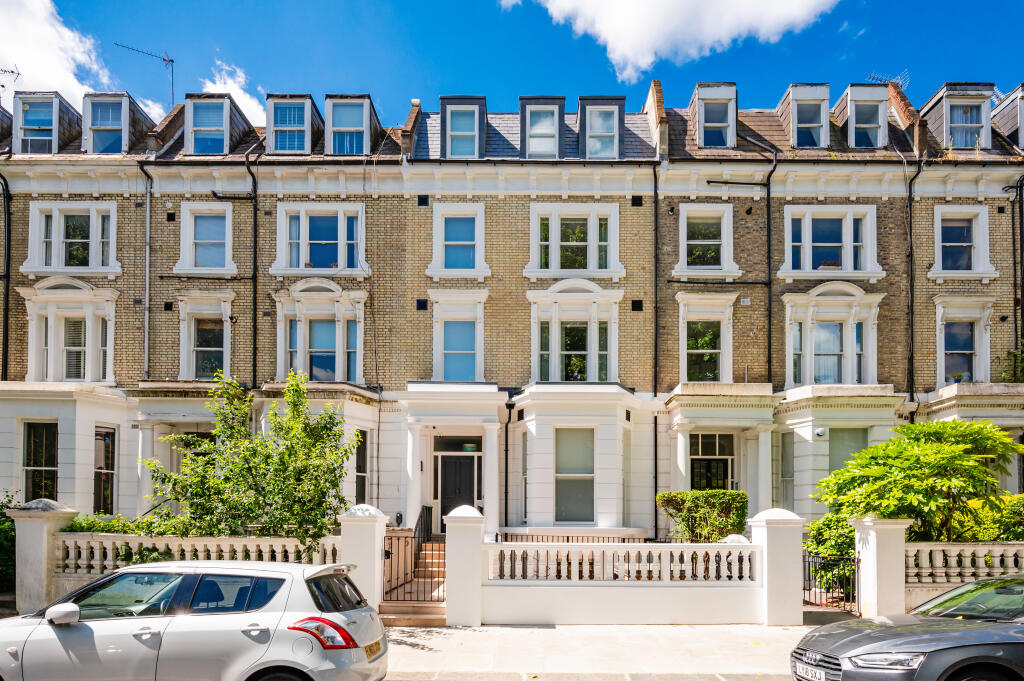
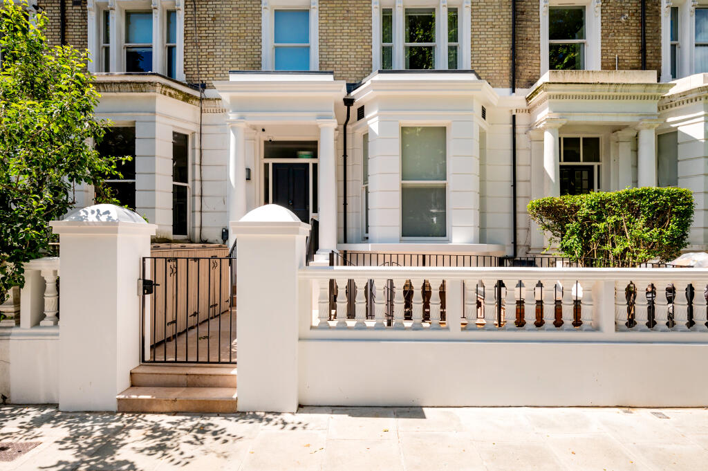
Elsham Road, London, W14
By City Relay Ltd
£ 2,200
City Relay Ltd says ..
no_data...
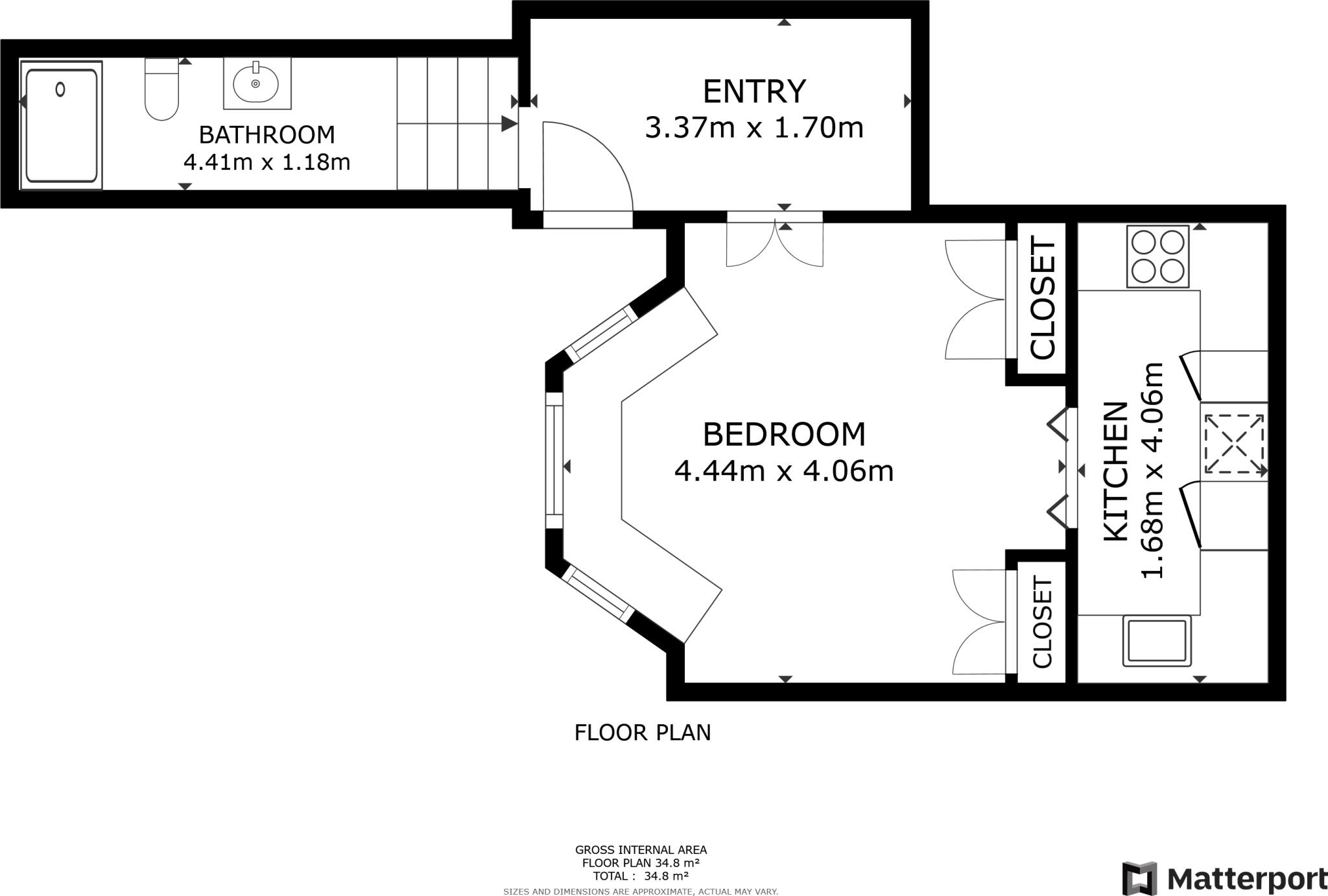
- Bedrooms
- 0
- Bathrooms
- 1
The heatmap indicates the level of crime in the area. The color of the heatmap indicates the crime severity and recency.
Metrics Year-on-Year
- Average area value
- 1,614,130.00 £Decreased by 28.76 %
- Average area rental value
- 2,563.00 £/moDecreased by 18.89 %
- Est rental Yield
- 1.91 %Increased by 14.37 %
- Crime Rate
- 4.00 %Unchanged by 0.00 %
from 2,265,638.00 £
from 3,160.00 £/mo
from 1.67 %
from 4.00 %
Agent Activity
City Relay Ltd created the listing.
Nearby Schools
| Name | Type | Ofsted | Distance |
|---|---|---|---|
| Masbro Childrens Centre | Children's Centre | 0.28 KM | |
| The Cardinal Vaughan Memorial Rc School | Academy Converter | 0.34 KM | |
| St Mary'S Catholic Primary School | Voluntary Aided School | Good | 0.39 KM |
| Norland Place School | Other Independent School | 0.56 KM | |
| Sial | Other Independent School | Good | 0.58 KM |
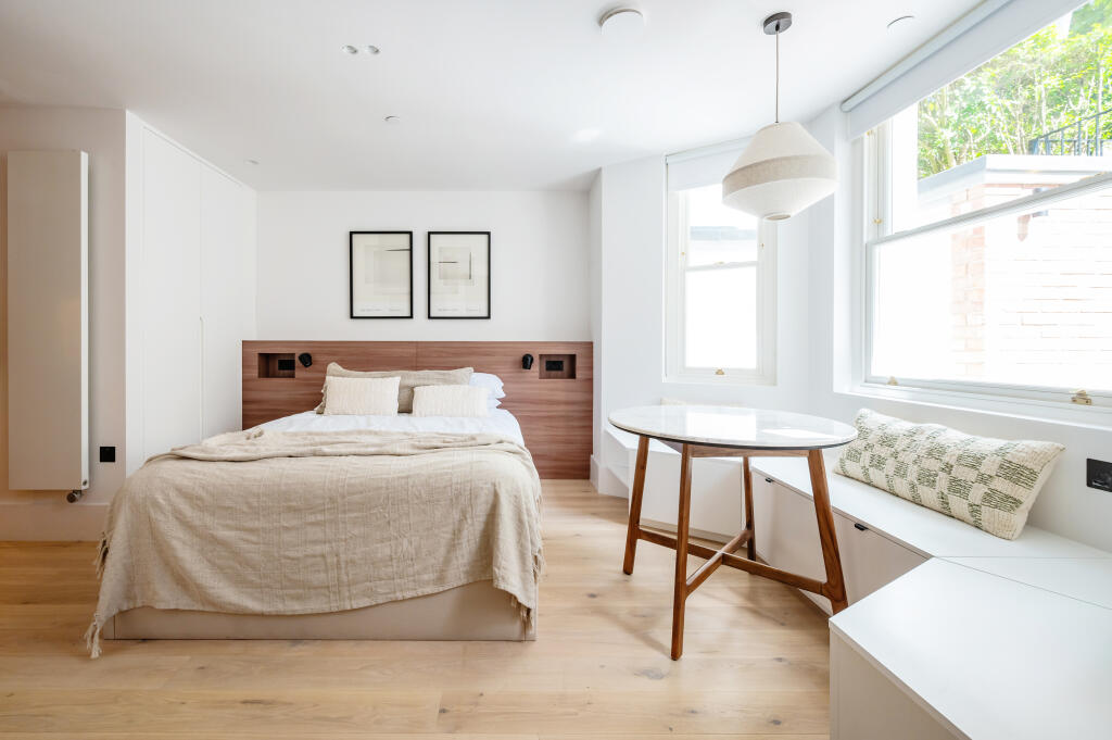
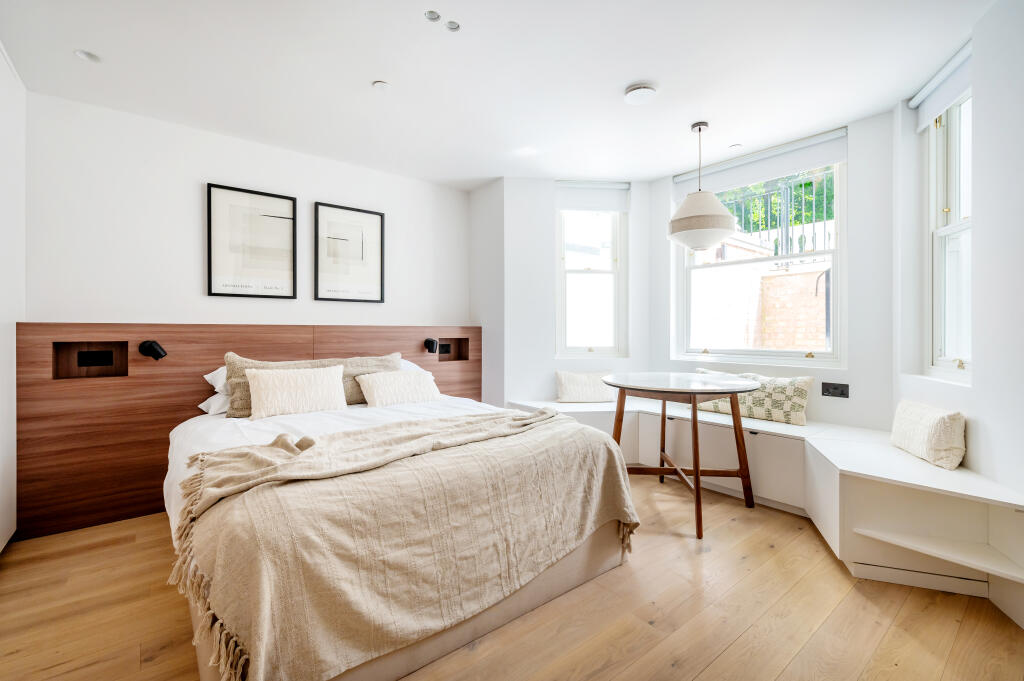
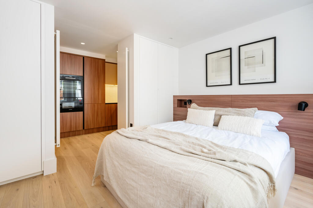
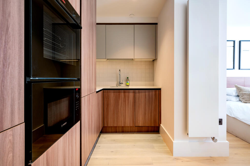
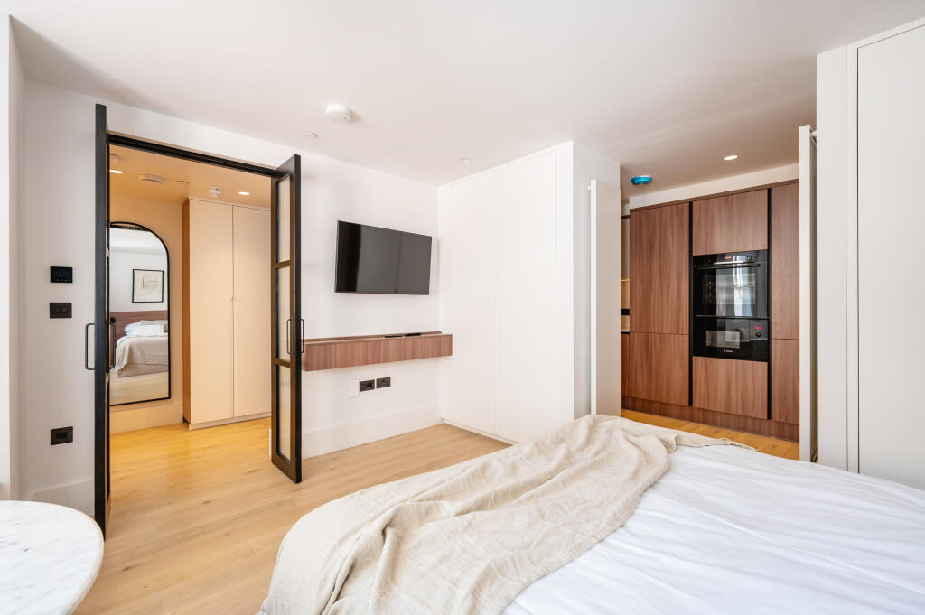
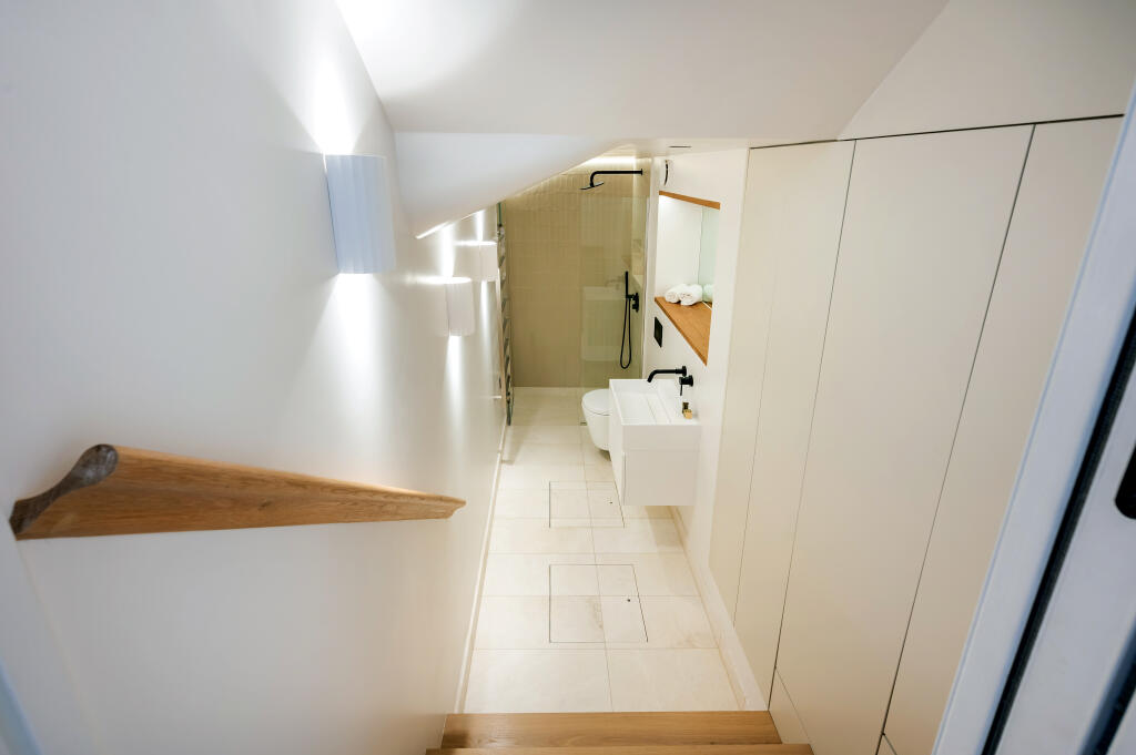
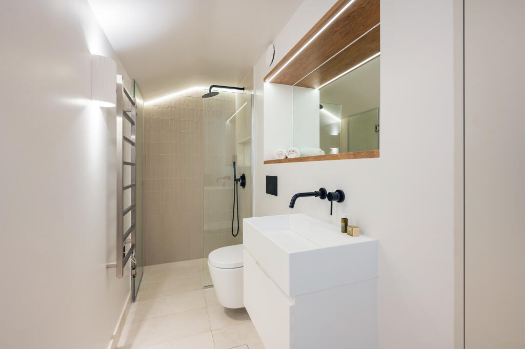
Images


Nearby Streets
| Name | Average Price | Average Sqft | Distance |
|---|---|---|---|
| Sinclair Road | £ 0 | 0 | 0.00 KM |
| Royal Crescent | £ 895,000 | 0 | 0.00 KM |
| Sinclair Road | £ 0 | 0 | 0.00 KM |
| Holland Gardens | £ 0 | 0 | 0.00 KM |
| Norland Road | £ 0 | 0 | 0.00 KM |
Nearby Transport
| Name | NLC | TLC | Distance |
|---|---|---|---|
| Shepherd'S Bush | 9587 | SPB | 0.57 KM |
| Kensington (Olympia) | 3092 | KPA | 0.58 KM |
| West Brompton | 8875 | WBP | 2.60 KM |
| Kensal Green | 1447 | KNL | 3.44 KM |
| Kensal Rise | 1448 | KNR | 3.72 KM |
Nearby Listings
| Address | Price | Type | Score | Distance |
|---|---|---|---|---|
| Elsham Road, London, W14 | £ 2,200 | RENT | Unknown | 0.00 KM |
| Elsham Road, W14 | £ 2,100 | RENT | Unknown | 0.00 KM |
| Elsham Road, London, W14 | £ 2,150 | RENT | Unknown | 0.01 KM |
| Elsham Road, London, W14 | £ 2,530 | RENT | Unknown | 0.01 KM |
| Elsham Road, London, W14 | £ 2,200 | RENT | Unknown | 0.01 KM |
Nearby Properties
| Address | Price | Distance |
|---|---|---|
| 64 Elsham Road | £ 600,000 | 0.01 KM |
| 57c Elsham Road | £ 720,000 | 0.01 KM |
| 69e Elsham Road | £ 290,000 | 0.01 KM |
| 50c Elsham Road | £ 307,000 | 0.01 KM |
| 71e Elsham Road | £ 570,000 | 0.01 KM |