UN
High Street, Southampton
By Unilife
£ 400
Unilife says ..
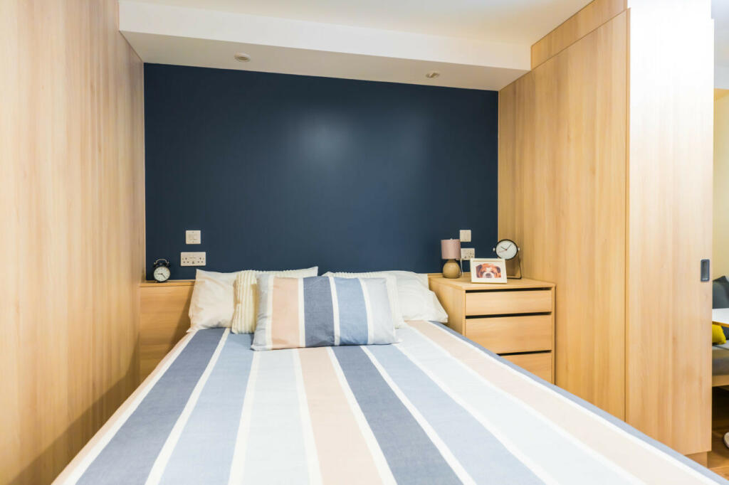
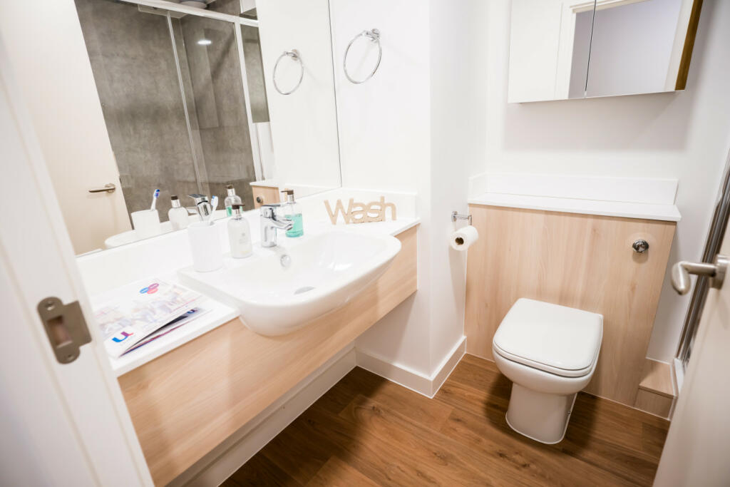
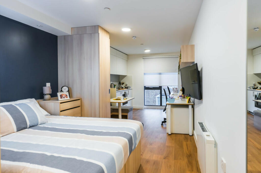
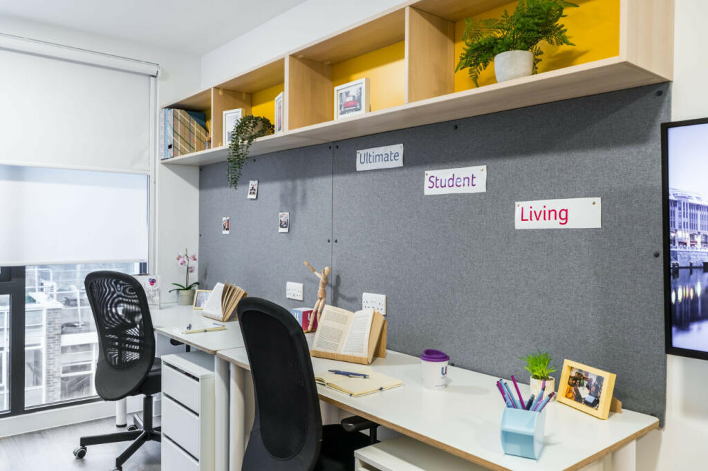
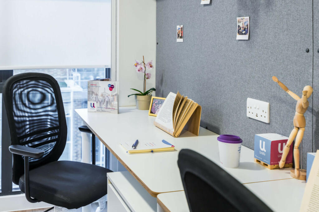
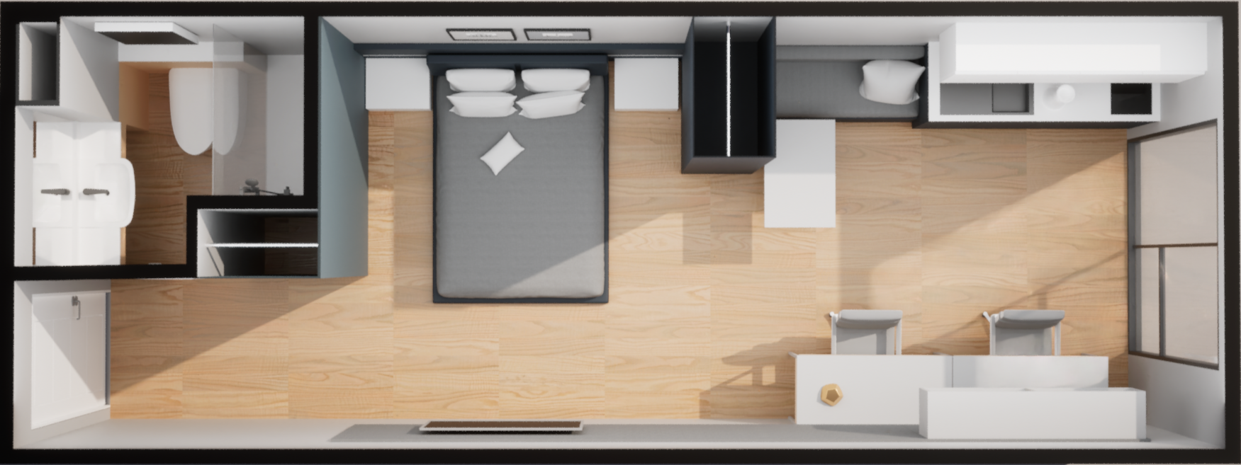
2nd, 3rd & 4th floor, spacious, dual occupancy, double bed, two study desks, ensuite, kitchenette.
- Bedrooms
- 1
- Bathrooms
- 1
The heatmap indicates the level of crime in the area. The color of the heatmap indicates the crime severity and recency.
Metrics Year-on-Year
- Average area value
- 222,098.00 £Decreased by 0.46 %
- Average area rental value
- 1,204.00 £/moDecreased by 7.81 %
- Est rental Yield
- 6.51 %Decreased by 7.26 %
- Crime Rate
- 28.00 %Unchanged by 0.00 %
from 223,118.00 £
from 1,306.00 £/mo
from 7.02 %
from 28.00 %
Agent Activity
Unilife created the listing.
Nearby Schools
| Name | Type | Ofsted | Distance |
|---|---|---|---|
| St John'S Primary And Nursery School | Foundation School | Good | 0.43 KM |
| Hope Community School Southampton | Free Schools | 0.72 KM | |
| Southampton Solent University | Higher Education Institutions | Good | 0.78 KM |
| Southampton City College | Further Education | Requires improvement | 0.97 KM |
| St Mary'S Church Of England Voluntary Controlled Primary School | Voluntary Controlled School | Good | 0.99 KM |
Images
Nearby Streets
| Name | Average Price | Average Sqft | Distance |
|---|---|---|---|
| Hamtun Street | £ 0 | 0 | 0.00 KM |
| Simnel Street | £ 0 | 0 | 0.00 KM |
| Market Place | £ 0 | 0 | 0.00 KM |
| Westquay Top Floor Dining Area | £ 0 | 0 | 0.00 KM |
| West Quay Road | £ 0 | 0 | 0.00 KM |
Nearby Transport
| Name | NLC | TLC | Distance |
|---|---|---|---|
| Southampton Central | 5932 | SOU | 1.27 KM |
| St Denys | 5914 | SDN | 2.89 KM |
| Woolston | 5925 | WLS | 2.96 KM |
| Bitterne | 5945 | BTE | 3.48 KM |
| Millbrook (Hants) | 5909 | MBK | 3.51 KM |
Nearby Listings
| Address | Price | Type | Score | Distance |
|---|---|---|---|---|
| Unilife High Street, 12-14 High Street, Southampton, SO142DF | £ 300 | RENT | Unknown | 0.00 KM |
| High Street, Southampton | £ 360 | RENT | Unknown | 0.00 KM |
| Unilife High Street, 12-14 High Street, Southampton, SO142DF | £ 250 | RENT | Unknown | 0.00 KM |
| Unilife High Street, 12-14 High Street, Southampton, SO142DF | £ 335 | RENT | Unknown | 0.00 KM |
| High Street, Southampton | £ 395 | RENT | Unknown | 0.00 KM |
Nearby Properties
| Address | Price | Distance |
|---|---|---|
| 25 Saxon Gate | £ 141,000 | 0.23 KM |
| 9 Saxon Gate | £ 131,500 | 0.23 KM |
| 8 Maddison Street | £ 245,000 | 0.23 KM |
| 11 Maddison Street | £ 154,000 | 0.23 KM |
| 29 Saxon Gate | £ 133,500 | 0.23 KM |