DR
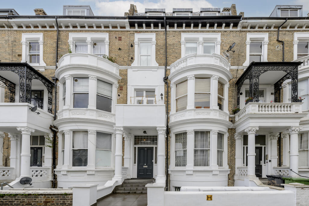
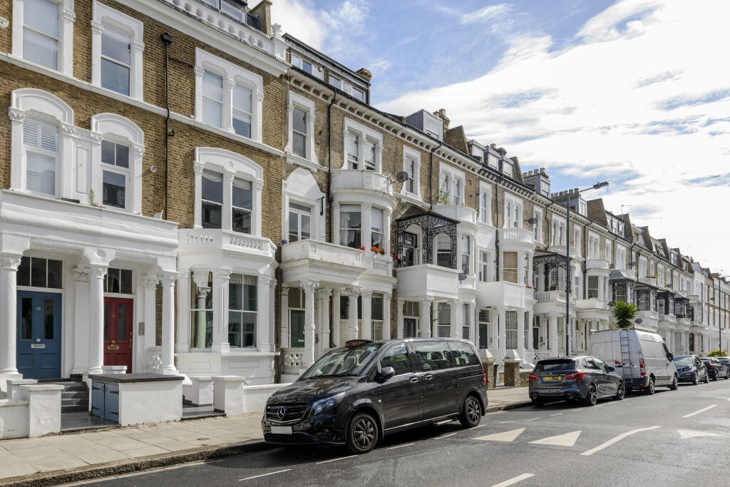
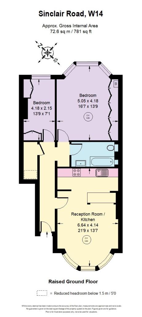
Sinclair Road, Brook Green, London, UK, W14
By Druce
£ 2,800
Druce says ..
None
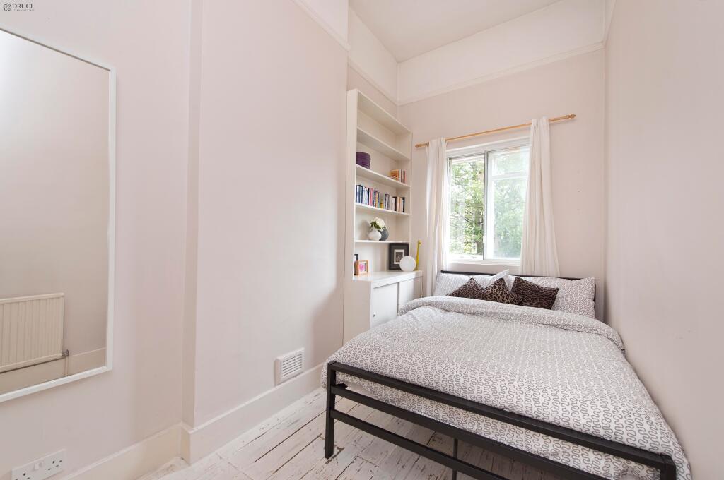
- Bedrooms
- 2
- Bathrooms
- 1
The heatmap indicates the level of crime in the area. The color of the heatmap indicates the crime severity and recency.
Metrics Year-on-Year
- Average area value
- 1,006,667.00 £Increased by 5.72 %
- Average area rental value
- 1,276.00 £/moDecreased by 19.29 %
- Est rental Yield
- 1.52 %Decreased by 23.62 %
- Crime Rate
- 3.00 %Unchanged by 0.00 %
from 952,186.00 £
from 1,581.00 £/mo
from 1.99 %
from 3.00 %
Agent Activity
Druce created the listing.
Nearby Schools
| Name | Type | Ofsted | Distance |
|---|---|---|---|
| Masbro Childrens Centre | Children's Centre | 0.23 KM | |
| St Mary'S Catholic Primary School | Voluntary Aided School | Good | 0.29 KM |
| The Cardinal Vaughan Memorial Rc School | Academy Converter | 0.47 KM | |
| Masbro Brook Green Children'S Centre | Children's Centre Linked Site | 0.62 KM | |
| Addison Primary School | Community School | Good | 0.62 KM |
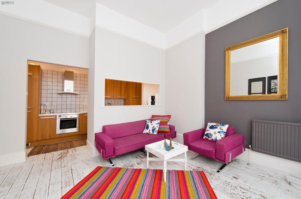
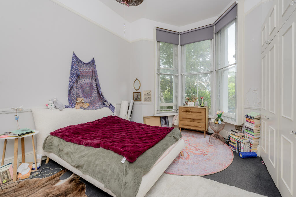
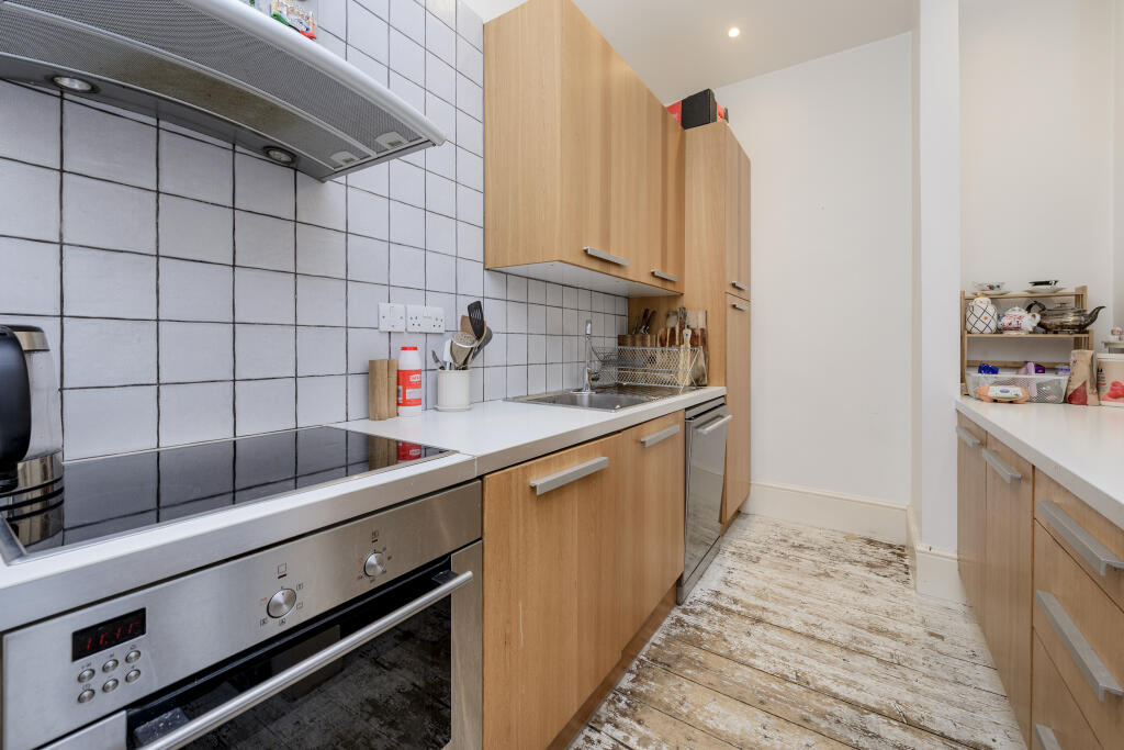
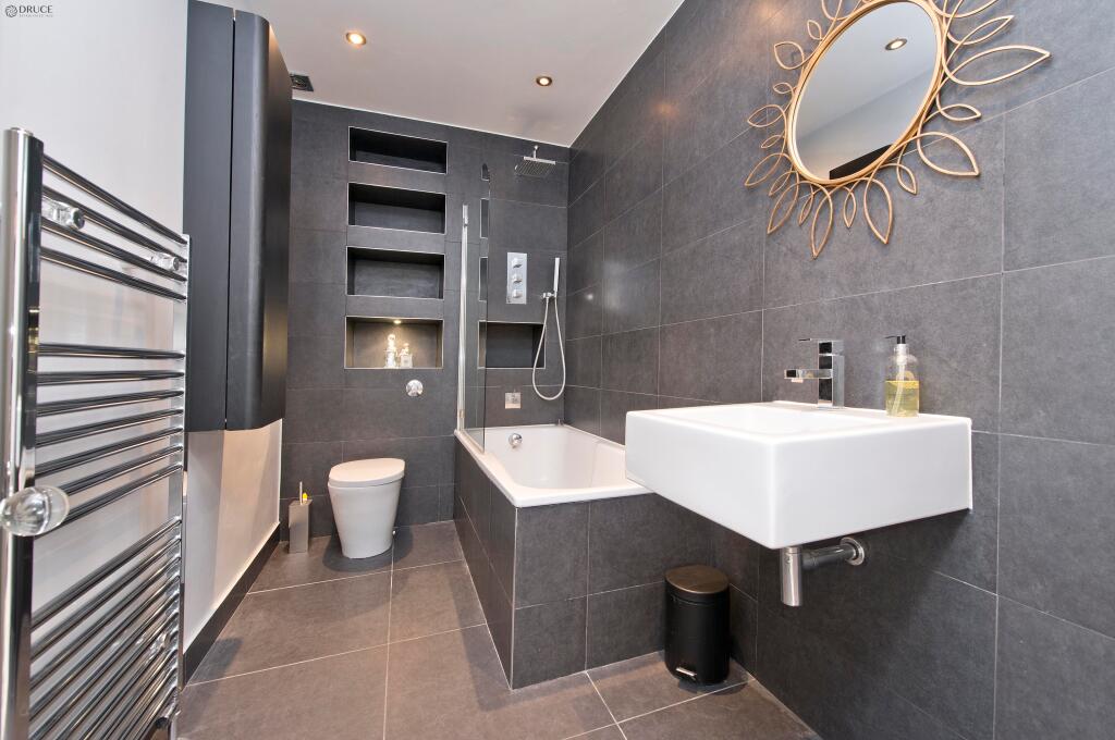
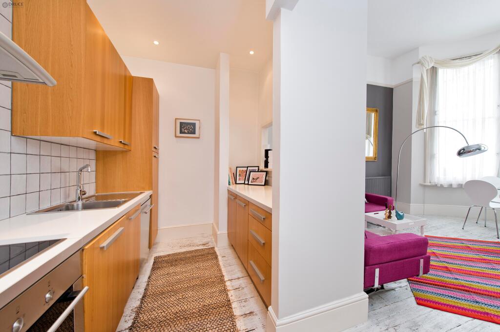
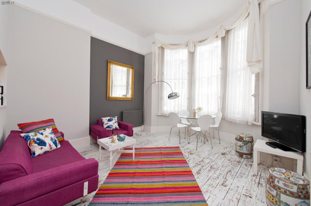
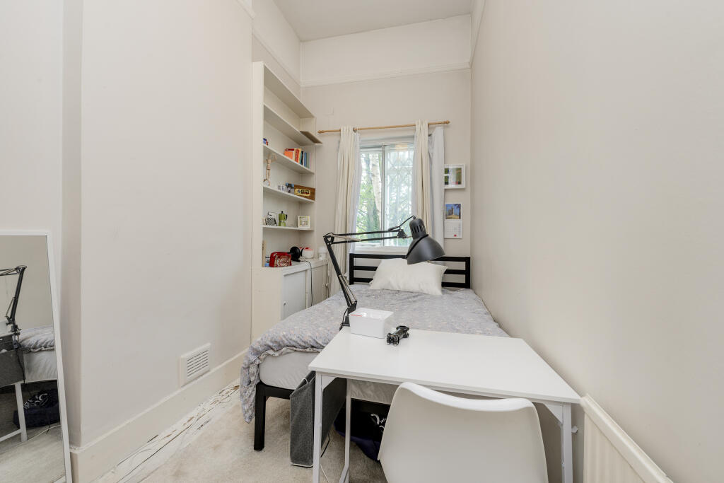
Images
Nearby Streets
| Name | Average Price | Average Sqft | Distance |
|---|---|---|---|
| Sinclair Road | £ 0 | 0 | 0.00 KM |
| Sinclair Road | £ 0 | 0 | 0.00 KM |
| Holland Gardens | £ 0 | 0 | 0.00 KM |
| Olympia Way | £ 0 | 0 | 0.00 KM |
| Royal Crescent | £ 895,000 | 0 | 0.00 KM |
Nearby Transport
| Name | NLC | TLC | Distance |
|---|---|---|---|
| Kensington (Olympia) | 3092 | KPA | 0.43 KM |
| Shepherd'S Bush | 9587 | SPB | 0.74 KM |
| West Brompton | 8875 | WBP | 2.46 KM |
| Kensal Green | 1447 | KNL | 3.63 KM |
| Queens Park (London) | 1419 | QPW | 3.89 KM |
Nearby Listings
| Address | Price | Type | Score | Distance |
|---|---|---|---|---|
| Sinclair Road, Brook Green, London, UK, W14 | £ 2,800 | RENT | Unknown | 0.00 KM |
| Sinclair Road, London, W14 | £ 2,750 | RENT | Unknown | 0.00 KM |
| Sinclair Road, Shepherds Bush, W14 | £ 1,750 | RENT | Unknown | 0.00 KM |
| Sinclair Road, Holland Park, W14 | £ 2,150 | RENT | Unknown | 0.00 KM |
| Sinclair Road, Holland Park, W14 | £ 2,200 | RENT | Unknown | 0.00 KM |
Nearby Properties
| Address | Price | Distance |
|---|---|---|
| 98 Sinclair Road | £ 315,000 | 0.01 KM |
| 102a Sinclair Road | £ 670,000 | 0.01 KM |
| 82d Sinclair Road | £ 360,000 | 0.01 KM |
| 72g Sinclair Road | £ 410,000 | 0.01 KM |
| 72a Sinclair Road | £ 575,000 | 0.01 KM |