NI
S2 - Edmund Road - Available July 2025
By Nicholas Humphreys
£ 110
Nicholas Humphreys says ..
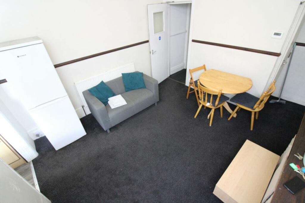
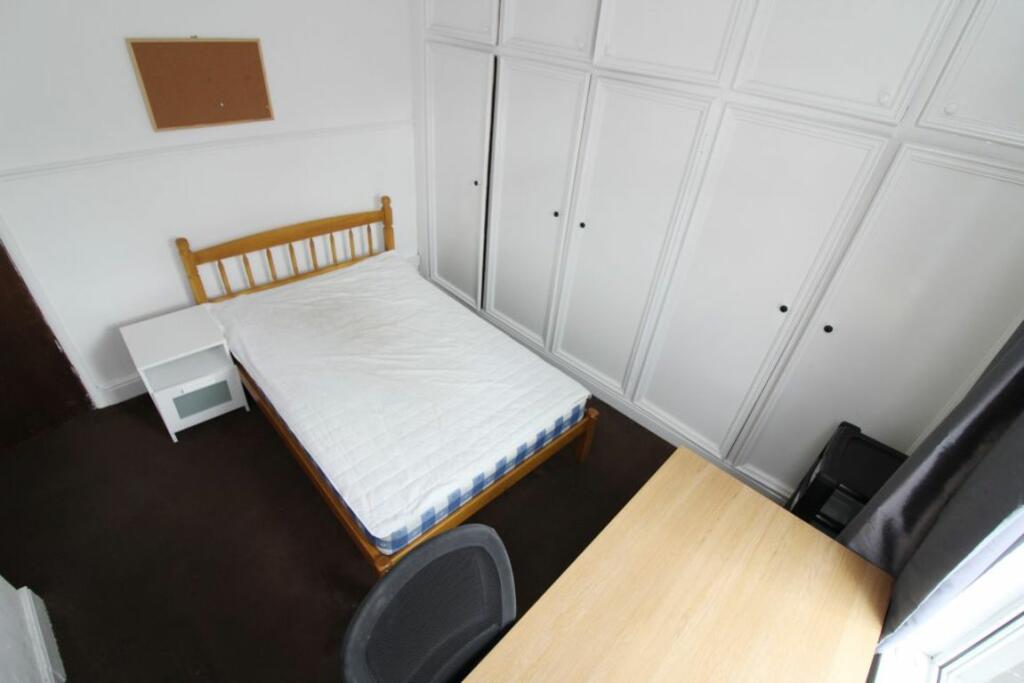
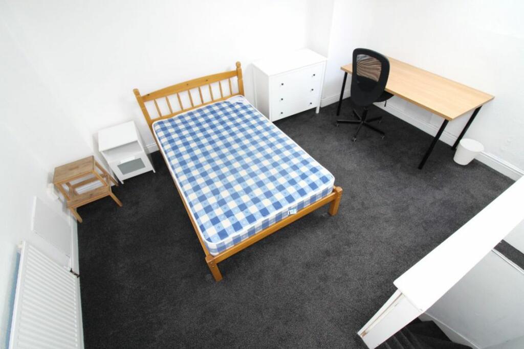
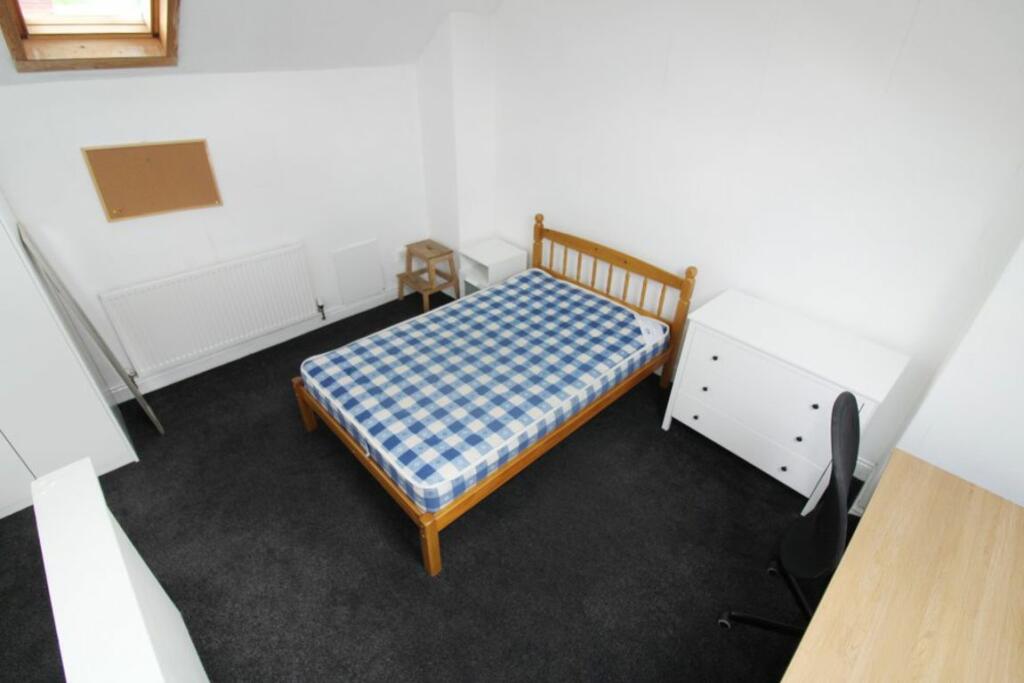
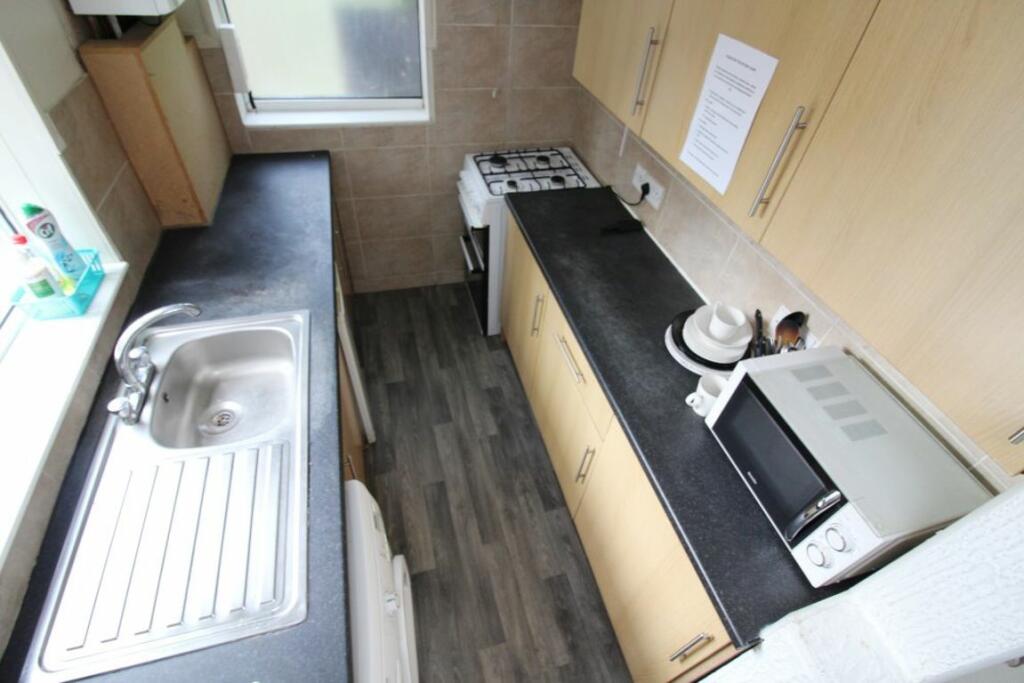
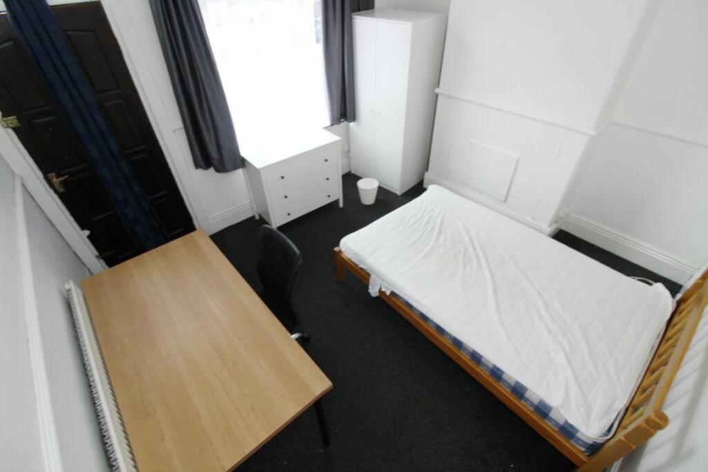
** 3 Double Bedrooms**Lounge/Diner **Bills Included***
- Bedrooms
- 3
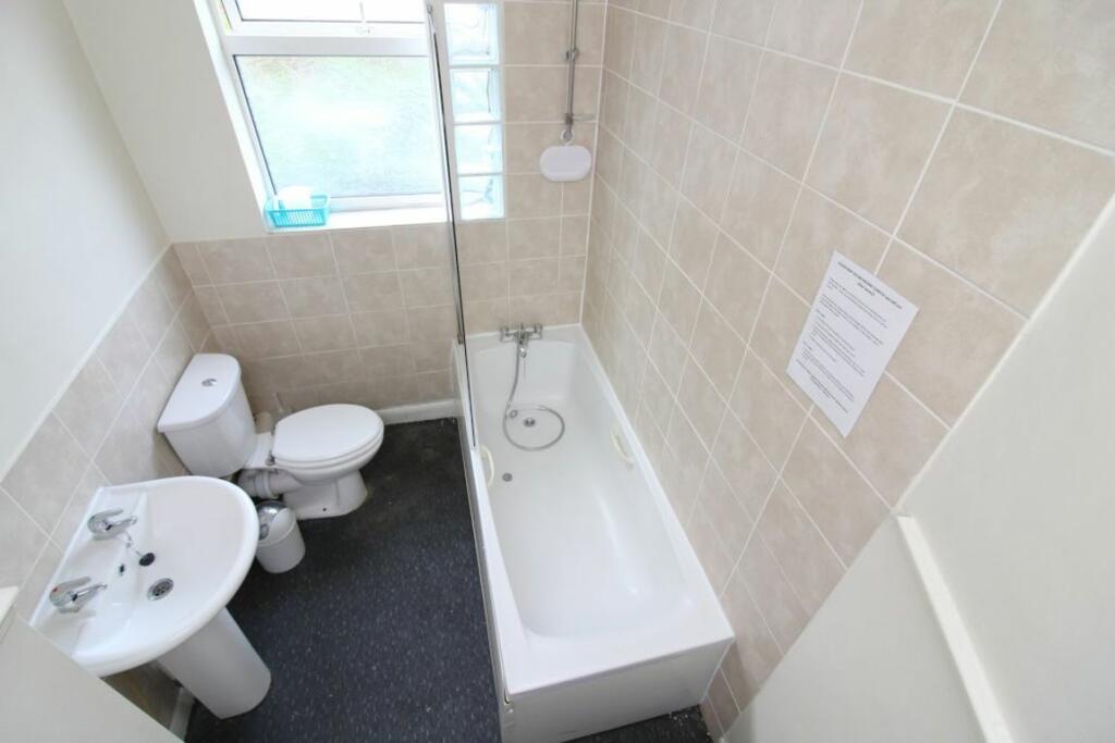
- Bathrooms
- 0
The heatmap indicates the level of crime in the area. The color of the heatmap indicates the crime severity and recency.
Metrics Year-on-Year
- Average area value
- 123,441.00 £Decreased by 13.64 %
- Average area rental value
- 1,222.00 £/moIncreased by 27.69 %
- Est rental Yield
- 11.88 %Increased by 47.95 %
- Crime Rate
- 2.00 %Unchanged by 0.00 %
from 142,936.00 £
from 957.00 £/mo
from 8.03 %
from 2.00 %
Agent Activity
Nicholas Humphreys created the listing.
Nearby Schools
| Name | Type | Ofsted | Distance |
|---|---|---|---|
| Lowfield Community Primary School | Community School | Good | 0.61 KM |
| Anns Grove Primary School | Community School | Good | 0.76 KM |
| Sharrow Children'S Centre | Children's Centre | 0.81 KM | |
| Utc Sheffield City Centre | University Technical College | Good | 0.82 KM |
| Sharrow Nursery, Infant And Junior School | Foundation School | Good | 0.99 KM |
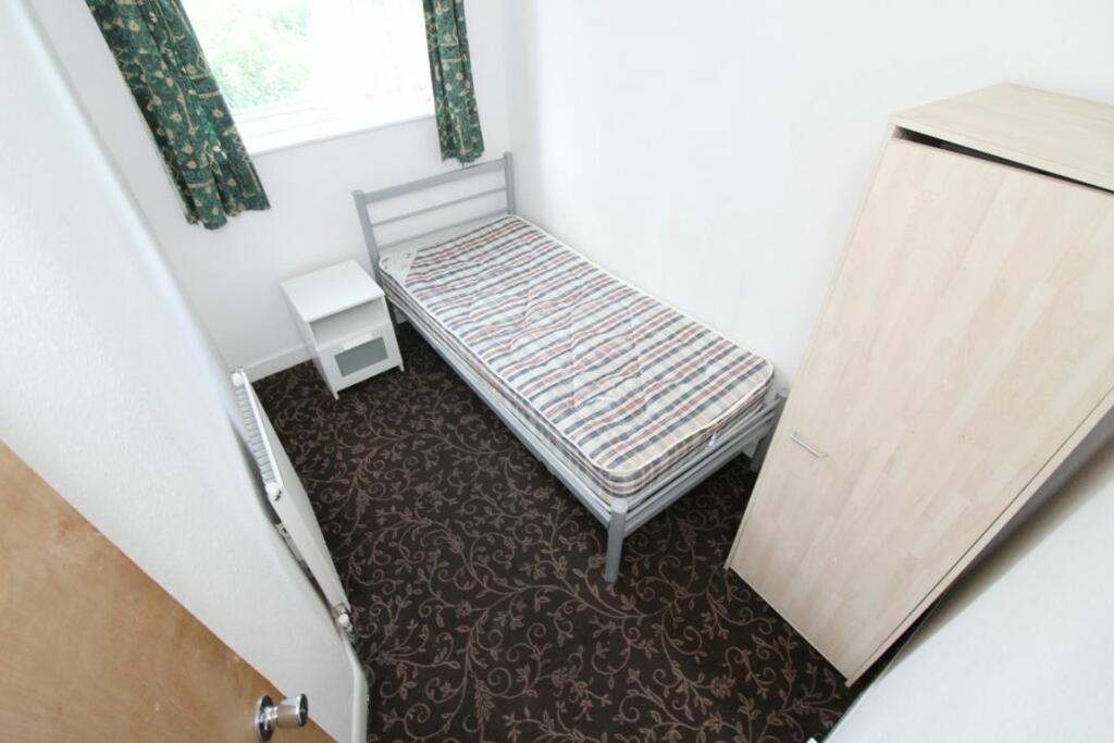
Images

Nearby Streets
| Name | Average Price | Average Sqft | Distance |
|---|---|---|---|
| Silver Mill Road | £ 0 | 0 | 0.00 KM |
| Bramall Court | £ 0 | 0 | 0.00 KM |
| Bramall Lane | £ 0 | 0 | 0.00 KM |
| Denby Street | £ 0 | 0 | 0.00 KM |
| Manton Street | £ 110,000 | 0 | 0.00 KM |
Nearby Transport
| Name | NLC | TLC | Distance |
|---|---|---|---|
| Sheffield | 6691 | SHF | 1.32 KM |
| Darnall | 6729 | DAN | 6.39 KM |
| Dore And Totley | 6690 | DOR | 6.89 KM |
| Dronfield | 6616 | DRO | 7.40 KM |
| Meadowhall | 6663 | MHS | 8.22 KM |
Nearby Listings
| Address | Price | Type | Score | Distance |
|---|---|---|---|---|
| S2 - Edmund Road - Available July 2025 | £ 110 | RENT | Unknown | 0.00 KM |
| 260 Edmund Road, City Centre | £ 89 | RENT | Unknown | 0.00 KM |
| Edmund Road, Sheffield, S2 | £ 1,353 | RENT | Unknown | 0.00 KM |
| S2 - Edmund Road - 4 Bedroom/2 Bathrooms | £ 95 | RENT | Unknown | 0.01 KM |
| 292 Edmund Road - STUDENT PROPERTY | £ 104 | RENT | Unknown | 0.01 KM |
Nearby Properties
| Address | Price | Distance |
|---|---|---|
| 288 Edmund Road | £ 73,000 | 0.01 KM |
| 280 Edmund Road | £ 95,000 | 0.01 KM |
| 270 Edmund Road | £ 146,500 | 0.01 KM |
| 298 Edmund Road | £ 112,500 | 0.01 KM |
| 308 Edmund Road | £ 79,000 | 0.01 KM |