HL
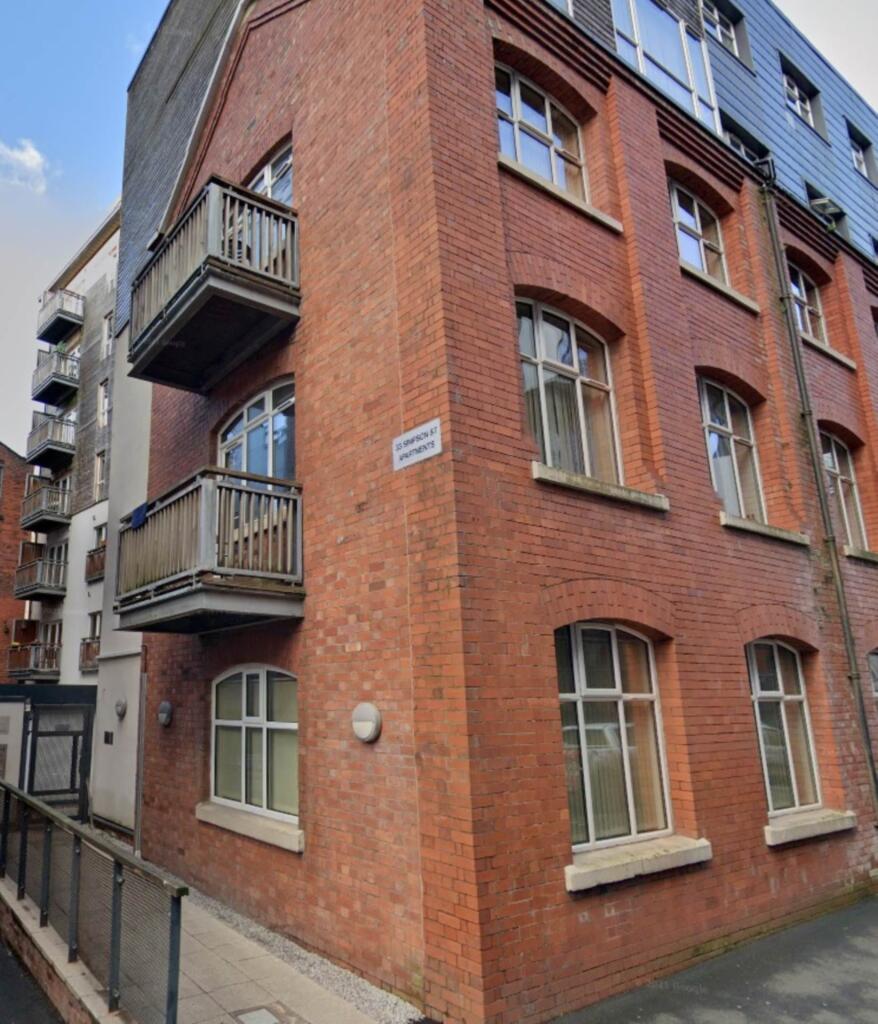
Simpson Street, Manchester
By HLGB
£ 950
HLGB says ..
Two Bedroom Ground Floor Apartment Available Fully Furnished.
- Bedrooms
- 2
- Bathrooms
- 2
The heatmap indicates the level of crime in the area. The color of the heatmap indicates the crime severity and recency.
Metrics Year-on-Year
- Average area value
- 344,188.00 £Increased by 14.03 %
- Average area rental value
- 1,585.00 £/moIncreased by 8.19 %
- Est rental Yield
- 5.53 %Decreased by 4.98 %
- Crime Rate
- 0.00 %
from 301,843.00 £
from 1,465.00 £/mo
from 5.82 %
from 0.00 %
Agent Activity
HLGB created the listing.
Nearby Schools
| Name | Type | Ofsted | Distance |
|---|---|---|---|
| King Of Kings | Other Independent School | Good | 0.29 KM |
| The Cooperative College | Miscellaneous | 0.63 KM | |
| Abbott Community Primary School | Community School | Outstanding | 0.91 KM |
| Eden Boys' Leadership Academy, Manchester | Free Schools | 0.97 KM | |
| St Patrick'S Rc Primary School | Voluntary Aided School | Requires improvement | 0.99 KM |
Images
Nearby Streets
| Name | Average Price | Average Sqft | Distance |
|---|---|---|---|
| Baptist Street | £ 270,563 | 0 | 0.00 KM |
| Durant Street | £ 0 | 0 | 0.00 KM |
| Bendix Street | £ 0 | 0 | 0.00 KM |
| New Mount Street | £ 150,000 | 0 | 0.00 KM |
| Irk Street | £ 392,500 | 0 | 0.00 KM |
Nearby Transport
| Name | NLC | TLC | Distance |
|---|---|---|---|
| Manchester Victoria | 2970 | MCV | 0.95 KM |
| Manchester Piccadilly | 2968 | MAN | 1.27 KM |
| Manchester Oxford Road | 2966 | MCO | 1.82 KM |
| Salford Central | 2798 | SFD | 2.38 KM |
| Deansgate | 2963 | DGT | 2.46 KM |
Nearby Listings
| Address | Price | Type | Score | Distance |
|---|---|---|---|---|
| 33 Simpson Street, Northern Quarter | £ 1,000 | RENT | Unknown | 0.00 KM |
| 33 Simpson Street, Manchester | £ 1,600 | RENT | Unknown | 0.00 KM |
| Simpson Street, Manchester, M4 | £ 1,150 | RENT | Unknown | 0.00 KM |
| Strong Building, 33 Simpson Street, Manchester City Centre, M4 | £ 950 | RENT | Unknown | 0.01 KM |
| Simpson Street, Manchester, M4 | £ 1,200 | RENT | Unknown | 0.01 KM |
Nearby Properties
| Address | Price | Distance |
|---|---|---|
| 19 Len Cox Walk | £ 85,000 | 0.40 KM |
| 9 Len Cox Walk | £ 73,500 | 0.40 KM |
| 4 Len Cox Walk | £ 156,000 | 0.40 KM |
| 32 Len Cox Walk | £ 245,000 | 0.40 KM |
| 8 Len Cox Walk | £ 127,500 | 0.40 KM |