
Jackson & Co says ..
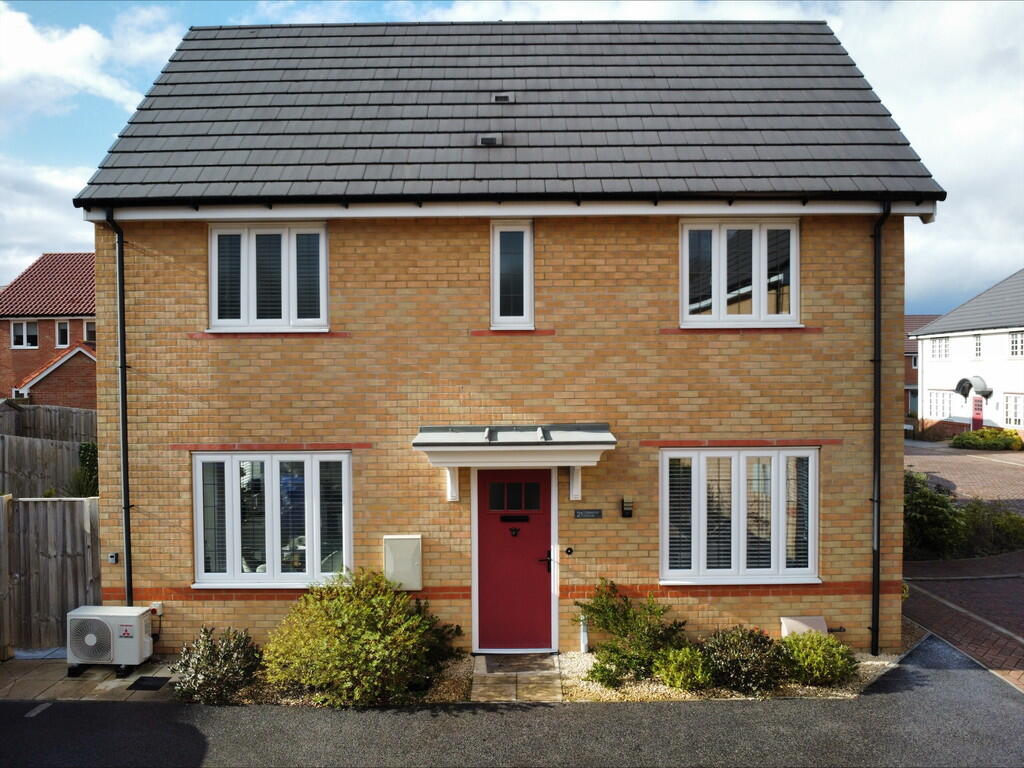
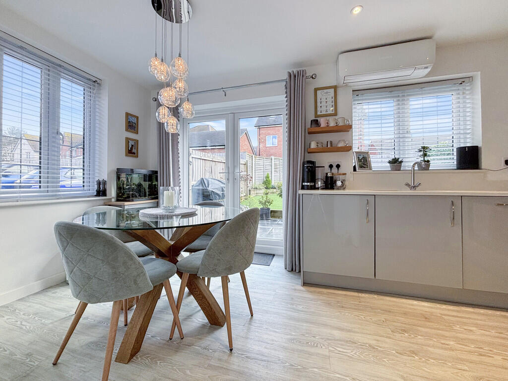
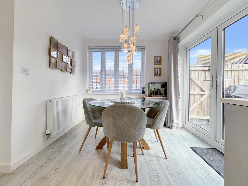
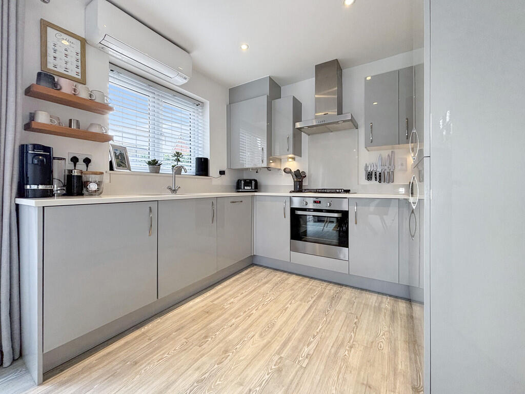
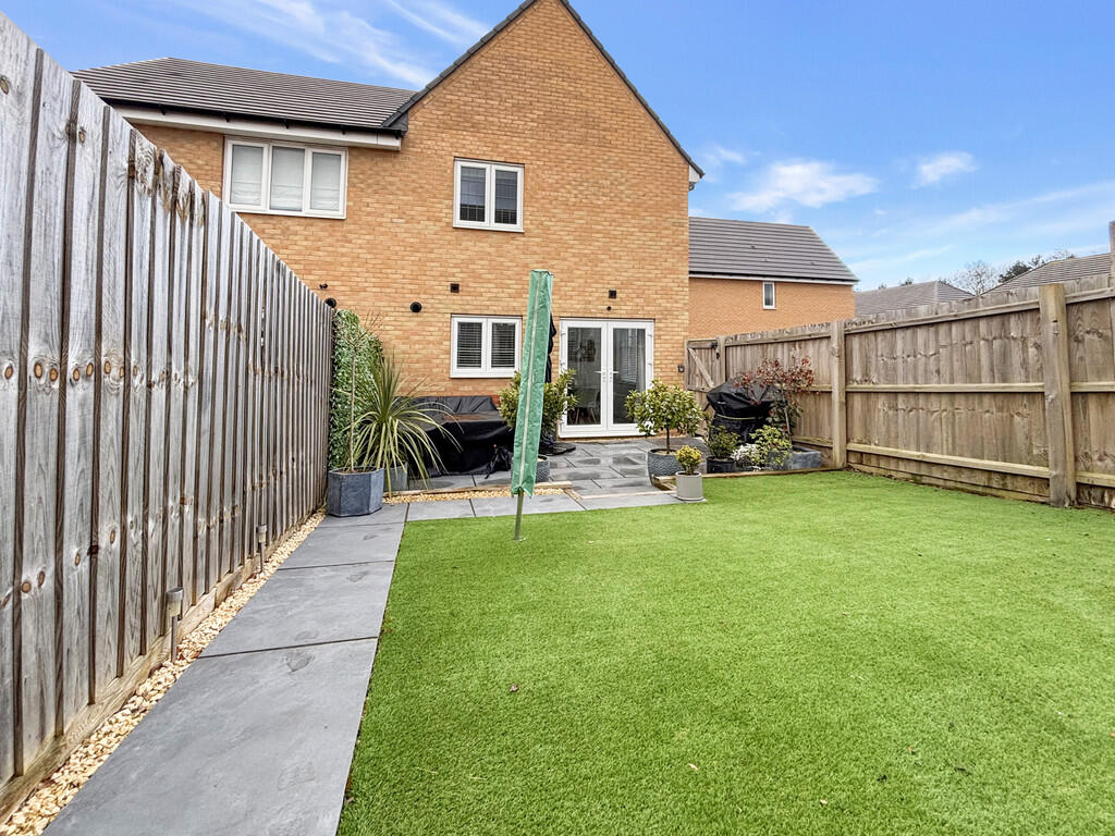
This impressive property boasts a quiet location, tucked away in a cul-de-sac and a modern layout, including a spacious kitchen/dining room that opens onto a favourable south-facing garden, perfect for entertaining or relaxing in the sun. Enhanced with air conditioning.
Property Oracle says ..
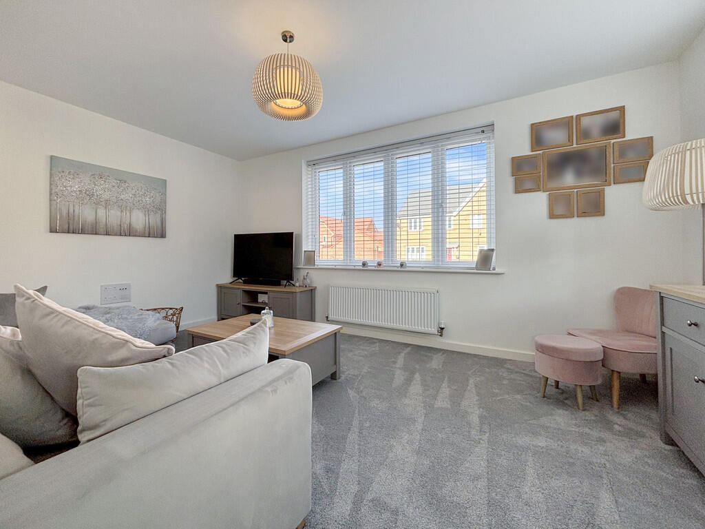
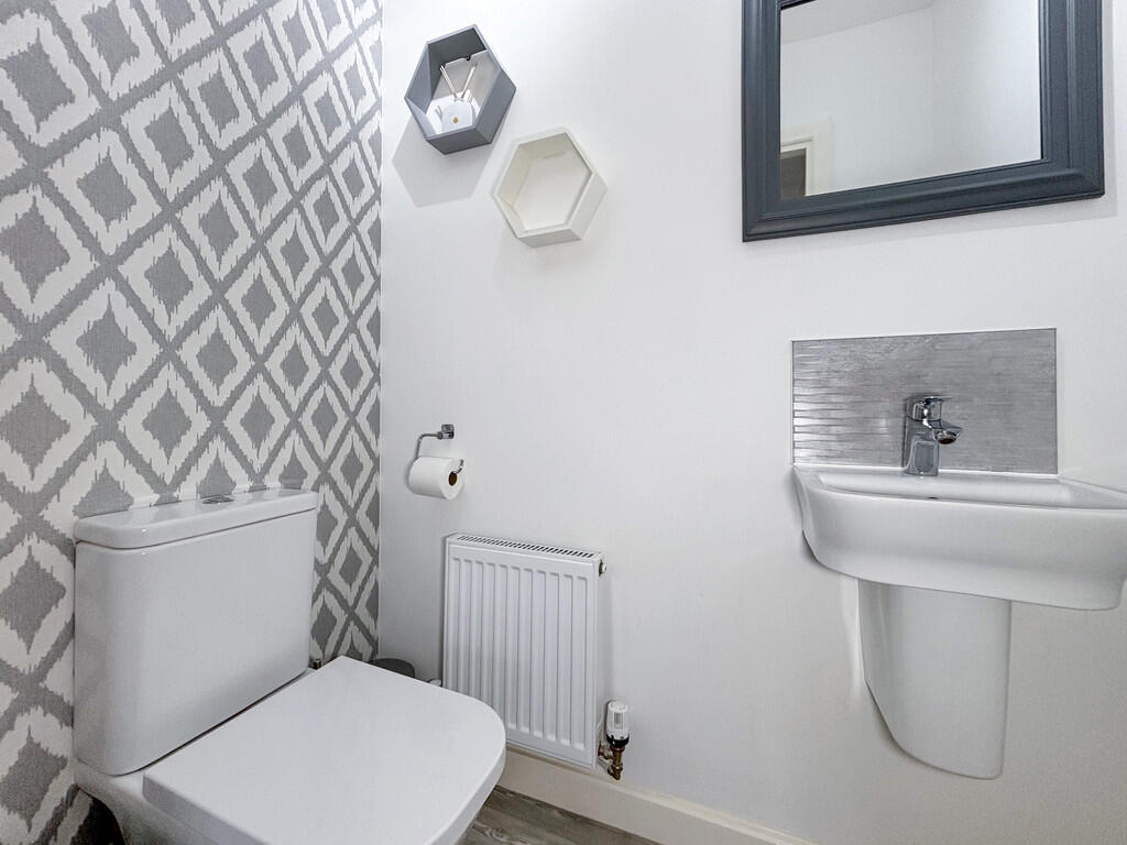
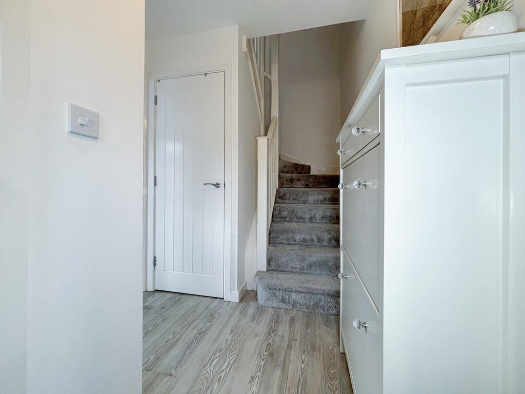
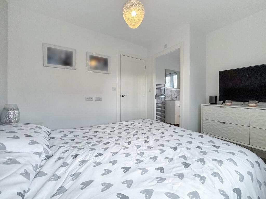
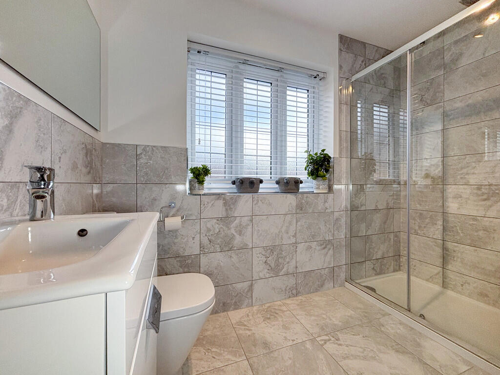
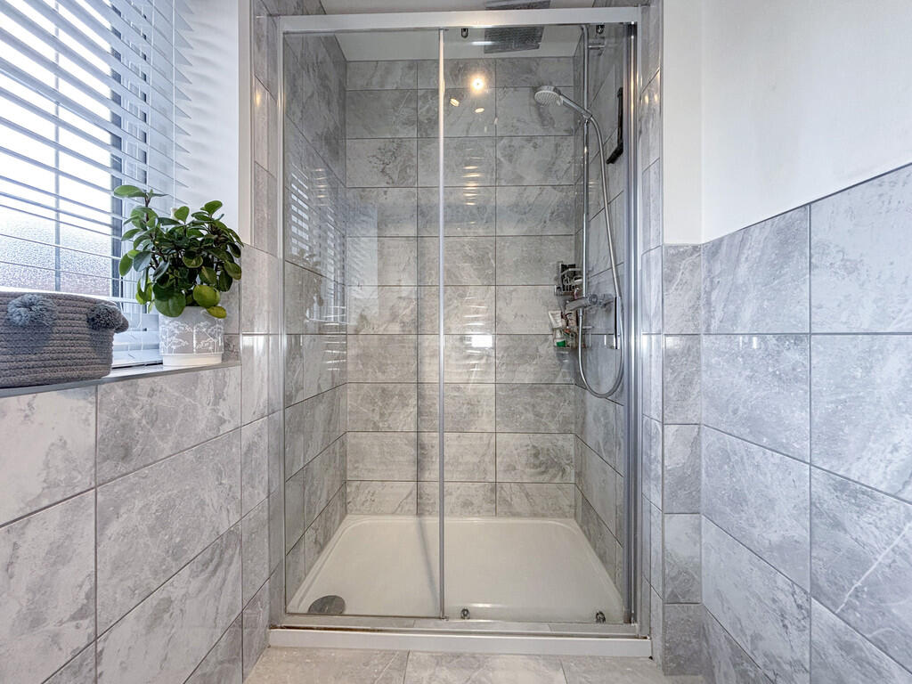
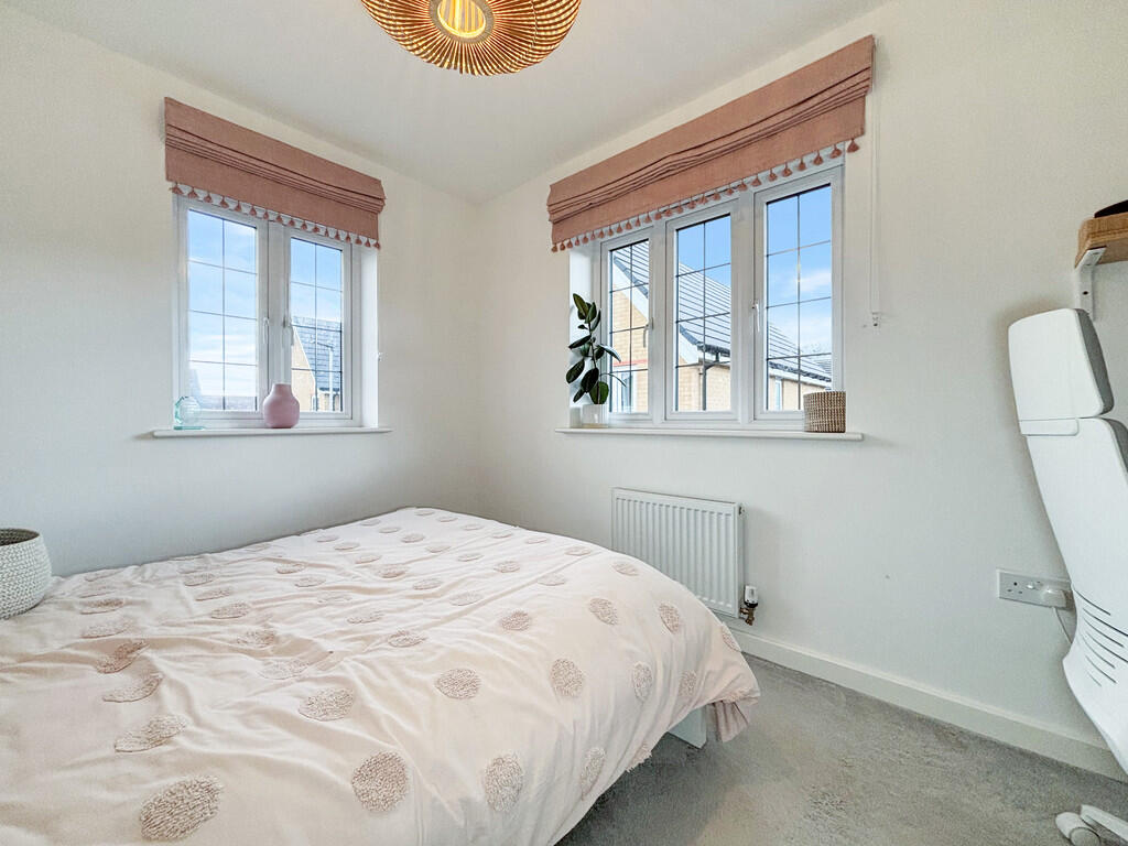
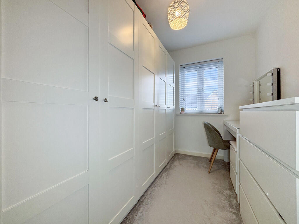
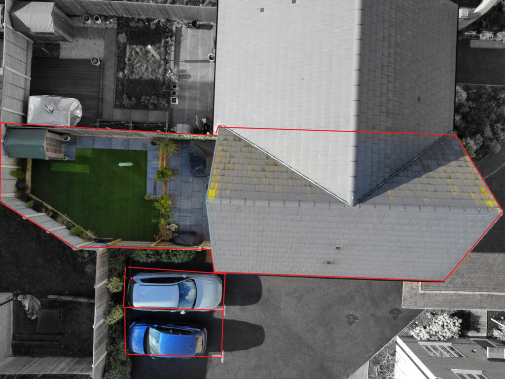
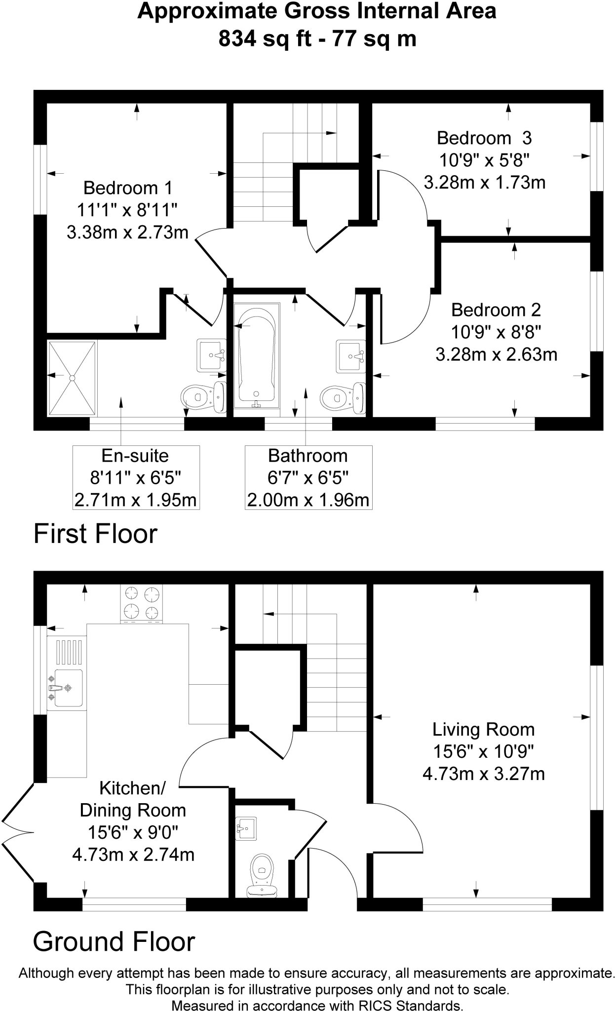
The property located on Weston Drive, Bury St Edmunds, is a 3-bedroom, 2-bathroom semi-detached house with a total area of 415.08 sqft and a plot size of 834 sqft. The list price is £320,000. Location: The property benefits from its proximity to several schools, including The Albany (0.34 km), Howard Community Academy (0.54 km), Carousel Children’s Centre (0.80 km), St Benedict’s Catholic School (1.07 km), and Bury St Edmunds County Upper School (1.21 km). The proximity to Bury St Edmunds train station (2.38 km) also enhances its accessibility. The area’s average house price is £234,748, and the average price per sqft is £278. Nearby streets, such as Mannock Drive, show higher average prices (£340,000), suggesting a potentially desirable location. However, more detailed information on the quality of local amenities and the overall desirability of the St Olaves area would strengthen this assessment. Condition: Based on the provided images, the property appears to be in excellent condition. The interior is modern, clean, and well-maintained, with recently updated fixtures and fittings. There is no visible evidence of wear and tear or the need for renovation. Land: The property includes a relatively small but well-maintained garden with a paved patio area and artificial turf. While not expansive, the garden provides a usable outdoor space. Price: The list price of £320,000 seems slightly above the average price for the area (£234,748). However, considering the property’s modern condition, the relatively small plot size, and its location in what seems to be a desirable area, the price may be justified. The lack of sqft data for nearby comparable properties makes a definitive price comparison challenging. A more detailed analysis of comparable properties with similar features and plot sizes would be needed to determine if the price is truly competitive. The average price per sqft in the area (£278) is significantly lower than what the asking price suggests. This discrepancy requires further investigation into the specifics of comparable properties to determine the reasonableness of the list price.
Therefore, we give this property 7 / 10. *Disclaimer: This is our option and does constitute a recommendation or financial advice. Do your own research. *
- Price
- 7
- Condition
- 10
- Location
- 8
- Land
- 6
- Bedrooms
- 3
- Bathrooms
- 2
- Sqft (est)
- 415.08
- Lot (est)
- 834.00
The heatmap indicates the level of crime in the area. The color of the heatmap indicates the crime severity and recency.
Metrics Year-on-Year
- Average area value
- 223,188.00 £Decreased by 13.36 %
- Est sale value
- 130,335.12 £Decreased by 2.48 %
- Average area rental value
- 1,283.00 £/moIncreased by 2.15 %
- Est letting value
- 415.08 £/moUnchanged by 0.00 %
- Est rental Yield
- 6.90 %Increased by 17.95 %
- Crime Rate
- 20.00 %Unchanged by 0.00 %
Agent Activity
Jackson & Co created the listing.
Nearby Schools
| Name | Type | Ofsted | Distance |
|---|---|---|---|
| The Albany | Academy Alternative Provision Converter | 0.34 KM | |
| Howard Community Academy | Academy Sponsor Led | 0.54 KM | |
| Carousel Children'S Centre | Children's Centre | 0.80 KM | |
| St Benedict'S Catholic School | Voluntary Aided School | Good | 1.07 KM |
| Bury St Edmunds County Upper School | Academy Converter | Serious Weaknesses | 1.21 KM |
Images


Nearby Streets
| Name | Average Price | Average Sqft | Distance |
|---|---|---|---|
| Mannock Drive | £ 340,000 | 0 | 0.00 KM |
| Tollcott Drive | £ 0 | 0 | 0.00 KM |
| Goddard street | £ 390,000 | 0 | 0.00 KM |
| Sam Weller Walk | £ 0 | 0 | 0.00 KM |
| Flemish Avenue | £ 146,000 | 0 | 0.00 KM |
Nearby Transport
| Name | NLC | TLC | Distance |
|---|---|---|---|
| Bury St Edmunds | 7008 | BSE | 2.38 KM |
Nearby Listings
| Address | Price | Type | Score | Distance |
|---|---|---|---|---|
| Weston Drive, Bury St. Edmunds | £ 300,000 | BUY | 7 / 10 | 0.00 KM |
| Weston Drive, Bury St Edmunds | £ 440,000 | BUY | 7 / 10 | 0.00 KM |
| Weston Drive, Bury St. Edmunds | £ 310,000 | BUY | Unknown | 0.00 KM |
| Weston Drive, Bury St Edmunds | £ 320,000 | BUY | 7 / 10 | 0.00 KM |
| Weston Drive, Bury St Edmunds | £ 300,000 | BUY | 7 / 10 | 0.02 KM |
Nearby Properties
| Address | Price | Distance |
|---|---|---|
| 20 Warwick Drive | £ 134,500 | 0.20 KM |
| 8 Warwick Drive | £ 198,000 | 0.20 KM |
| 29 Warwick Drive | £ 172,000 | 0.20 KM |
| 15 Warwick Drive | £ 149,950 | 0.20 KM |
| 40 Warwick Drive | £ 147,500 | 0.20 KM |