AC
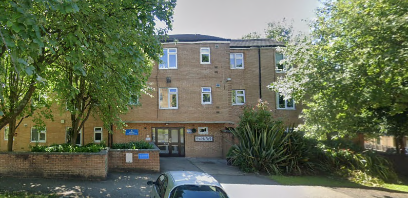
Woodtop, Harcourt Street, Burnley, Lancashire, BB11
By Accent
£ 178
Accent says ..
One bedroom, ground floor flat in an over 55s independent living scheme, suitable for one person only
- Bedrooms
- 1
- Bathrooms
- 0
The heatmap indicates the level of crime in the area. The color of the heatmap indicates the crime severity and recency.
Metrics Year-on-Year
- Average area value
- 446,826.00 £Increased by 0.22 %
- Average area rental value
- 1,514.00 £/moDecreased by 8.57 %
- Est rental Yield
- 4.07 %Decreased by 8.74 %
- Crime Rate
- 13.00 %Unchanged by 0.00 %
from 445,846.00 £
from 1,656.00 £/mo
from 4.46 %
from 13.00 %
Agent Activity
Accent created the listing.
Nearby Schools
| Name | Type | Ofsted | Distance |
|---|---|---|---|
| Taywood Nursery | Local Authority Nursery School | Outstanding | 0.29 KM |
| Sure Start South West Burnley Children'S Centre | Children's Centre | 0.36 KM | |
| Whittlefield Primary School | Community School | Good | 0.66 KM |
| Coal Clough Academy | Academy Alternative Provision Sponsor Led | Good | 0.67 KM |
| Ightenhill Children'S Centre | Children's Centre | 0.70 KM |
Images
Nearby Streets
| Name | Average Price | Average Sqft | Distance |
|---|---|---|---|
| Claremont Street | £ 85,000 | 0 | 0.00 KM |
| B6239 | £ 0 | 0 | 0.00 KM |
| Florence Avenue | £ 0 | 0 | 0.00 KM |
| Acorn Mews | £ 69,975 | 0 | 0.00 KM |
| Heron Court | £ 80,000 | 0 | 0.00 KM |
Nearby Transport
| Name | NLC | TLC | Distance |
|---|---|---|---|
| Burnley Barracks | 2743 | BUB | 0.94 KM |
| Rose Grove | 2722 | RSG | 1.86 KM |
| Burnley Manchester Road | 2549 | BYM | 1.93 KM |
| Burnley Central | 2550 | BNC | 2.41 KM |
| Brierfield | 2554 | BRF | 5.17 KM |
Nearby Listings
| Address | Price | Type | Score | Distance |
|---|---|---|---|---|
| Woodtop, Harcourt Street, Burnley, Lancashire, BB11 | £ 178 | RENT | Unknown | 0.00 KM |
| Cog Lane, Burnley | £ 100 | RENT | Unknown | 0.18 KM |
| Burdett Street, Burnley, BB11 5AG | £ 545 | RENT | Unknown | 0.25 KM |
| Cog Lane, Burnley, BB11 | £ 675 | RENT | Unknown | 0.30 KM |
| Bruce Street, Burnley | £ 120 | RENT | Unknown | 0.34 KM |
Nearby Properties
| Address | Price | Distance |
|---|---|---|
| 29 Fielden Street | £ 105,950 | 0.05 KM |
| 34 Burdett Street | £ 95,000 | 0.05 KM |
| 36 Burdett Street | £ 25,350 | 0.05 KM |
| 28 Burdett Street | £ 46,000 | 0.05 KM |
| 26 Burdett Street | £ 38,000 | 0.05 KM |