EL
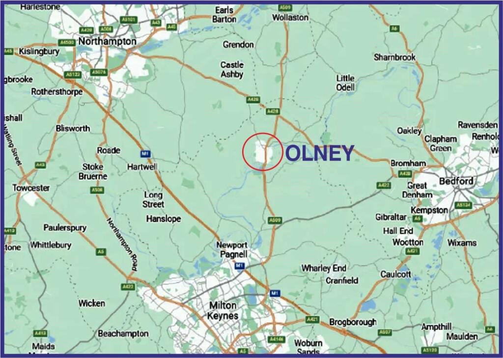
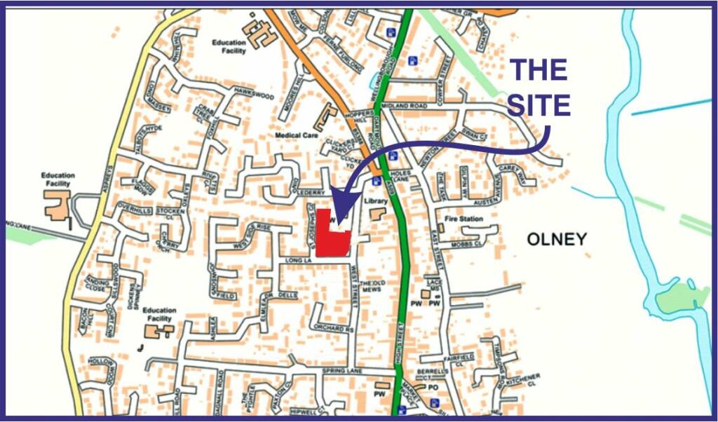
West Street, Olney , Olney, MK46
By Elevation
£ 2,000,000
Elevation says ..
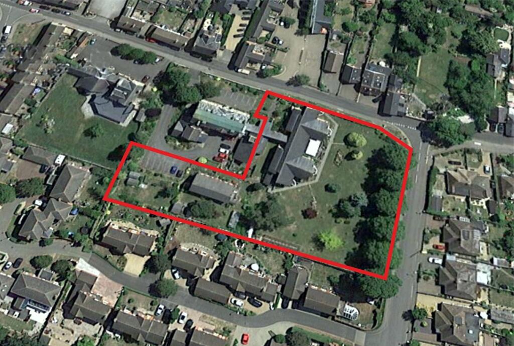
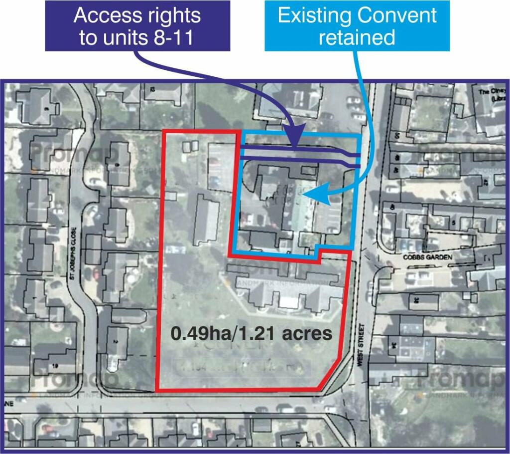
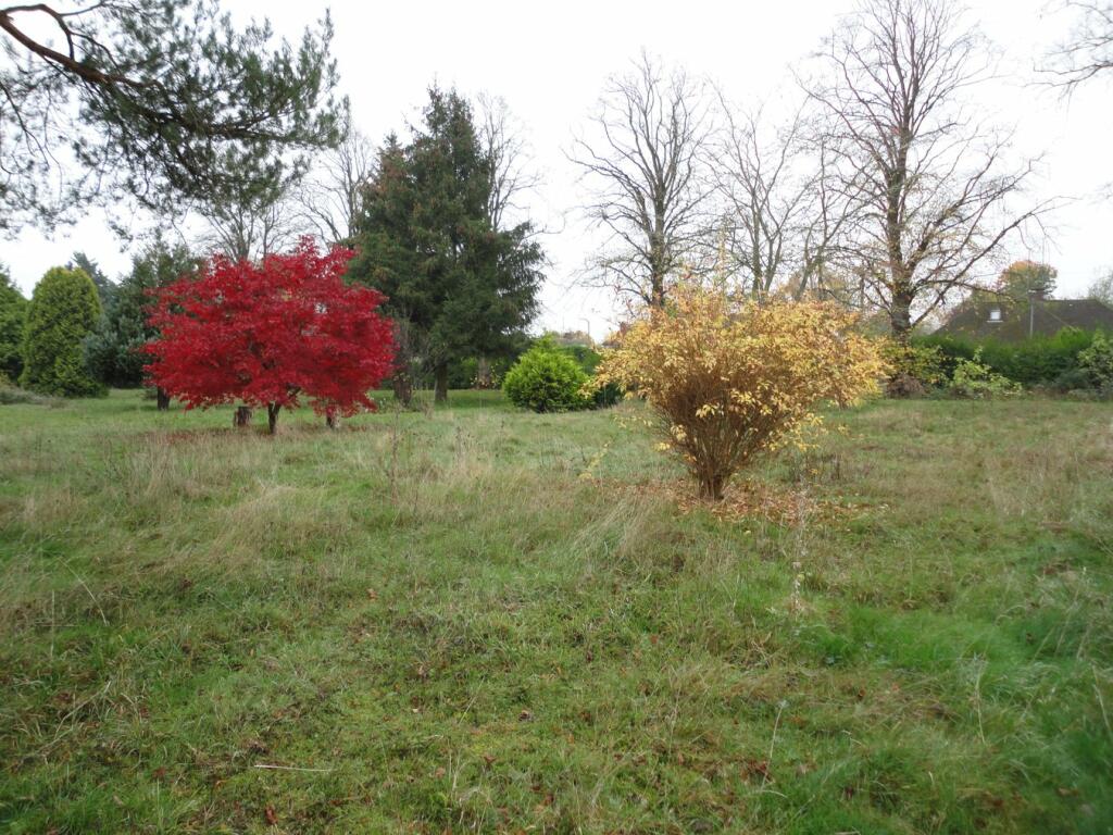
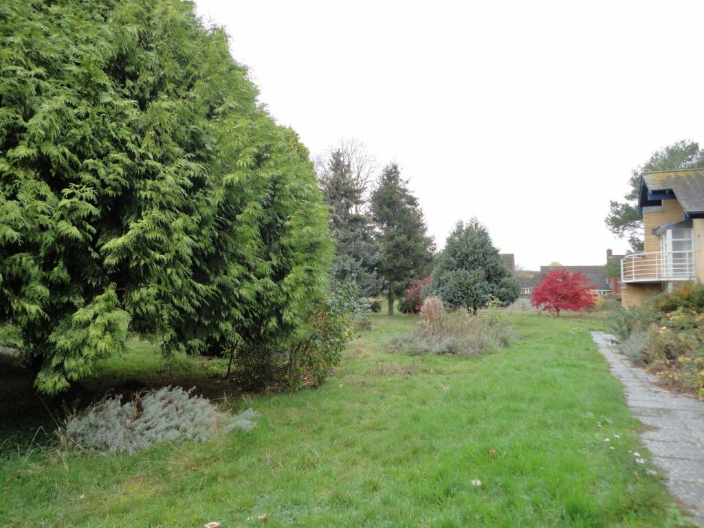
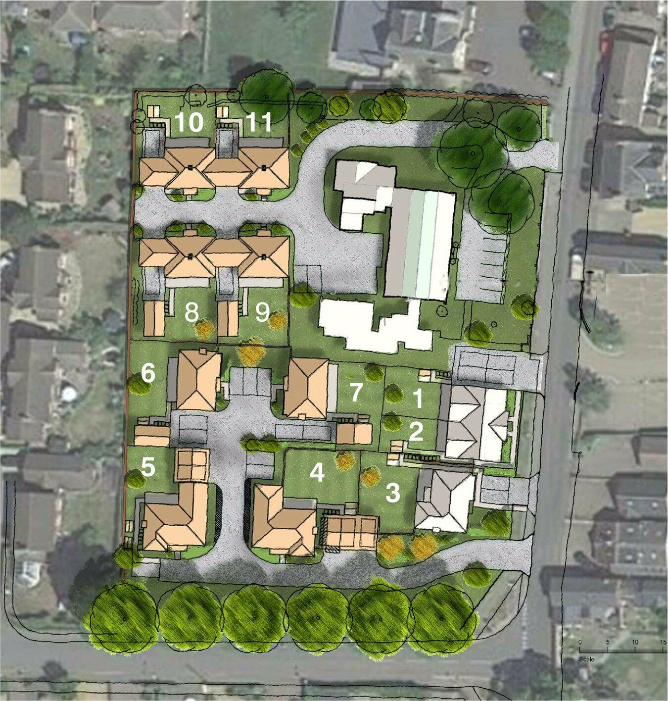
**FOR SALE FREEHOLD BY INFORMAL TENDER - CONSENTED DEVELOPMENT SITE IN OLNEY, BUCKINGHAMSHIRE** **CLOSING DATE 29th JANUARY 2025**Located in a highly sought after residential area, this site has detailed planning permission for the construction of eleven, 3 and 4 bedroom dwellings, foll...
- Bedrooms
- 0
- Bathrooms
- 0
The heatmap indicates the level of crime in the area. The color of the heatmap indicates the crime severity and recency.
Metrics Year-on-Year
- Average area value
- 512,857.00 £Decreased by 2.36 %
- Average area rental value
- 1,018.00 £/moDecreased by 42.26 %
- Est rental Yield
- 2.38 %Decreased by 40.94 %
- Crime Rate
- 2.00 %Unchanged by 0.00 %
from 525,271.00 £
from 1,763.00 £/mo
from 4.03 %
from 2.00 %
Agent Activity
Elevation created the listing.
Nearby Schools
| Name | Type | Ofsted | Distance |
|---|---|---|---|
| Olney Middle School | Academy Converter | Good | 0.65 KM |
| Olney Infant Academy | Academy Converter | 0.75 KM | |
| Sherington Church Of England School | Voluntary Controlled School | Good | 5.16 KM |
| Lavendon School | Community School | Outstanding | 5.36 KM |
| Newton Blossomville Church Of England School | Voluntary Controlled School | Outstanding | 6.09 KM |
Images


Nearby Streets
| Name | Average Price | Average Sqft | Distance |
|---|---|---|---|
| Springfield Road | £ 475,000 | 0 | 0.00 KM |
| Silver Birch Grove | £ 850,000 | 0 | 0.00 KM |
| Rose Court | £ 0 | 0 | 0.00 KM |
| Fairfield Close | £ 0 | 0 | 0.00 KM |
| Teedon Lane | £ 0 | 0 | 0.00 KM |
Nearby Listings
| Address | Price | Type | Score | Distance |
|---|---|---|---|---|
| West Street, Olney , Olney, MK46 | £ 2,000,000 | COMMERCIAL_BUY | Unknown | 0.00 KM |
Nearby Properties
| Address | Price | Distance |
|---|---|---|
| 4 West Street | £ 480,000 | 0.04 KM |
| 14 West Street | £ 400,000 | 0.07 KM |
| 34 West Street | £ 635,000 | 0.07 KM |
| 46 West Street | £ 432,500 | 0.07 KM |
| 66 West Street | £ 235,000 | 0.10 KM |