
FR
Humphrey Road, Manchester, M16
By Frestons
£ 1,200
Frestons says ..
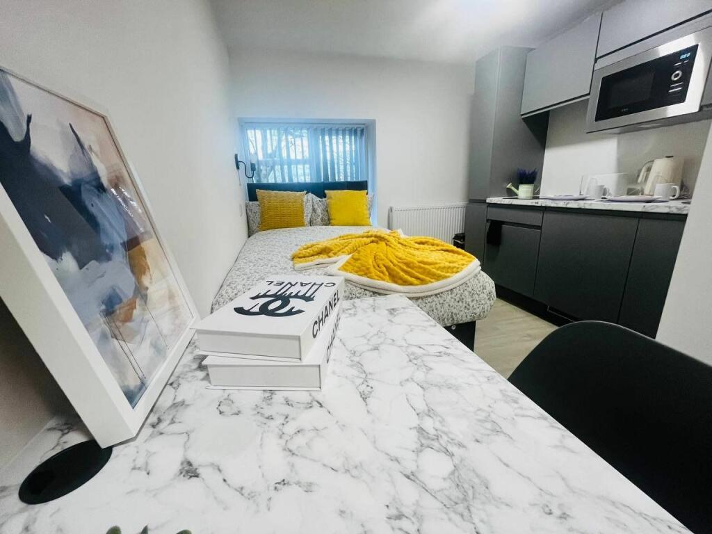
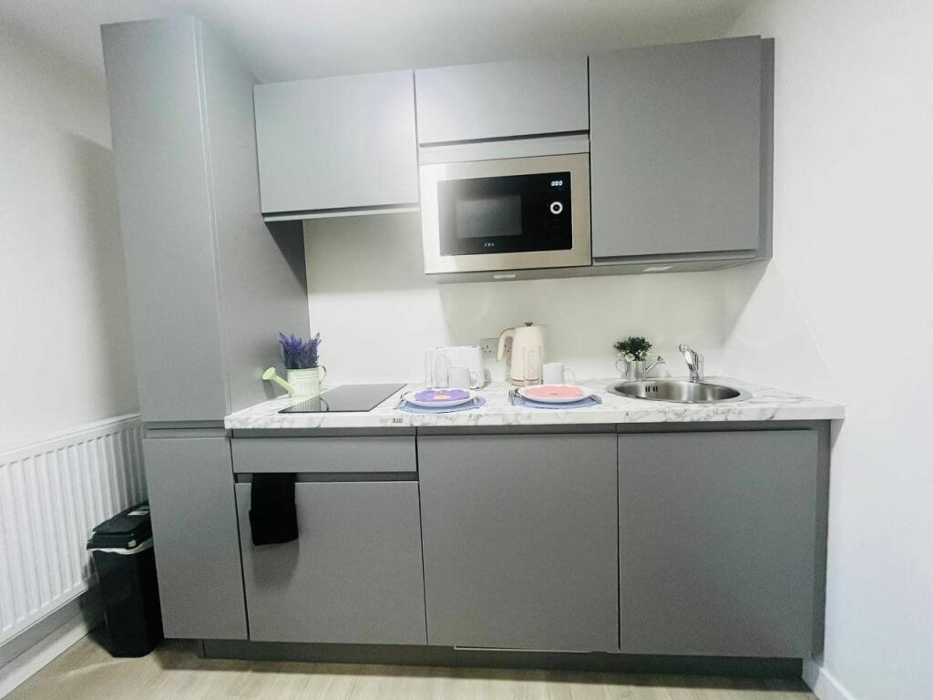
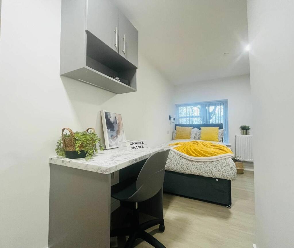
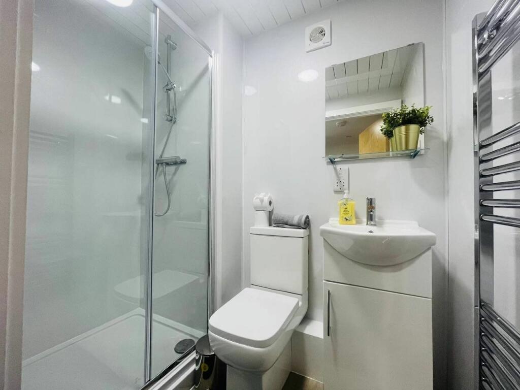
ALL BILLS INCLUDED: Frestons are delighted to present this spacious studio apartment in M16.
- Bedrooms
- 0
- Bathrooms
- 1
The heatmap indicates the level of crime in the area. The color of the heatmap indicates the crime severity and recency.
Metrics Year-on-Year
- Average area value
- 244,667.00 £Decreased by 2.21 %
- Average area rental value
- 1,191.00 £/moIncreased by 3.39 %
- Est rental Yield
- 5.84 %Increased by 5.61 %
- Crime Rate
- 0.00 %
from 250,188.00 £
from 1,152.00 £/mo
from 5.53 %
from 0.00 %
Agent Activity
Frestons created the listing.
Nearby Schools
| Name | Type | Ofsted | Distance |
|---|---|---|---|
| Old Trafford Children'S Centre | Children's Centre Linked Site | 0.04 KM | |
| Seymour Park Community Primary School | Community School | Outstanding | 0.34 KM |
| Old Trafford Community Academy | Academy Converter | Good | 0.88 KM |
| St Alphonsus Rc Primary School | Voluntary Aided School | Outstanding | 0.98 KM |
| Afifah School | Other Independent School | Good | 1.06 KM |
Images


Nearby Streets
| Name | Average Price | Average Sqft | Distance |
|---|---|---|---|
| Stanley Close | £ 210,000 | 0 | 0.00 KM |
| Northumberland Crescent | £ 135,000 | 0 | 0.00 KM |
| Trafford Bank Road | £ 0 | 0 | 0.00 KM |
| Jubilee Court, Seymour Grove | £ 0 | 0 | 0.00 KM |
| Carlton Avenue | £ 0 | 0 | 0.00 KM |
Nearby Transport
| Name | NLC | TLC | Distance |
|---|---|---|---|
| Manchester United Football Ground | 2996 | MUF | 2.04 KM |
| Deansgate | 2963 | DGT | 2.74 KM |
| Salford Crescent | 2794 | SLD | 2.83 KM |
| Salford Central | 2798 | SFD | 3.08 KM |
| Manchester Oxford Road | 2966 | MCO | 3.62 KM |
Nearby Listings
| Address | Price | Type | Score | Distance |
|---|---|---|---|---|
| St. Hildas Road, Old Trafford | £ 2,200 | RENT | Unknown | 0.04 KM |
| Stanley Road,Old Trafford,Manchester,M16 | £ 1,950 | RENT | Unknown | 0.14 KM |
| Chester Road, Manchester, M16 | £ 1,150 | RENT | Unknown | 0.19 KM |
| Chester Road Manchester M16 | £ 1,050 | RENT | Unknown | 0.19 KM |
| West Point, Manchester, M16 | £ 2,250 | RENT | Unknown | 0.19 KM |
Nearby Properties
| Address | Price | Distance |
|---|---|---|
| 90 Humphrey Road | £ 282,000 | 0.03 KM |
| 118 Humphrey Road | £ 240,000 | 0.03 KM |
| 94 Humphrey Road | £ 238,000 | 0.03 KM |
| 116 Humphrey Road | £ 237,000 | 0.03 KM |
| 110 Humphrey Road | £ 192,000 | 0.03 KM |