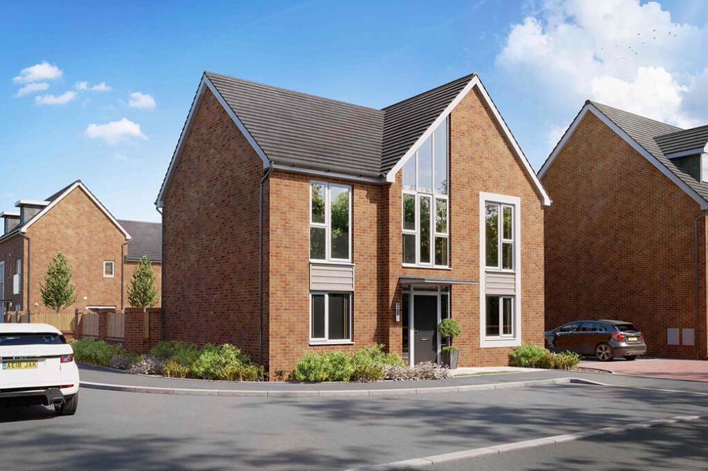
Farnsworth Drive, Clay Cross, S45 9FN
By St Modwen Homes
£ 394,995
Reviews
4 out of 5 stars
St Modwen Homes says ..
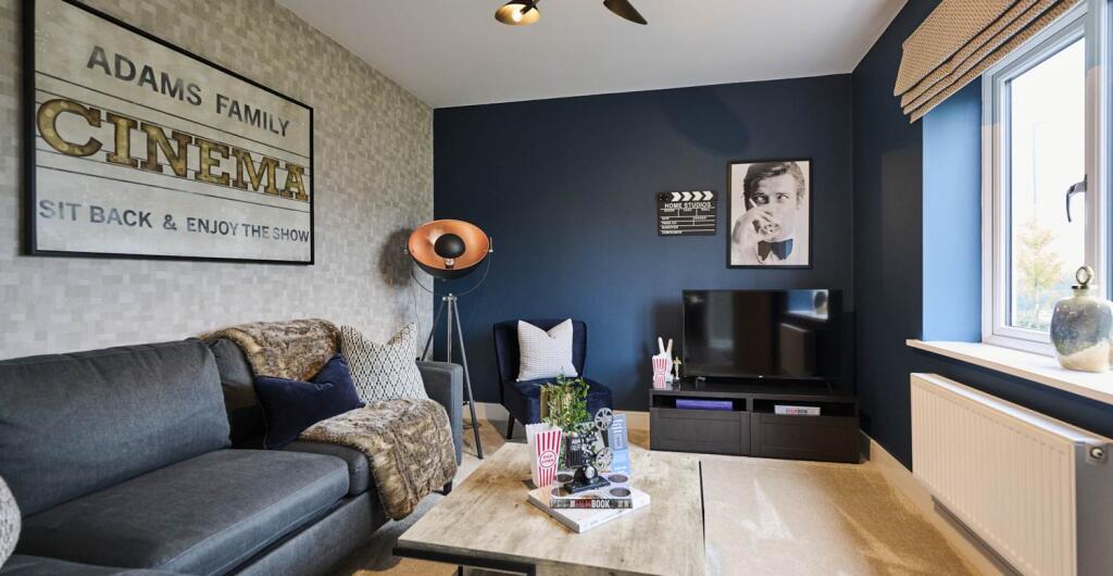
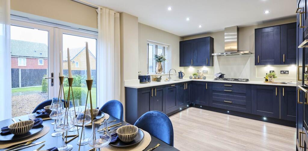
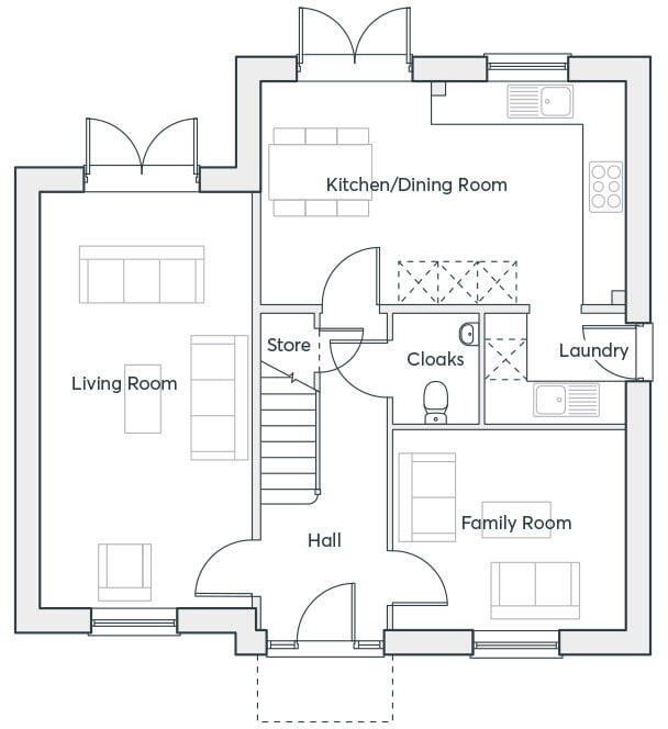
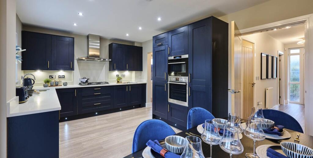
Open plan dining/kitchen with integrated appliances and French doors to the garden · Living room with French doors to the rear garden · Separate family room · Downstairs cloakroom · Laundry room off the kitchen · Master bedroom with en-suite and walk-in wardrobe &
Property Oracle says ..
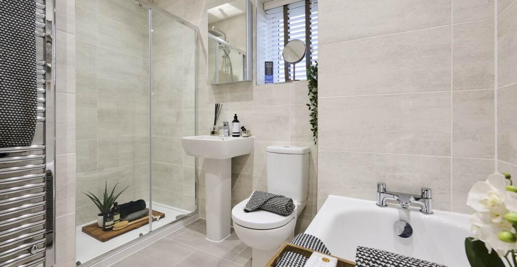
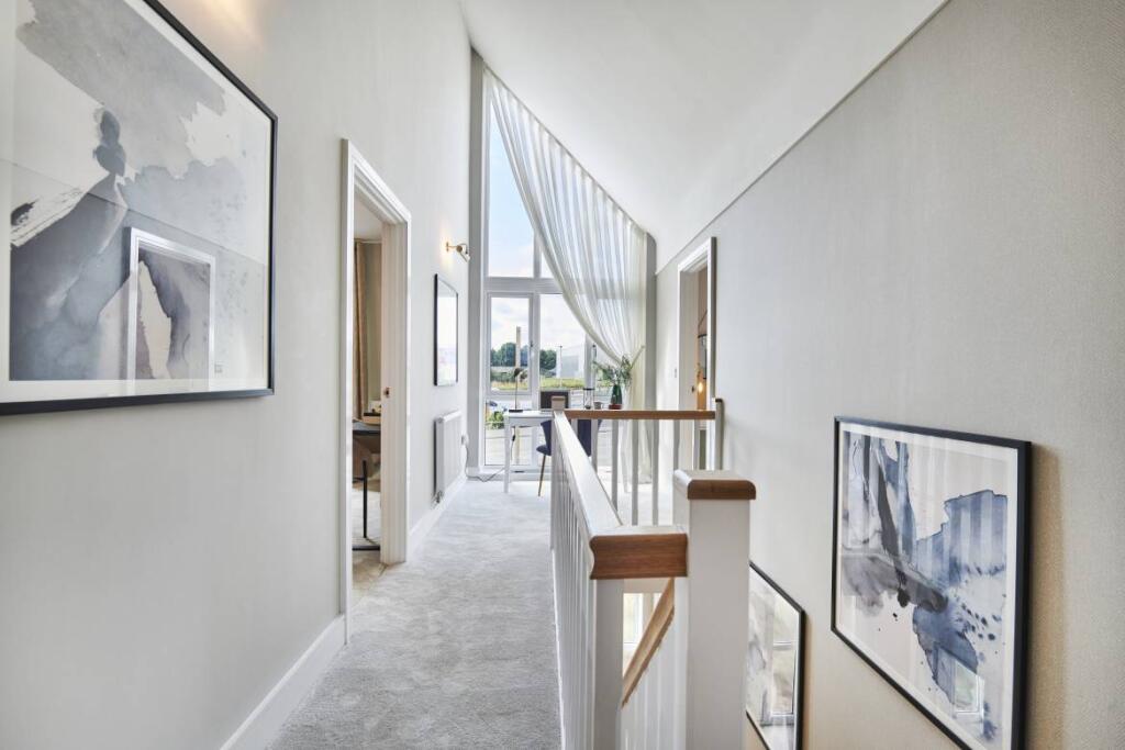
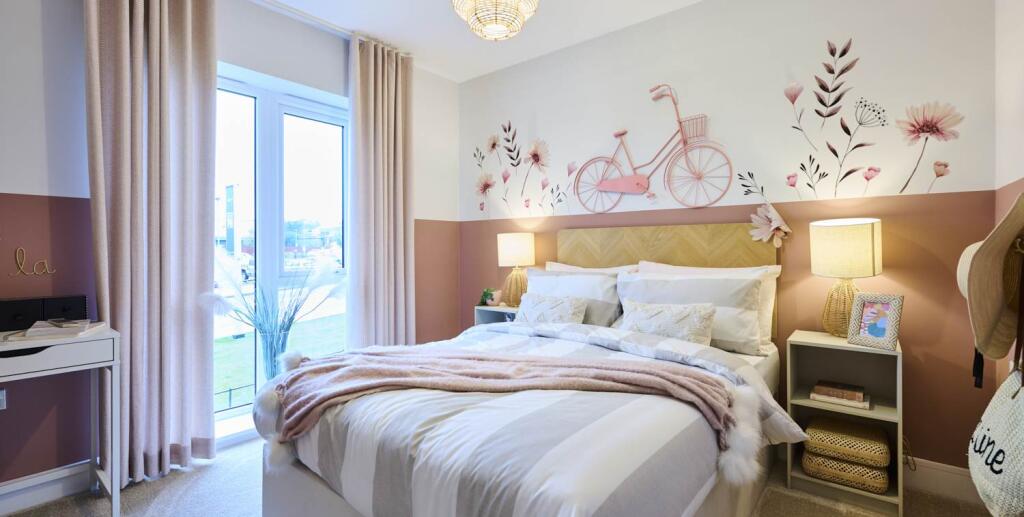
The property is a 4-bedroom detached house located in Clay Cross, Derbyshire, listed at £394,995. The area has an average house price of £561,961 and an average price per square foot of £432. However, it’s important to note that the provided data on square footage for both the subject property and nearby listings is missing, making a precise comparison challenging. The property appears to be modern in design and is presented in excellent condition, as shown in the images. It includes a rear garden, visible in several photos. The presence of nearby schools, such as Sharley Park Community Primary School (rated ‘Good’ by Ofsted) and Holmgate Primary School and Nursery (also rated ‘Good’), adds to the family-friendly appeal of the location. Transportation links to Chesterfield and Alfreton are also within reasonable distance.
Given the apparent excellent condition of the property, the inclusion of a garden, and the proximity to amenities and schools, the asking price of £394,995 may represent good value compared to the area average of £561,961, although a definitive conclusion on price-per-square-foot value cannot be reached without the missing square footage data. Further investigation into the specific location within Clay Cross and any unique features of the property would be beneficial for a more comprehensive evaluation.
Therefore, we give this property 8 / 10. *Disclaimer: This is our option and does constitute a recommendation or financial advice. Do your own research. *
- Price
- 8
- Condition
- 10
- Location
- 7
- Land
- 8
- Bedrooms
- 4
- Bathrooms
- 0
- Sqft (est)
- 700.00
The heatmap indicates the level of crime in the area. The color of the heatmap indicates the crime severity and recency.
Metrics Year-on-Year
- Average area value
- 207,250.00 £Decreased by 18.32 %
- Est sale value
- 127,400.00 £Decreased by 33.33 %
- Average area rental value
- 1,073.00 £/moIncreased by 15.75 %
- Est letting value
- 0.00 £/mo
- Est rental Yield
- 6.21 %Increased by 41.78 %
- Crime Rate
- 4.00 %Unchanged by 0.00 %
Agent Activity
St Modwen Homes created the listing.
Nearby Schools
| Name | Type | Ofsted | Distance |
|---|---|---|---|
| Tupton Hall School | Academy Sponsor Led | 0.97 KM | |
| Sharley Park Community Primary School | Community School | Good | 1.43 KM |
| Tupton Primary And Nursery Academy | Academy Sponsor Led | 1.92 KM | |
| Holmgate Primary School And Nursery | Community School | Good | 2.14 KM |
| North Wingfield Primary And Nursery Academy | Academy Converter | 2.92 KM |
Images


Nearby Streets
| Name | Average Price | Average Sqft | Distance |
|---|---|---|---|
| Pease Close | £ 225,000 | 0 | 0.00 KM |
| Miners Avenue | £ 0 | 0 | 0.00 KM |
| Brassington Lane | £ 0 | 0 | 0.00 KM |
| Egstow Place | £ 0 | 0 | 0.00 KM |
| Derby Road | £ 252,120 | 0 | 0.00 KM |
Nearby Transport
| Name | NLC | TLC | Distance |
|---|---|---|---|
| Chesterfield | 6615 | CHD | 7.25 KM |
| Alfreton | 1805 | ALF | 9.39 KM |
Nearby Listings
| Address | Price | Type | Score | Distance |
|---|---|---|---|---|
| Farnsworth Drive, Clay Cross, S45 9FN | £ 274,995 | BUY | 6 / 10 | 0.00 KM |
| Farnsworth Drive, Clay Cross, S45 9FN | £ 394,995 | BUY | 5 / 10 | 0.00 KM |
| Farnsworth Drive, Clay Cross, S45 9FN | £ 389,995 | BUY | 6 / 10 | 0.00 KM |
| Farnsworth Drive, Clay Cross, S45 9FN | £ 359,995 | BUY | 7 / 10 | 0.00 KM |
| Farnsworth Drive, Clay Cross, S45 9FN | £ 399,995 | BUY | 7 / 10 | 0.00 KM |
Nearby Properties
| Address | Price | Distance |
|---|---|---|
| 5 Bridge Street | £ 124,000 | 0.52 KM |
| 3 Bridge Street | £ 100,000 | 0.52 KM |
| 15 Egstow Street | £ 72,500 | 0.57 KM |
| 25 Egstow Street | £ 47,000 | 0.57 KM |
| 14 Egstow Street | £ 86,000 | 0.57 KM |