TH
Avenue Road, Bexleyheath, DA7
By The Agency UK
£ 1,600
The Agency UK says ..
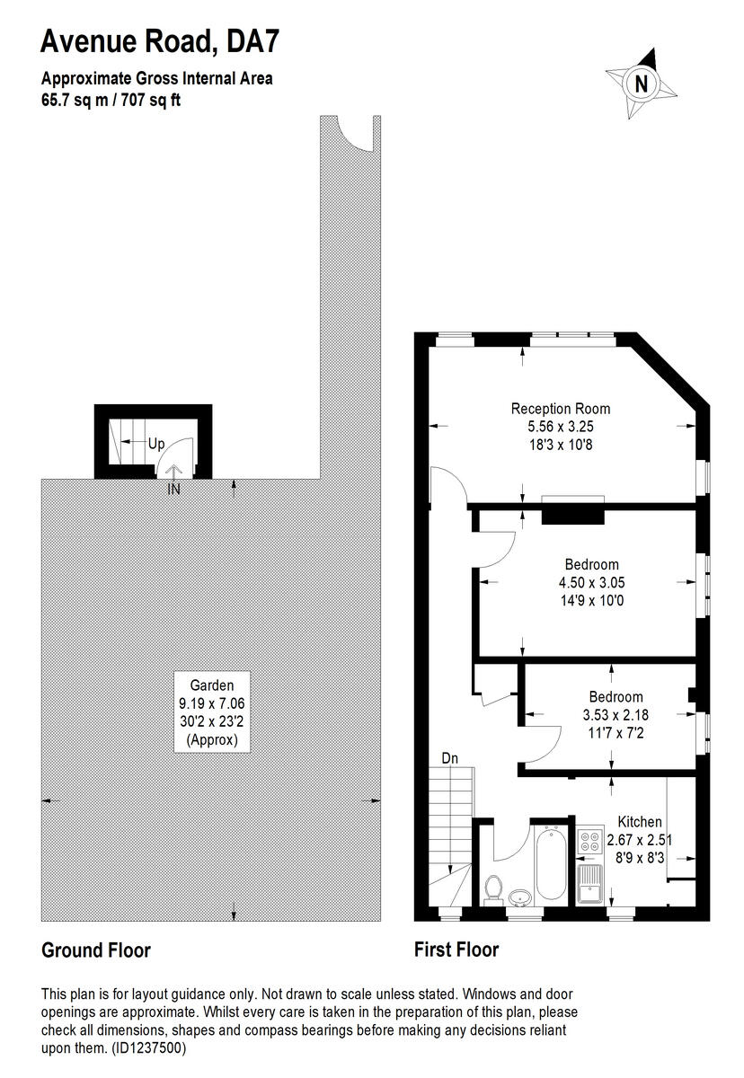
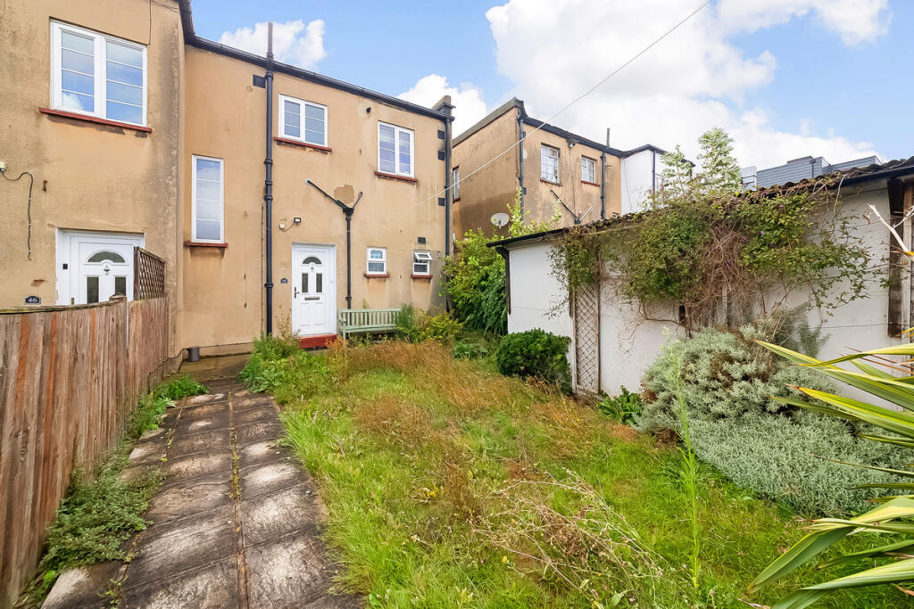
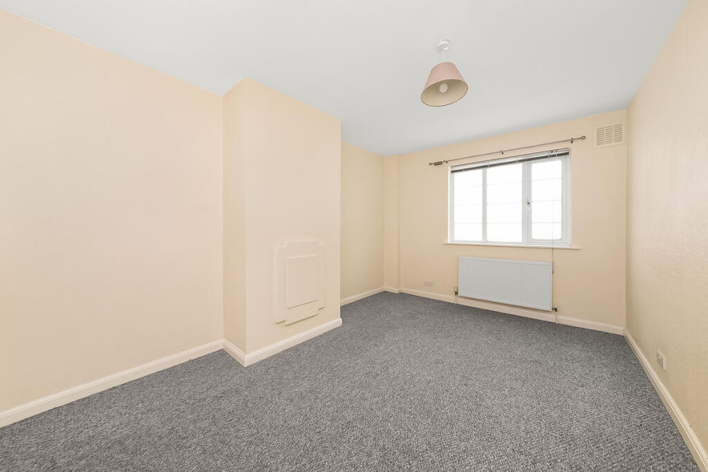
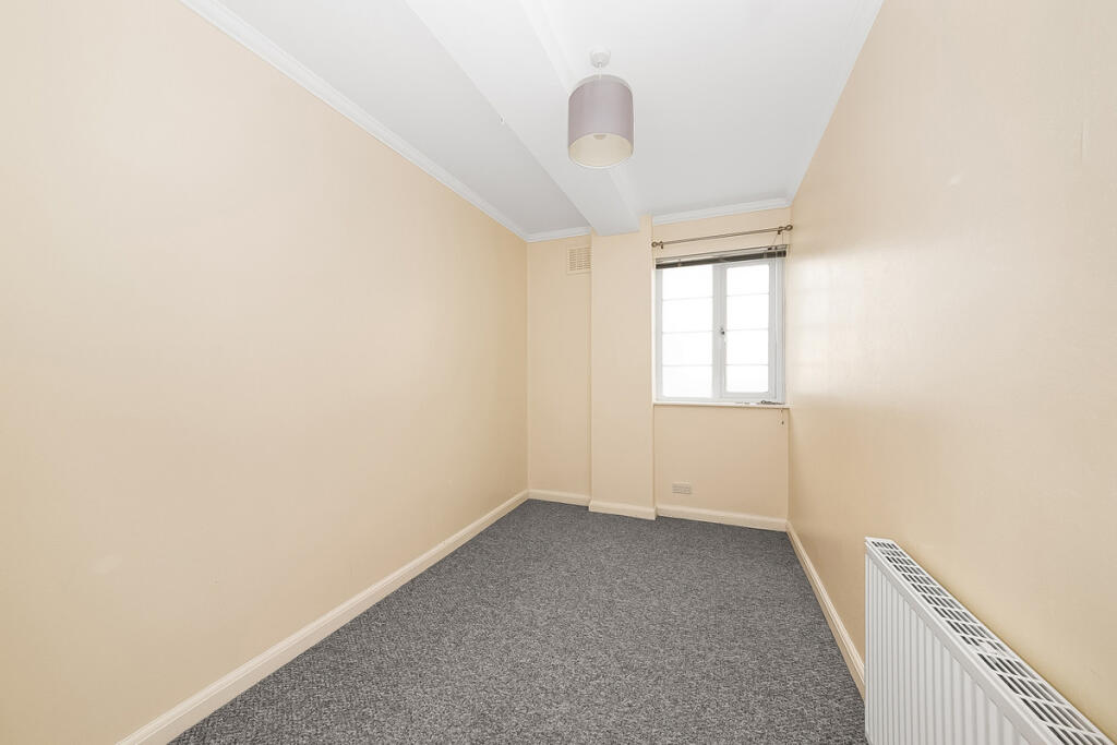
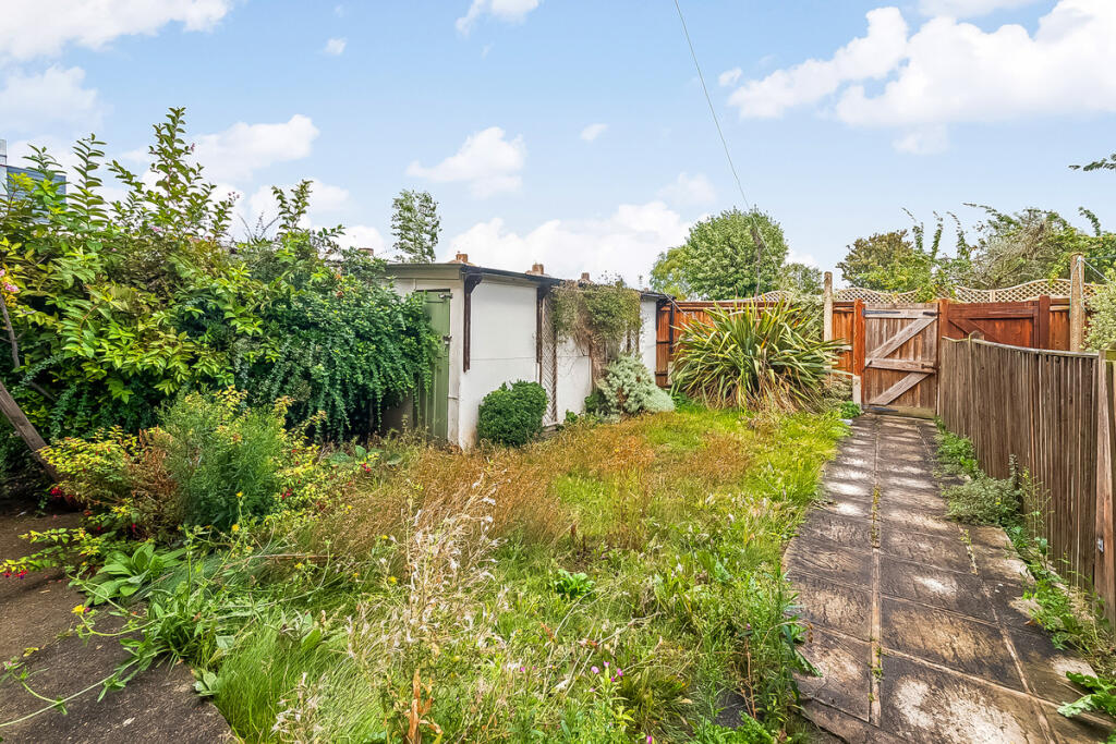
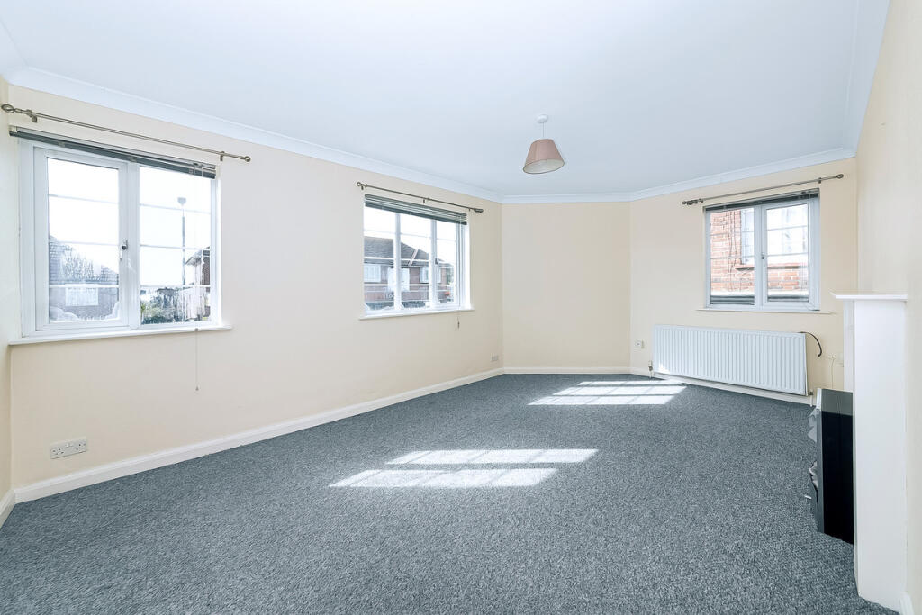
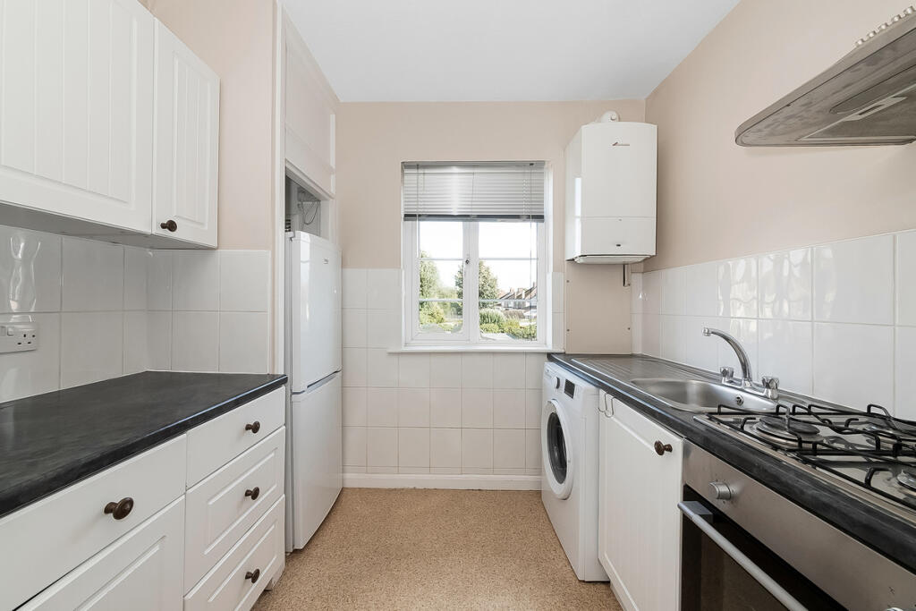
Spacious 2 bedroom maisonette with a garden close to Bexleyheath Station, local shops and spanning just over 700 sqft
- Bedrooms
- 2
- Bathrooms
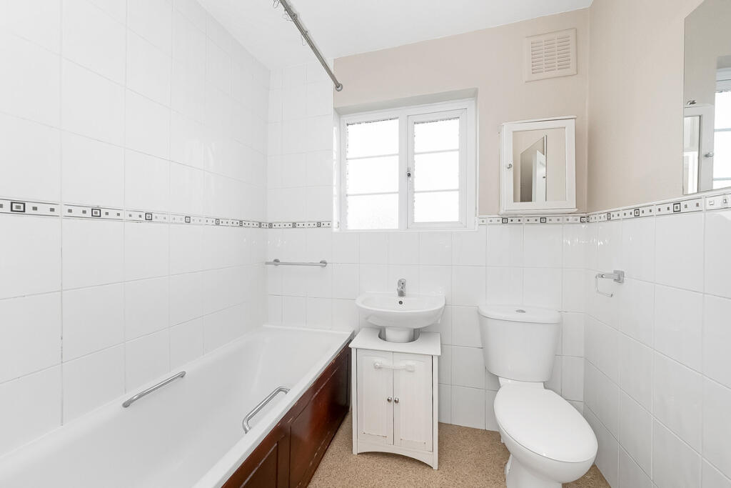
- 1
The heatmap indicates the level of crime in the area. The color of the heatmap indicates the crime severity and recency.
Metrics Year-on-Year
- Average area value
- 453,750.00 £Decreased by 9.43 %
- Average area rental value
- 1,905.00 £/moIncreased by 5.31 %
- Est rental Yield
- 5.04 %Increased by 16.40 %
- Crime Rate
- 35.00 %Unchanged by 0.00 %
from 500,978.00 £
from 1,809.00 £/mo
from 4.33 %
from 35.00 %
Agent Activity
The Agency UK created the listing.
Nearby Schools
| Name | Type | Ofsted | Distance |
|---|---|---|---|
| Upland Primary School | Academy Converter | Good | 0.51 KM |
| Danson Children'S Centre | Children's Centre | 0.64 KM | |
| Brampton Primary Academy | Academy Converter | Good | 0.66 KM |
| Crook Log Primary School | Community School | Good | 0.83 KM |
| St Thomas More Catholic Primary School | Voluntary Aided School | Outstanding | 0.89 KM |
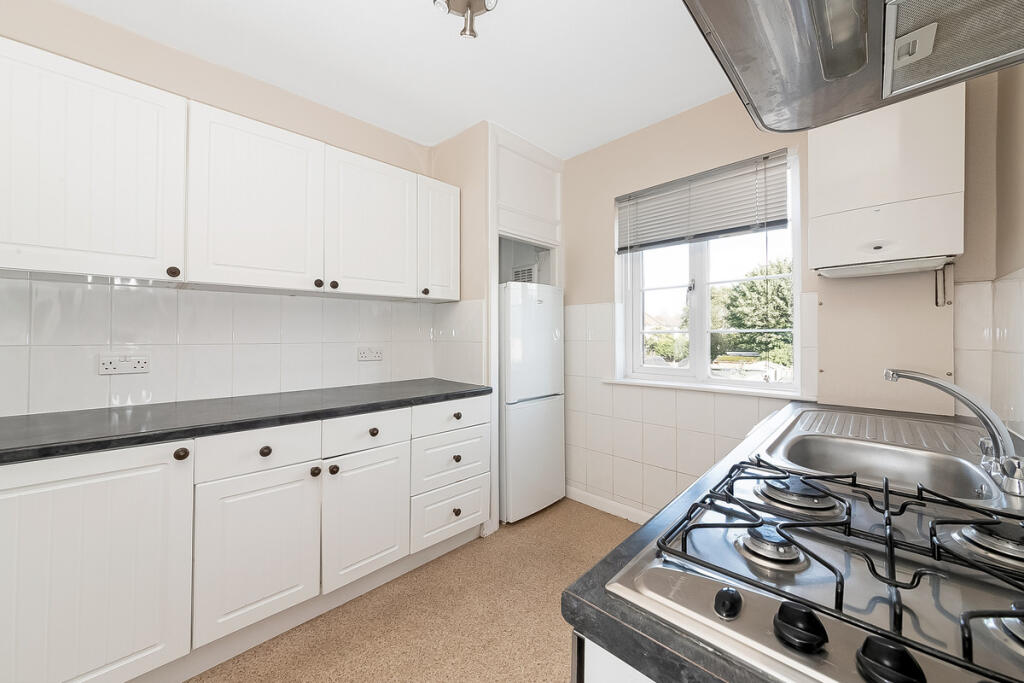
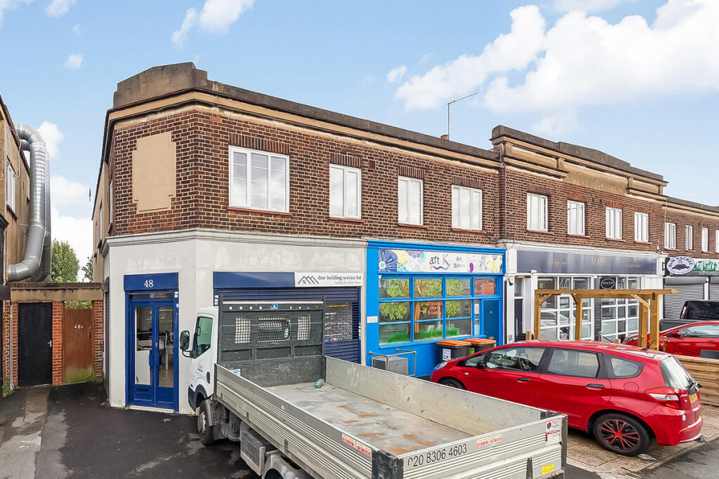
Images
Nearby Streets
| Name | Average Price | Average Sqft | Distance |
|---|---|---|---|
| Beechwood Crescent | £ 0 | 0 | 0.00 KM |
| Portman Close | £ 512,500 | 0 | 0.00 KM |
| Emerton Close | £ 0 | 0 | 0.00 KM |
| Queen Street | £ 0 | 0 | 0.00 KM |
| Bynon Avenue | £ 400,000 | 0 | 0.00 KM |
Nearby Transport
| Name | NLC | TLC | Distance |
|---|---|---|---|
| Bexleyheath | 5094 | BXH | 0.17 KM |
| Barnehurst | 5089 | BNH | 3.02 KM |
| Bexley | 5093 | BXY | 3.02 KM |
| Albany Park | 5132 | AYP | 3.11 KM |
| Abbey Wood | 5131 | ABW | 3.40 KM |
Nearby Listings
| Address | Price | Type | Score | Distance |
|---|---|---|---|---|
| Avenue Road, Bexleyheath, DA7 | £ 1,600 | RENT | Unknown | 0.00 KM |
| Woodlands Road, Bexleyheath, DA7 | £ 2,200 | RENT | Unknown | 0.04 KM |
| Woodlands Road, Bexleyheath, Kent, DA7 | £ 2,250 | RENT | Unknown | 0.08 KM |
| Sheridan Road, Bexleyheath | £ 2,650 | RENT | Unknown | 0.08 KM |
| Avenue Road, Bexleyheath, DA7 | £ 1,300 | RENT | Unknown | 0.08 KM |
Nearby Properties
| Address | Price | Distance |
|---|---|---|
| 68a Avenue Road | £ 73,500 | 0.02 KM |
| 69 Avenue Road | £ 270,000 | 0.09 KM |
| 57 Avenue Road | £ 450,000 | 0.09 KM |
| 71 Avenue Road | £ 305,000 | 0.09 KM |
| 49 Avenue Road | £ 345,000 | 0.09 KM |