SA
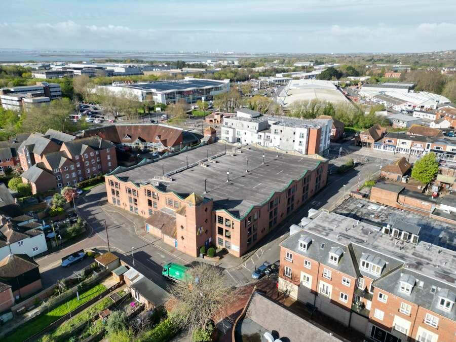
Bulbeck Road Carpark, Havant
By Savills
£ 1
Savills says ..
RESIDENTIAL DEVELOPMENT OPPORTUNITY
- Bedrooms
- 0
- Bathrooms
- 0
The heatmap indicates the level of crime in the area. The color of the heatmap indicates the crime severity and recency.
Metrics Year-on-Year
- Average area value
- 354,000.00 £Decreased by 21.23 %
- Average area rental value
- 1,321.00 £/moIncreased by 24.62 %
- Est rental Yield
- 4.48 %Increased by 58.30 %
- Crime Rate
- 23.00 %Unchanged by 0.00 %
from 449,421.00 £
from 1,060.00 £/mo
from 2.83 %
from 23.00 %
Agent Activity
Savills created the listing.
Nearby Schools
| Name | Type | Ofsted | Distance |
|---|---|---|---|
| Bosmere Junior School | Community School | Good | 0.26 KM |
| Fairfield Infant School | Community School | Good | 0.70 KM |
| Trosnant Infant School | Community School | Good | 1.15 KM |
| Trosnant Junior School | Community School | Good | 1.15 KM |
| Trospacc Children'S Centre | Children's Centre | 1.15 KM |
Images

Nearby Streets
| Name | Average Price | Average Sqft | Distance |
|---|---|---|---|
| Park Road South | £ 120,000 | 0 | 0.00 KM |
| Winifred Court | £ 0 | 0 | 0.00 KM |
| Prince George Street | £ 0 | 0 | 0.00 KM |
| Prince George Street Car Park | £ 0 | 0 | 0.00 KM |
| The Mallards | £ 0 | 0 | 0.00 KM |
Nearby Transport
| Name | NLC | TLC | Distance |
|---|---|---|---|
| Havant | 5532 | HAV | 0.52 KM |
| Bedhampton | 5538 | BDH | 1.34 KM |
| Warblington | 5264 | WBL | 1.92 KM |
| Emsworth | 5257 | EMS | 5.07 KM |
| Rowlands Castle | 5658 | RLN | 5.50 KM |
Nearby Properties
| Address | Price | Distance |
|---|---|---|
| 9 Springwell | £ 282,500 | 0.14 KM |
| 17 Springwell | £ 287,000 | 0.14 KM |
| 7 Springwell | £ 4,300 | 0.14 KM |
| 4 Springwell | £ 250,000 | 0.14 KM |
| 3 Springwell | £ 275,950 | 0.14 KM |