BTF Partnership says ..
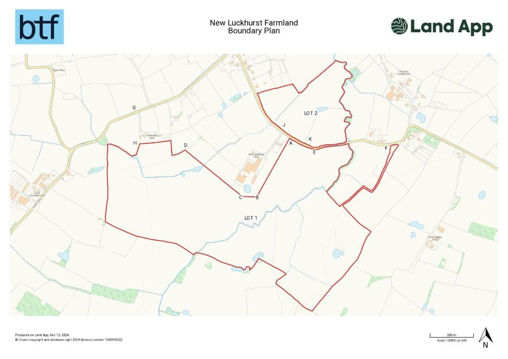
Two parcels of level arable land situated in the Weald of Kent between the villages of Smarden and Bethersden.
Property Oracle says ..
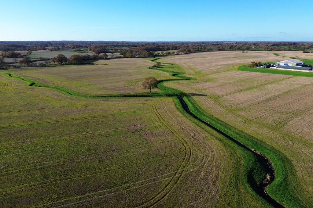
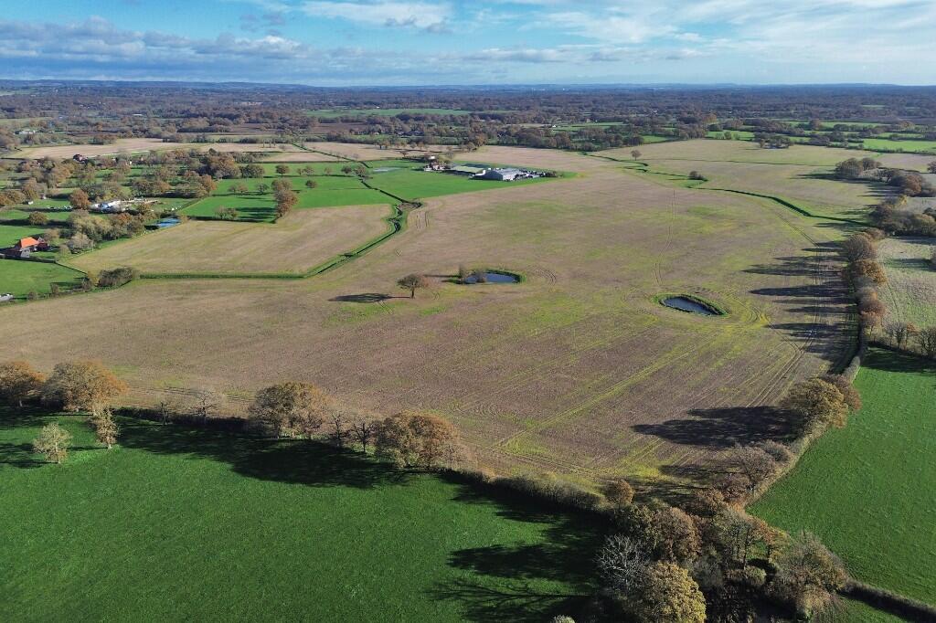
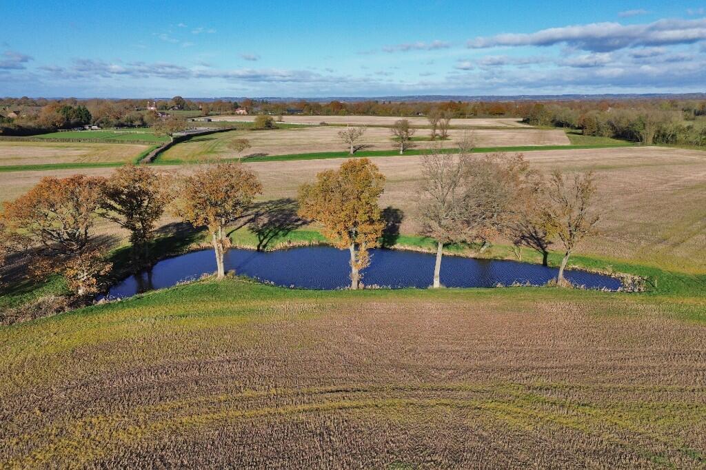
This listing from BTF Partnership presents a significant plot of farmland located on Bethersden Road, Weald North, Ashford, Kent. The listing presents undeveloped farmland. The property boasts a substantial land area, as clearly indicated in the provided aerial imagery and boundary plan. The land’s size is substantial, and visual assessment suggests it is several acres, although the exact size remains unspecified. The images display open fields with a stream running through the property, making it attractive for agriculture or potential future development(subject to planning approvals). Proximity to various nearby towns and villages offers some nearby amenities, although significant distances to more substantial shopping, commercial, and recreational centers necessitate travel. The listing price of £265,000 is presented without contextual information regarding the land’s size and development opportunities. This lack of crucial information hampers fair market value evaluation. Overall, the property offers significant potential given its sizable land, however, due to the absence of building or structural details and the uncertainty of the planning possibilities this limits the assessment significantly. Potential buyers interested in agricultural use or future development projects should conduct thorough research on planning permissions, land usage regulations, and conduct a professional valuation.
Therefore, we give this property 4 / 10. *Disclaimer: This is our option and does constitute a recommendation or financial advice. Do your own research. *
- Price
- 4
- Condition
- 1
- Location
- 3
- Land
- 8
- Bedrooms
- 0
- Bathrooms
- 0
The heatmap indicates the level of crime in the area. The color of the heatmap indicates the crime severity and recency.
Metrics Year-on-Year
- Average area value
- 257,097.00 £Decreased by 8.25 %
- Average area rental value
- 956.00 £/moIncreased by 1.92 %
- Est rental Yield
- 4.46 %Increased by 10.95 %
- Crime Rate
- 0.00 %
Agent Activity
BTF Partnership created the listing.
Nearby Schools
| Name | Type | Ofsted | Distance |
|---|---|---|---|
| Smarden Primary School | Academy Converter | Good | 1.99 KM |
| Little Acorns School | Other Independent Special School | Good | 4.12 KM |
| High Halden Church Of England Primary School | Voluntary Controlled School | Good | 4.21 KM |
| Greenfields School | Other Independent Special School | Good | 4.64 KM |
| St Michael'S Church Of England Primary School | Academy Converter | Good | 5.01 KM |
Images
Nearby Streets
| Name | Average Price | Average Sqft | Distance |
|---|---|---|---|
| Bethersden Road | £ 0 | 0 | 0.00 KM |
Nearby Transport
| Name | NLC | TLC | Distance |
|---|---|---|---|
| Pluckley | 5225 | PLC | 6.63 KM |
| Headcorn | 5220 | HCN | 8.07 KM |
Nearby Listings
| Address | Price | Type | Score | Distance |
|---|---|---|---|---|
| Bethersden Road, TN27 | £ 1,250,000 | BUY | 5 / 10 | 0.00 KM |
| Bethersden Road, TN27 | £ 265,000 | BUY | 4 / 10 | 0.00 KM |
| Bethersden Road, Smarden, Ashford, Kent, TN27 | £ 685,000 | BUY | Unknown | 0.51 KM |
| Haffenden Quarter, Smarden, Kent, TN27 8QR | £ 1,195,000 | BUY | Unknown | 0.57 KM |
| Bethersden Road, Smarden, Ashford, Kent, TN27 8QT | £ 500,000 | BUY | 7 / 10 | 0.71 KM |
Nearby Properties
| Address | Price | Distance |
|---|---|---|
| Blinks Farmhouse | £ 450,000 | 0.47 KM |
| Haffenden Barn | £ 799,000 | 0.51 KM |
| Phoenix Oast | £ 780,000 | 0.51 KM |
| High Brooms | £ 850,000 | 0.70 KM |
| Coronation Villa | £ 580,000 | 0.70 KM |