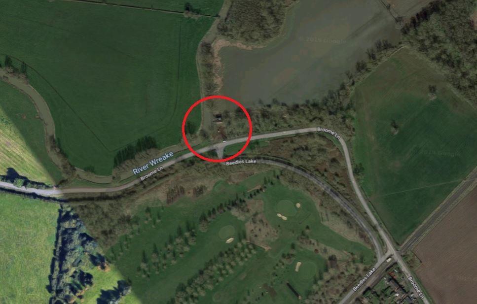
Commercial Storage Land, Broome Lane, East Goscote, Leicester LE7 3WQ
By P&F
£ 75,000
Reviews
2 out of 5 stars
P&F says ..
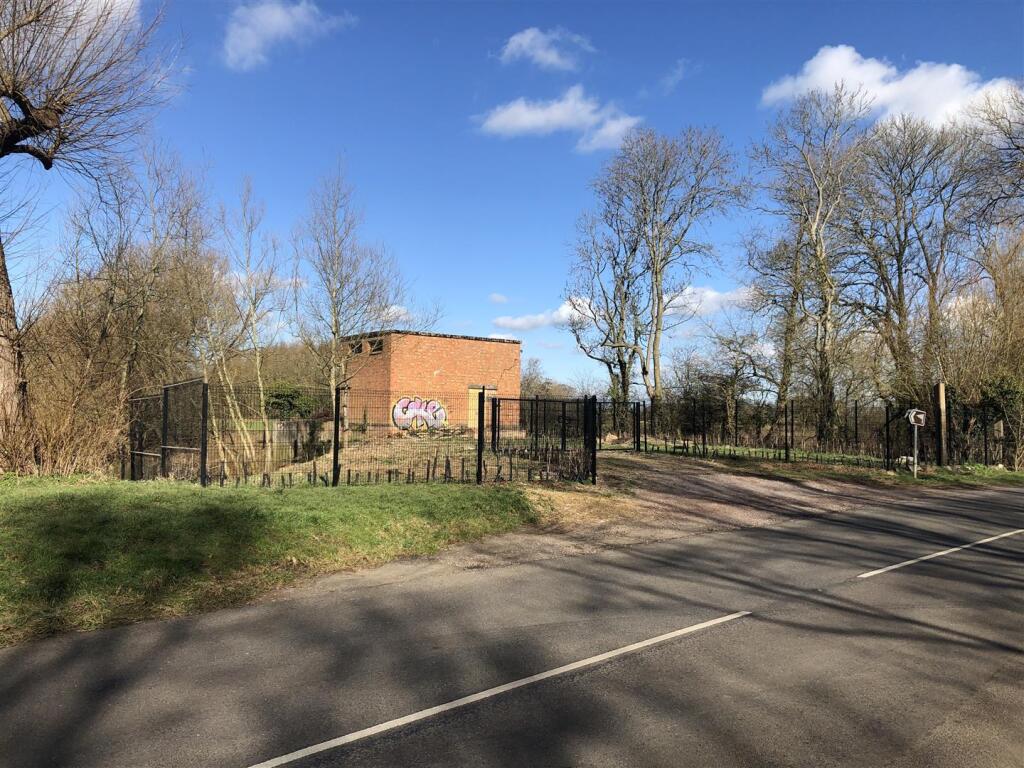
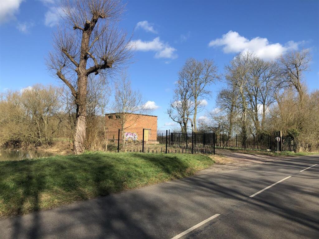
0.18 Acres Fenced and Gated Storage Land Offers invited in excess of £75,000 Freehold
Property Oracle says ..
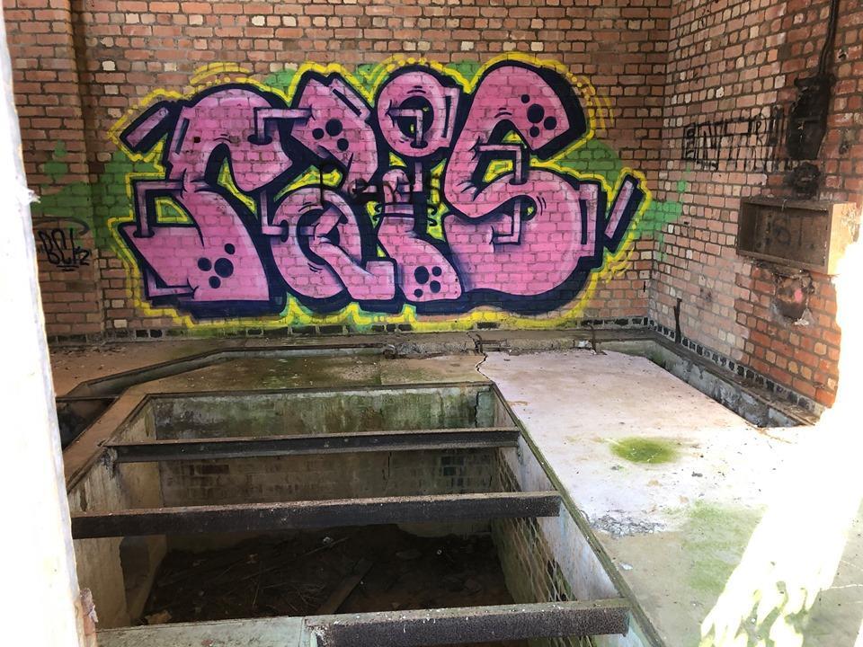
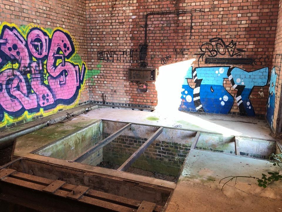
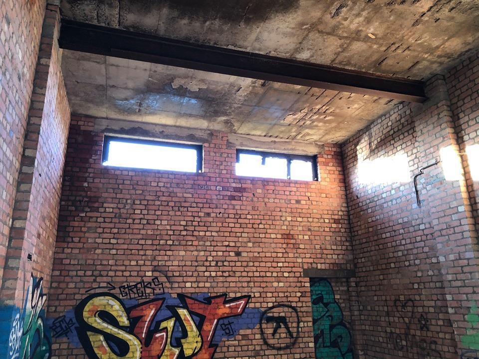
Commercial Storage Land, Broome Lane, East Goscote, Leicester is a plot of land with a derelict building. The building shows significant signs of disrepair and vandalism, as evidenced by the graffiti and general state of the structure. The location is rural, with the nearest railway stations being Syston (4.19 km) and Sileby (6.22 km). Several primary schools are within a 2.5 km radius, including Broomfield Community Primary School (0.77 km), which is rated ‘Good’ by Ofsted. The land itself appears to be relatively small, based on the provided images and plot size information. The list price of £75,000 is significantly lower than the average house price in the area (£549,850), but given the condition of the property and its classification as land rather than a habitable dwelling, this price may or may not be considered reasonable. Further information on the potential uses of the land and any planning permissions would be needed for a complete evaluation of the price.
Therefore, we give this property 4 / 10. *Disclaimer: This is our option and does constitute a recommendation or financial advice. Do your own research. *
- Price
- 7
- Condition
- 3
- Location
- 5
- Land
- 3
- Bedrooms
- 0
- Bathrooms
- 0
The heatmap indicates the level of crime in the area. The color of the heatmap indicates the crime severity and recency.
Metrics Year-on-Year
- Average area value
- 607,500.00 £Increased by 4.15 %
- Average area rental value
- 1,328.00 £/moDecreased by 13.15 %
- Est rental Yield
- 2.62 %Decreased by 16.83 %
- Crime Rate
- 8.00 %Unchanged by 0.00 %
Agent Activity
P&F created the listing.
Nearby Schools
| Name | Type | Ofsted | Distance |
|---|---|---|---|
| Broomfield Community Primary School | Academy Converter | Good | 0.77 KM |
| Queniborough Church Of England Primary School | Academy Converter | Good | 1.91 KM |
| St Michael & All Angels Church Of England Primary School | Academy Converter | 2.19 KM | |
| Wreake Valley Academy | Academy Converter | Requires improvement | 2.31 KM |
| Ratcliffe College | Other Independent School | 2.58 KM |
Images

Nearby Streets
| Name | Average Price | Average Sqft | Distance |
|---|---|---|---|
| The Covert | £ 325,000 | 0 | 0.00 KM |
| The Leys | £ 444,950 | 0 | 0.00 KM |
| Yeoman's Dale | £ 0 | 0 | 0.00 KM |
| Ploughman's Lea | £ 0 | 0 | 0.00 KM |
| Woodman's Chase | £ 0 | 0 | 0.00 KM |
Nearby Transport
| Name | NLC | TLC | Distance |
|---|---|---|---|
| Syston | 1900 | SYS | 4.19 KM |
| Sileby | 1902 | SIL | 6.22 KM |
Nearby Listings
| Address | Price | Type | Score | Distance |
|---|---|---|---|---|
| Commercial Storage Land, Broome Lane, East Goscote, Leicester LE7 3WQ | £ 75,000 | BUY | 4 / 10 | 0.00 KM |
| Commercial Storage Land, Broome Lane, East Goscote, Leicester LE7 3WQ | £ 68,500 | BUY | 5 / 10 | 0.00 KM |
| Badgers Corner, East Goscote, Leicester, Leicestershire, LE7 | £ 300,000 | BUY | 7 / 10 | 0.12 KM |
| Badgers Corner, East Goscote, LE7 | £ 260,000 | BUY | 7 / 10 | 0.15 KM |
| Fox Hollow, East Goscote, LE7 | £ 299,950 | BUY | 7 / 10 | 0.20 KM |
Nearby Properties
| Address | Price | Distance |
|---|---|---|
| 6 The Covert | £ 129,500 | 0.10 KM |
| 4 The Covert | £ 127,500 | 0.10 KM |
| 6 Badgers Corner | £ 139,000 | 0.12 KM |
| 4 Badgers Corner | £ 179,950 | 0.12 KM |
| 9 Badgers Corner | £ 194,000 | 0.12 KM |