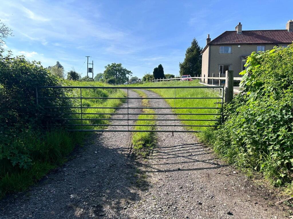
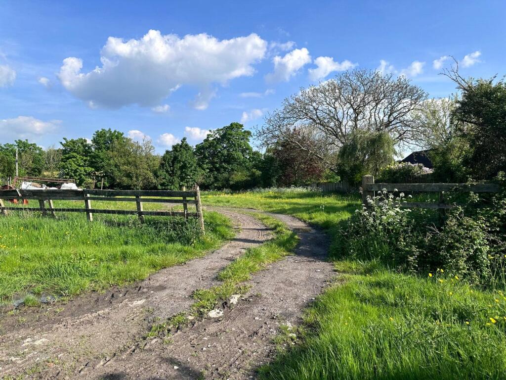
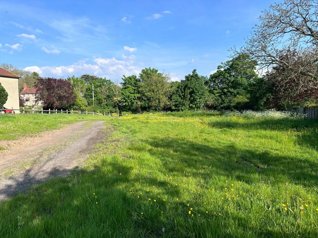
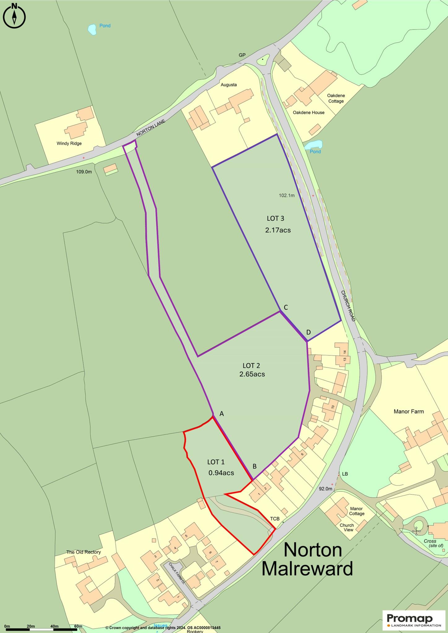
0.94 acres at Church Road, Norton Malreward
By Killens
£ 60,000
Reviews
3 out of 5 stars
Killens says ..
A paddock with potential situated close to the centre of the village. For sale by informal tender as Lot 1. Tenders to be submitted by 12pm on Wednesday 24th July. 16/7/24 - Please note the plan on the brochure has been changed to be consistent with the plan detailed on the property po...
Property Oracle says ..
This property listing is for a 0.94-acre plot of land located at Church Road, Norton Malreward, in the Chew Valley, Somerset. The land appears to be a paddock, largely undeveloped but with potential for various uses. The area is described as being close to the village centre. Nearby properties range in value from smaller cottages to more substantial family homes, suggesting a diverse and potentially thriving market. Transport links are available via several nearby railway stations, though the specific distance to local amenities from this plot is unclear. Several schools are within a reasonable distance, enhancing its appeal as a potential location for family living. The lack of buildings and the ‘for sale by informal tender’ aspect means this property is likely aimed at developers or buyers looking for a project and a substantial amount of land in a rural setting. The relatively low listing price suggests the price per sq ft is significantly lower compared to developed properties. The land’s condition shows it requires improvements before it can be fully utilised. The overall value of the property largely depends on the intended use, the buyer’s perspective, and success of any future planning permission needed, if applicable.
Therefore, we give this property 6 / 10. *Disclaimer: This is our option and does constitute a recommendation or financial advice. Do your own research. *
- Price
- 7
- Condition
- 4
- Location
- 7
- Land
- 8
- Bedrooms
- 0
- Bathrooms
- 0
- Sqft (est)
- 87,603.17
- Lot (est)
- 41,190.26
The heatmap indicates the level of crime in the area. The color of the heatmap indicates the crime severity and recency.
Metrics Year-on-Year
- Average area value
- 751,364.00 £Decreased by 6.33 %
- Est sale value
- 32,237,966.56 £Increased by 636.00 %
- Average area rental value
- 1,688.00 £/moIncreased by 12.53 %
- Est letting value
- 0.00 £/mo
- Est rental Yield
- 2.70 %Increased by 20.54 %
- Crime Rate
- 73.00 %Unchanged by 0.00 %
Agent Activity
Killens marked this listing as sold.
Killens created the listing.
Nearby Schools
| Name | Type | Ofsted | Distance |
|---|---|---|---|
| Stanton Drew Primary School | Academy Converter | 2.29 KM | |
| Bridge Farm Primary School | Community School | Outstanding | 2.59 KM |
| Wansdyke Primary School | Academy Converter | 2.73 KM | |
| Pensford Primary School | Academy Converter | 2.95 KM | |
| Bridge Learning Campus | Academy Sponsor Led | Good | 3.13 KM |
Images

Nearby Streets
| Name | Average Price | Average Sqft | Distance |
|---|---|---|---|
| Maesknoll Lane | £ 1,100,000 | 0 | 0.00 KM |
| Longacre Road | £ 405,000 | 0 | 0.00 KM |
| Sandy Lane | £ 866,875 | 0 | 0.00 KM |
Nearby Transport
| Name | NLC | TLC | Distance |
|---|---|---|---|
| Bedminster | 3245 | BMT | 6.73 KM |
| Parson Street | 3246 | PSN | 6.73 KM |
| Bristol Temple Meads | 3231 | BRI | 7.39 KM |
| Lawrence Hill | 3225 | LWH | 8.39 KM |
| Stapleton Road | 3250 | SRD | 9.42 KM |
Nearby Listings
| Address | Price | Type | Score | Distance |
|---|---|---|---|---|
| 0.94 acres at Church Road, Norton Malreward | £ 60,000 | BUY | 6 / 10 | 0.00 KM |
| Spacious Four-Bedroom Home with Stunning Rural Views, Norton Malreward | £ 775,000 | BUY | 7 / 10 | 0.04 KM |
| Idyllic country cottage with character, and lovely views | £ 615,000 | BUY | Unknown | 0.11 KM |
| 2.17 acres at Church Road, Norton Malreward | £ 35,000 | BUY | 6 / 10 | 0.24 KM |
| Secluded Four-Bedroom Period Property with Stunning Gardens, Norton Malreward | £ 900,000 | BUY | 7 / 10 | 0.32 KM |
Nearby Properties
| Address | Price | Distance |
|---|---|---|
| 13 Church Road | £ 275,000 | 0.03 KM |
| Rookery Farmhouse | £ 745,000 | 0.03 KM |
| 14 Church Road | £ 250,000 | 0.03 KM |
| Church View | £ 562,500 | 0.03 KM |
| Manor Cottage | £ 167,000 | 0.03 KM |