
MA
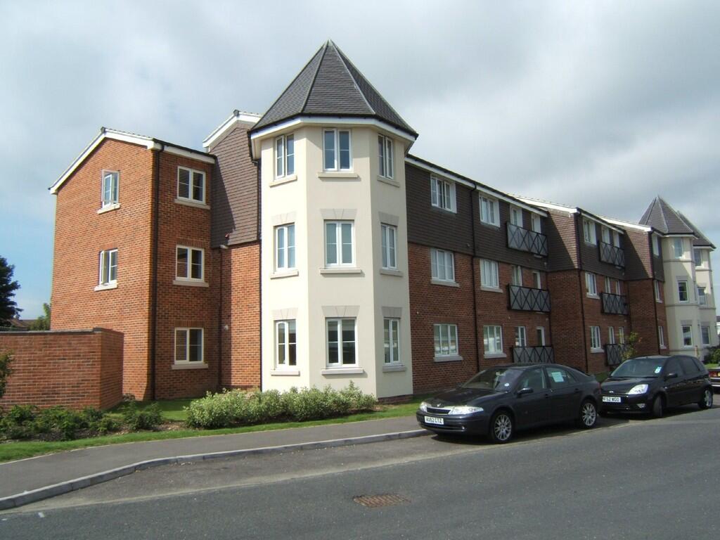
Bognor Regis
By Martin & Co
£ 925
Martin & Co says ..
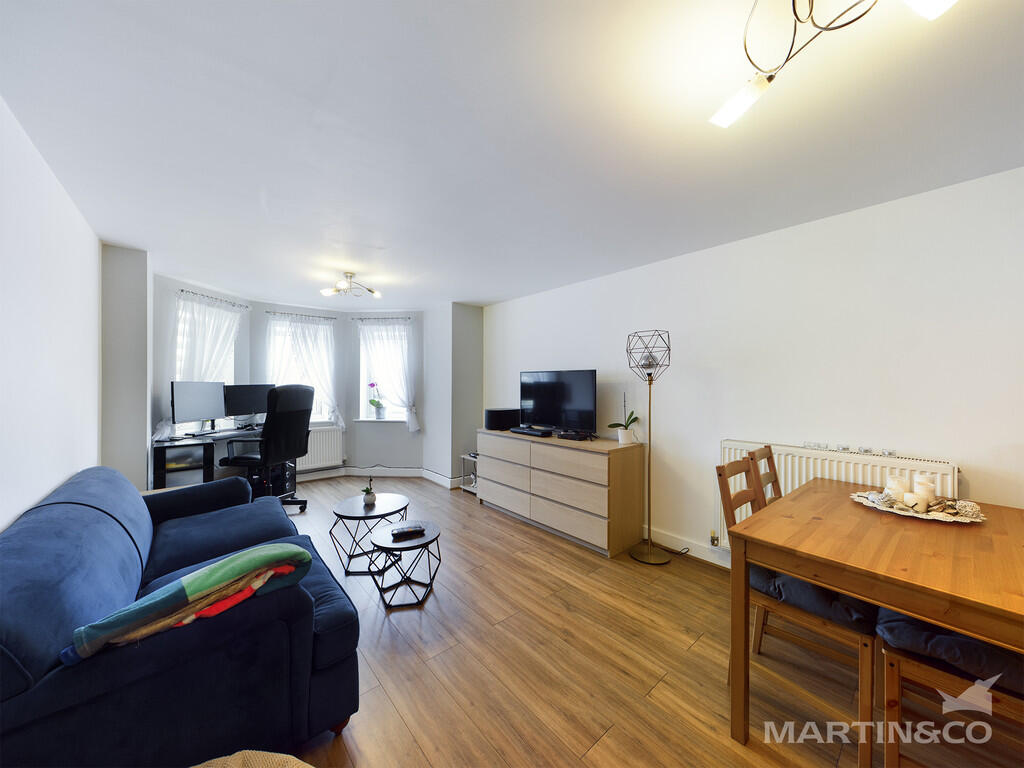
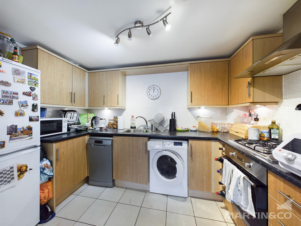
A larger than average one bedroom apartment, built to a high specification.
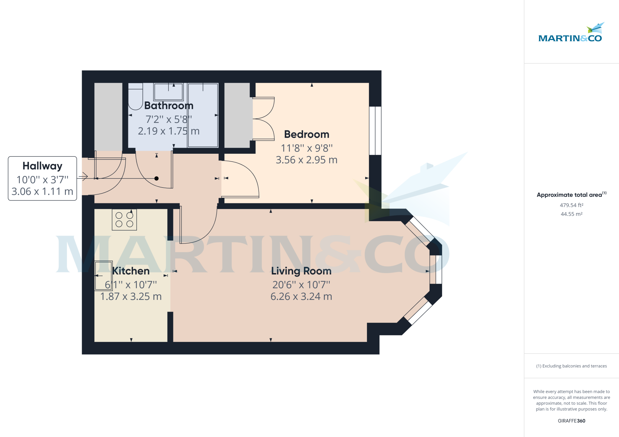
- Bedrooms
- 1
- Bathrooms
- 1
The heatmap indicates the level of crime in the area. The color of the heatmap indicates the crime severity and recency.
Metrics Year-on-Year
- Average area value
- 636,667.00 £Decreased by 17.62 %
- Average area rental value
- 2,030.00 £/moIncreased by 3.89 %
- Est rental Yield
- 3.83 %Increased by 26.40 %
- Crime Rate
- 4.00 %Unchanged by 0.00 %
from 772,798.00 £
from 1,954.00 £/mo
from 3.03 %
from 4.00 %
Agent Activity
Martin & Co created the listing.
Nearby Schools
| Name | Type | Ofsted | Distance |
|---|---|---|---|
| South Bersted Cofe Primary School | Voluntary Controlled School | Good | 0.41 KM |
| Bersted Green Primary School, Bognor Regis | Community School | Good | 0.55 KM |
| Treehouse Children & Family Centre (Bersted) | Children's Centre | 0.67 KM | |
| Edward Bryant School | Academy Converter | Good | 1.35 KM |
| Bognor Regis Nursery School | Local Authority Nursery School | Outstanding | 1.43 KM |
Images

Nearby Streets
| Name | Average Price | Average Sqft | Distance |
|---|---|---|---|
| The Paddock | £ 289,950 | 0 | 0.00 KM |
| Shearwater Drive | £ 0 | 0 | 0.00 KM |
| Chichester Road | £ 316,667 | 0 | 0.00 KM |
| Gordon Avenue | £ 0 | 0 | 0.00 KM |
| Fletcher Way | £ 0 | 0 | 0.00 KM |
Nearby Transport
| Name | NLC | TLC | Distance |
|---|---|---|---|
| Bognor Regis | 5253 | BOG | 1.46 KM |
| Barnham | 5252 | BAA | 5.23 KM |
Nearby Listings
| Address | Price | Type | Score | Distance |
|---|---|---|---|---|
| Bognor Regis | £ 925 | RENT | Unknown | 0.00 KM |
| Durban Road, Bognor Regis | £ 895 | RENT | Unknown | 0.01 KM |
| Durban Road, Bognor Regis | £ 895 | RENT | Unknown | 0.01 KM |
| Durban Road, Bognor Regis | £ 875 | RENT | Unknown | 0.01 KM |
| Durban Road, Bognor Regis | £ 875 | RENT | Unknown | 0.01 KM |
Nearby Properties
| Address | Price | Distance |
|---|---|---|
| 39 Ash Grove | £ 184,000 | 0.11 KM |
| 73 Ash Grove | £ 144,995 | 0.11 KM |
| 71 Ash Grove | £ 280,000 | 0.11 KM |
| 63 Ash Grove | £ 229,950 | 0.11 KM |
| 27 Ash Grove | £ 265,000 | 0.11 KM |