MA
Churchgate Street, Bury St. Edmunds, Suffolk, IP33
By Map Letting & Property Management
£ 1,250
Map Letting & Property Management says ..
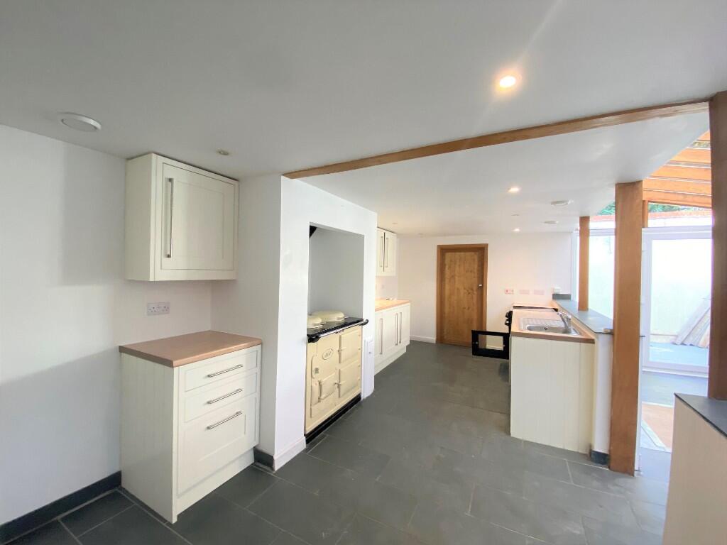
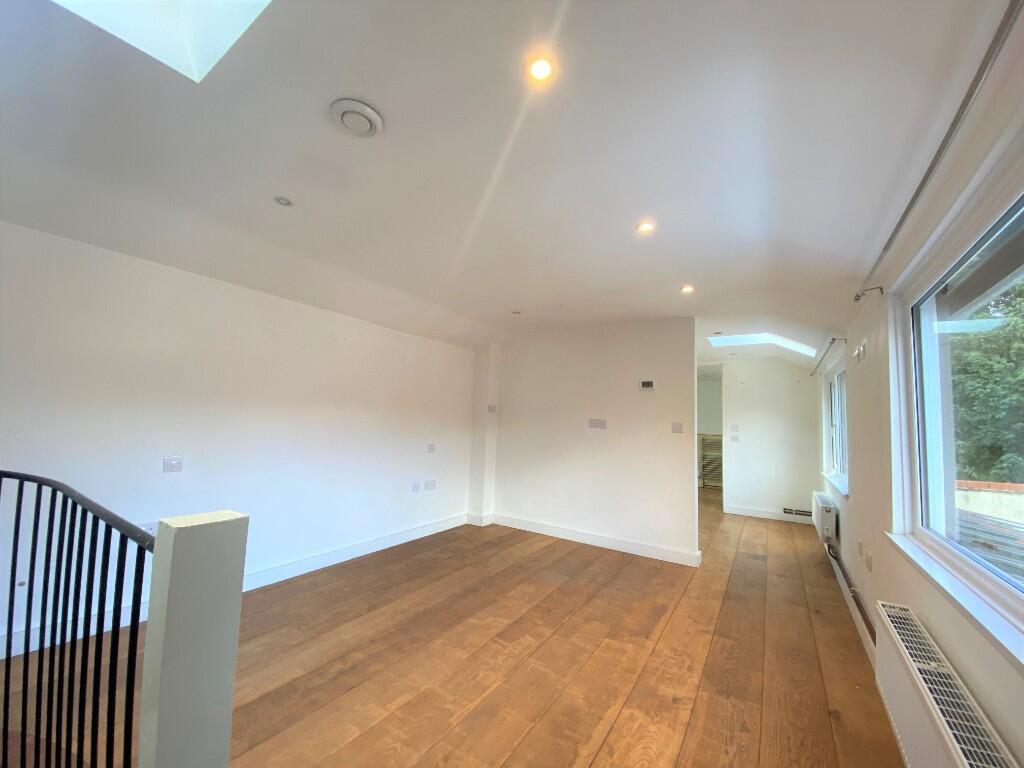
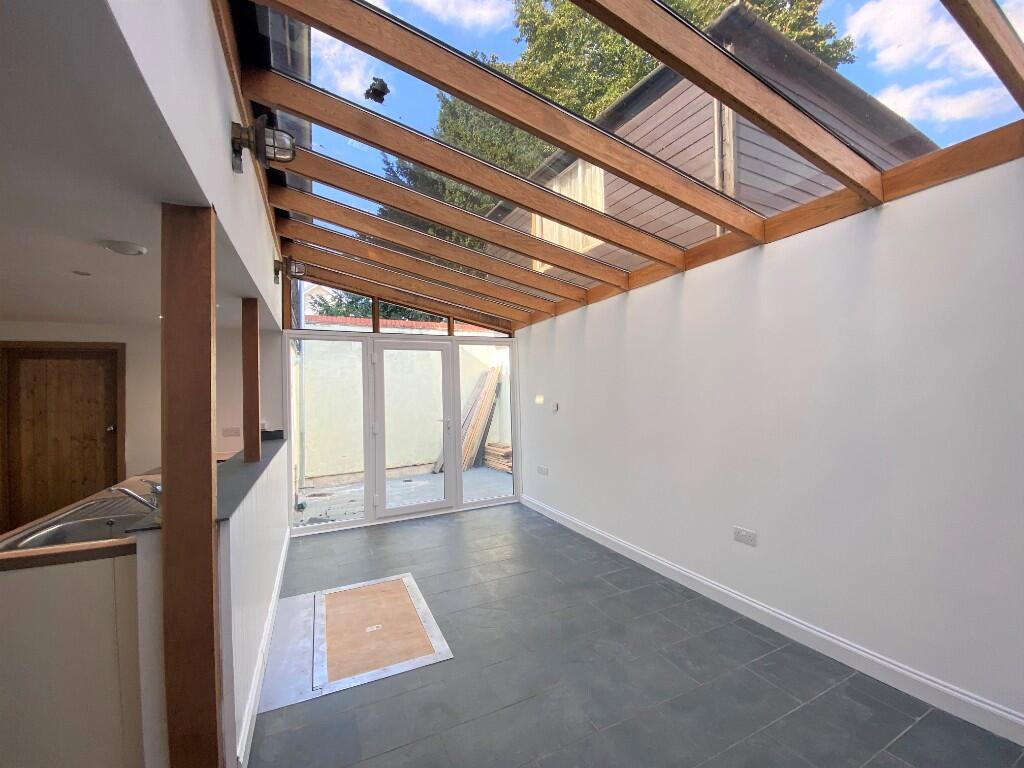
Unique conversion with open plan living space and courtyard area.
- Bedrooms
- 1
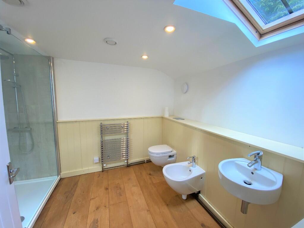
- Bathrooms
- 1
The heatmap indicates the level of crime in the area. The color of the heatmap indicates the crime severity and recency.
Metrics Year-on-Year
- Average area value
- 388,333.00 £Decreased by 1.98 %
- Average area rental value
- 1,597.00 £/moIncreased by 18.47 %
- Est rental Yield
- 4.93 %Increased by 20.83 %
- Crime Rate
- 20.00 %Unchanged by 0.00 %
from 396,178.00 £
from 1,348.00 £/mo
from 4.08 %
from 20.00 %
Agent Activity
Map Letting & Property Management created the listing.
Nearby Schools
| Name | Type | Ofsted | Distance |
|---|---|---|---|
| Guildhall Feoffment Community Primary School | Community School | Good | 0.23 KM |
| St Edmund'S Catholic Primary School | Voluntary Aided School | Good | 0.42 KM |
| Bury Library Children'S Centre | Children's Centre | 0.64 KM | |
| Learning Support, Western Area Education Office | Miscellaneous | 0.80 KM | |
| Westgate Community Primary School And Nursery | Community School | Good | 1.42 KM |
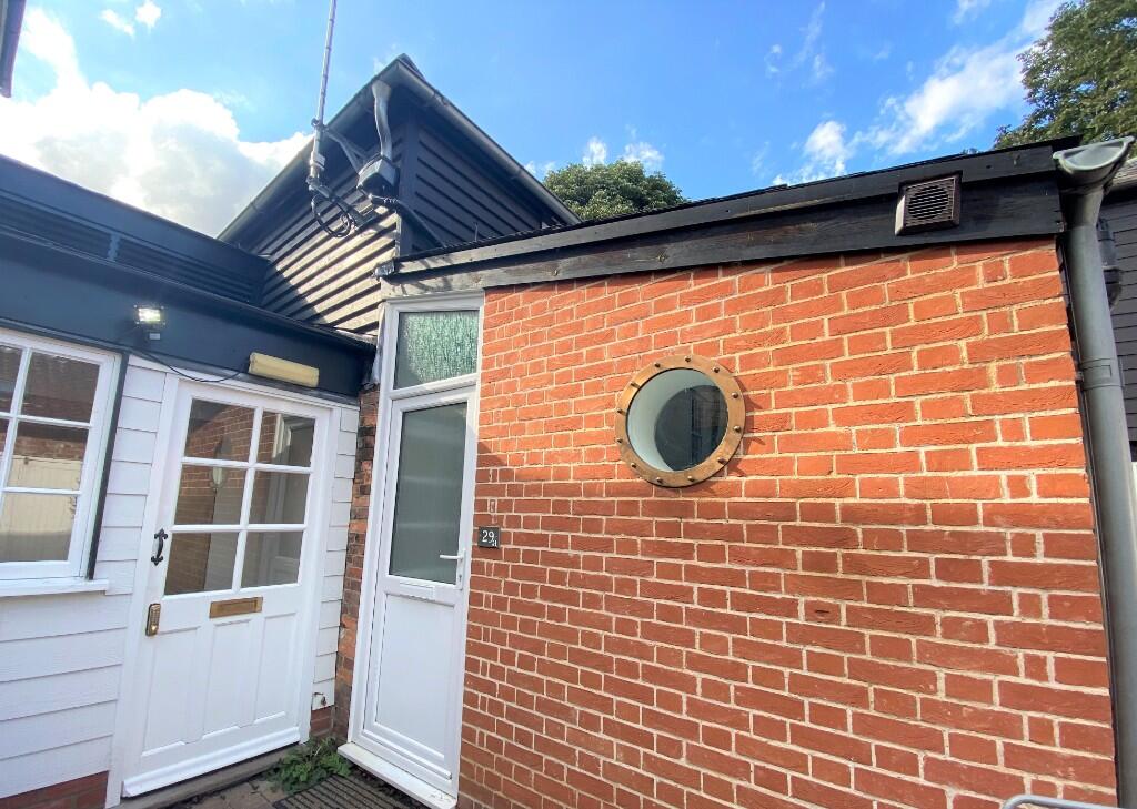
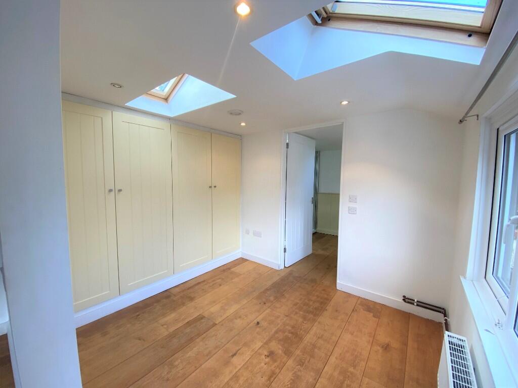
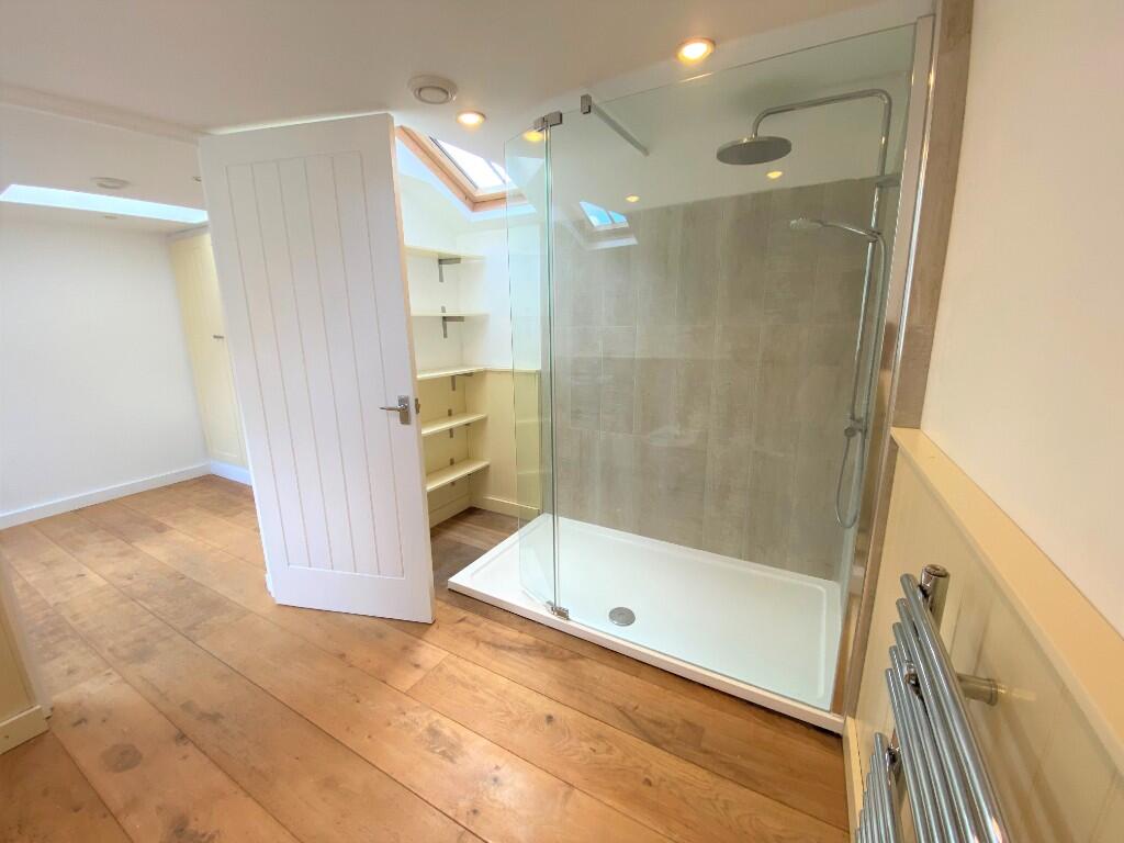
Images
Nearby Streets
| Name | Average Price | Average Sqft | Distance |
|---|---|---|---|
| Tuns Lane | £ 0 | 0 | 0.00 KM |
| Buttermarket | £ 0 | 0 | 0.00 KM |
| Plumptons Court | £ 0 | 0 | 0.00 KM |
| Market Square | £ 0 | 0 | 0.00 KM |
| Redwood Gardens | £ 0 | 0 | 0.00 KM |
Nearby Transport
| Name | NLC | TLC | Distance |
|---|---|---|---|
| Bury St Edmunds | 7008 | BSE | 1.15 KM |
Nearby Listings
| Address | Price | Type | Score | Distance |
|---|---|---|---|---|
| Churchgate Street, Bury St. Edmunds, Suffolk, IP33 | £ 1,250 | RENT | Unknown | 0.00 KM |
| Hatter Street, Bury St. Edmunds | £ 1,300 | RENT | Unknown | 0.10 KM |
| Abbeygate Street, IP33 1LW | £ 1,442 | RENT | Unknown | 0.13 KM |
| Abbeygate Street, Bury St Edmunds, Suffolk | £ 1,200 | RENT | Unknown | 0.13 KM |
| Abbeygate Street, Bury St Edmunds, IP33 1LW | £ 1,150 | RENT | Unknown | 0.13 KM |
Nearby Properties
| Address | Price | Distance |
|---|---|---|
| 38 Churchgate Street | £ 350,000 | 0.00 KM |
| 29 Churchgate Street | £ 95,000 | 0.00 KM |
| 27 Churchgate Street | £ 690,000 | 0.00 KM |
| 40a Churchgate Street | £ 226,000 | 0.00 KM |
| The Courtyard 29a Churchgate Street | £ 127,500 | 0.00 KM |