FO
Langley
By Focus
£ 1,400
Focus says ..
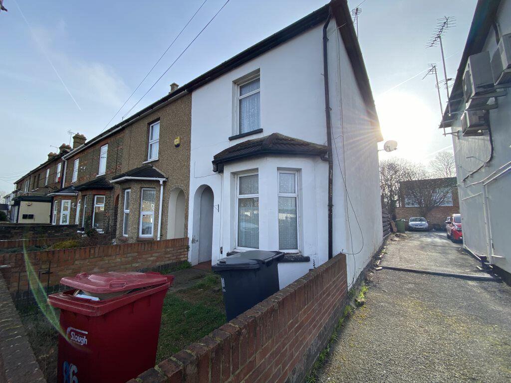
A three bedroom house situated with easy access to station and M4. Council Tax Bank D £1850.09
- Bedrooms
- 3
- Bathrooms
- 1
The heatmap indicates the level of crime in the area. The color of the heatmap indicates the crime severity and recency.
Metrics Year-on-Year
- Average area value
- 266,250.00 £Decreased by 18.69 %
- Average area rental value
- 1,013.00 £/moIncreased by 3.58 %
- Est rental Yield
- 4.57 %Increased by 27.65 %
- Crime Rate
- 7.00 %Unchanged by 0.00 %
from 327,468.00 £
from 978.00 £/mo
from 3.58 %
from 7.00 %
Agent Activity
Focus created the listing.
Nearby Schools
| Name | Type | Ofsted | Distance |
|---|---|---|---|
| Holy Family Catholic Primary School | Voluntary Aided School | Outstanding | 0.33 KM |
| Foxborough Primary School | Academy Sponsor Led | Good | 0.52 KM |
| Marish Primary School | Academy Converter | Good | 0.62 KM |
| Romsey Close Children'S Centre | Children's Centre | 0.68 KM | |
| Langley Grammar School | Academy Converter | 0.84 KM |
Images
Nearby Streets
| Name | Average Price | Average Sqft | Distance |
|---|---|---|---|
| Shelley Close | £ 0 | 0 | 0.00 KM |
| London Road | £ 0 | 0 | 0.00 KM |
| High Street Langley | £ 275,000 | 0 | 0.00 KM |
| Field Hurst | £ 0 | 0 | 0.00 KM |
| Oak Tree Drive | £ 0 | 0 | 0.00 KM |
Nearby Transport
| Name | NLC | TLC | Distance |
|---|---|---|---|
| Langley | 3171 | LNY | 1.36 KM |
| Sunnymeads | 5675 | SNY | 3.29 KM |
| Datchet | 5668 | DAT | 4.04 KM |
| Wraysbury | 5673 | WRY | 4.32 KM |
| Iver | 3170 | IVR | 4.49 KM |
Nearby Listings
| Address | Price | Type | Score | Distance |
|---|---|---|---|---|
| High Street, Langley | £ 750 | RENT | Unknown | 0.04 KM |
| High Street, Langley, SL3 | £ 2,000 | RENT | Unknown | 0.14 KM |
| High Street, Langley, Berkshire, SL3 | £ 2,100 | RENT | Unknown | 0.14 KM |
| Wylands Road, Langley, Berkshire, SL3 | £ 1,450 | RENT | Unknown | 0.19 KM |
| Trelawney Avenue, Slough, SL3 | £ 1,950 | RENT | Unknown | 0.19 KM |
Nearby Properties
| Address | Price | Distance |
|---|---|---|
| 90 High Street | £ 315,000 | 0.03 KM |
| 86 High Street | £ 202,500 | 0.03 KM |
| 118 High Street | £ 205,000 | 0.03 KM |
| 92 High Street | £ 140,000 | 0.03 KM |
| 102 High Street | £ 275,000 | 0.03 KM |