
Lot 4, Ulverston, Cumbria, LA12
By Harrison Coward
£ 78,000
Reviews
3 out of 5 stars
Harrison Coward says ..
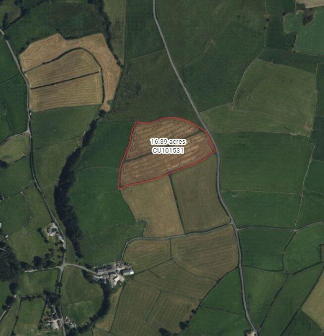
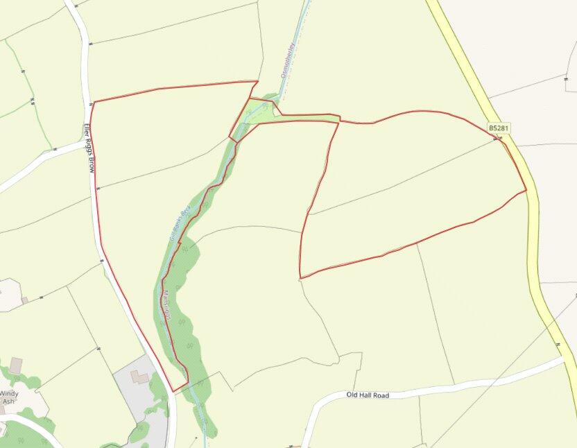
Announcement of the sale by Private Treaty of approximately 8.25 acres of freehold agricultural and amenity land, within close distance of Ulverston, offering unique opportunities with the benefit of vacant possession on completion.
Property Oracle says ..
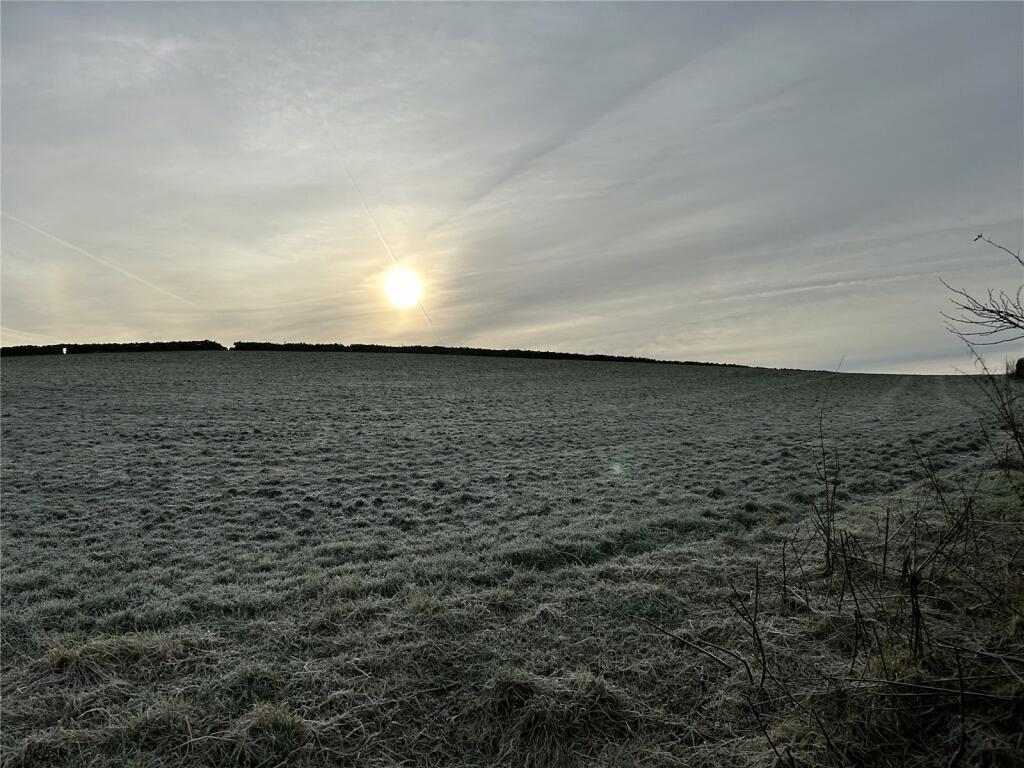
This listing presents an opportunity to purchase approximately 8.25 acres of land situated near Ulverston, Cumbria. The location offers potential access to amenities in Ulverston, including schools like Church Walk Cofe Primary School (rated ‘Good’ by Ofsted) and transportation links via Northern Trains. The proximity to the B5281 road enhances connectivity. However, the property’s precise location within the Furness Peninsula requires further clarification to fully assess its accessibility and proximity to crucial services. The land itself, as depicted in the photographs, seems to be in excellent condition. It appears to be largely flat and grassy, suggesting suitability for various developments, although a physical survey would be crucial for confirmation. Comparing the price of £78,000 to nearby land sales suggests it could be competitively priced, though the lack of building on the plot and lack of specific property details (square footage) make it difficult to offer a definitive assessment of value for money. Prospective buyers should consider conducting a thorough site visit, commission professional land surveys, and ascertain planning permission possibilities before making an offer. The property is ideally suited to those seeking to acquire a large plot in a countryside setting with potential development options. The limited information regarding the property prevents a completely conclusive analysis.
Therefore, we give this property 7 / 10. *Disclaimer: This is our option and does constitute a recommendation or financial advice. Do your own research. *
- Price
- 7
- Condition
- 7
- Location
- 6
- Land
- 8
- Bedrooms
- 0
- Bathrooms
- 0
The heatmap indicates the level of crime in the area. The color of the heatmap indicates the crime severity and recency.
Metrics Year-on-Year
- Average area value
- 211,667.00 £Decreased by 36.91 %
- Average area rental value
- 3,650.00 £/moIncreased by 208.02 %
- Est rental Yield
- 20.69 %Increased by 387.97 %
- Crime Rate
- 0.00 %
Agent Activity
Harrison Coward created the listing.
Nearby Schools
| Name | Type | Ofsted | Distance |
|---|---|---|---|
| Church Walk Cofe Primary School | Voluntary Aided School | Good | 2.09 KM |
| Sir John Barrow School | Community School | Good | 2.71 KM |
| Ulverston Surestart Children'S Centre | Children's Centre | 2.77 KM | |
| St Mary'S Catholic Primary School | Voluntary Aided School | Good | 2.86 KM |
| Ulverston Victoria High School | Community School | Good | 3.08 KM |
Images
Nearby Streets
| Name | Average Price | Average Sqft | Distance |
|---|---|---|---|
| B5281 | £ 900,000 | 0 | 0.00 KM |
| Eller Riggs Brow | £ 697,500 | 0 | 0.00 KM |
| Old Hall Drive | £ 0 | 0 | 0.00 KM |
| Beckside Road | £ 275,000 | 0 | 0.00 KM |
| Church Field Walk | £ 0 | 0 | 0.00 KM |
Nearby Transport
| Name | NLC | TLC | Distance |
|---|---|---|---|
| Ulverston | 2010 | ULV | 2.70 KM |
Nearby Listings
| Address | Price | Type | Score | Distance |
|---|---|---|---|---|
| Ulverston, Ulverston | £ 900,000 | BUY | 6 / 10 | 0.68 KM |
| Mansriggs, Ulverston, Cumbria | £ 900,000 | BUY | 6 / 10 | 0.69 KM |
| Ulverston | £ 697,500 | BUY | 7 / 10 | 1.03 KM |
| Willowdene Gardens, Ulverston | £ 450,000 | BUY | 7 / 10 | 1.45 KM |
| Willowdene Gardens, Ulverston | £ 445,000 | BUY | 6 / 10 | 1.49 KM |
Nearby Properties
| Address | Price | Distance |
|---|---|---|
| 4 Town Bank Terrace | £ 245,000 | 1.57 KM |
| The Bungalow | £ 230,000 | 1.57 KM |
| 8 Town Bank Terrace | £ 299,500 | 1.57 KM |
| 12 Town Bank Terrace | £ 235,000 | 1.57 KM |
| Longlands | £ 345,000 | 1.57 KM |