
Angela Hirst says ..
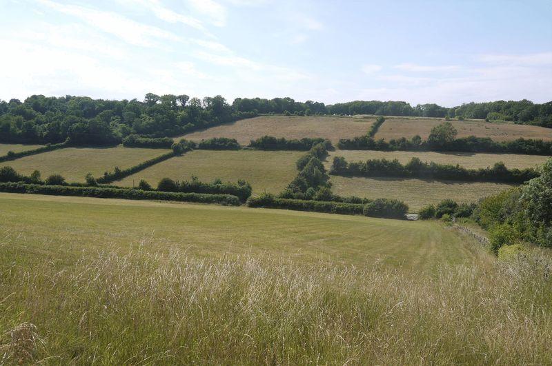
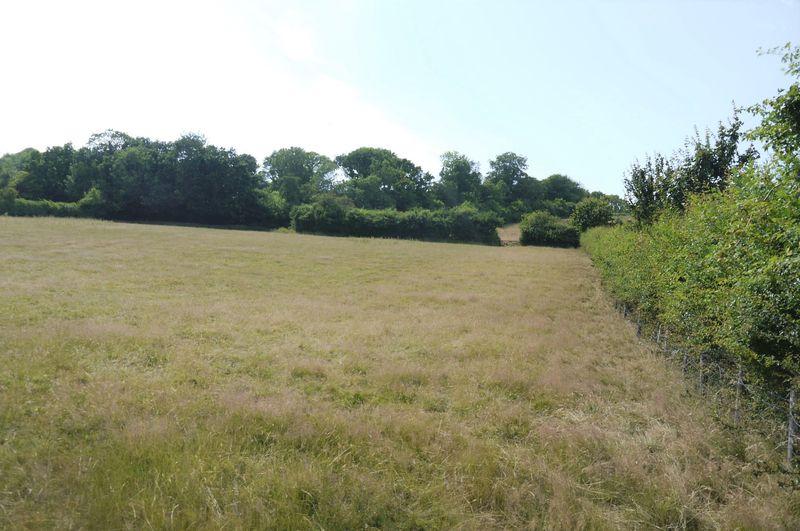
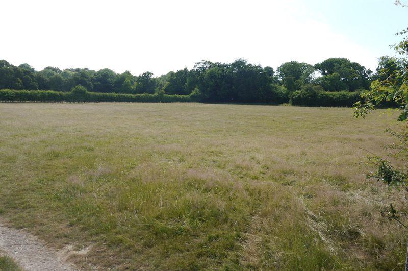
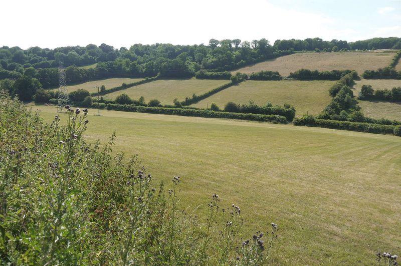
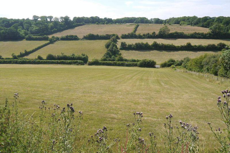
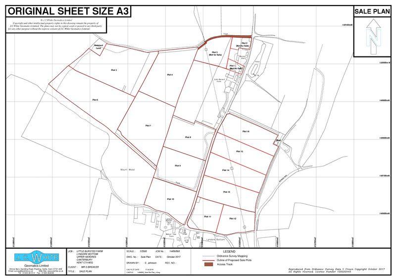
Location The land is located at Little Bursted Farm, Lynsore Bottom, Upper Hardres, Canterbury on both sides of Pett Bottom Road. The site consists of approximately 35.9 acres (14.5 ha) of sloping pasture. The pasture is deemed as Grade 3 on the Agricultural Land Classification Plan and within...
Property Oracle says ..
This property listing presents a plot of land situated in Nailbourne, Canterbury, within the CT4 6EH postcode. The listing focuses on selling the land itself rather than a building or home. The location is a rural setting providing a balance between countryside living and proximity to Canterbury and its amenities. Several primary schools with good Ofsted ratings are situated within a 3-6km radius. While the nearest train station requires a short drive, connectivity to broader transportation links is achievable. The lack of precise plot size and square footage makes it difficult to comment on the specific size of the area. The land’s condition appears suitable for development, based on the images, although this would need professional assessment to confirm suitability. The images show a fairly level and manageable expanse of land, seemingly well-suited for potential development. The price point sits within the range of comparable land sales in the region, but it is difficult to conclude whether it represents exceptional value without knowing the precise size and any potential development costs or restrictions. A potential buyer needs to conduct thorough due diligence regarding plot size, planning permissions, and development viability before committing. Overall, this is a viable option for those seeking land for development or a substantial rural plot in a well-located area.
Therefore, we give this property 6 / 10. *Disclaimer: This is our option and does constitute a recommendation or financial advice. Do your own research. *
- Price
- 7
- Condition
- 4
- Location
- 6
- Land
- 7
- Bedrooms
- 0
- Bathrooms
- 0
The heatmap indicates the level of crime in the area. The color of the heatmap indicates the crime severity and recency.
Metrics Year-on-Year
- Average area value
- 277,995.00 £Increased by 12.95 %
- Average area rental value
- 1,080.00 £/moDecreased by 3.91 %
- Est rental Yield
- 4.66 %Decreased by 14.96 %
- Crime Rate
- 0.00 %
Agent Activity
Angela Hirst marked this listing as sold.
Angela Hirst created the listing.
Nearby Schools
| Name | Type | Ofsted | Distance |
|---|---|---|---|
| Stelling Minnis Church Of England Primary School | Voluntary Controlled School | Good | 3.17 KM |
| Bridge And Patrixbourne Church Of England Primary School | Voluntary Controlled School | Good | 5.24 KM |
| Petham Primary School | Academy Sponsor Led | Good | 5.69 KM |
| St Anselm'S Catholic School, Canterbury | Academy Converter | Good | 5.99 KM |
| Simon Langton Grammar School For Boys | Foundation School | Outstanding | 6.03 KM |
Images


Nearby Streets
| Name | Average Price | Average Sqft | Distance |
|---|---|---|---|
| Pheasant's Hall Road | £ 700,000 | 0 | 0.00 KM |
Nearby Transport
| Name | NLC | TLC | Distance |
|---|---|---|---|
| Bekesbourne | 5198 | BKS | 7.12 KM |
| Canterbury East | 5164 | CBE | 7.74 KM |
| Canterbury West | 5007 | CBW | 8.82 KM |
Nearby Listings
| Address | Price | Type | Score | Distance |
|---|---|---|---|---|
| Canterbury | £ 98,400 | BUY | Unknown | 0.00 KM |
| Site for sale - Canterbury | £ 180,000 | BUY | 5 / 10 | 0.00 KM |
| Canterbury | £ 73,800 | BUY | Unknown | 0.00 KM |
| Canterbury | £ 67,500 | BUY | Unknown | 0.00 KM |
| Canterbury | £ 52,500 | BUY | Unknown | 0.00 KM |