
SC
Stanley Street, Derby
By Scargill Mann Residential Lettings Ltd
£ 750
Scargill Mann Residential Lettings Ltd says ..
No summary available.
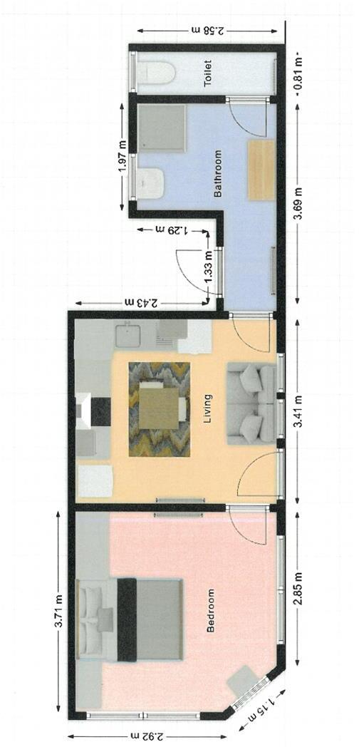
- Bedrooms
- 1
- Bathrooms
- 1
The heatmap indicates the level of crime in the area. The color of the heatmap indicates the crime severity and recency.
Metrics Year-on-Year
- Average area value
- 200,000.00 £Increased by 1.02 %
- Average area rental value
- 674.00 £/moDecreased by 6.91 %
- Est rental Yield
- 4.04 %Decreased by 7.97 %
- Crime Rate
- 8.00 %Unchanged by 0.00 %
from 197,971.00 £
from 724.00 £/mo
from 4.39 %
from 8.00 %
Agent Activity
Scargill Mann Residential Lettings Ltd created the listing.
Nearby Schools
| Name | Type | Ofsted | Distance |
|---|---|---|---|
| Ashgate Primary School | Community School | Good | 0.28 KM |
| Ashgate Nursery School | Local Authority Nursery School | Good | 0.33 KM |
| Jasmine Hall School | Other Independent Special School | 0.45 KM | |
| Derby Cathedral School | Free Schools | 0.61 KM | |
| Royal School For The Deaf Derby | Non-maintained Special School | Good | 0.64 KM |
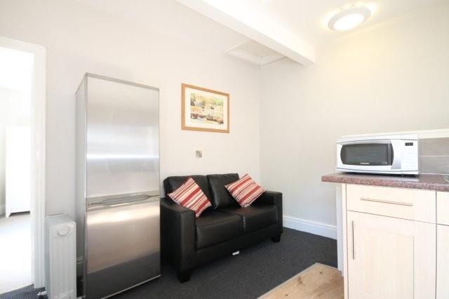
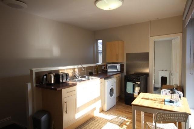
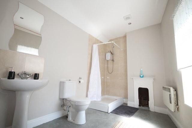
Images

Nearby Streets
| Name | Average Price | Average Sqft | Distance |
|---|---|---|---|
| Stepping Close | £ 0 | 0 | 0.00 KM |
| Noel Street | £ 0 | 0 | 0.00 KM |
| Bright Street | £ 190,000 | 0 | 0.00 KM |
| Boundary Road | £ 140,000 | 0 | 0.00 KM |
| Markeaton Brook Walk | £ 0 | 0 | 0.00 KM |
Nearby Transport
| Name | NLC | TLC | Distance |
|---|---|---|---|
| Derby | 1823 | DBY | 3.85 KM |
| Peartree | 1687 | PEA | 4.04 KM |
| Duffield | 1691 | DFI | 7.24 KM |
| Spondon | 1699 | SPO | 9.63 KM |
Nearby Listings
| Address | Price | Type | Score | Distance |
|---|---|---|---|---|
| Stanley Street, Derby | £ 750 | RENT | Unknown | 0.00 KM |
| Stanley Street, Derby | £ 750 | RENT | Unknown | 0.00 KM |
| Stanley Street, Derby | £ 650 | RENT | Unknown | 0.00 KM |
| Brigmor Walk, Derby, DE22 | £ 520 | RENT | Unknown | 0.06 KM |
| Campion Street, Derby | £ 750 | RENT | Unknown | 0.06 KM |
Nearby Properties
| Address | Price | Distance |
|---|---|---|
| 37 Drewry Lane | £ 125,000 | 0.06 KM |
| 4 Handford Street | £ 102,500 | 0.06 KM |
| 19 Handford Street | £ 88,000 | 0.06 KM |
| 13 Handford Street | £ 127,500 | 0.06 KM |
| 10 Handford Street | £ 119,950 | 0.06 KM |