CO
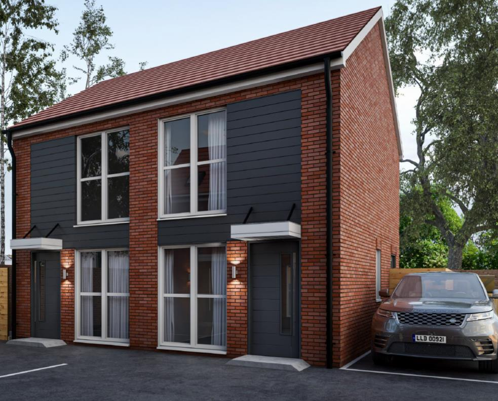
McIntyre Road, WORCESTER
By Connells Lettings
£ 900
Connells Lettings says ..
MCINTYRE ROAD, WORCESTER
- Bedrooms
- 1
- Bathrooms
- 1
The heatmap indicates the level of crime in the area. The color of the heatmap indicates the crime severity and recency.
Metrics Year-on-Year
- Average area value
- 323,333.00 £Decreased by 1.15 %
- Average area rental value
- 627.00 £/moDecreased by 17.93 %
- Est rental Yield
- 2.33 %Decreased by 16.79 %
- Crime Rate
- 13.00 %Unchanged by 0.00 %
from 327,093.00 £
from 764.00 £/mo
from 2.80 %
from 13.00 %
Agent Activity
Connells Lettings created the listing.
Nearby Schools
| Name | Type | Ofsted | Distance |
|---|---|---|---|
| Our Lady Queen Of Peace Catholic Primary | Voluntary Aided School | Good | 0.58 KM |
| Perryfields Primary Pupil Referral Unit | Pupil Referral Unit | Outstanding | 0.59 KM |
| St Clement'S Cofe Primary | Academy Converter | 0.65 KM | |
| Oldbury Park Primary Rsa Academy | Academy Converter | 0.75 KM | |
| University Of Worcester | Higher Education Institutions | 0.84 KM |
Images
Nearby Streets
| Name | Average Price | Average Sqft | Distance |
|---|---|---|---|
| Graham Road | £ 197,500 | 0 | 0.00 KM |
| Pearman Walk | £ 0 | 0 | 0.00 KM |
| Barn Close | £ 0 | 0 | 0.00 KM |
| Holywell Hill | £ 0 | 0 | 0.00 KM |
| Alexander Road | £ 0 | 0 | 0.00 KM |
Nearby Transport
| Name | NLC | TLC | Distance |
|---|---|---|---|
| Worcester Foregate Street | 4893 | WOF | 2.19 KM |
| Worcester Shrub Hill | 4891 | WOS | 3.50 KM |
| Worcestershire Parkway | 6580 | WOP | 9.70 KM |
Nearby Listings
| Address | Price | Type | Score | Distance |
|---|---|---|---|---|
| McIntyre Road, Worcester WR2 5LG | £ 130 | RENT | Unknown | 0.01 KM |
| Available Now - Room 2 - McIntyre Road | £ 608 | RENT | Unknown | 0.04 KM |
| Rowley Hill Street, WR2 | £ 475 | RENT | Unknown | 0.06 KM |
| Rowley Hill Street, Worcester, Worcestershire, WR2 | £ 475 | RENT | Unknown | 0.06 KM |
| Rowley Hill Street, Worcester, Worcestershire, WR2 | £ 475 | RENT | Unknown | 0.08 KM |
Nearby Properties
| Address | Price | Distance |
|---|---|---|
| 15 Mcintyre Road | £ 237,000 | 0.00 KM |
| 27 Mcintyre Road | £ 136,500 | 0.00 KM |
| 18 Mcintyre Road | £ 45,000 | 0.00 KM |
| 41 Mcintyre Road | £ 240,000 | 0.00 KM |
| 16 Mcintyre Road | £ 56,950 | 0.00 KM |