
Westbank Court, Coal Aston, Dronfield, S18
By Staves Estate Agents
£ 145,000
Reviews
3 out of 5 stars
Staves Estate Agents says ..
**SOLD prior to full marketing**
Property Oracle says ..
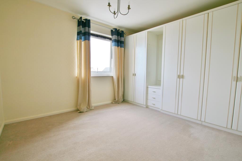
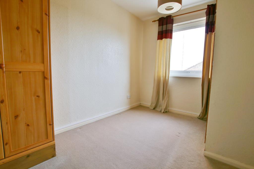
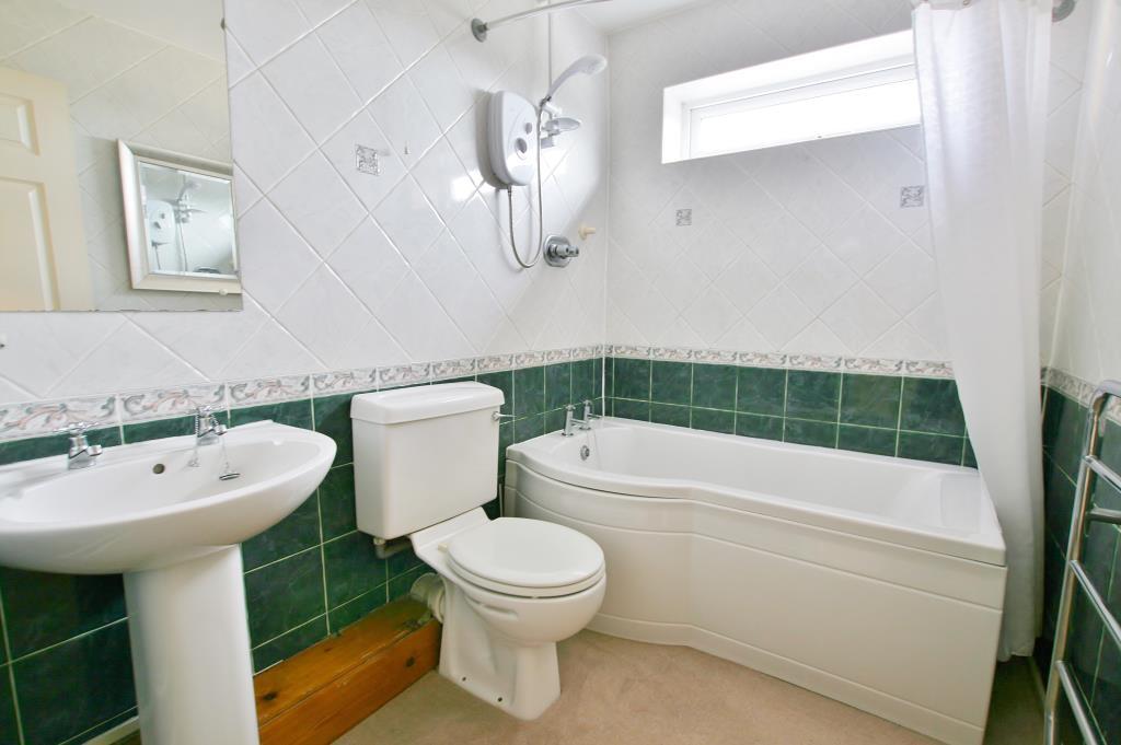
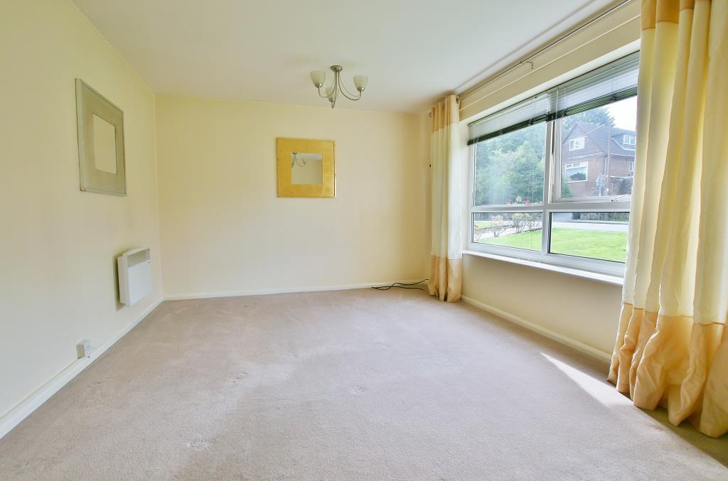
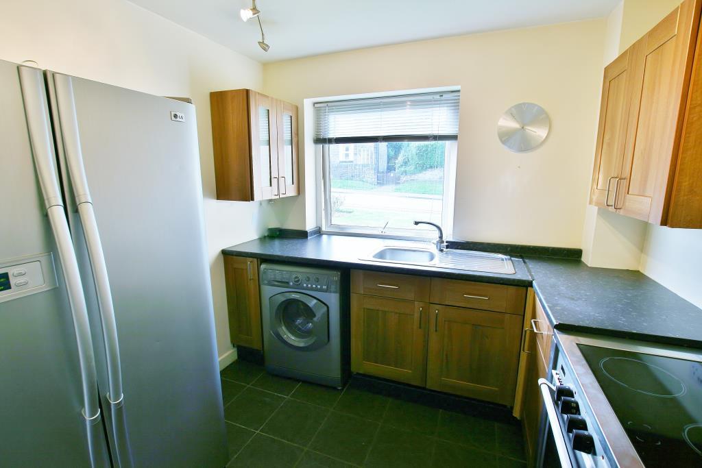
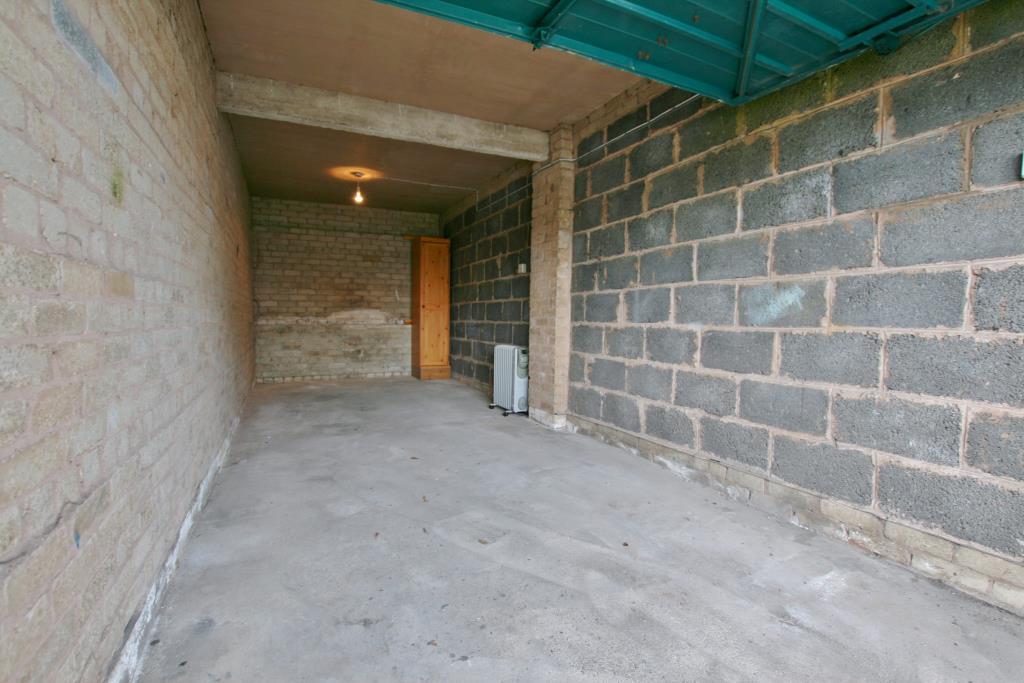
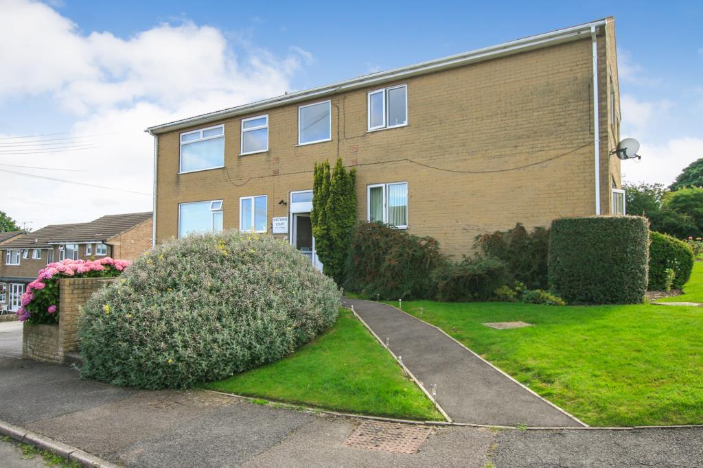
The property is a 2-bedroom apartment located in Coal Aston, Dronfield, Derbyshire. Coal Aston benefits from being relatively close to Dronfield town centre, which offers a range of amenities including shops and schools. The nearby schools, such as Holmesdale Infant School and Dronfield Henry Fanshawe School, are rated as Outstanding or Good by Ofsted, suggesting good educational opportunities in the area. Transportation links appear reasonable with Dronfield train station being within a 1.38km radius. From the images provided, the property appears to be in generally good condition, though it may benefit from some modernisation. The finishes are simple but functional. The apartment has a small garden area, which is a positive aspect. Determining a precise price score is difficult without knowing the square footage of the property. However, comparing the listing price of £145,000 to nearby properties, it may be considered reasonably priced, particularly if the square footage is comparable to smaller properties in the area. Several nearby properties have listed prices significantly higher, suggesting that £145,000 could represent good value, depending on the size of the apartment. More information on the square footage would allow for a more accurate assessment.
Therefore, we give this property 6 / 10. *Disclaimer: This is our option and does constitute a recommendation or financial advice. Do your own research. *
- Price
- 7
- Condition
- 7
- Location
- 7
- Land
- 6
- Bedrooms
- 2
- Bathrooms
- 1
The heatmap indicates the level of crime in the area. The color of the heatmap indicates the crime severity and recency.
Metrics Year-on-Year
- Average area value
- 448,325.00 £Decreased by 13.51 %
- Average area rental value
- 1,480.00 £/moDecreased by 11.32 %
- Est rental Yield
- 3.96 %Increased by 2.59 %
- Crime Rate
- 3.00 %Unchanged by 0.00 %
Agent Activity
Staves Estate Agents marked this listing as sold.
Staves Estate Agents created the listing.
Nearby Schools
| Name | Type | Ofsted | Distance |
|---|---|---|---|
| Holmesdale Infant School | Community School | Outstanding | 0.64 KM |
| Lenthall Infant And Nursery School | Community School | Good | 0.71 KM |
| Northfield Junior School | Community School | Good | 0.76 KM |
| Dronfield Stonelow Junior School | Community School | Good | 0.83 KM |
| Dronfield Henry Fanshawe School | Voluntary Controlled School | Outstanding | 1.24 KM |
Images

Nearby Streets
| Name | Average Price | Average Sqft | Distance |
|---|---|---|---|
| Meadow Close | £ 300,000 | 0 | 0.00 KM |
| Paddock Way | £ 0 | 0 | 0.00 KM |
| The Avenue | £ 365,000 | 0 | 0.00 KM |
| Sycamore Avenue | £ 0 | 0 | 0.00 KM |
| Park Avenue | £ 0 | 0 | 0.00 KM |
Nearby Transport
| Name | NLC | TLC | Distance |
|---|---|---|---|
| Dronfield | 6616 | DRO | 1.38 KM |
| Dore And Totley | 6690 | DOR | 6.21 KM |
| Sheffield | 6691 | SHF | 7.42 KM |
| Chesterfield | 6615 | CHD | 9.35 KM |
| Darnall | 6729 | DAN | 9.77 KM |
Nearby Listings
| Address | Price | Type | Score | Distance |
|---|---|---|---|---|
| Westbank Court, Coal Aston, Dronfield, S18 | £ 145,000 | BUY | 6 / 10 | 0.00 KM |
| Westbank Close, Coal Aston, Dronfield, Derbyshire, S18 | £ 330,000 | BUY | 6 / 10 | 0.04 KM |
| Holmley Lane, Coal Aston, Dronfield | £ 325,000 | BUY | 8 / 10 | 0.07 KM |
| Farm Close, Dronfield | £ 270,000 | BUY | 6 / 10 | 0.09 KM |
| Green Lane, Dronfield | £ 675,000 | BUY | Unknown | 0.13 KM |
Nearby Properties
| Address | Price | Distance |
|---|---|---|
| 11 Farm Close | £ 250,000 | 0.09 KM |
| 16 Farm Close | £ 218,000 | 0.09 KM |
| 6 Farm Close | £ 188,000 | 0.09 KM |
| 10 Farm Close | £ 270,000 | 0.09 KM |
| 14 Farm Close | £ 120,000 | 0.09 KM |