CO
Poverty Lane, Maghull, L31 1GP
By Countryside Partnerships North
£ 427,000
Reviews
3 out of 5 stars
Countryside Partnerships North says ..
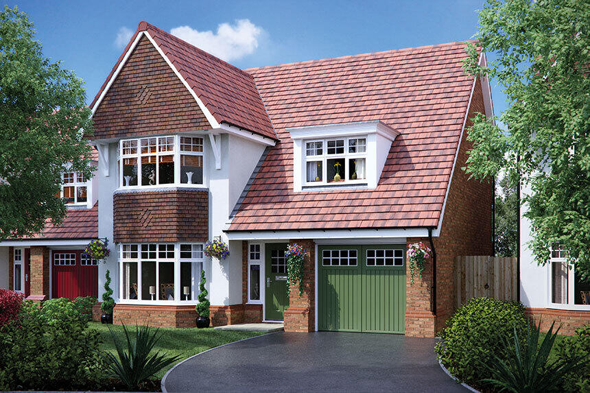
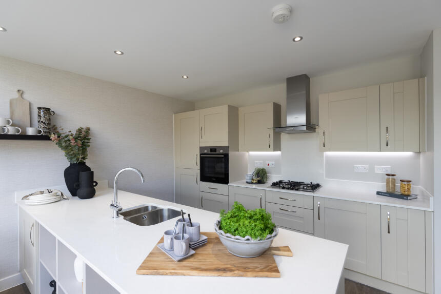
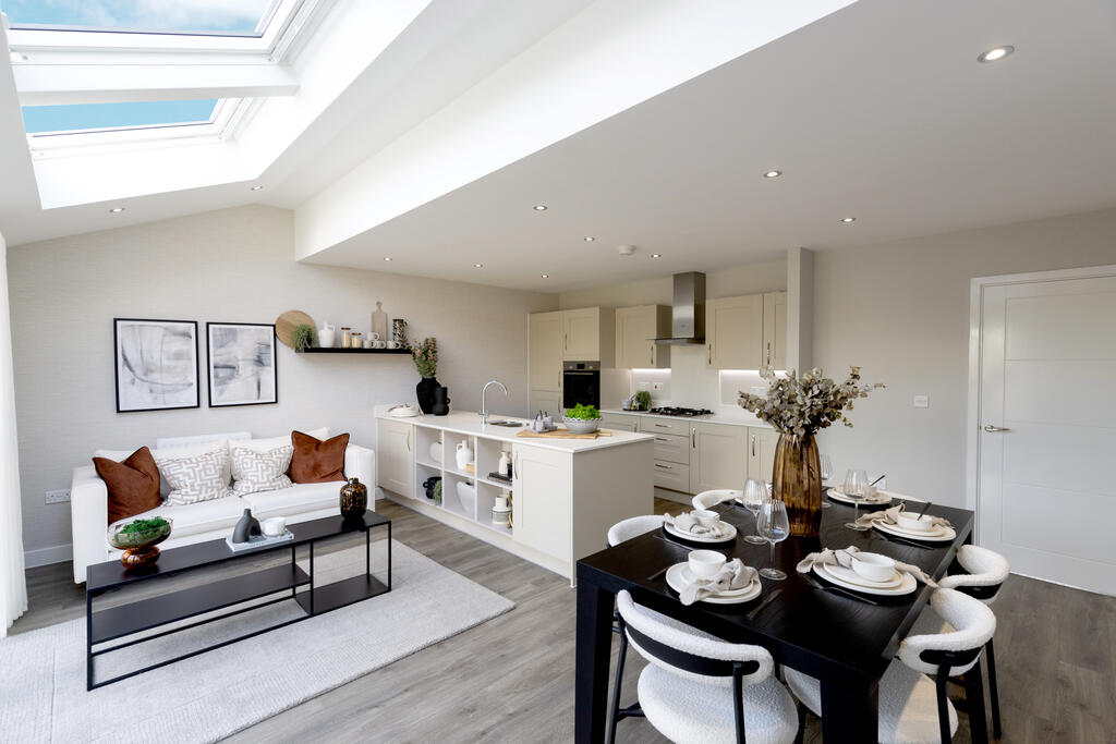
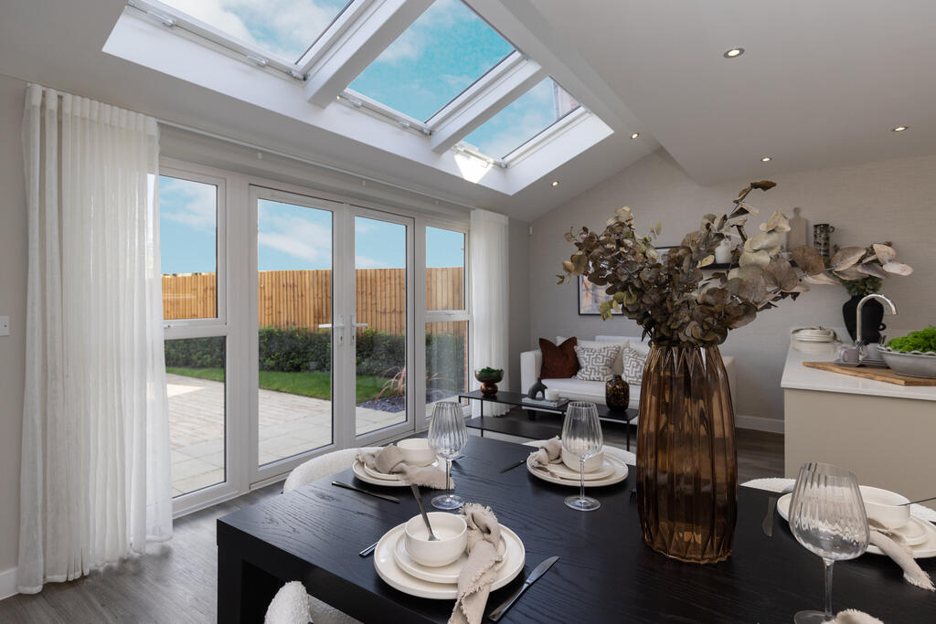
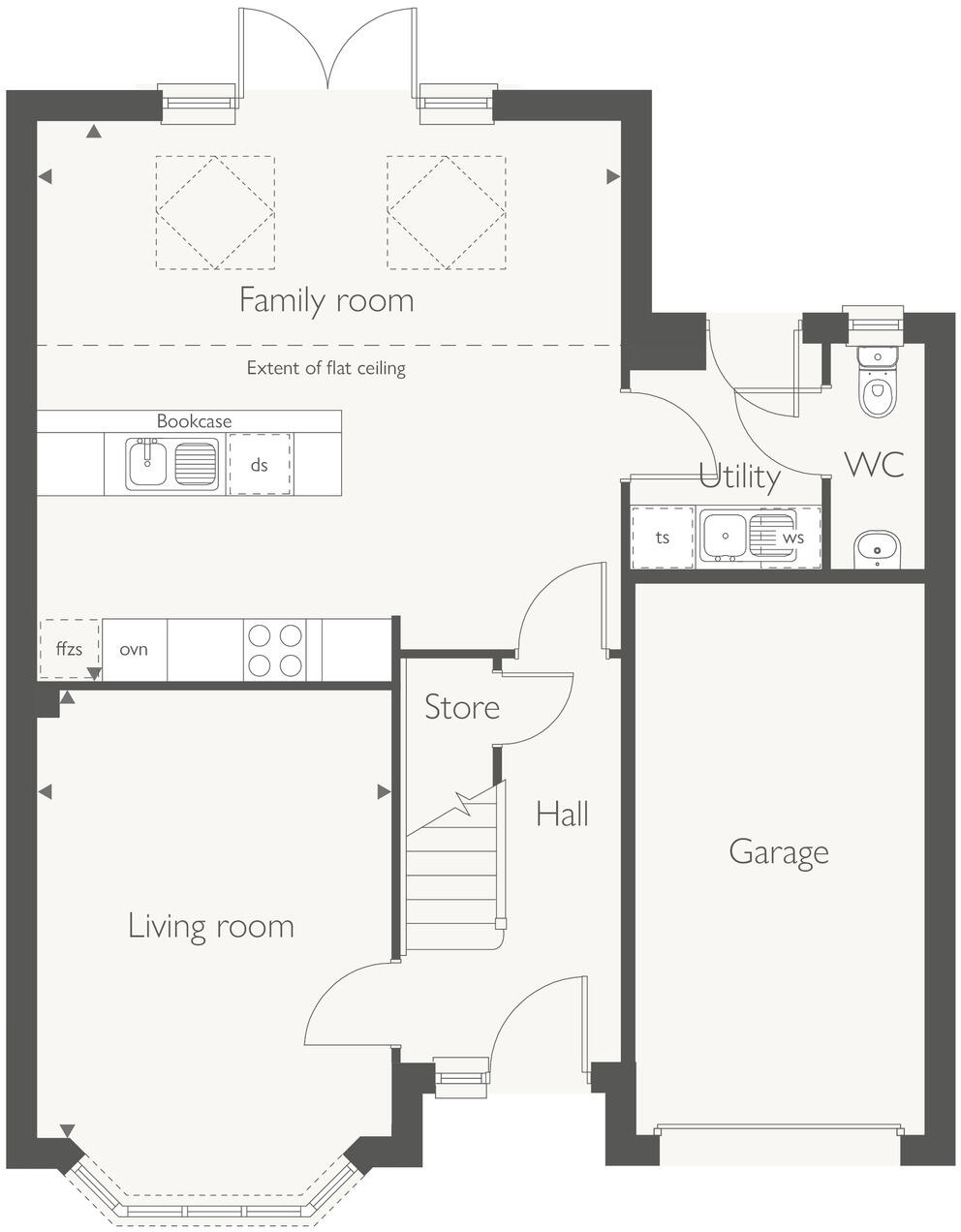
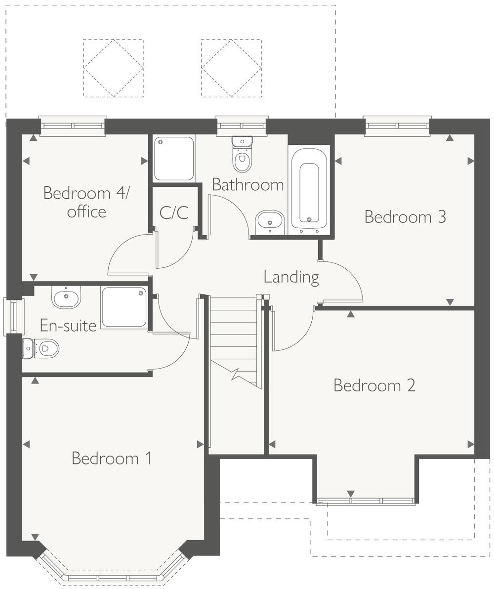
The Oakham is built with the family firmly in mind, every aspect perfectly planned to cater for your needs. A spacious living room to your left, complete with a bay window, sits at the front of this beautiful home. The hall takes you to a light and spacious open plan kitchen/dining ro...
Property Oracle says ..
Therefore, we give this property 6 / 10. *Disclaimer: This is our option and does constitute a recommendation or financial advice. Do your own research. *
- Price
- 3
- Condition
- 9
- Location
- 7
- Land
- 6
- Bedrooms
- 4
- Bathrooms
- 0
- Sqft (est)
- 865.00
The heatmap indicates the level of crime in the area. The color of the heatmap indicates the crime severity and recency.
Metrics Year-on-Year
- Average area value
- 257,222.00 £Decreased by 8.17 %
- Est sale value
- 214,520.00 £Increased by 16.43 %
- Average area rental value
- 1,100.00 £/moIncreased by 7.32 %
- Est letting value
- 865.00 £/mo
- Est rental Yield
- 5.13 %Increased by 16.86 %
- Crime Rate
- 6.00 %Unchanged by 0.00 %
from 280,098.00 £
from 184,245.00 £
from 1,025.00 £/mo
from 0.00 £/mo
from 4.39 %
from 6.00 %
Agent Activity
Countryside Partnerships North created the listing.
Nearby Schools
| Name | Type | Ofsted | Distance |
|---|---|---|---|
| Summerhill Primary School | Community School | Good | 0.41 KM |
| Maricourt Catholic High School | Voluntary Aided School | Requires improvement | 1.73 KM |
| Hudson Children'S Centre | Children's Centre | 1.99 KM | |
| Hudson Primary School | Community School | Good | 1.99 KM |
| St Andrews Church Of England Primary School, Maghull | Academy Converter | 2.02 KM |
Images
Nearby Streets
| Name | Average Price | Average Sqft | Distance |
|---|---|---|---|
| Goshawk Drive | £ 0 | 0 | 0.00 KM |
| Kingfisher Gardens | £ 0 | 0 | 0.00 KM |
| Harrier Close | £ 0 | 0 | 0.00 KM |
| Gadwall Close | £ 0 | 0 | 0.00 KM |
| Lancaster Close | £ 210,000 | 0 | 0.00 KM |
Nearby Transport
| Name | NLC | TLC | Distance |
|---|---|---|---|
| Maghull | 2155 | MAG | 0.91 KM |
| Maghull North | 6576 | MNS | 1.10 KM |
| Kirkby (Merseyside) | 2124 | KIR | 3.17 KM |
| Old Roan | 2258 | ORN | 3.85 KM |
| Town Green | 2283 | TWN | 4.47 KM |
Nearby Listings
| Address | Price | Type | Score | Distance |
|---|---|---|---|---|
| Poverty Lane, Maghull, L31 1GP | £ 427,000 | BUY | 6 / 10 | 0.00 KM |
| Poverty Lane, Maghull, L31 1GP | £ 355,000 | BUY | 7 / 10 | 0.00 KM |
| Poverty Lane, Maghull, L31 1GP | £ 355,000 | BUY | 6 / 10 | 0.00 KM |
| Poverty Lane, Maghull, L31 1GP | £ 435,000 | BUY | 6 / 10 | 0.00 KM |
| Poverty Lane, Maghull, L31 1GP | £ 380,000 | BUY | 7 / 10 | 0.00 KM |
Nearby Properties
| Address | Price | Distance |
|---|---|---|
| 102 Poverty Lane | £ 229,950 | 0.23 KM |
| 104 Poverty Lane | £ 140,000 | 0.23 KM |
| 106 Poverty Lane | £ 176,500 | 0.23 KM |
| 108 Poverty Lane | £ 135,000 | 0.23 KM |
| 110 Poverty Lane | £ 219,950 | 0.23 KM |