A
Burnham On Sea, Somerset, TA8
By A & F
£ 980
A & F says ..
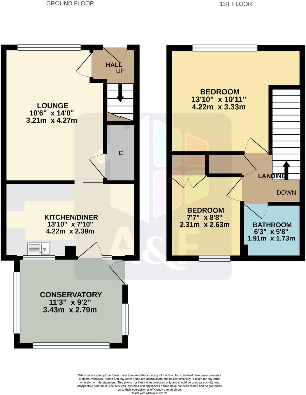
A 2 Bedroom Semi-Detached House with Garage, Driveway, Gardens & Conservatory
- Bedrooms
- 2
- Bathrooms
- 1
The heatmap indicates the level of crime in the area. The color of the heatmap indicates the crime severity and recency.
Metrics Year-on-Year
- Average area value
- 277,658.00 £Decreased by 1.13 %
- Average area rental value
- 942.00 £/moDecreased by 17.59 %
- Est rental Yield
- 4.07 %Decreased by 16.60 %
- Crime Rate
- 9.00 %Unchanged by 0.00 %
from 280,828.00 £
from 1,143.00 £/mo
from 4.88 %
from 9.00 %
Agent Activity
A & F created the listing.
Nearby Schools
| Name | Type | Ofsted | Distance |
|---|---|---|---|
| Burnham-On-Sea Community Infant School | Community School | Outstanding | 0.27 KM |
| Burnham-On-Sea Building | Children's Centre Linked Site | 0.29 KM | |
| St Andrew'S Church Of England Voluntary Controlled Junior School | Voluntary Controlled School | Good | 1.00 KM |
| The King Alfred School An Academy | Academy Sponsor Led | 1.37 KM | |
| Churchfield Church School | Academy Sponsor Led | Good | 1.93 KM |
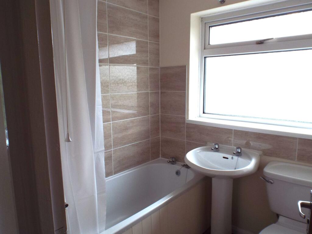
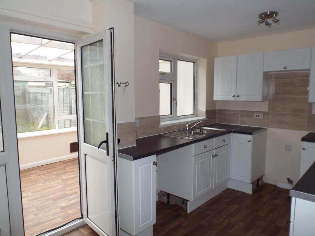
Images


Nearby Streets
| Name | Average Price | Average Sqft | Distance |
|---|---|---|---|
| Raleigh Gardens | £ 199,950 | 0 | 0.00 KM |
| Barrington Road | £ 285,000 | 0 | 0.00 KM |
| St Peter's Road | £ 0 | 0 | 0.00 KM |
| Salisbury Road | £ 282,250 | 0 | 0.00 KM |
| Frobisher Close | £ 258,283 | 0 | 0.00 KM |
Nearby Transport
| Name | NLC | TLC | Distance |
|---|---|---|---|
| Highbridge And Burnham | 3314 | HIG | 2.76 KM |
Nearby Listings
| Address | Price | Type | Score | Distance |
|---|---|---|---|---|
| Gloucester Road, Burnham-On-Sea, TA8 | £ 1,300 | RENT | Unknown | 0.22 KM |
| Dewar Close, Burnham-on-Sea, Somerset, TA8 | £ 795 | RENT | Unknown | 0.24 KM |
| Barrington Road, , BURNHAM ON SEA | £ 1,300 | RENT | Unknown | 0.26 KM |
| Wells Close, Burnham on Sea, Somerset, TA8 | £ 1,250 | RENT | Unknown | 0.37 KM |
| Burnham On Sea, Somerset, TA8 | £ 980 | RENT | Unknown | 0.49 KM |
Nearby Properties
| Address | Price | Distance |
|---|---|---|
| 7 Beresford Close | £ 134,000 | 0.01 KM |
| 9 Beresford Close | £ 170,000 | 0.01 KM |
| 8 Beresford Close | £ 140,000 | 0.01 KM |
| 2 Beresford Close | £ 70,000 | 0.01 KM |
| 6 Beresford Close | £ 271,500 | 0.01 KM |