
15 Shotley Grove, Dipe Lane, East Boldon
By Andrew Craig
£ 159,950
Reviews
3 out of 5 stars
Andrew Craig says ..
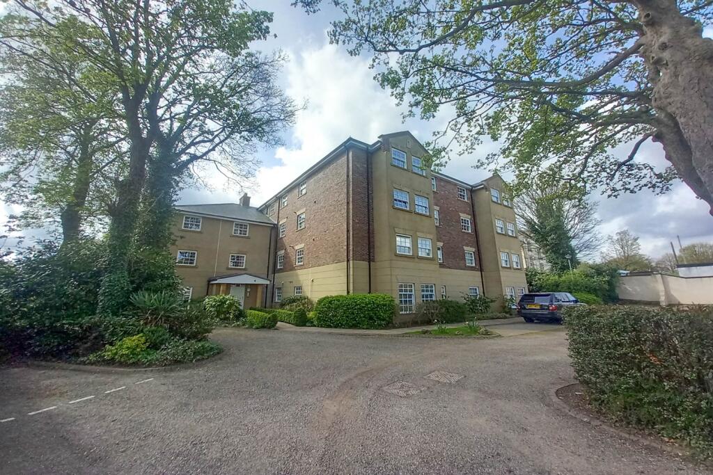
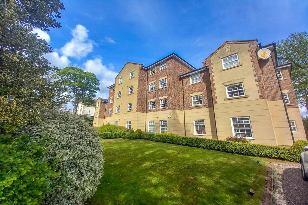
Located within the well regarded and secluded Shotley Grove, this second floor apartment offers an excellent opportunity for a range of buyers. Surrounded by beautifully maintained communal gardens, the development benefits from a secure entry system, ample resident parking, and convenient lift a...
Property Oracle says ..
The property is located in East Boldon, South Tyneside, Tyne and Wear. It is an apartment with two bedrooms and two bathrooms. While the square footage and plot size are not provided, the list price is £159,950. Nearby properties show a range of prices, suggesting some variability in the market. The average price for properties in the area is £195,969, with an average price per square foot of £172. Several schools with varying Ofsted ratings are within a reasonable distance, and Sunderland train station is approximately 7.91 km away.
The property appears to be in good condition based on the provided images. The building is well-maintained, and the landscaping is neat. There is a small grassy area visible in the photos, suggesting some communal green space. However, the lack of information regarding the apartment’s specific size and private outdoor space makes it difficult to definitively assess the land aspect.
Given the average house price in the area is higher than the list price of this property, and considering the apparent good condition of the building, the price may represent good value, particularly if the apartment itself is of a reasonable size. However, without knowing the size of the apartment, a definitive conclusion on value for money cannot be reached.
Therefore, we give this property 6 / 10. *Disclaimer: This is our option and does constitute a recommendation or financial advice. Do your own research. *
- Price
- 7
- Condition
- 8
- Location
- 7
- Land
- 3
- Bedrooms
- 2
- Bathrooms
- 2
The heatmap indicates the level of crime in the area. The color of the heatmap indicates the crime severity and recency.
Metrics Year-on-Year
- Average area value
- 188,295.00 £Decreased by 1.76 %
- Average area rental value
- 1,010.00 £/moIncreased by 61.86 %
- Est rental Yield
- 6.44 %Increased by 64.71 %
- Crime Rate
- 1.00 %Unchanged by 0.00 %
Agent Activity
Andrew Craig created the listing.
Nearby Schools
| Name | Type | Ofsted | Distance |
|---|---|---|---|
| West Boldon Primary School | Community School | Good | 0.72 KM |
| Boldon School | Community School | Good | 0.94 KM |
| East Boldon Junior School | Community School | Requires improvement | 1.28 KM |
| Helen Gibson Nursery School | Local Authority Nursery School | Outstanding | 1.28 KM |
| East Boldon Infants' School | Community School | Outstanding | 1.32 KM |
Images
Nearby Streets
| Name | Average Price | Average Sqft | Distance |
|---|---|---|---|
| Western Terrace | £ 975,000 | 0 | 0.00 KM |
| The Fairways | £ 430,000 | 0 | 0.00 KM |
| Tennyson Avenue | £ 0 | 0 | 0.00 KM |
| Mill View | £ 0 | 0 | 0.00 KM |
| The Orchard | £ 0 | 0 | 0.00 KM |
Nearby Transport
| Name | NLC | TLC | Distance |
|---|---|---|---|
| Sunderland | 7640 | SUN | 7.91 KM |
Nearby Listings
| Address | Price | Type | Score | Distance |
|---|---|---|---|---|
| Dipe Lane, East Boldon | £ 150,000 | BUY | Unknown | 0.00 KM |
| 15 Shotley Grove, Dipe Lane, East Boldon | £ 159,950 | BUY | 6 / 10 | 0.00 KM |
| Shotley Grove, East Boldon | £ 179,000 | BUY | 7 / 10 | 0.00 KM |
| Shotley Grove, Dipe Lane, East Boldon, Tyne and Wear, NE36 0DB | £ 195,000 | BUY | 6 / 10 | 0.14 KM |
| Claremount Court, West Boldon | £ 550,000 | BUY | 6 / 10 | 0.18 KM |
Nearby Properties
| Address | Price | Distance |
|---|---|---|
| 36 Lyndon Grove | £ 265,000 | 0.14 KM |
| 30 Lyndon Grove | £ 231,000 | 0.14 KM |
| 24 Lyndon Grove | £ 194,000 | 0.14 KM |
| 45 Lyndon Grove | £ 260,000 | 0.14 KM |
| 59 Lyndon Grove | £ 228,250 | 0.14 KM |