Saxe Coburg says ..
Opportunity to purchase the FREEHOLD AND PARKING FOR TWO CARS. Saxe Coburg are offering the opportunity to purchase the freehold of two flats in this converted building and parking for two cars in this ideal location just a stones throw away from Westbourne High Street.
Property Oracle says ..
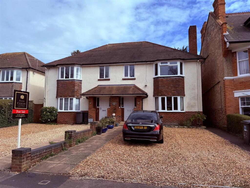
The property at 30 R L S Avenue, Bournemouth, BH4 8EG is listed at £35,000. This is significantly below the average price for the area, which is £319,243. The average price per square foot is £399.00, however, the property’s square footage is not provided, preventing a direct comparison. The property appears to be a semi-detached house, situated in the Westbourne & West Cliff locality of Bournemouth. The area benefits from proximity to several schools and railway stations. The nearby streets show a range of property values, with some significantly higher than the listed price of the subject property. However, without knowing the size of the property and the condition, it is difficult to assess the value. The image suggests the property is in relatively good condition, although a full inspection would be required to confirm this. There is a driveway and what appears to be a small garden area. However, without plot size details, a definitive assessment of the land cannot be made. Given the significant difference between the listed price and the average property price in the area, the price of £35,000 appears exceptionally low, potentially indicating a need for significant renovation or other factors affecting its value not apparent from the provided information. More information is needed to provide a complete and accurate assessment of this property.
Therefore, we give this property 4 / 10. *Disclaimer: This is our option and does constitute a recommendation or financial advice. Do your own research. *
- Price
- 1
- Condition
- 0
- Location
- 7
- Land
- 0
- Bedrooms
- 0
- Bathrooms
- 0
The heatmap indicates the level of crime in the area. The color of the heatmap indicates the crime severity and recency.
Metrics Year-on-Year
- Average area value
- 376,737.00 £Increased by 7.60 %
- Average area rental value
- 1,284.00 £/moDecreased by 2.65 %
- Est rental Yield
- 4.09 %Decreased by 9.51 %
- Crime Rate
- 15.00 %Unchanged by 0.00 %
Agent Activity
Saxe Coburg created the listing.
Nearby Schools
| Name | Type | Ofsted | Distance |
|---|---|---|---|
| Talbot Heath School | Other Independent School | 1.24 KM | |
| Branksome Children'S Centre | Children's Centre | 1.38 KM | |
| Bishop Aldhelm'S Church Of England Primary School | Academy Converter | 1.65 KM | |
| St Michael'S Church Of England Primary School | Academy Converter | Good | 1.69 KM |
| Victoria Education Centre | Non-maintained Special School | Good | 1.73 KM |
Images
Nearby Streets
| Name | Average Price | Average Sqft | Distance |
|---|---|---|---|
| Heatherbank Road | £ 362,500 | 0 | 0.00 KM |
| Seamoor Road | £ 225,000 | 0 | 0.00 KM |
| Westgate Park | £ 299,950 | 0 | 0.00 KM |
| Milburn Close | £ 0 | 0 | 0.00 KM |
| County Gates Gyratory (cycleway) | £ 0 | 0 | 0.00 KM |
Nearby Transport
| Name | NLC | TLC | Distance |
|---|---|---|---|
| Branksome | 5875 | BSM | 1.94 KM |
| Bournemouth | 5876 | BMH | 4.37 KM |
| Parkstone (Dorset) | 5882 | PKS | 4.93 KM |
| Pokesdown | 5885 | POK | 8.74 KM |
| Poole | 5883 | POO | 8.83 KM |
Nearby Listings
| Address | Price | Type | Score | Distance |
|---|---|---|---|---|
| R L Stevenson Avenue, Bournemouth, BH4 | £ 600,000 | BUY | Unknown | 0.00 KM |
| R L Stevenson Avenue, WESTBOURNE, BH4 | £ 165,000 | BUY | Unknown | 0.00 KM |
| Robert Louis Stevenson Avenue, Westbourne, Westbourne, BH4 | £ 600,000 | BUY | 5 / 10 | 0.00 KM |
| R L Stevenson Avenue, WESTBOURNE, BH4 | £ 600,000 | BUY | Unknown | 0.00 KM |
| 30 R L S Avenue, Bournemouth | £ 35,000 | BUY | 4 / 10 | 0.00 KM |
Nearby Properties
| Address | Price | Distance |
|---|---|---|
| 16a R L Stevenson Avenue | £ 198,679 | 0.00 KM |
| 36 R L Stevenson Avenue | £ 350,000 | 0.00 KM |
| 14a R L Stevenson Avenue | £ 164,000 | 0.00 KM |
| 40 R L Stevenson Avenue | £ 325,000 | 0.00 KM |
| 26a R L Stevenson Avenue | £ 175,000 | 0.00 KM |