CR
145 Fulham Road, London
By Croft International
£ 470
Croft International says ..
No summary available.
- Bedrooms
- 0
- Bathrooms
- 1
The heatmap indicates the level of crime in the area. The color of the heatmap indicates the crime severity and recency.
Metrics Year-on-Year
- Average area value
- 371,130.00 £Increased by 2.62 %
- Average area rental value
- 1,597.00 £/moIncreased by 9.08 %
- Est rental Yield
- 5.16 %Increased by 6.17 %
- Crime Rate
- 5.00 %Unchanged by 0.00 %
from 361,672.00 £
from 1,464.00 £/mo
from 4.86 %
from 5.00 %
Agent Activity
Croft International created the listing.
Nearby Schools
| Name | Type | Ofsted | Distance |
|---|---|---|---|
| Parsons Green Prep School | Other Independent School | 0.21 KM | |
| Parayhouse School | Non-maintained Special School | Good | 0.31 KM |
| Thomas'S Academy | Academy Converter | Good | 0.31 KM |
| Psla Children'S Centre Services At New Kings Family Space | Children's Centre Linked Site | 0.37 KM | |
| St Johns Walham Green Church Of England Primary School | Voluntary Aided School | Good | 0.39 KM |
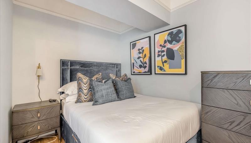
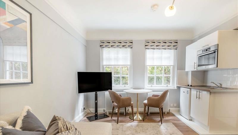
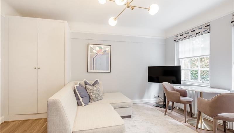
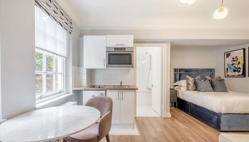
Images

Nearby Streets
| Name | Average Price | Average Sqft | Distance |
|---|---|---|---|
| Laurel Bank Gardens | £ 570,000 | 0 | 0.00 KM |
| A219 | £ 0 | 0 | 0.00 KM |
| Oxberry Avenue | £ 955,000 | 0 | 0.00 KM |
| Beaconsfield Alleyway | £ 2,250,000 | 0 | 0.00 KM |
| Fulham Palace Road | £ 0 | 0 | 0.00 KM |
Nearby Transport
| Name | NLC | TLC | Distance |
|---|---|---|---|
| Putney | 5603 | PUT | 1.82 KM |
| West Brompton | 8875 | WBP | 1.87 KM |
| Wandsworth Town | 5576 | WNT | 2.55 KM |
| Kensington (Olympia) | 3092 | KPA | 2.64 KM |
| Imperial Wharf | 9586 | IMW | 2.65 KM |
Nearby Listings
| Address | Price | Type | Score | Distance |
|---|---|---|---|---|
| 145 Fulham Road, London | £ 470 | RENT | Unknown | 0.00 KM |
| Fulham Road, London, SW6 | £ 2,800 | RENT | Unknown | 0.04 KM |
| Munster Road, Parsons Green, London, SW6 | £ 3,900 | RENT | Unknown | 0.06 KM |
| Munster Road, Parsons Green, London, SW6 | £ 1,800 | RENT | Unknown | 0.06 KM |
| Claridge Court, Fulham, SW6 | £ 2,150 | RENT | Unknown | 0.06 KM |
Nearby Properties
| Address | Price | Distance |
|---|---|---|
| 702k Fulham Road | £ 540,000 | 0.02 KM |
| 678a Fulham Road | £ 1,125,000 | 0.02 KM |
| 702g Fulham Road | £ 1,240,000 | 0.02 KM |
| 700a Fulham Road | £ 945,000 | 0.02 KM |
| 702h Fulham Road | £ 480,000 | 0.02 KM |