Sharp Road, Bury St Edmunds, Suffolk, IP33
By Jackson-Stops
£ 895,000
Reviews
4 out of 5 stars
Jackson-Stops says ..
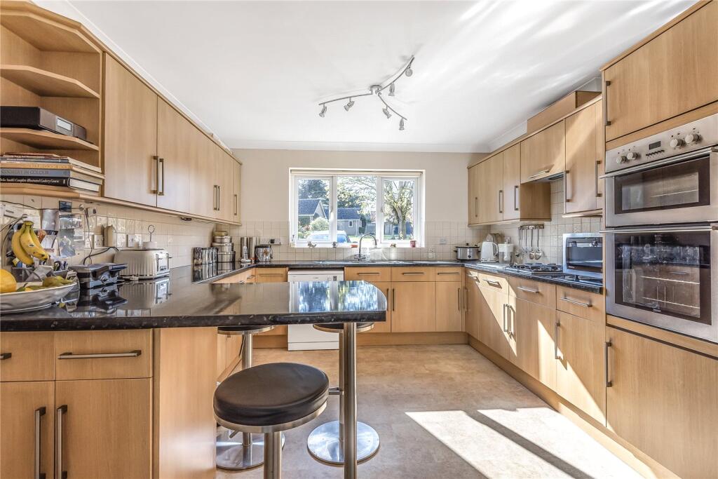
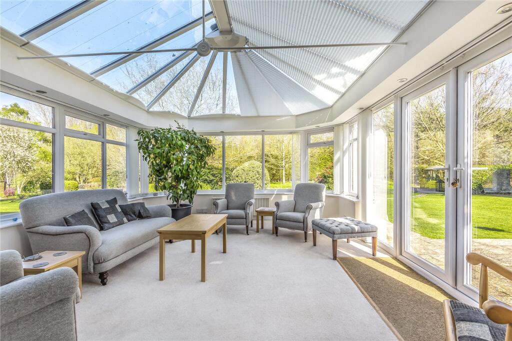
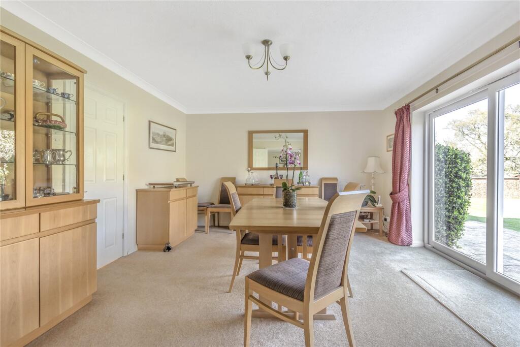
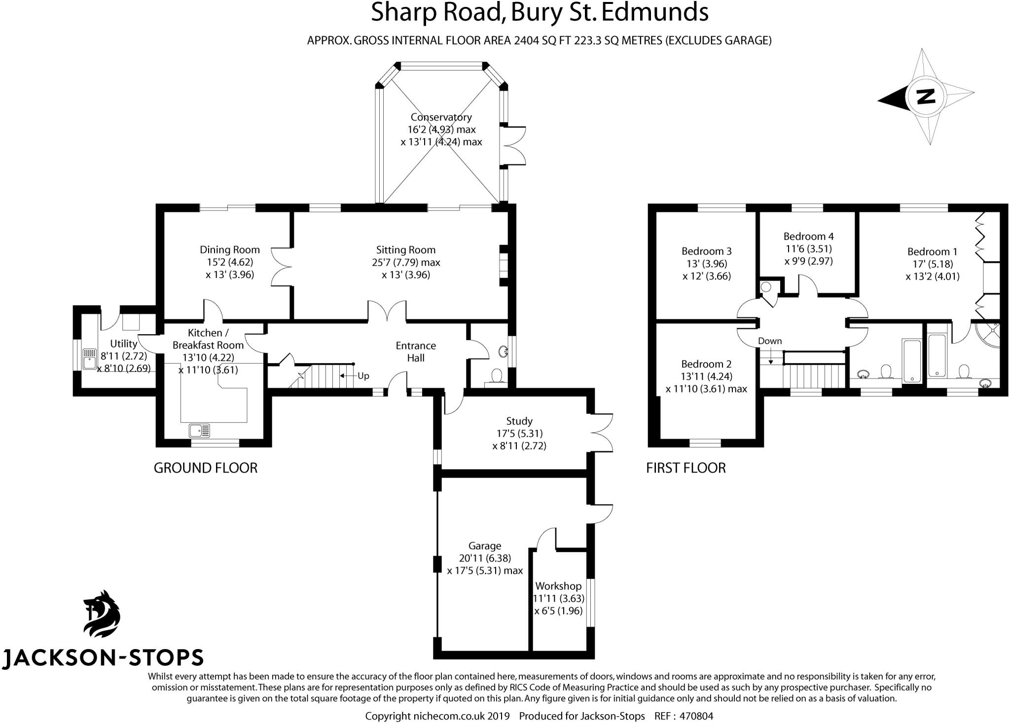
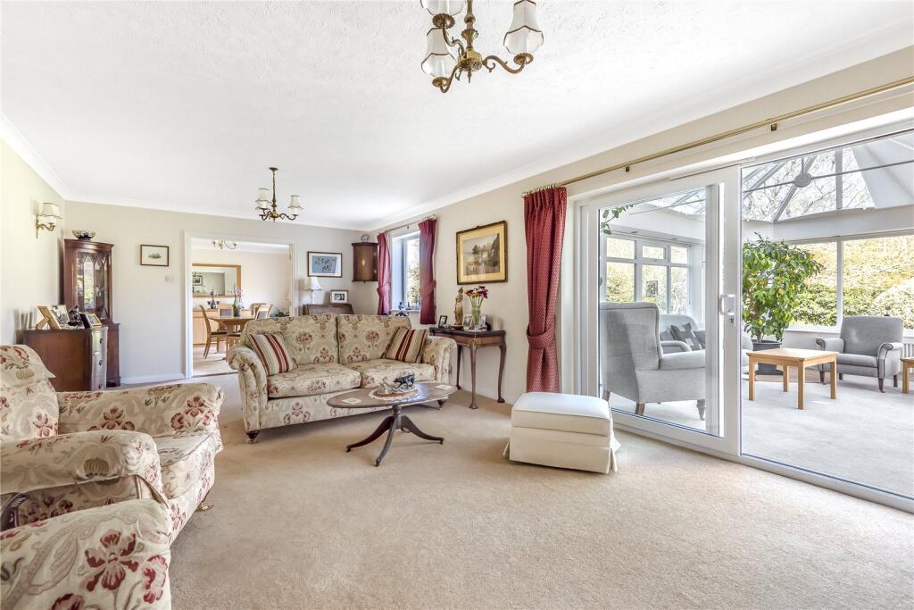
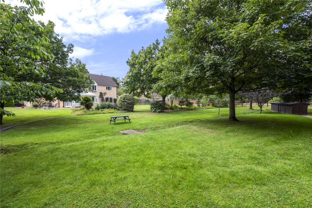
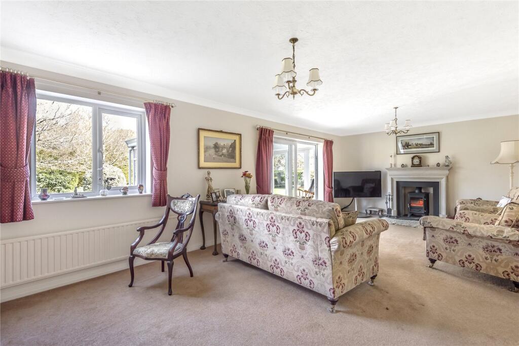
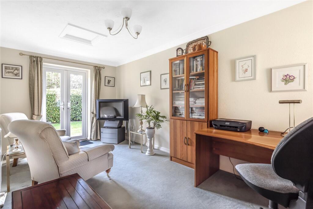
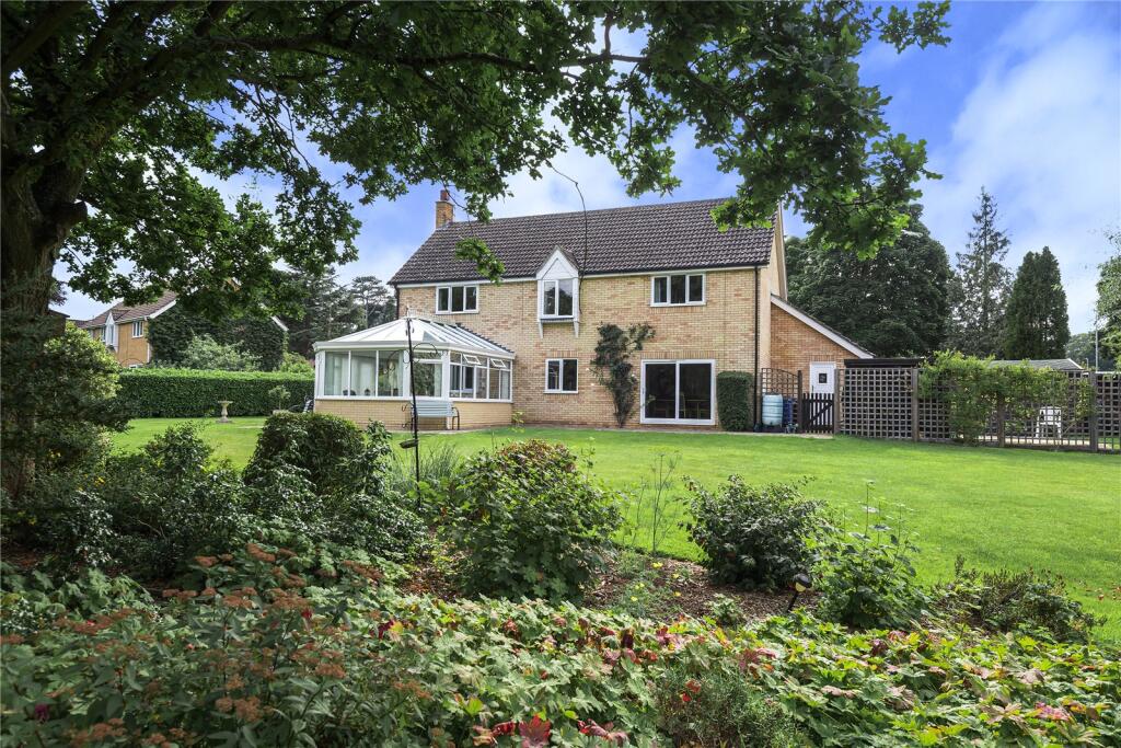
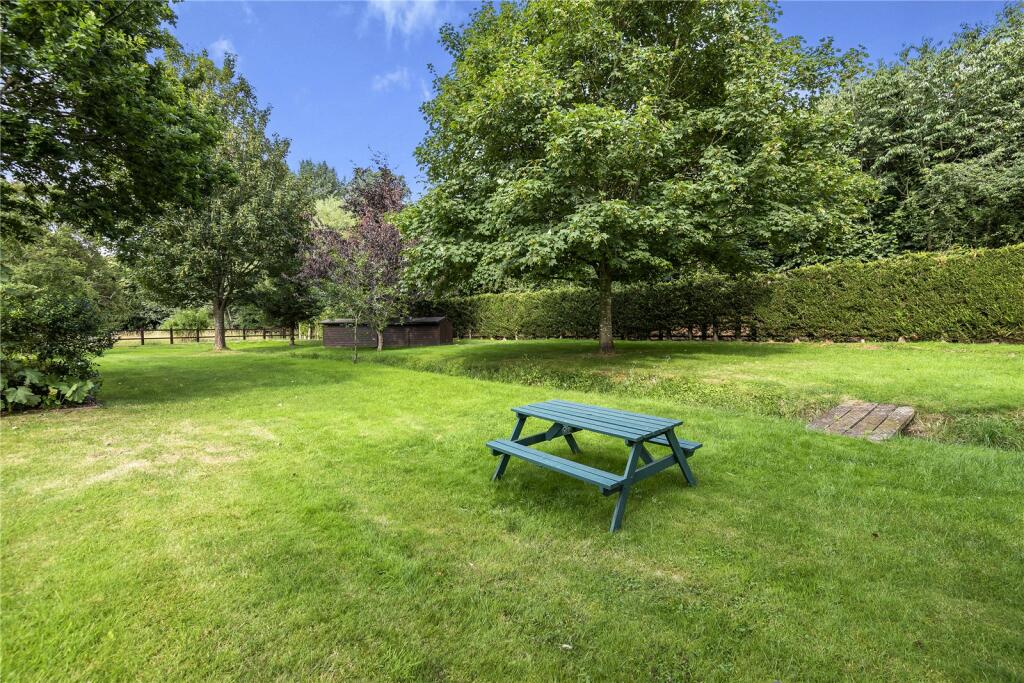
A superbly presented and much improved detached family house, standing in large grounds of around 0.66 of an acre, in one of the most desirable residential addresses in town. Entrance hall, sitting room, dining room, conservatory, kitchen/breakfast room, study, utility and cloakroom....
Property Oracle says ..
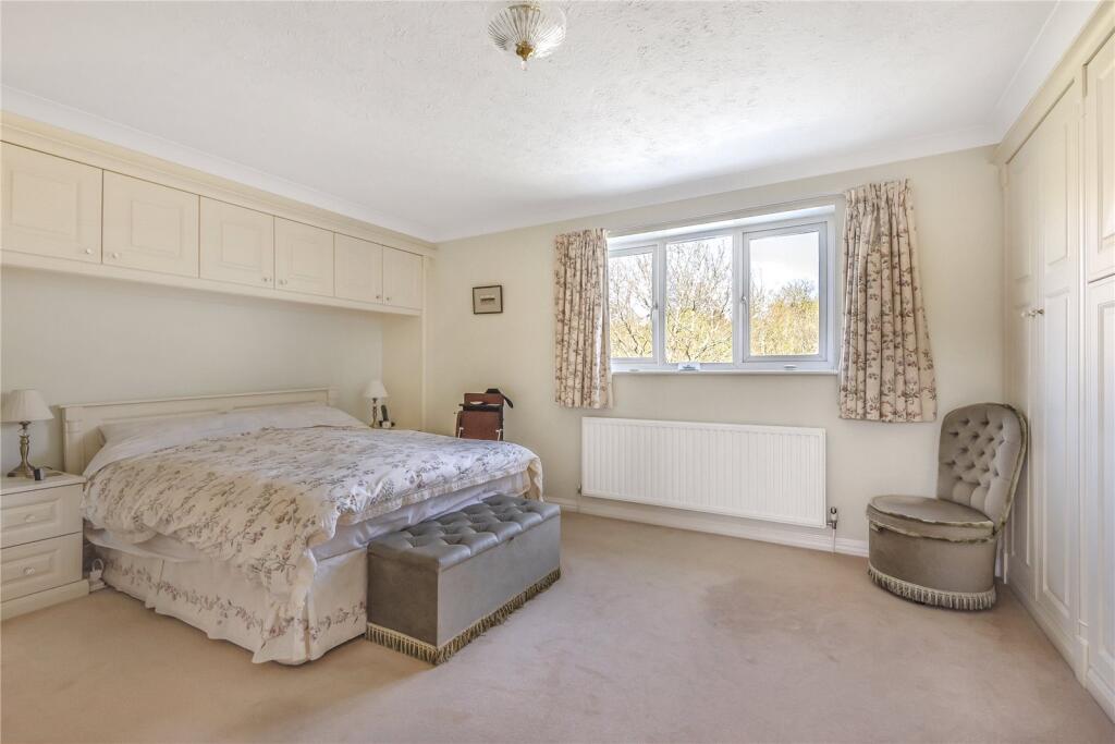
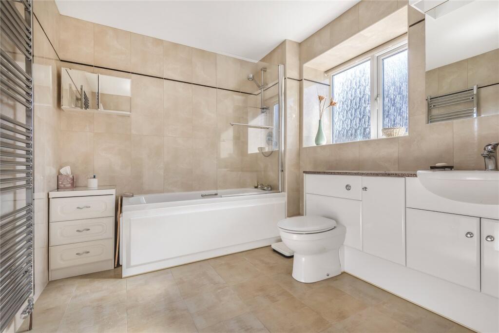
This property is a four-bedroom, two-bathroom house located in Bury St Edmunds, Suffolk. The location is desirable, with nearby schools (Westgate Community Primary School and Nursery, St Edmund’s Catholic Primary School, and Guildhall Feoffment Community Primary School, all rated “Good” by Ofsted) and convenient access to Bury St Edmunds town centre via public transport (Greater Anglia train station is 2.46km away). The property itself appears to be in good condition based on the provided photos, showing a well-maintained interior and exterior. The property includes a large garden, adding to its appeal. The list price of £895,000 is higher than the average price for the area (£468,742), but considering the size (2,211.15 sqft), the good condition, desirable location, and substantial garden (2,404 sqft plot size), the price may be justifiable within the context of the local market. However, a detailed comparison with similar properties in the immediate vicinity would be beneficial to fully assess its value. The average price per sqft in the area is £485, while this property is listed at approximately £405 per sqft. This suggests that the property may be slightly overpriced compared to the average, but this could be offset by the larger plot size and desirable features.
Therefore, we give this property 8 / 10. *Disclaimer: This is our option and does constitute a recommendation or financial advice. Do your own research. *
- Price
- 7
- Condition
- 8
- Location
- 9
- Land
- 9
- Bedrooms
- 4
- Bathrooms
- 2
- Sqft (est)
- 2,211.15
- Lot (est)
- 2,404.00
The heatmap indicates the level of crime in the area. The color of the heatmap indicates the crime severity and recency.
Metrics Year-on-Year
- Average area value
- 488,748.00 £Decreased by 5.95 %
- Est sale value
- 1,101,152.70 £Decreased by 4.60 %
- Average area rental value
- 1,587.00 £/moDecreased by 5.76 %
- Est letting value
- 2,211.15 £/moUnchanged by 0.00 %
- Est rental Yield
- 3.90 %Increased by 0.26 %
- Crime Rate
- 0.00 %
Agent Activity
Jackson-Stops created the listing.
Nearby Schools
| Name | Type | Ofsted | Distance |
|---|---|---|---|
| Westgate Community Primary School And Nursery | Community School | Good | 0.80 KM |
| St Edmund'S Catholic Primary School | Voluntary Aided School | Good | 1.19 KM |
| Guildhall Feoffment Community Primary School | Community School | Good | 1.54 KM |
| Bury Library Children'S Centre | Children's Centre | 1.73 KM | |
| Abbeygate Sixth Form College | Free Schools 16 To 19 | 1.82 KM |
Images


Nearby Streets
| Name | Average Price | Average Sqft | Distance |
|---|---|---|---|
| Maid Marion Court | £ 0 | 0 | 0.00 KM |
| Maple Close | £ 0 | 0 | 0.00 KM |
| Chevington Close | £ 350,000 | 0 | 0.00 KM |
| Westgarth Gardens | £ 300,000 | 0 | 0.00 KM |
| Cullum Road | £ 0 | 0 | 0.00 KM |
Nearby Transport
| Name | NLC | TLC | Distance |
|---|---|---|---|
| Bury St Edmunds | 7008 | BSE | 2.46 KM |
Nearby Listings
| Address | Price | Type | Score | Distance |
|---|---|---|---|---|
| Sharp Road, Bury St Edmunds, Suffolk, IP33 | £ 895,000 | BUY | 8 / 10 | 0.00 KM |
| Sharp Road, Bury St Edmunds, Suffolk, IP33 | £ 995,000 | BUY | 7 / 10 | 0.08 KM |
| Sharp Road, Bury St Edmunds | £ 860,000 | BUY | 7 / 10 | 0.13 KM |
| Bury St. Edmunds, Suffolk. | £ 995,000 | BUY | 9 / 10 | 0.13 KM |
| Caulfield Close, Bury St. Edmunds | £ 410,000 | BUY | 7 / 10 | 0.41 KM |
Nearby Properties
| Address | Price | Distance |
|---|---|---|
| 21 Sharp Road | £ 480,000 | 0.11 KM |
| Hardwick House | £ 815,000 | 0.11 KM |
| 15 Sharp Road | £ 223,000 | 0.11 KM |
| 12 Sharp Road | £ 590,000 | 0.13 KM |
| 17 Sharp Road | £ 650,000 | 0.13 KM |