
SH
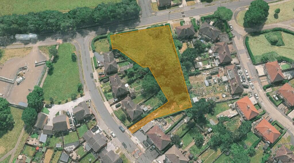
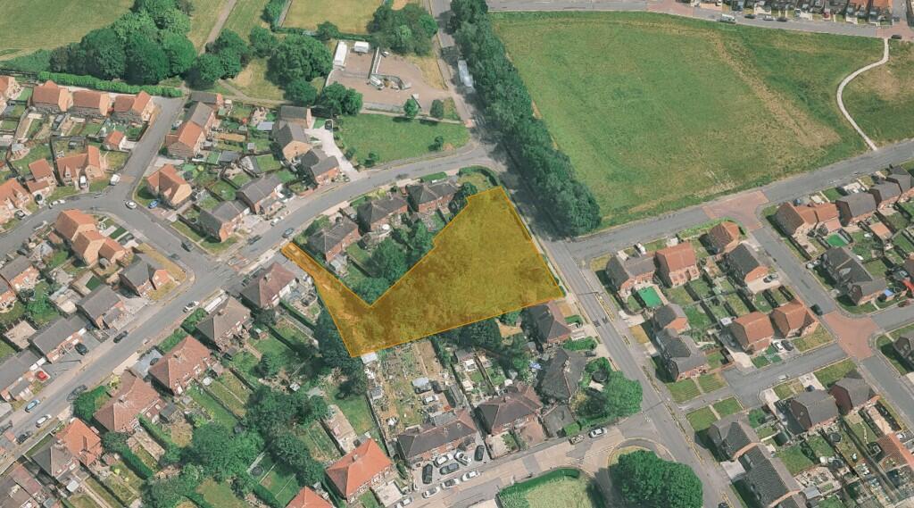
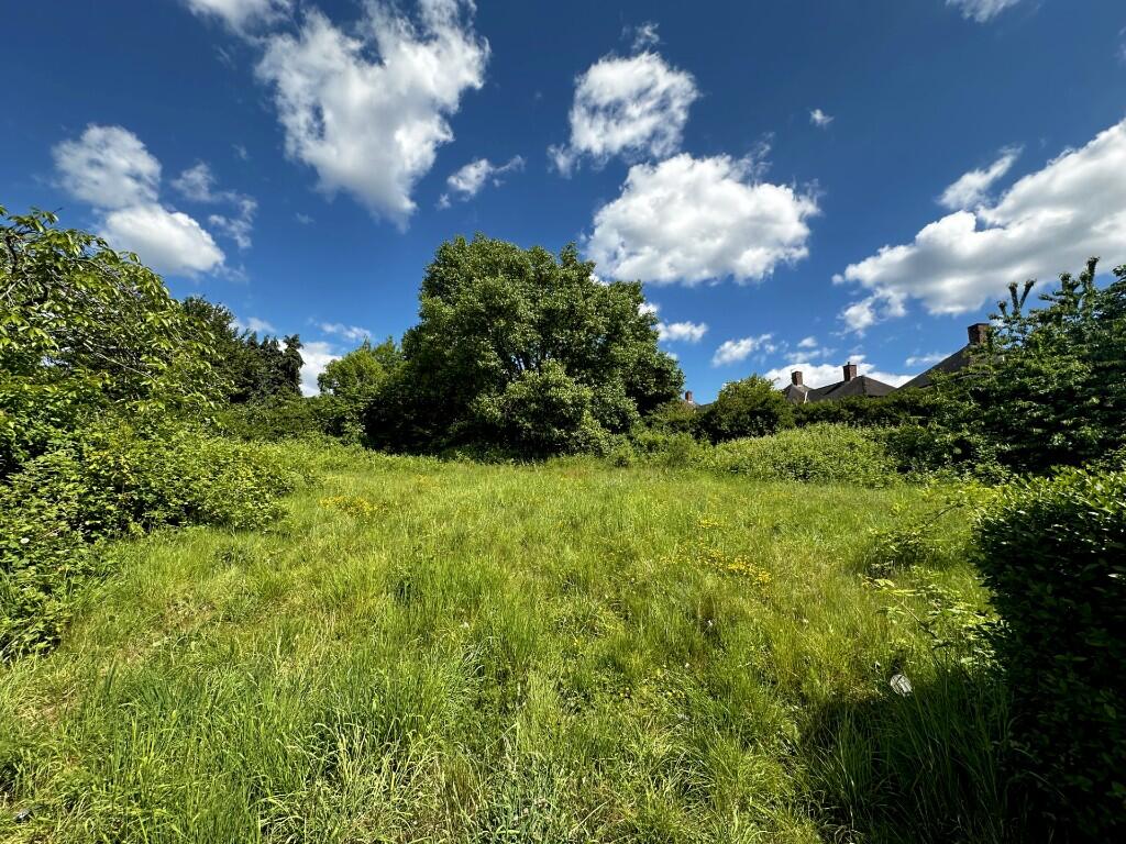
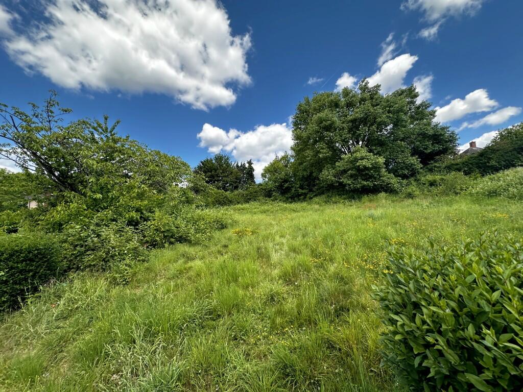
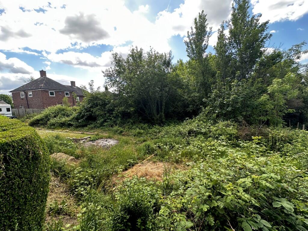
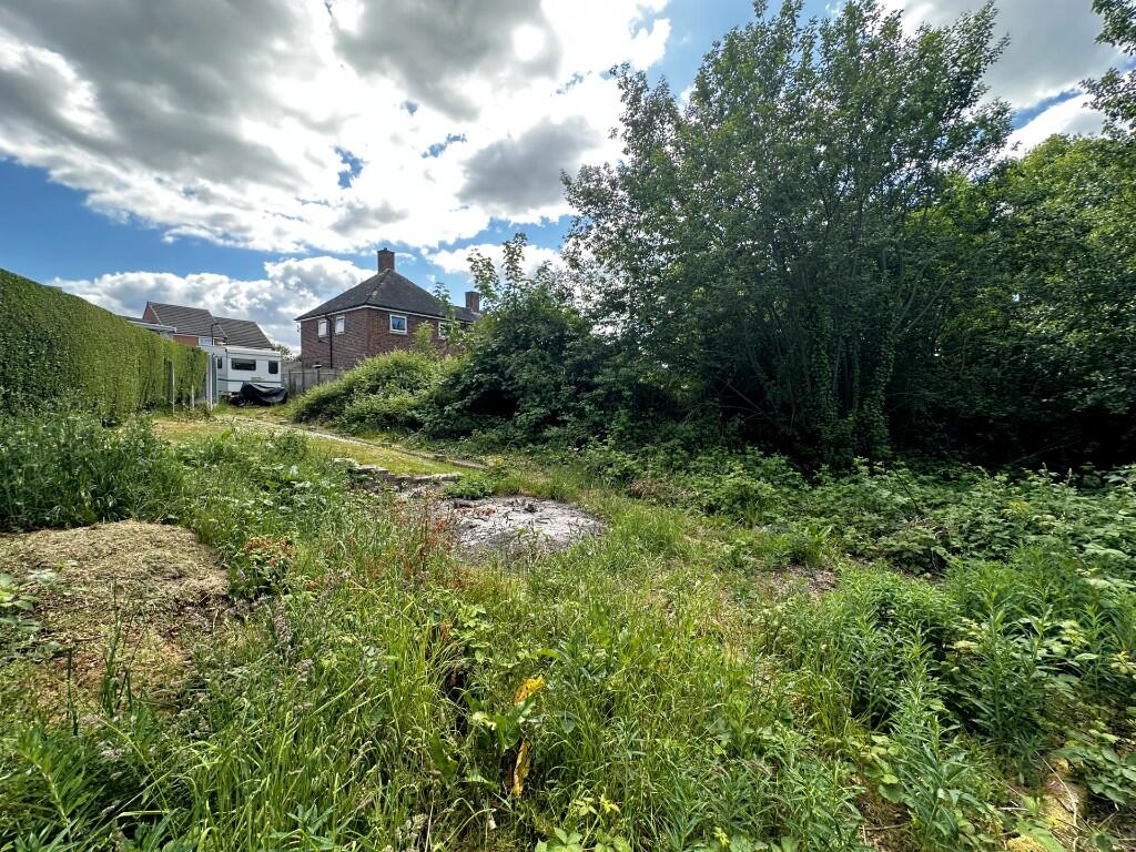
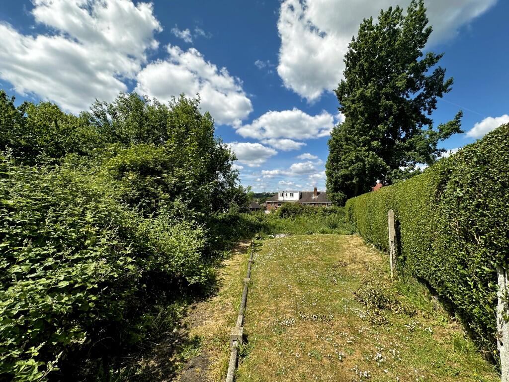
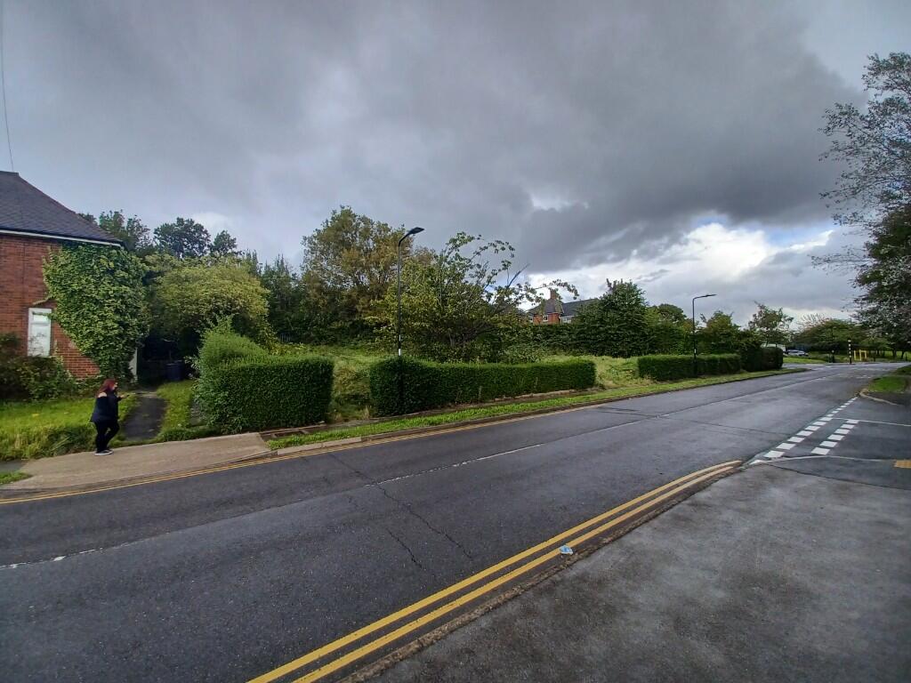
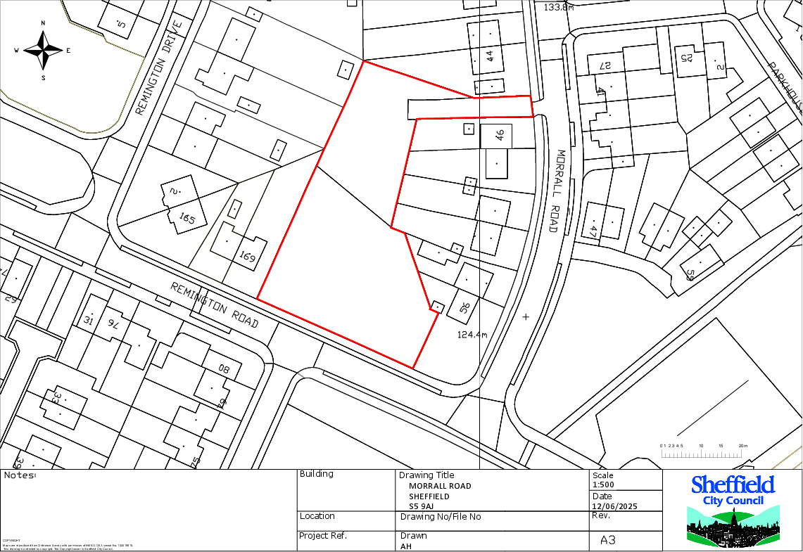
Land at Morrall Road, S5 9AF
By Sheffield City Council
£ 1
Sheffield City Council says ..
Sheffield City Council are inviting offers for this development opportunity at Morrall Road, S5 9AF.
- Bedrooms
- 0
- Bathrooms
- 0
The heatmap indicates the level of crime in the area. The color of the heatmap indicates the crime severity and recency.
Metrics Year-on-Year
- Average area value
- 276,071.00 £Increased by 29.23 %
- Average area rental value
- 713.00 £/moDecreased by 20.69 %
- Est rental Yield
- 3.10 %Decreased by 38.61 %
- Crime Rate
- 6.00 %Unchanged by 0.00 %
from 213,623.00 £
from 899.00 £/mo
from 5.05 %
from 6.00 %
Agent Activity
Sheffield City Council created the listing.
Nearby Schools
| Name | Type | Ofsted | Distance |
|---|---|---|---|
| Monteney Primary School | Academy Converter | Good | 0.82 KM |
| Monteney Children'S Centre | Children's Centre Linked Site | 0.91 KM | |
| Ecclesfield Primary School | Community School | Good | 1.05 KM |
| Woolley Wood School | Community Special School | Good | 1.22 KM |
| Mansel Primary | Academy Sponsor Led | Good | 1.29 KM |
Images


Nearby Streets
| Name | Average Price | Average Sqft | Distance |
|---|---|---|---|
| Remington Road | £ 0 | 0 | 0.00 KM |
| Lindsay Drive | £ 159,950 | 0 | 0.00 KM |
| St Michaels Close | £ 0 | 0 | 0.00 KM |
| St. Wandrilles Close | £ 0 | 0 | 0.00 KM |
| Hill Top Rise | £ 0 | 0 | 0.00 KM |
Nearby Transport
| Name | NLC | TLC | Distance |
|---|---|---|---|
| Chapeltown (South Yorkshire) | 6664 | CLN | 3.24 KM |
| Sheffield | 6691 | SHF | 6.43 KM |
| Meadowhall | 6663 | MHS | 7.14 KM |
| Elsecar | 6667 | ELR | 8.87 KM |
| Darnall | 6729 | DAN | 8.87 KM |
Nearby Listings
| Address | Price | Type | Score | Distance |
|---|---|---|---|---|
| Land at Morrall Road, S5 9AF | £ 1 | BUY | Unknown | 0.00 KM |
| Merryton Crescent, Sheffield | £ 210,000 | BUY | 7 / 10 | 0.12 KM |
| Morrall Road, Sheffield | £ 165,000 | BUY | Unknown | 0.13 KM |
| Darnbrook Drive, Sheffield | £ 195,000 | BUY | 7 / 10 | 0.15 KM |
| Remington Drive, Sheffield | £ 220,000 | BUY | Unknown | 0.16 KM |
Nearby Properties
| Address | Price | Distance |
|---|---|---|
| 1 Morrall Road | £ 138,000 | 0.10 KM |
| 56 Morrall Road | £ 36,000 | 0.10 KM |
| 6 Morrall Road | £ 110,000 | 0.10 KM |
| 42 Morrall Road | £ 490,000 | 0.10 KM |
| 34 Morrall Road | £ 105,000 | 0.10 KM |