Adare Street, Port Talbot, West Glamorgan, SA12 6QF
By Peter Morgan
£ 180,000
Reviews
3 out of 5 stars
Peter Morgan says ..
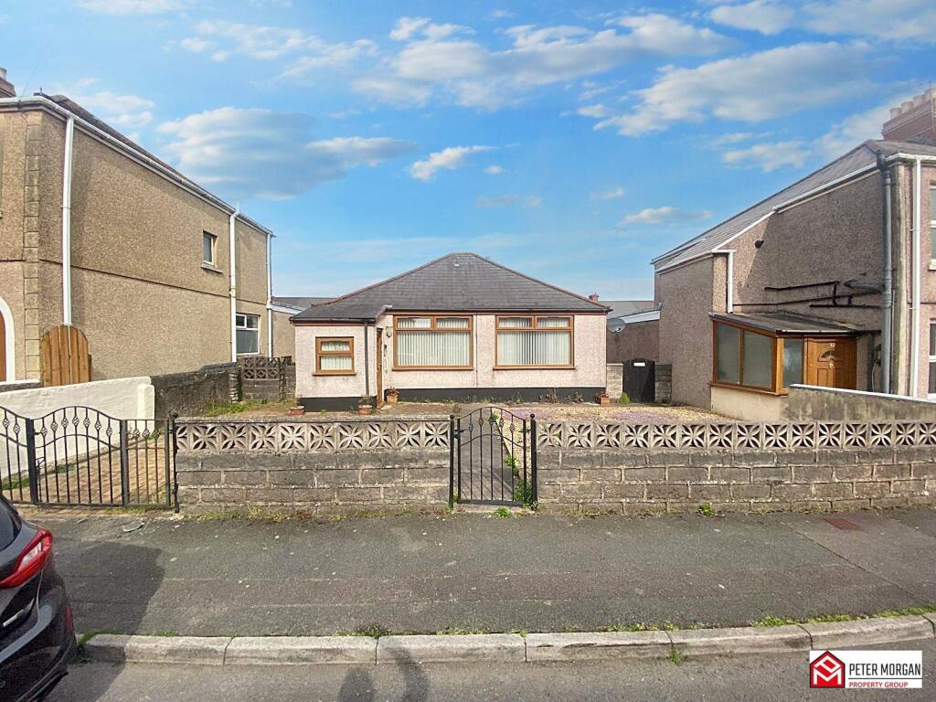
NO ONWARDS CHAIN | Freehold | Detached Bungalow | Two Bedrooms & Two Reception Rooms | Enclosed Rear Garden & Off Road Parking | EPC - D / Council Tax Band - C | Convenient Location | Need A Mortgage? We Can Help!
Property Oracle says ..
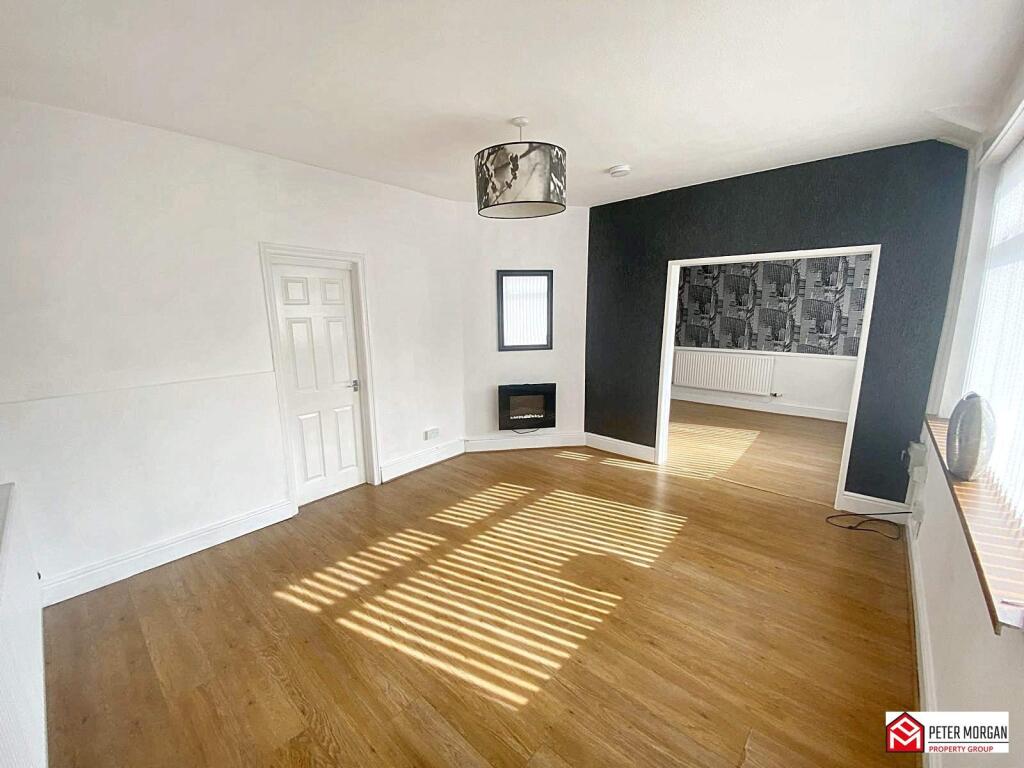
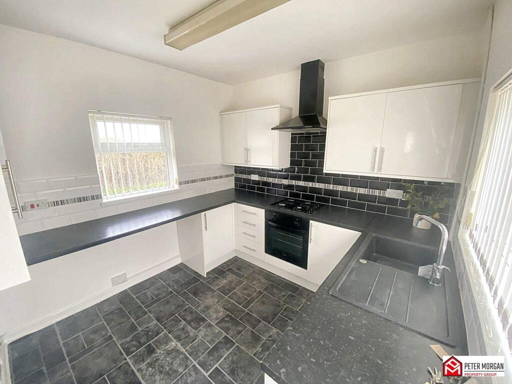
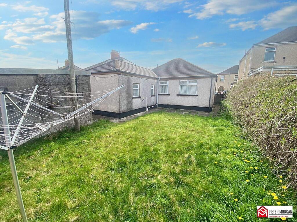
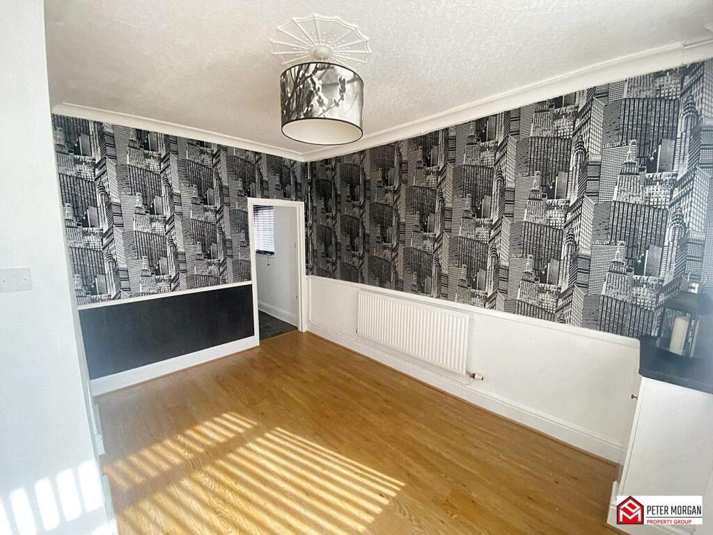
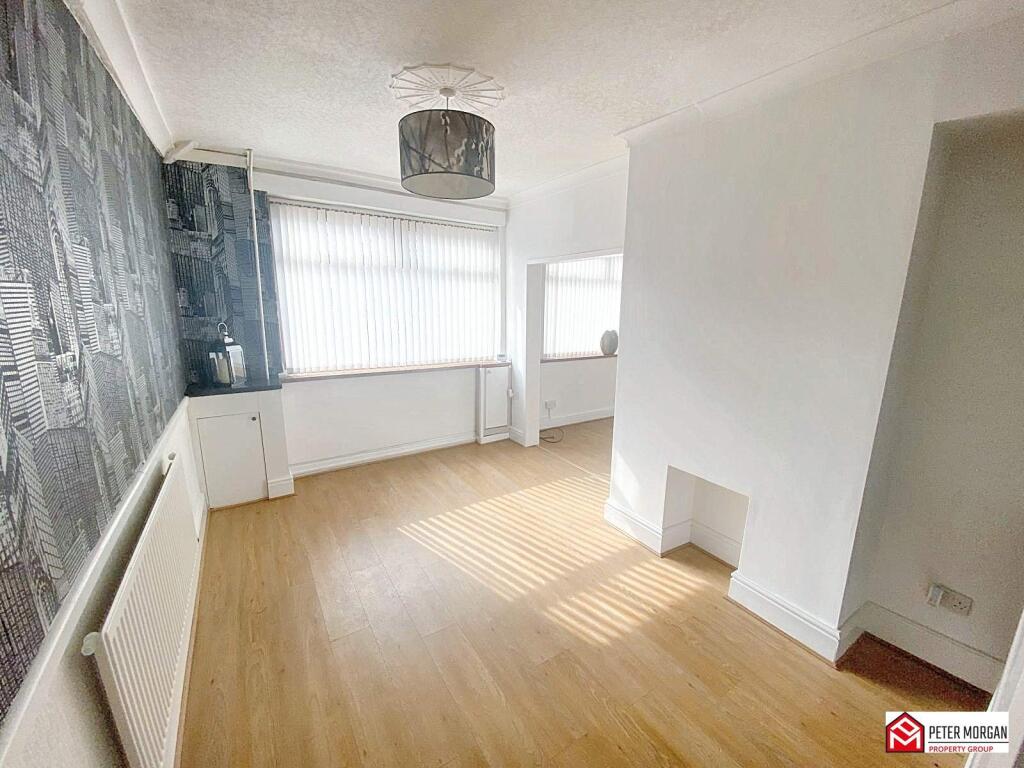
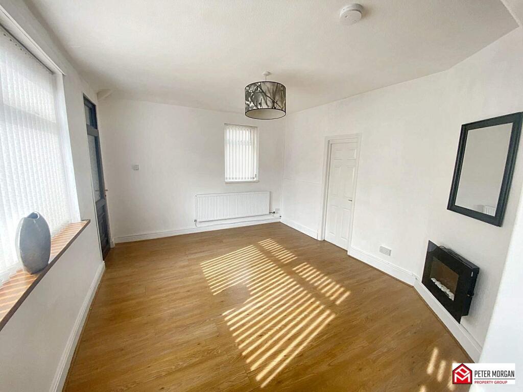
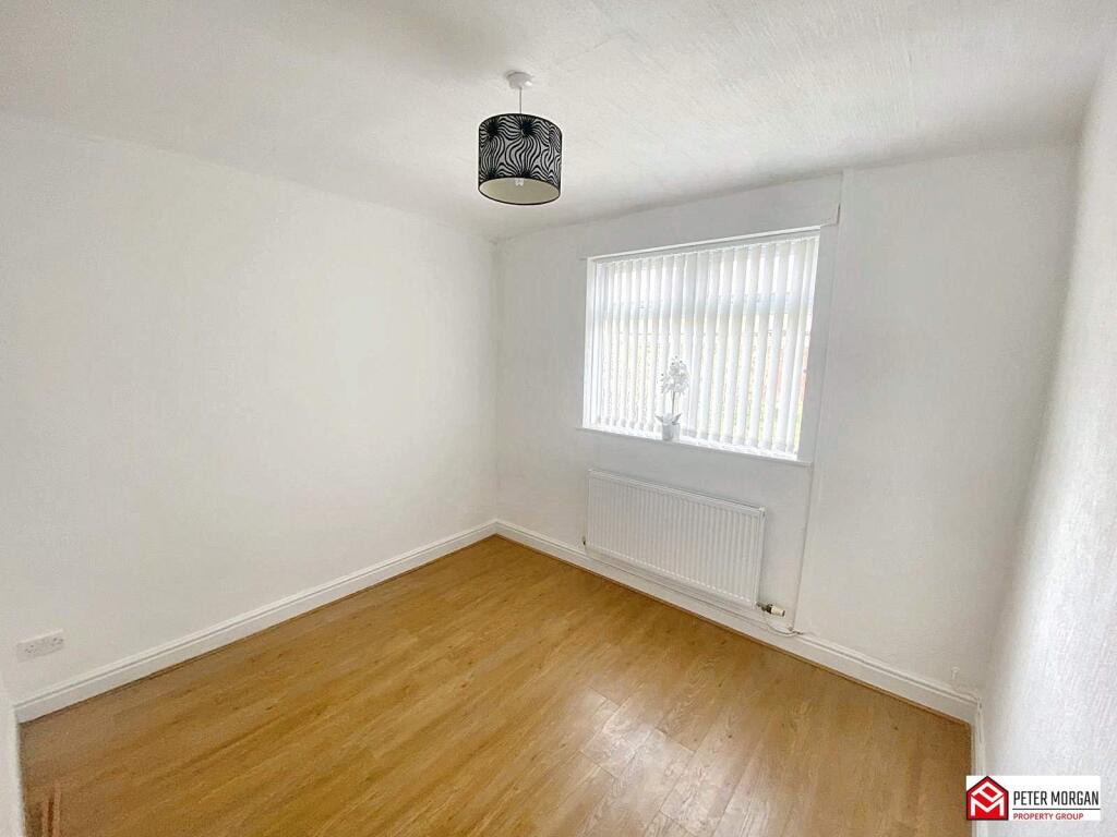
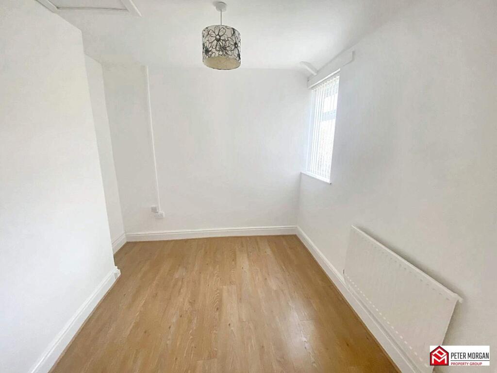
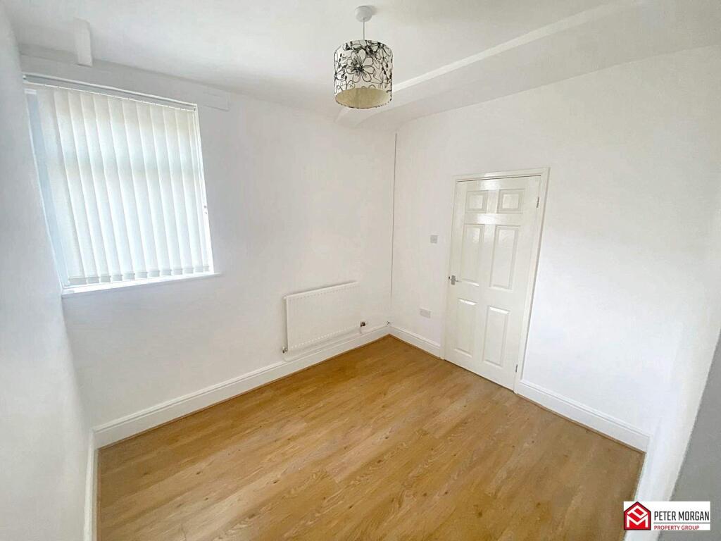
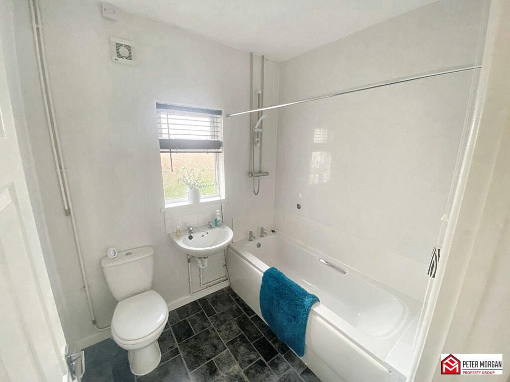
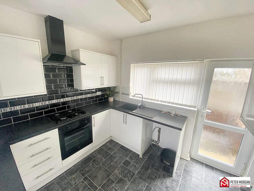
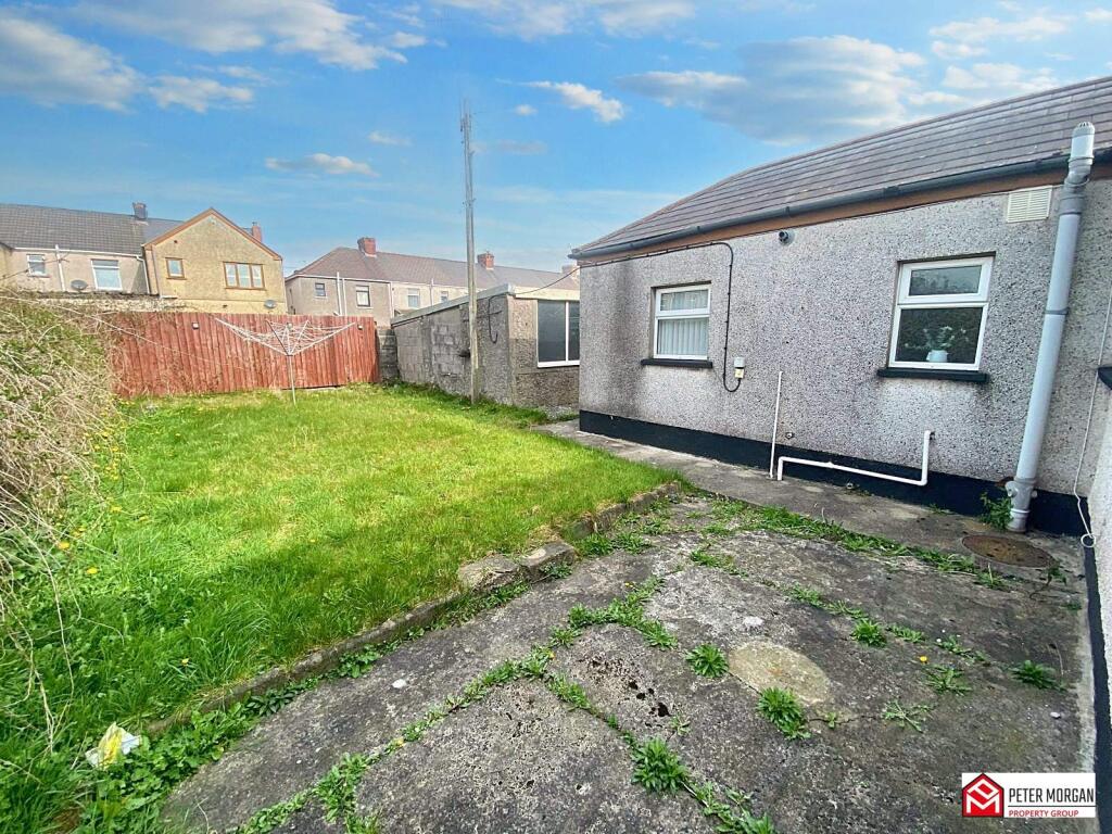
The property is a detached bungalow situated in the Sandfields East area of Port Talbot, West Glamorgan. The area benefits from relatively close proximity to several primary and secondary schools, with Sandfields Primary School being the closest at 0.42km. Transportation links appear reasonable with Port Talbot Parkway train station approximately 2.13km away. The images suggest the property is in good condition, having undergone some modernisation, particularly in the kitchen and bathrooms. The interior appears clean and well-maintained. The exterior also presents well, although the garden could benefit from some landscaping. The presence of a detached garage is a positive feature. While the plot size is not specified, the images show a garden of reasonable size for a property of this type. This is a positive aspect, particularly given the average plot size is not provided. The list price of £180,000 is noticeably lower than the area average of £271,493. However, without knowing the square footage of this property, a definitive statement on value for money cannot be made. A comparison with nearby properties on Adare Street shows prices ranging from £87,000 to £143,000 for terraced houses. The list price for this detached bungalow appears to be at the higher end of this range, but still significantly below the overall area average. Further information on the square footage would be needed to make a more informed judgment on the price.
Therefore, we give this property 7 / 10. *Disclaimer: This is our option and does constitute a recommendation or financial advice. Do your own research. *
- Price
- 7
- Condition
- 8
- Location
- 7
- Land
- 6
- Bedrooms
- 2
- Bathrooms
- 1
The heatmap indicates the level of crime in the area. The color of the heatmap indicates the crime severity and recency.
Metrics Year-on-Year
- Average area value
- 406,364.00 £Increased by 51.98 %
- Average area rental value
- 1,294.00 £/moIncreased by 17.32 %
- Est rental Yield
- 3.82 %Decreased by 22.83 %
- Crime Rate
- 9.00 %Unchanged by 0.00 %
Agent Activity
Peter Morgan created the listing.
Nearby Schools
| Name | Type | Ofsted | Distance |
|---|---|---|---|
| Sandfields Primary School | Welsh Establishment | 0.42 KM | |
| Tywyn Primary School | Welsh Establishment | 0.84 KM | |
| St Joseph'S Catholic Junior School | Welsh Establishment | 0.90 KM | |
| St Joseph'S Rc School And 6Th Form Centre | Welsh Establishment | 0.98 KM | |
| St Joseph'S Catholic Infant School | Welsh Establishment | 1.35 KM |
Images
Nearby Streets
| Name | Average Price | Average Sqft | Distance |
|---|---|---|---|
| Gerald Street | £ 120,000 | 0 | 0.00 KM |
| Ruskin Avenue | £ 0 | 0 | 0.00 KM |
| Heol Bronwen | £ 0 | 0 | 0.00 KM |
| Afan Way | £ 0 | 0 | 0.00 KM |
| Rhodes Avenue | £ 0 | 0 | 0.00 KM |
Nearby Transport
| Name | NLC | TLC | Distance |
|---|---|---|---|
| Port Talbot Parkway | 4181 | PTA | 2.13 KM |
| Baglan | 4186 | BAJ | 2.73 KM |
| Briton Ferry | 4187 | BNF | 5.36 KM |
| Neath | 4216 | NTH | 7.70 KM |
| Skewen | 4217 | SKE | 9.11 KM |
Nearby Listings
| Address | Price | Type | Score | Distance |
|---|---|---|---|---|
| Adare Street, Port Talbot, West Glamorgan, SA12 6QF | £ 180,000 | BUY | 7 / 10 | 0.00 KM |
| Adare Street, Aberavon, Port Talbot, Neath Port Talbot. SA12 6QF | £ 175,000 | BUY | 7 / 10 | 0.04 KM |
| Adare Street, Port Talbot, Neath Port Talbot. SA12 6QF | £ 165,000 | BUY | 7 / 10 | 0.04 KM |
| Maesgwyn Street, Port Talbot, Neath Port Talbot. | £ 169,995 | BUY | 7 / 10 | 0.08 KM |
| Victoria Road, Port Talbot, Neath Port Talbot. SA12 6QG | £ 185,000 | BUY | 5 / 10 | 0.09 KM |
Nearby Properties
| Address | Price | Distance |
|---|---|---|
| 7 Adare Street | £ 87,000 | 0.05 KM |
| 34 Adare Street | £ 120,000 | 0.05 KM |
| 11 Adare Street | £ 129,000 | 0.05 KM |
| 19 Adare Street | £ 143,000 | 0.05 KM |
| 21 Adare Street | £ 106,995 | 0.05 KM |