Drove Road, Whaplode Drove, Spalding
By Sedge Ltd
£ 165,000
Reviews
2 out of 5 stars
Sedge Ltd says ..
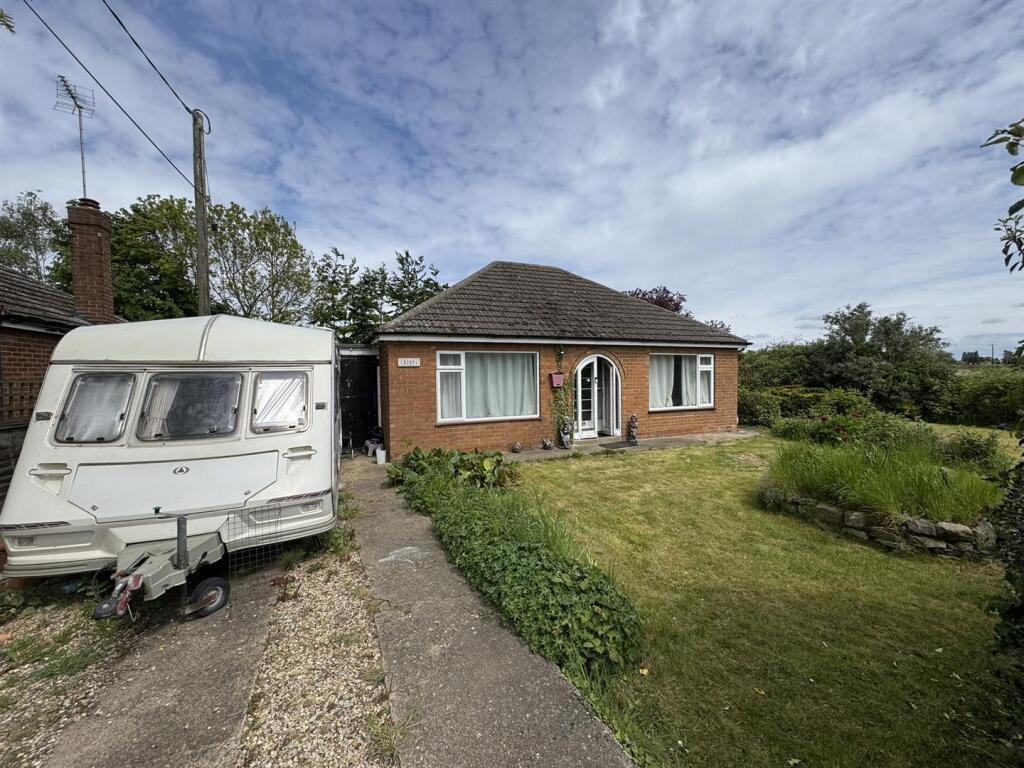
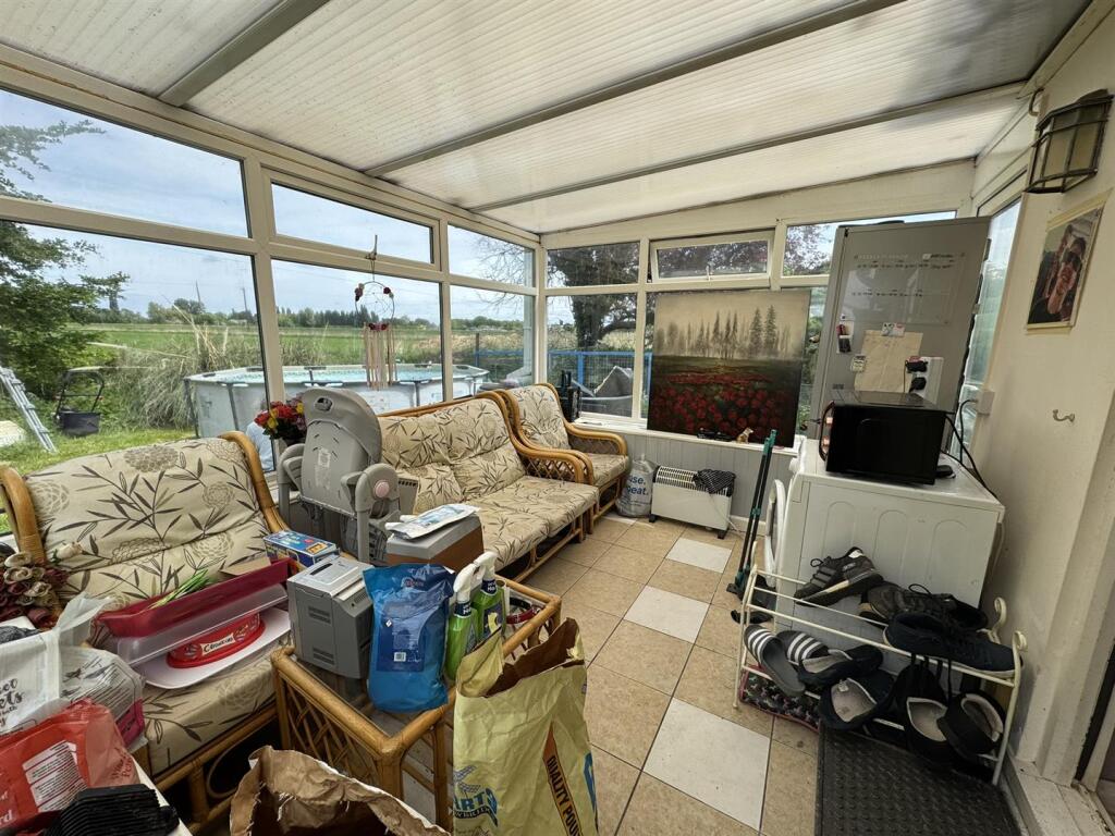
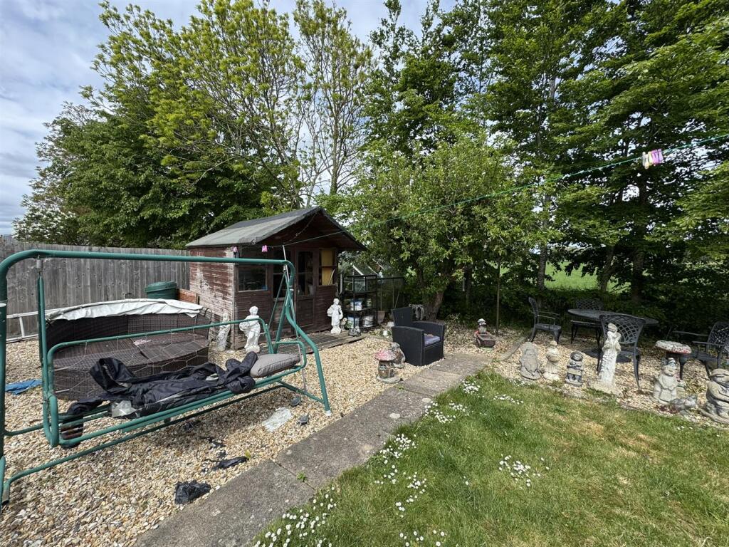
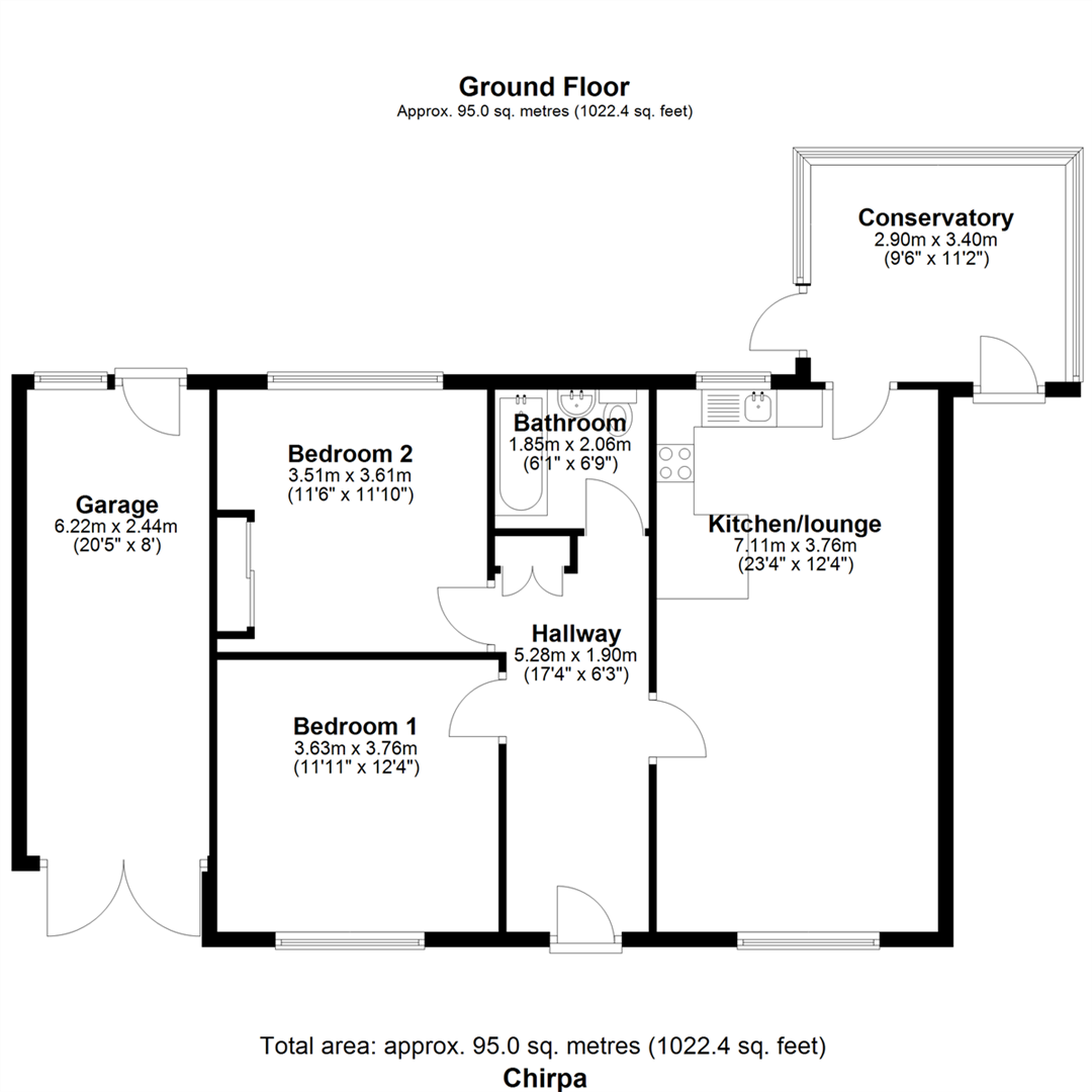
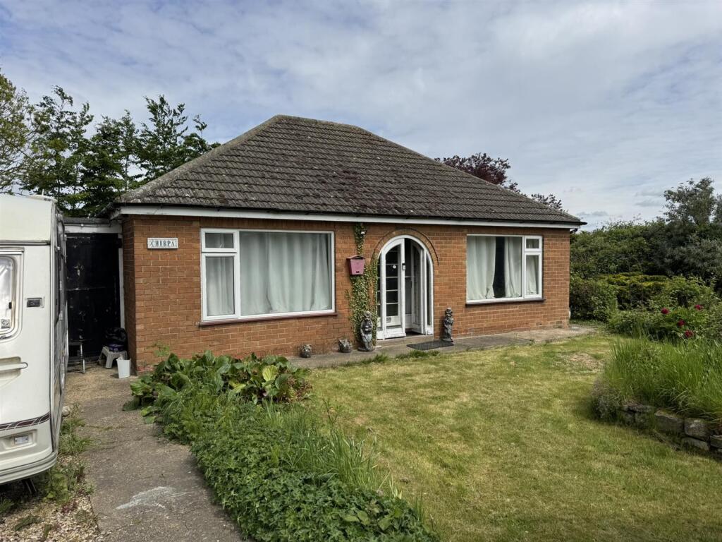
Renovation Opportunity – Detached Bungalow in Shepeau Stow Located in a peaceful village setting, this two-bedroom detached bungalow offers great potential for renovation and personalisation. The accommodation includes: Entrance Hall, Open Plan Kitchen/Living Area, Conservatory, Two ...
Property Oracle says ..
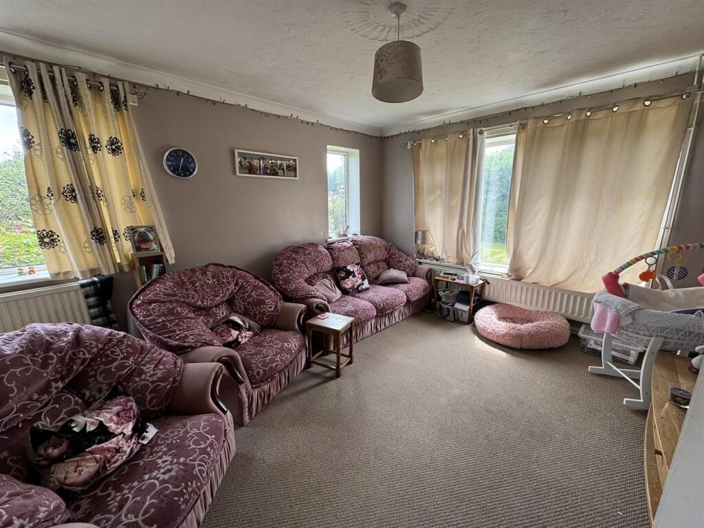
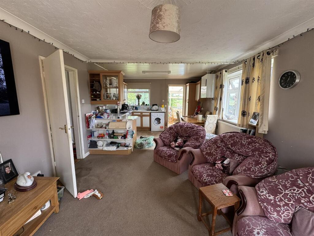
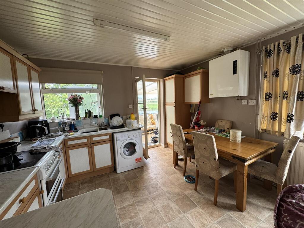
The property is a 2-bedroom detached bungalow located in Whaplode Drove, Spalding, Lincolnshire. The list price is £165,000, and the property has a plot size of 1,022.57 sqft and 995.34 sqft of internal space. The average house price in the area is significantly higher at £428,638, with an average price per sqft of £372. While the property benefits from a garden and is within a reasonable distance of several schools (Shepeau Stow Primary School being the closest at 0.60 KM), the condition of the property appears to require some level of renovation or modernisation. This is evident in the provided images, which show dated interiors and fixtures. The relatively low list price compared to the area average may reflect the need for these improvements. More information on the condition of the property and the local market would be needed for a more comprehensive evaluation.
Therefore, we give this property 5 / 10. *Disclaimer: This is our option and does constitute a recommendation or financial advice. Do your own research. *
- Price
- 7
- Condition
- 4
- Location
- 6
- Land
- 6
- Bedrooms
- 2
- Bathrooms
- 1
- Sqft (est)
- 995.34
- Lot (est)
- 1,022.57
The heatmap indicates the level of crime in the area. The color of the heatmap indicates the crime severity and recency.
Metrics Year-on-Year
- Average area value
- 536,667.00 £Increased by 14.03 %
- Est sale value
- 386,191.92 £Increased by 12.46 %
- Average area rental value
- 1,423.00 £/moIncreased by 11.26 %
- Est letting value
- 995.34 £/mo
- Est rental Yield
- 3.18 %Decreased by 2.45 %
- Crime Rate
- 127.00 %Unchanged by 0.00 %
Agent Activity
Sedge Ltd created the listing.
Nearby Schools
| Name | Type | Ofsted | Distance |
|---|---|---|---|
| Shepeau Stow Primary School | Community School | Good | 0.60 KM |
| The Gedney Hill Church Of England Vc Primary School | Voluntary Controlled School | Requires improvement | 5.17 KM |
| Moulton Chapel Primary School | Community School | Good | 5.99 KM |
| Calman Colaiste (Kisimul Group) | Special Post 16 Institution | Good | 8.36 KM |
| The Duke Of Bedford Primary School | Community School | Good | 8.68 KM |
Images


Nearby Streets
| Name | Average Price | Average Sqft | Distance |
|---|---|---|---|
| Lea Lane | £ 0 | 0 | 0.00 KM |
| Oxcroft Bank | £ 394,995 | 0 | 0.00 KM |
Nearby Listings
| Address | Price | Type | Score | Distance |
|---|---|---|---|---|
| Drove Road, Whaplode Drove, Spalding | £ 425,000 | BUY | 8 / 10 | 0.00 KM |
| Drove Road, Whaplode Drove, Spalding | £ 165,000 | BUY | 5 / 10 | 0.00 KM |
| Drove Road, Shepeau Stow | £ 250,000 | BUY | 6 / 10 | 0.02 KM |
| Drove Road, Shepeau Stow | £ 300,000 | BUY | 6 / 10 | 0.02 KM |
| Drove Road, Shepeau Stow | £ 300,000 | BUY | 7 / 10 | 0.02 KM |
Nearby Properties
| Address | Price | Distance |
|---|---|---|
| Thistlemoor | £ 300,000 | 0.54 KM |
| Fenfield Cottage | £ 232,000 | 0.54 KM |
| Wyndene | £ 179,000 | 0.54 KM |
| The Bungalow | £ 64,000 | 0.78 KM |
| Holly Cottage | £ 146,000 | 0.93 KM |