NO
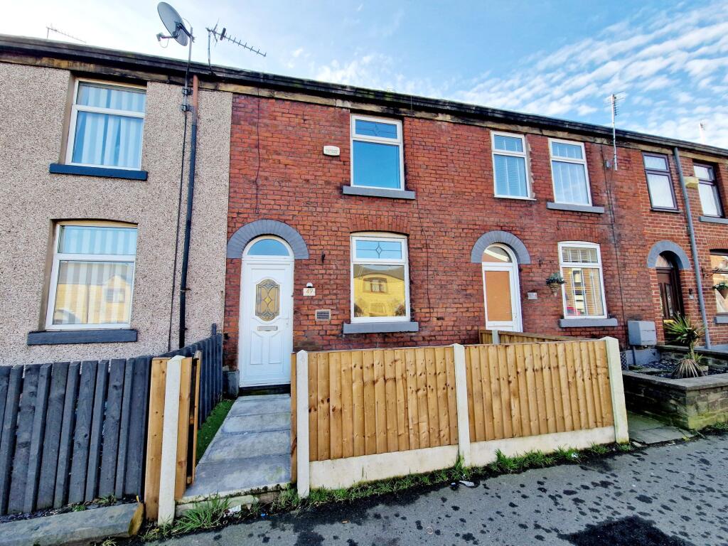
Walshaw Road, Bury, BL8
By Normie & Co
£ 850
Normie & Co says ..
Terraced
- Bedrooms
- 2
- Bathrooms
- 1
The heatmap indicates the level of crime in the area. The color of the heatmap indicates the crime severity and recency.
Metrics Year-on-Year
- Average area value
- 423,750.00 £Increased by 20.30 %
- Average area rental value
- 1,712.00 £/moIncreased by 1.36 %
- Est rental Yield
- 4.85 %Decreased by 15.65 %
- Crime Rate
- 0.00 %
from 352,259.00 £
from 1,689.00 £/mo
from 5.75 %
from 0.00 %
Agent Activity
Normie & Co created the listing.
Nearby Schools
| Name | Type | Ofsted | Distance |
|---|---|---|---|
| Bury West & North Children'S Centre Hub | Children's Centre | 0.58 KM | |
| Woodbank Primary School | Community School | Good | 0.61 KM |
| Elton Community Primary School | Academy Sponsor Led | Good | 0.63 KM |
| Guardian Angels Roman Catholic Primary School, Bury | Voluntary Aided School | Outstanding | 0.82 KM |
| Mill School - Bury | Other Independent Special School | 1.04 KM |
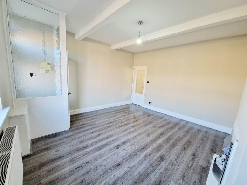
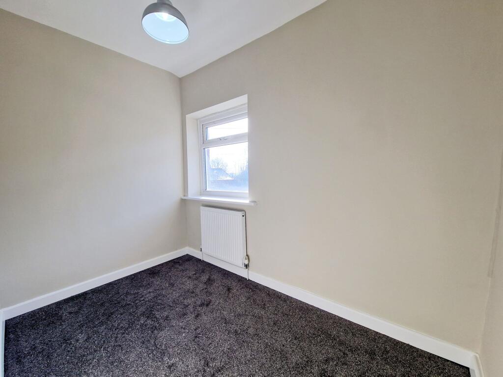
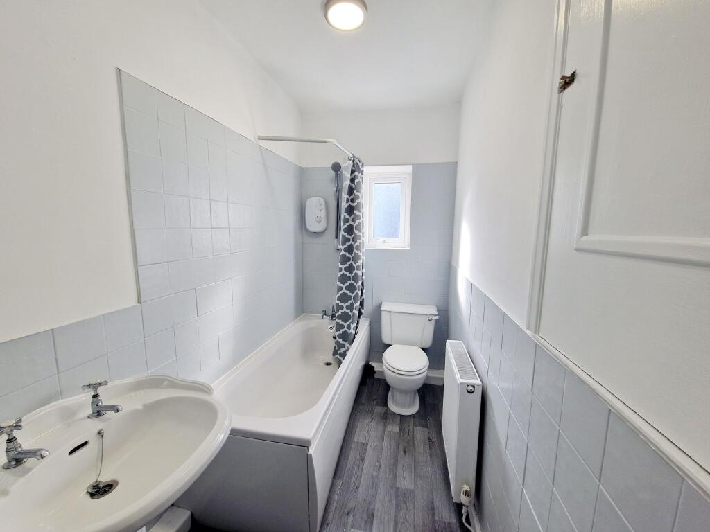
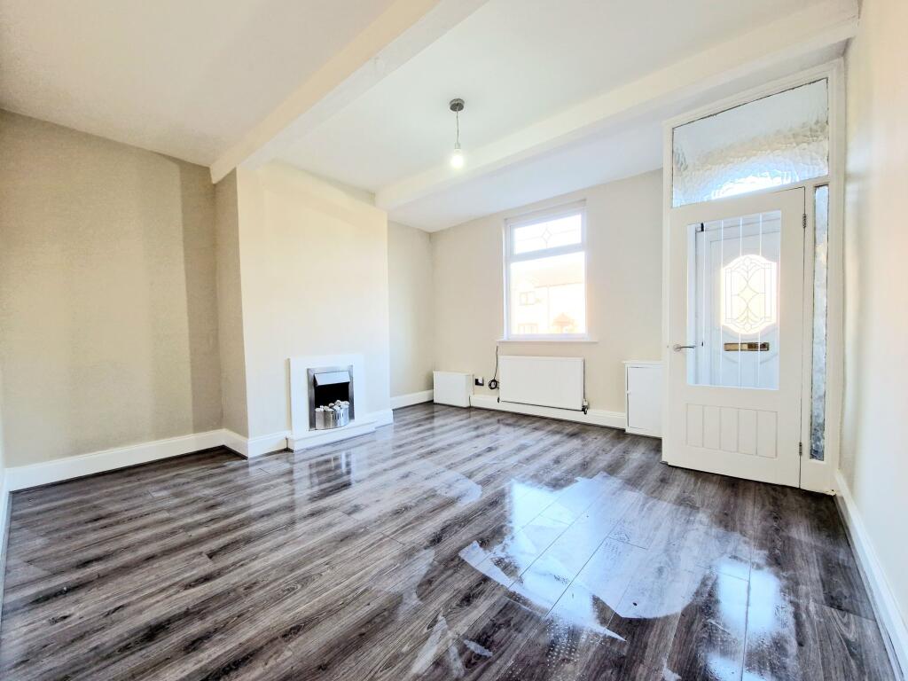
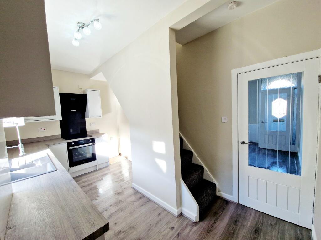
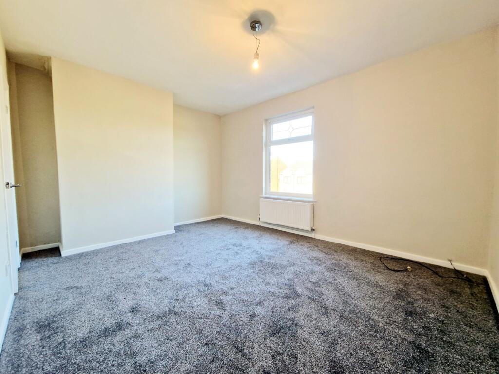
Images


Nearby Streets
| Name | Average Price | Average Sqft | Distance |
|---|---|---|---|
| Wike Street | £ 0 | 0 | 0.00 KM |
| Back Merton Street | £ 145,000 | 0 | 0.00 KM |
| Back Tottington Road North | £ 140,000 | 0 | 0.00 KM |
| Albion Court | £ 0 | 0 | 0.00 KM |
| Harvey Street | £ 0 | 0 | 0.00 KM |
Nearby Transport
| Name | NLC | TLC | Distance |
|---|---|---|---|
| Clifton (Manchester) | 2795 | CLI | 8.33 KM |
| Kearsley (Manchester) | 2605 | KSL | 9.17 KM |
| Swinton (Manchester) | 2800 | SNN | 9.61 KM |
| Farnworth | 2811 | FNW | 9.93 KM |
Nearby Listings
| Address | Price | Type | Score | Distance |
|---|---|---|---|---|
| Walshaw Road, Bury, BL8 | £ 850 | RENT | Unknown | 0.00 KM |
| Vanguard Close, Bury, BL8 | £ 799 | RENT | Unknown | 0.16 KM |
| Tottington Road, Apartment 3, Bury | £ 850 | RENT | Unknown | 0.21 KM |
| Mayor Street, Bury | £ 875 | RENT | Unknown | 0.22 KM |
| Mayor Street, Bury, Greater Manchester, BL8 1LP | £ 850 | RENT | Unknown | 0.24 KM |
Nearby Properties
| Address | Price | Distance |
|---|---|---|
| 43 Walshaw Road | £ 118,000 | 0.01 KM |
| 49 Walshaw Road | £ 140,000 | 0.01 KM |
| 41 Walshaw Road | £ 65,000 | 0.01 KM |
| 47 Walshaw Road | £ 79,718 | 0.01 KM |
| 51 Walshaw Road | £ 73,000 | 0.01 KM |