
Chart Lane, Brasted Chart, Westerham, Kent, TN16
By Knight Frank
£ 2,500,000
Reviews
4 out of 5 stars
Knight Frank says ..
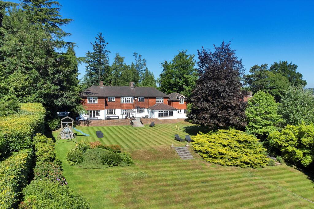
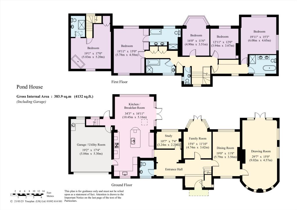
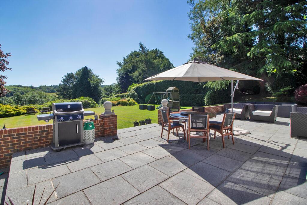
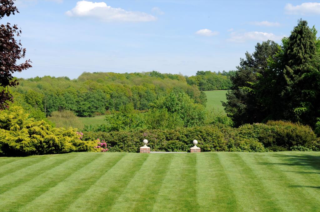
Offered with no onward chain, this handsome detached 1920's house extends to over 4100 sq foot with wonderful views over fields and woodland Nestled within an Area of Outstanding Natural Beauty, yet less than a mile from Brasted village, Pond House enjoys far reaching views to the rear over fiel...
Property Oracle says ..
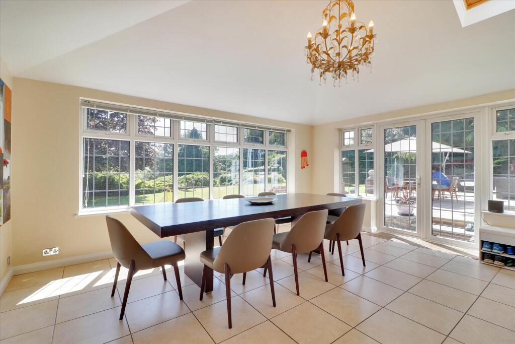
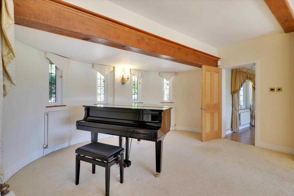
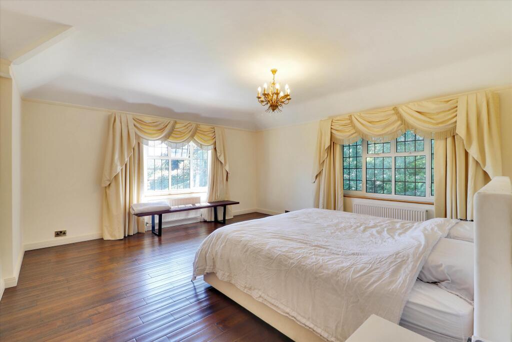
This property is a detached house located in Chart Lane, Brasted Chart, Westerham, Kent. It boasts 5 bedrooms and 4 bathrooms, and has a sizable plot of 4,132 sqft. The house is in excellent condition, and the images show that it has been well maintained. The location is desirable, being close to good schools and transport links. The price of £2,500,000 seems reasonable given the size, condition, and location of the property. The average price per sqft in the area is £493, and this property is significantly larger than average.
Therefore, we give this property 8 / 10. *Disclaimer: This is our option and does constitute a recommendation or financial advice. Do your own research. *
- Price
- 7
- Condition
- 10
- Location
- 9
- Land
- 8
- Bedrooms
- 5
- Bathrooms
- 4
- Sqft (est)
- 2,941.63
- Lot (est)
- 4,132.00
The heatmap indicates the level of crime in the area. The color of the heatmap indicates the crime severity and recency.
Metrics Year-on-Year
- Average area value
- 1,056,667.00 £Increased by 9.22 %
- Est sale value
- 2,309,179.55 £Increased by 34.88 %
- Average area rental value
- 6,495.00 £/moIncreased by 171.98 %
- Est letting value
- 11,766.52 £/moIncreased by 300.00 %
- Est rental Yield
- 7.38 %Increased by 149.32 %
- Crime Rate
- 16.00 %Unchanged by 0.00 %
Agent Activity
Knight Frank created the listing.
Nearby Schools
| Name | Type | Ofsted | Distance |
|---|---|---|---|
| Valence School | Foundation Special School | Good | 1.55 KM |
| Sundridge And Brasted Church Of England Voluntary Controlled Primary School | Voluntary Controlled School | Requires improvement | 2.87 KM |
| Radnor House Sevenoaks | Other Independent School | 2.99 KM | |
| Ide Hill Church Of England Primary School | Voluntary Aided School | Good | 3.01 KM |
| Churchill Church Of England Voluntary Controlled Primary School | Voluntary Controlled School | Good | 4.00 KM |
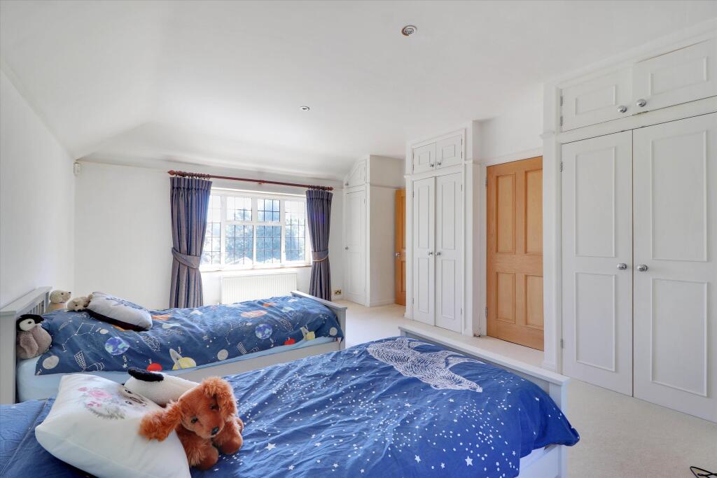
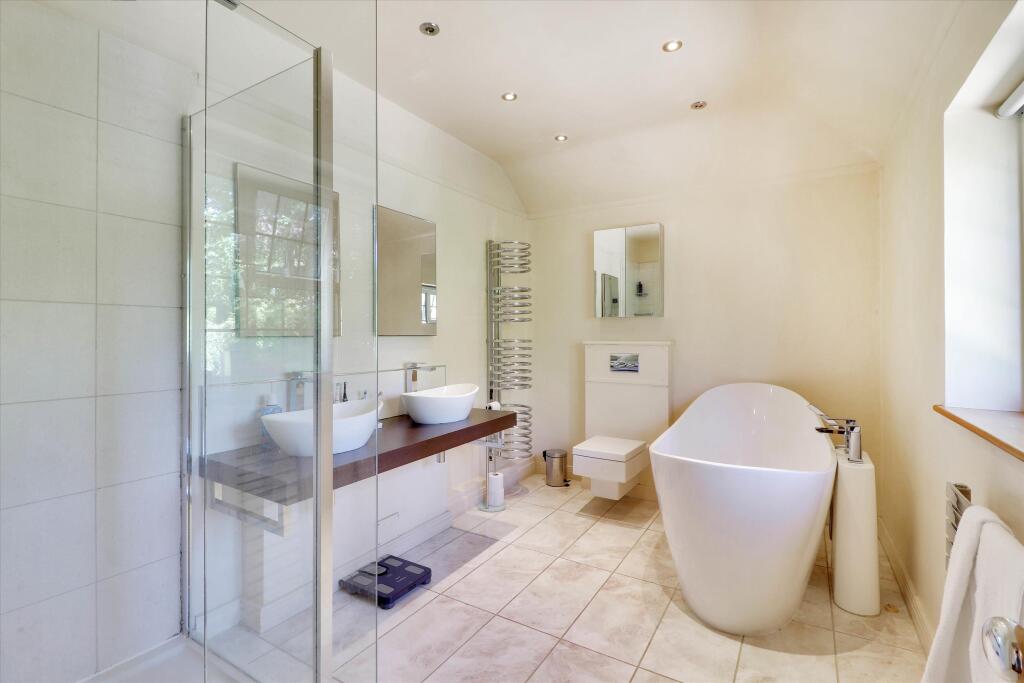
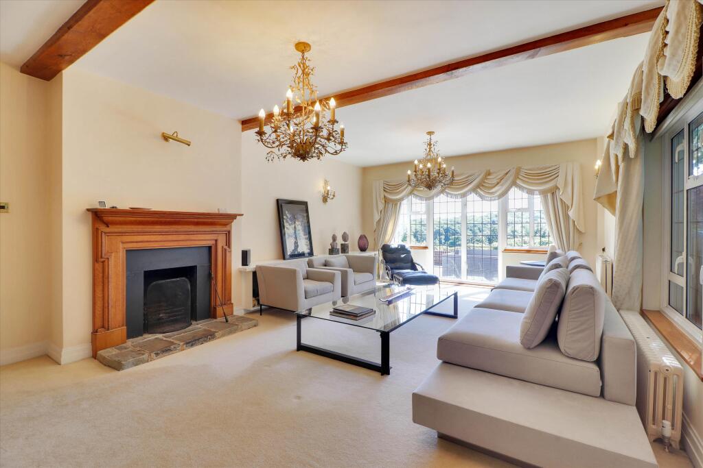
Images


Nearby Streets
| Name | Average Price | Average Sqft | Distance |
|---|---|---|---|
| French Street | £ 0 | 0 | 0.00 KM |
Nearby Transport
| Name | NLC | TLC | Distance |
|---|---|---|---|
| Edenbridge(Kent) | 5473 | EBR | 7.71 KM |
| Edenbridge Town | 5359 | EBT | 8.08 KM |
| Dunton Green | 5102 | DNG | 8.32 KM |
| Sevenoaks | 5124 | SEV | 8.76 KM |
| Hever | 5417 | HEV | 9.12 KM |
Nearby Listings
| Address | Price | Type | Score | Distance |
|---|---|---|---|---|
| Chart Lane, Brasted Chart, Westerham, Kent, TN16 | £ 2,500,000 | BUY | 8 / 10 | 0.00 KM |
| Chart Lane, Brasted Chart, Westerham, Kent | £ 1,595,000 | BUY | 7 / 10 | 0.06 KM |
| Brasted Chart, Westerham, Kent | £ 1,000,000 | BUY | 7 / 10 | 0.29 KM |
| Brasted Chart, Westerham | £ 900,000 | BUY | 7 / 10 | 0.29 KM |
| Brasted Chart, Westerham, Kent, TN16 | £ 2,050,000 | BUY | 8 / 10 | 0.29 KM |
Nearby Properties
| Address | Price | Distance |
|---|---|---|
| Pound Hill | £ 1,250,000 | 0.27 KM |
| Coldwaters | £ 1,150,000 | 0.27 KM |
| The Orchard House | £ 940,000 | 0.27 KM |
| 2 Vine Place | £ 420,000 | 0.29 KM |
| 5 Pipers Green Road | £ 330,150 | 0.68 KM |