
St. Pauls Road, Burntwood, WS7 0DF
By Paul Carr
£ 310,000
Reviews
2 out of 5 stars
Paul Carr says ..
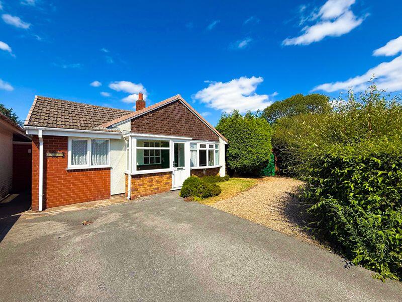
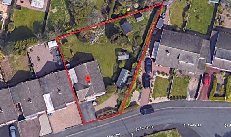
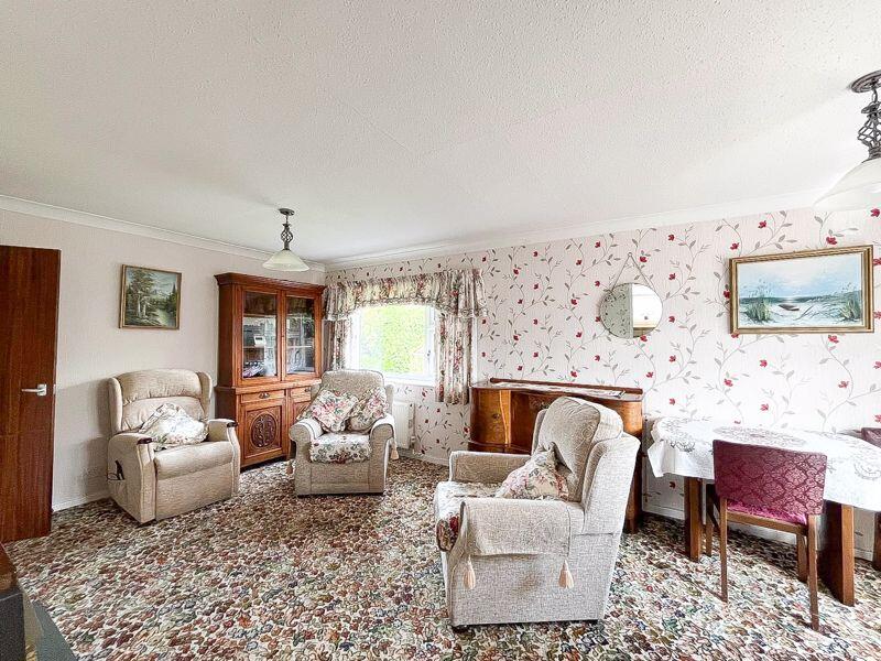
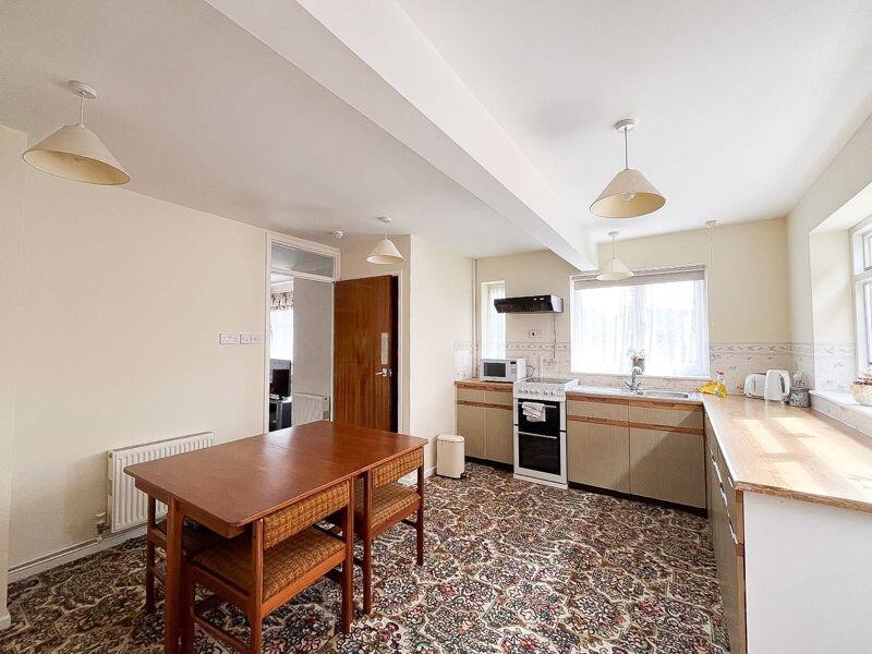
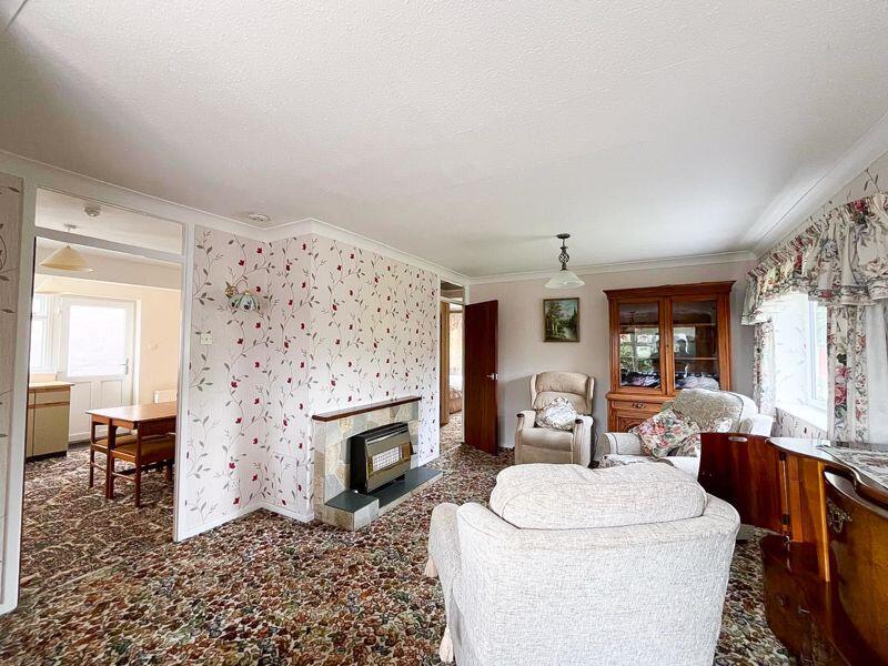
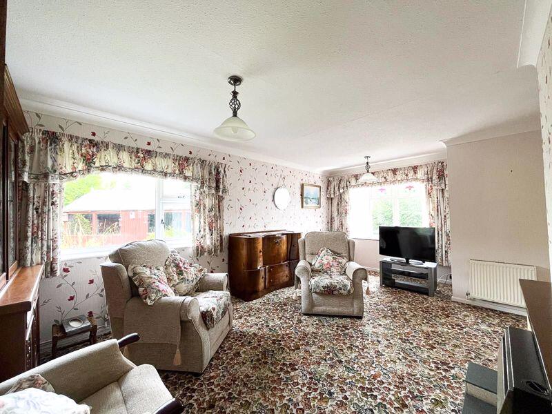
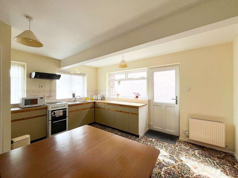
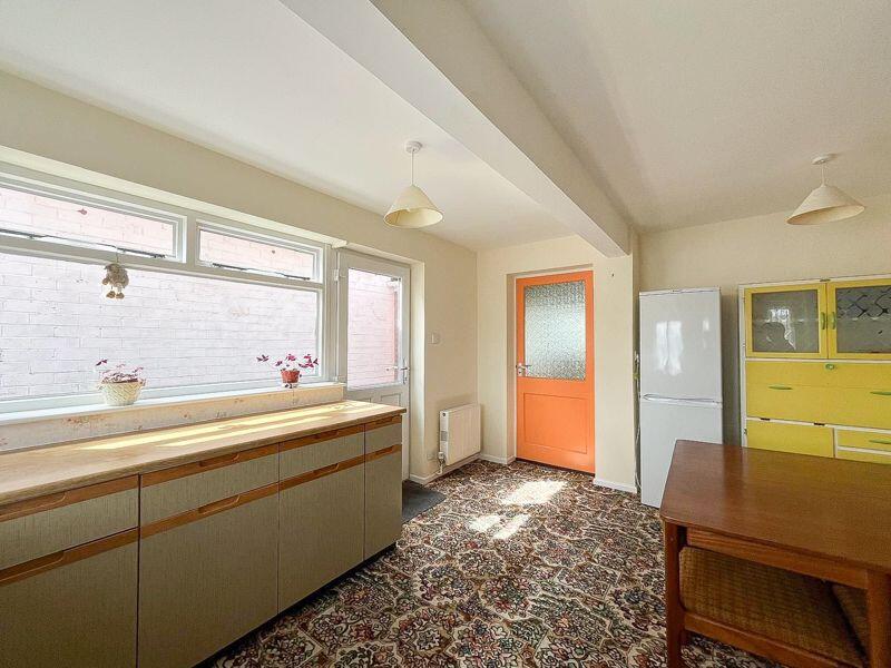
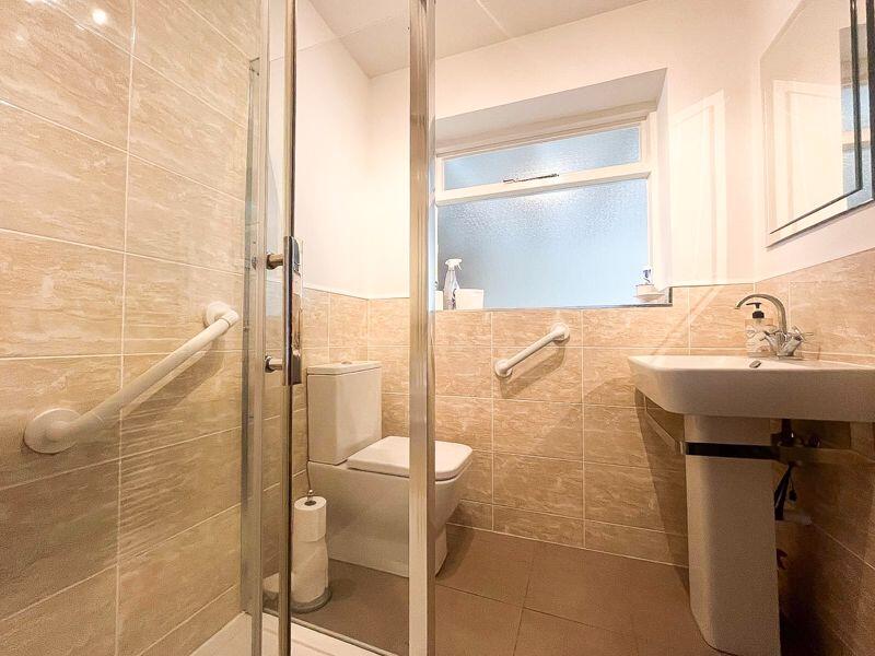
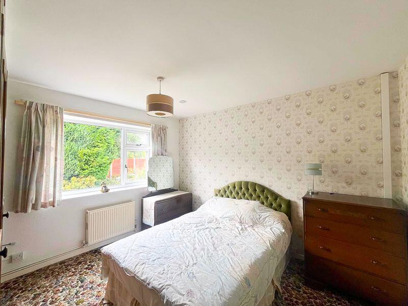
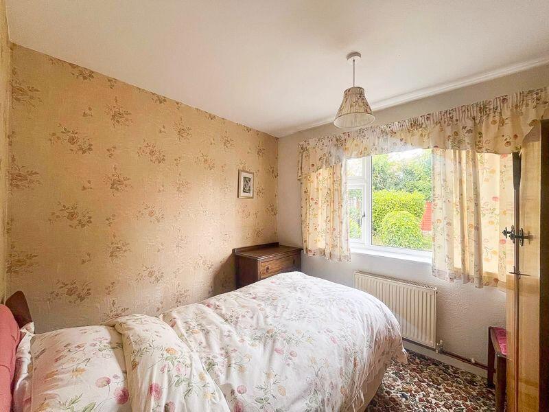
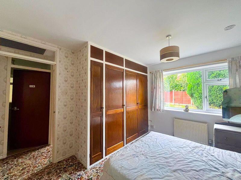
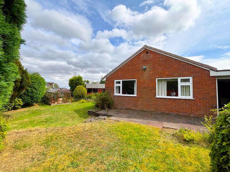
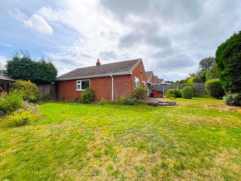
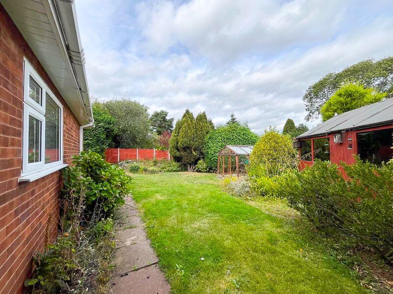
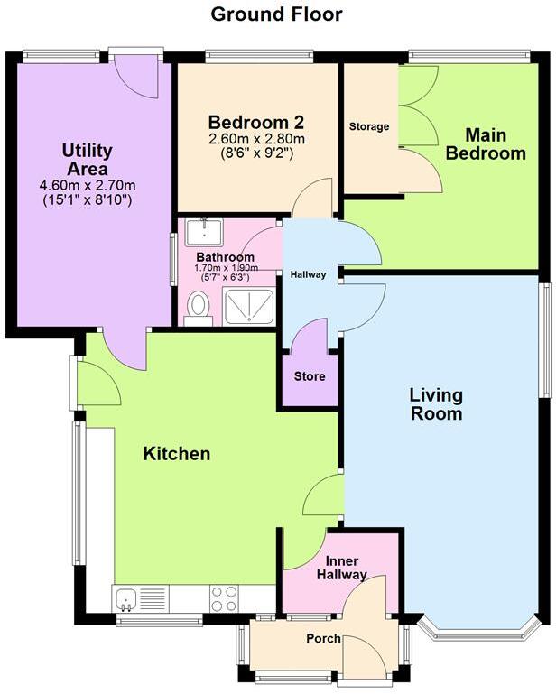
*NO CHAIN* Welcome to St. Pauls Road, a spacious two bedroom bungalow occupying an enviable plot size with unrivalled scope and potential. Internally this well loved home features a versatile layout with a spacious reception room, kitchen diner, utility room, two generous bedrooms and a well equi...
Property Oracle says ..
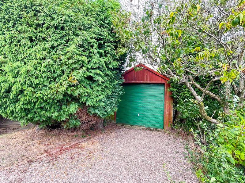
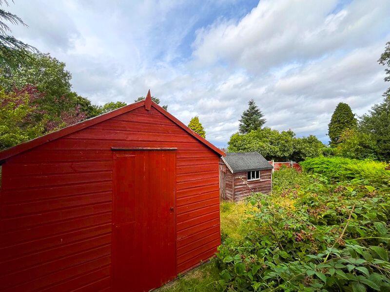
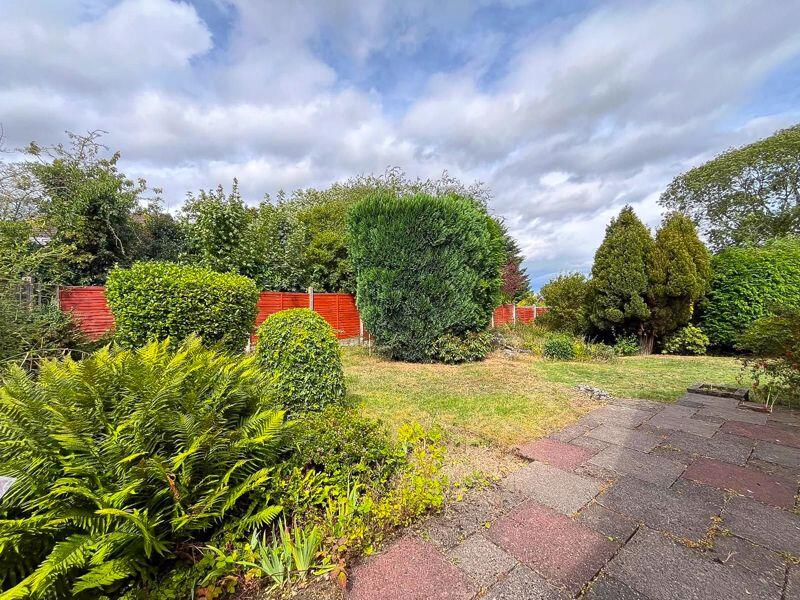
This is a detached bungalow located on St. Pauls Road, Burntwood. It features 2 bedrooms and 1 bathroom within 246.82 sqft of living space. From the images, the property appears to be in need of renovation. The interior design, including the carpets and wallpaper, looks dated. The property includes a garden with sheds and a greenhouse, offering a good amount of outdoor space. The list price is £310,000. The average price per sqft in the area is £123.00. The property size is 246.82 sqft, working out at £1,256 per sqft. The average property price in the area is £65,000. However, nearby streets such as St Peter’s Road have an average price of £360,000.
Therefore, we give this property 5 / 10. *Disclaimer: This is our option and does constitute a recommendation or financial advice. Do your own research. *
- Price
- 3
- Condition
- 4
- Location
- 7
- Land
- 7
- Bedrooms
- 2
- Bathrooms
- 1
- Sqft (est)
- 246.82
The heatmap indicates the level of crime in the area. The color of the heatmap indicates the crime severity and recency.
Metrics Year-on-Year
- Average area value
- 65,000.00 £Decreased by 67.00 %
- Est sale value
- 30,358.86 £Decreased by 39.11 %
- Average area rental value
- 725.00 £/moIncreased by 21.44 %
- Est letting value
- 246.82 £/mo
- Est rental Yield
- 13.38 %Increased by 267.58 %
- Crime Rate
- 5.00 %Unchanged by 0.00 %
Agent Activity
Paul Carr created the listing.
Nearby Schools
| Name | Type | Ofsted | Distance |
|---|---|---|---|
| Highfields Primary Academy | Academy Converter | 0.49 KM | |
| Fulfen Primary School | Community School | Good | 0.95 KM |
| Springhill Primary Academy | Academy Sponsor Led | Good | 1.00 KM |
| Ridgeway Primary School | Foundation School | Good | 1.58 KM |
| Boney Hay Primary Academy | Academy Converter | Good | 2.42 KM |
Images

Nearby Streets
| Name | Average Price | Average Sqft | Distance |
|---|---|---|---|
| St Peter's Road | £ 360,000 | 0 | 0.00 KM |
| Rose Lane | £ 297,500 | 0 | 0.00 KM |
| Bracken Close | £ 290,000 | 0 | 0.00 KM |
| Anson Close | £ 0 | 0 | 0.00 KM |
| Vaughan Way | £ 205,000 | 0 | 0.00 KM |
Nearby Transport
| Name | NLC | TLC | Distance |
|---|---|---|---|
| Shenstone | 1178 | SEN | 8.51 KM |
| Rugeley Town | 1135 | RGT | 9.04 KM |
| Lichfield City | 1177 | LIC | 9.48 KM |
Nearby Listings
| Address | Price | Type | Score | Distance |
|---|---|---|---|---|
| St. Pauls Road, Burntwood, WS7 0DF | £ 180,000 | BUY | Unknown | 0.00 KM |
| St. Pauls Road, Burntwood, WS7 0DF | £ 310,000 | BUY | 5 / 10 | 0.00 KM |
| Swanfields, Burntwood, WS7 0BH | £ 475,000 | BUY | 7 / 10 | 0.05 KM |
| St. Lukes Road, Burntwood, WS7 0DH | £ 255,000 | BUY | Unknown | 0.10 KM |
| Tudor Road, Burntwood | £ 325,000 | BUY | 7 / 10 | 0.10 KM |
Nearby Properties
| Address | Price | Distance |
|---|---|---|
| 2 St Pauls Road | £ 156,000 | 0.01 KM |
| 16 St Pauls Road | £ 227,000 | 0.01 KM |
| 1 St Pauls Road | £ 161,000 | 0.01 KM |
| 14 St Pauls Road | £ 235,000 | 0.01 KM |
| 16 St Lukes Road | £ 127,500 | 0.10 KM |