FO
Burnham
By Focus
£ 925
Focus says ..
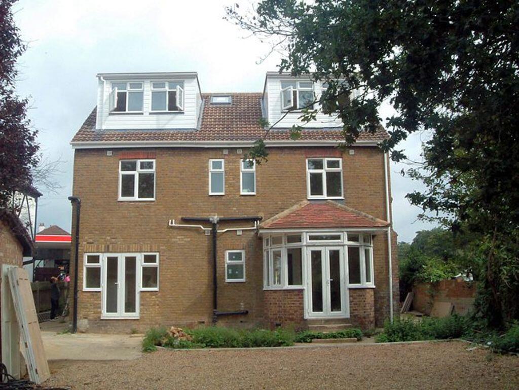
A one bedroom first floor apartment presented in good order with gas central heating and resident parking to rear. The property is within walking distance of Burnham High Street, local amenities and parks. Total floor area approximately 34 square metres EPC rating C Council tax band B Holding de...
- Bedrooms
- 1
- Bathrooms
- 1
The heatmap indicates the level of crime in the area. The color of the heatmap indicates the crime severity and recency.
Metrics Year-on-Year
- Average area value
- 817,143.00 £Increased by 53.84 %
- Average area rental value
- 1,640.00 £/moDecreased by 18.93 %
- Est rental Yield
- 2.41 %Decreased by 47.26 %
- Crime Rate
- 7.00 %Unchanged by 0.00 %
from 531,149.00 £
from 2,023.00 £/mo
from 4.57 %
from 7.00 %
Agent Activity
Focus created the listing.
Nearby Schools
| Name | Type | Ofsted | Distance |
|---|---|---|---|
| Lent Rise School | Academy Converter | Good | 0.54 KM |
| Our Lady Of Peace Catholic Primary And Nursery School | Voluntary Aided School | Good | 0.72 KM |
| Burnham Family Centre | Children's Centre | 0.80 KM | |
| St Peter'S Church Of England Primary School | Voluntary Aided School | Good | 0.80 KM |
| Priory School | Foundation School | Good | 0.90 KM |
Images
Nearby Streets
| Name | Average Price | Average Sqft | Distance |
|---|---|---|---|
| High Street | £ 0 | 0 | 0.00 KM |
| Hamilton Gardens | £ 883,750 | 0 | 0.00 KM |
| Bosworth court | £ 0 | 0 | 0.00 KM |
| Wyeth Close | £ 600,000 | 0 | 0.00 KM |
| Lammas Road | £ 0 | 0 | 0.00 KM |
Nearby Transport
| Name | NLC | TLC | Distance |
|---|---|---|---|
| Burnham | 3176 | BNM | 1.68 KM |
| Taplow | 3151 | TAP | 2.28 KM |
| Maidenhead | 3147 | MAI | 6.88 KM |
| Windsor And Eton Central | 3175 | WNC | 7.44 KM |
| Furze Platt | 3144 | FZP | 7.48 KM |
Nearby Listings
| Address | Price | Type | Score | Distance |
|---|---|---|---|---|
| Burnham | £ 925 | RENT | Unknown | 0.00 KM |
| Burnham Court, Stomp Road, Burnham, SL1 | £ 1,350 | RENT | Unknown | 0.06 KM |
| Burnham | £ 850 | RENT | Unknown | 0.08 KM |
| Opendale Road, SLOUGH | £ 2,000 | RENT | Unknown | 0.15 KM |
| Opendale Road, Buenham, Buckinghamshire, SL1 7LY | £ 2,000 | RENT | Unknown | 0.17 KM |
Nearby Properties
| Address | Price | Distance |
|---|---|---|
| 78 Stomp Road | £ 482,500 | 0.00 KM |
| 92 Stomp Road | £ 465,000 | 0.00 KM |
| 90 Stomp Road | £ 370,000 | 0.00 KM |
| 72 Stomp Road | £ 472,000 | 0.00 KM |
| 94 Stomp Road | £ 365,000 | 0.00 KM |