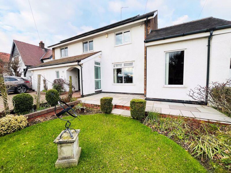
62 Moorland Road, Poulton-Le-Fylde, FY6 7EU
By Butson Blofeld
£ 470,000
Reviews
3 out of 5 stars
Butson Blofeld says ..
A DETACHED FAMILY HOME WITH SPACIOUS AND VERSATILE ACCOMMODATION SITUATED IN A SOUGHT AFTER RESIDENTIAL LOCATION CLOSE TO LOCAL AMENITIES AND WITHIN A SHORT DISTANCE OF POULTON CENTRE, THIS DETACHED PROPERTY OFFERS A FANTASTIC OPPORTUNITY FOR A YOUNG FAMILY. MID CENTURY AND INDIVIDUALLY DEI...
Property Oracle says ..
The property is located on Moorland Road in Poulton-le-Fylde, Lancashire. It’s a detached house with four bedrooms and two bathrooms, and a total area of 1,615.06 sqft. The plot size is 1,252 sqft. The list price is £470,000.
The average house price in the area is £215,183, with an average price per sqft of £270. This property is significantly larger than average at 1615 sqft. The property is within close proximity to Hodgson Academy (0.11 KM), Brookfield School (0.59 KM), St John’s Catholic Primary School (0.62 KM), and Poulton-le-Fylde The Breck Primary School (0.66 KM). Train stations are also within reasonable distance.
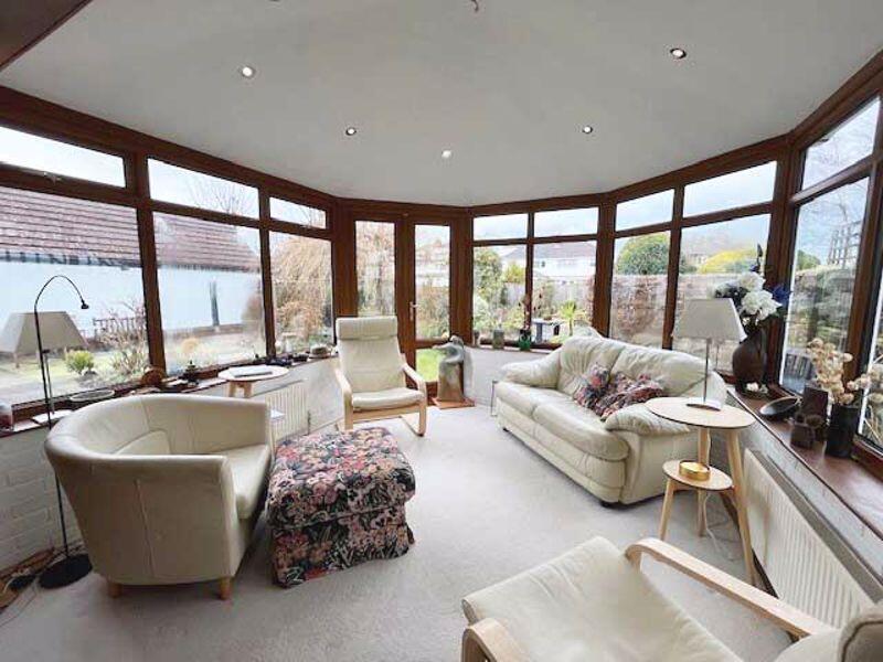
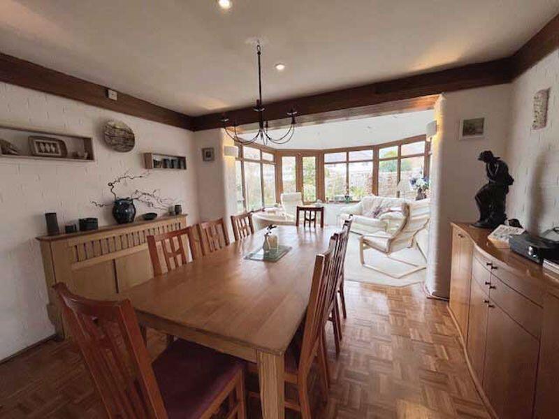
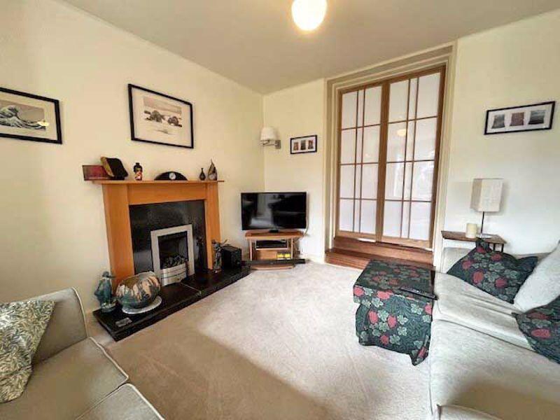
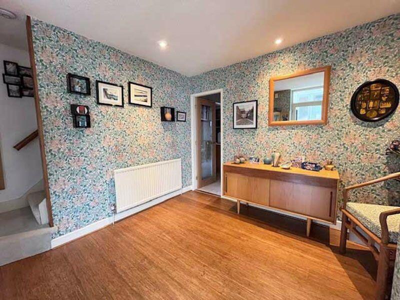
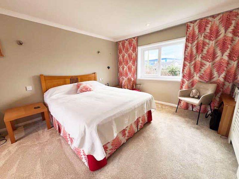
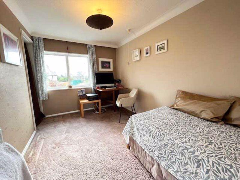
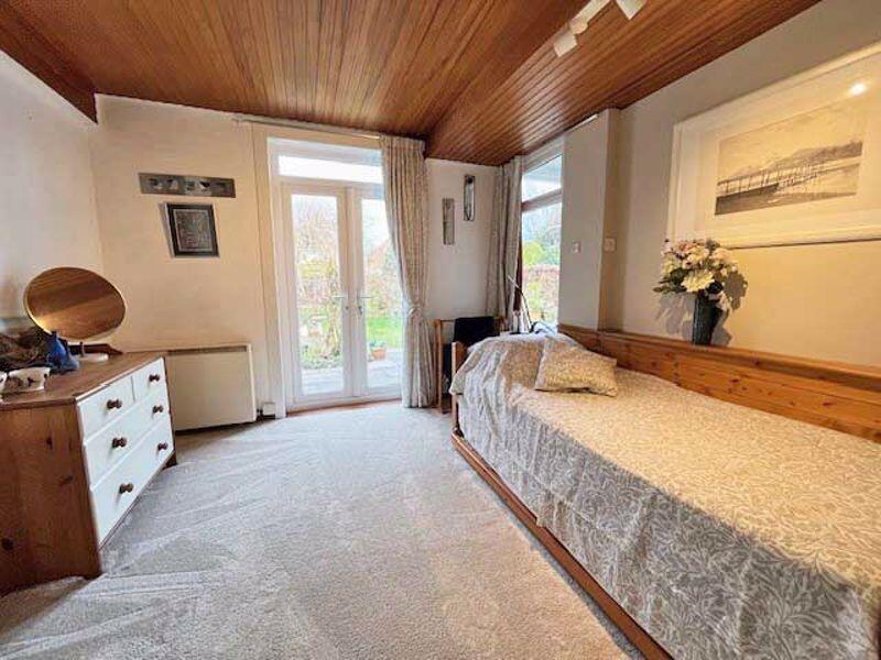
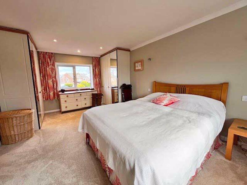
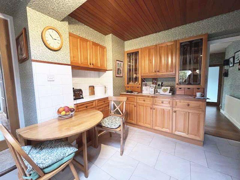
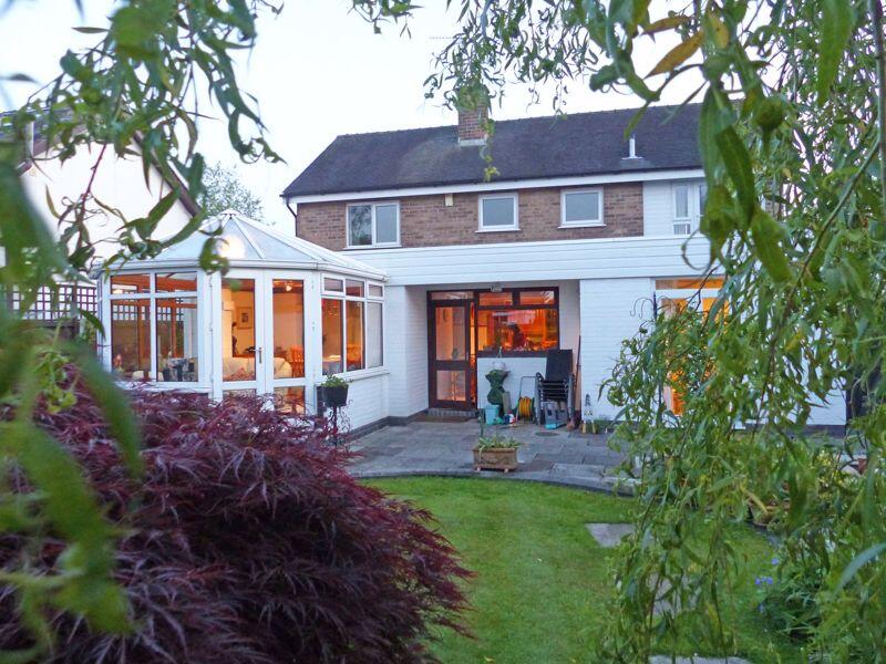
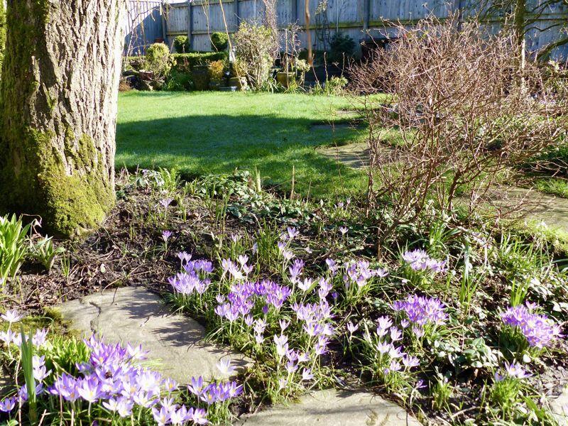
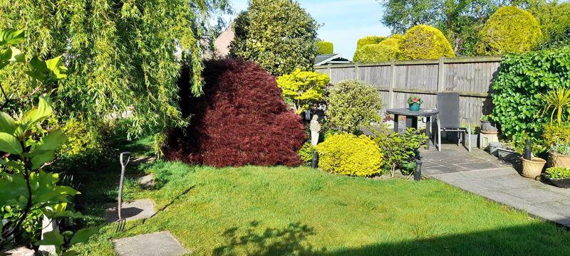
Based on the images provided, the property appears to be in good condition. There is evidence of some modernisation, such as the conservatory and kitchen, but it retains some traditional features. The garden is well-maintained and of a reasonable size for the property.
Given the size, location, condition, and the presence of a garden, the list price of £470,000 seems slightly high compared to the average price per sqft in the area. However, the larger than average size and desirable location could justify the higher price. Further investigation into comparable properties in the immediate vicinity would be required to determine a more precise valuation.
Therefore, we give this property 7 / 10. *Disclaimer: This is our option and does constitute a recommendation or financial advice. Do your own research. *
- Price
- 7
- Condition
- 8
- Location
- 9
- Land
- 7
- Bedrooms
- 4
- Bathrooms
- 2
- Sqft (est)
- 1,615.06
- Lot (est)
- 1,252.00
The heatmap indicates the level of crime in the area. The color of the heatmap indicates the crime severity and recency.
Metrics Year-on-Year
- Average area value
- 317,727.00 £Increased by 27.62 %
- Est sale value
- 426,375.84 £Increased by 26.32 %
- Average area rental value
- 941.00 £/moDecreased by 13.83 %
- Est letting value
- 0.00 £/mo
- Est rental Yield
- 3.55 %Decreased by 32.51 %
- Crime Rate
- 12.00 %Unchanged by 0.00 %
Agent Activity
Butson Blofeld created the listing.
Nearby Schools
| Name | Type | Ofsted | Distance |
|---|---|---|---|
| Hodgson Academy | Academy Converter | 0.11 KM | |
| Brookfield School | Community Special School | Good | 0.59 KM |
| St John'S Catholic Primary School, Poulton-Le-Fylde | Voluntary Aided School | Outstanding | 0.62 KM |
| Poulton-Le-Fylde The Breck Primary School | Community School | Outstanding | 0.66 KM |
| Mckee College House | Pupil Referral Unit | Good | 0.90 KM |
Images


Nearby Streets
| Name | Average Price | Average Sqft | Distance |
|---|---|---|---|
| Manor Drive | £ 95,000 | 0 | 0.00 KM |
| Manor Mews | £ 0 | 0 | 0.00 KM |
| Greenbank | £ 0 | 0 | 0.00 KM |
| The Laurels | £ 0 | 0 | 0.00 KM |
| First Avenue | £ 0 | 0 | 0.00 KM |
Nearby Transport
| Name | NLC | TLC | Distance |
|---|---|---|---|
| Poulton-Le-Fylde | 2671 | PFY | 0.96 KM |
| Layton (Lancs) | 2669 | LAY | 5.51 KM |
| Blackpool North | 2739 | BPN | 8.01 KM |
| Blackpool South | 2740 | BPS | 9.24 KM |
Nearby Listings
| Address | Price | Type | Score | Distance |
|---|---|---|---|---|
| 62 Moorland Road, Poulton-Le-Fylde, FY6 7EU | £ 470,000 | BUY | 7 / 10 | 0.00 KM |
| Taywood Close, Poulton-Le-Fylde, FY6 | £ 250,000 | BUY | 7 / 10 | 0.13 KM |
| No. 19, Moorway, Poulton-le-Fylde, Lancs FY6 7EX | £ 225,000 | BUY | 6 / 10 | 0.16 KM |
| 6 Moorway, Poulton-Le-Fylde, FY6 7EX | £ 315,000 | BUY | Unknown | 0.16 KM |
| 51 Moorway, Poulton-Le-Fylde, FY6 7EX | £ 174,950 | BUY | 6 / 10 | 0.16 KM |
Nearby Properties
| Address | Price | Distance |
|---|---|---|
| 3 Taywood Close | £ 150,000 | 0.13 KM |
| 13 Taywood Close | £ 142,000 | 0.13 KM |
| 11 Taywood Close | £ 155,000 | 0.13 KM |
| 4 Taywood Close | £ 92,950 | 0.13 KM |
| 10 Taywood Close | £ 202,000 | 0.13 KM |