HO
High Street, Lowestoft
By Howards Lettings
£ 650
Howards Lettings says ..
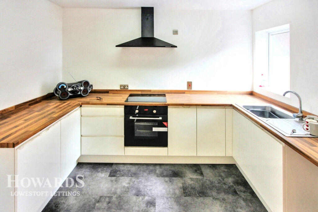
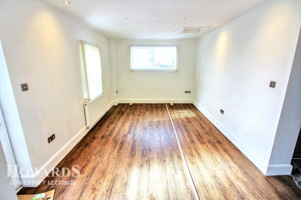
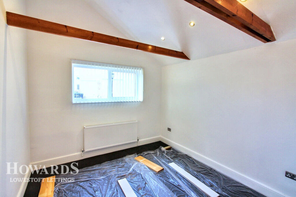
Beautifully presented and modern Ground floor apartment offered in good order throughout & benefitting from energy efficient electric heating, Interest is expected to be high so get in touch today for your video tour or to discuss an application!
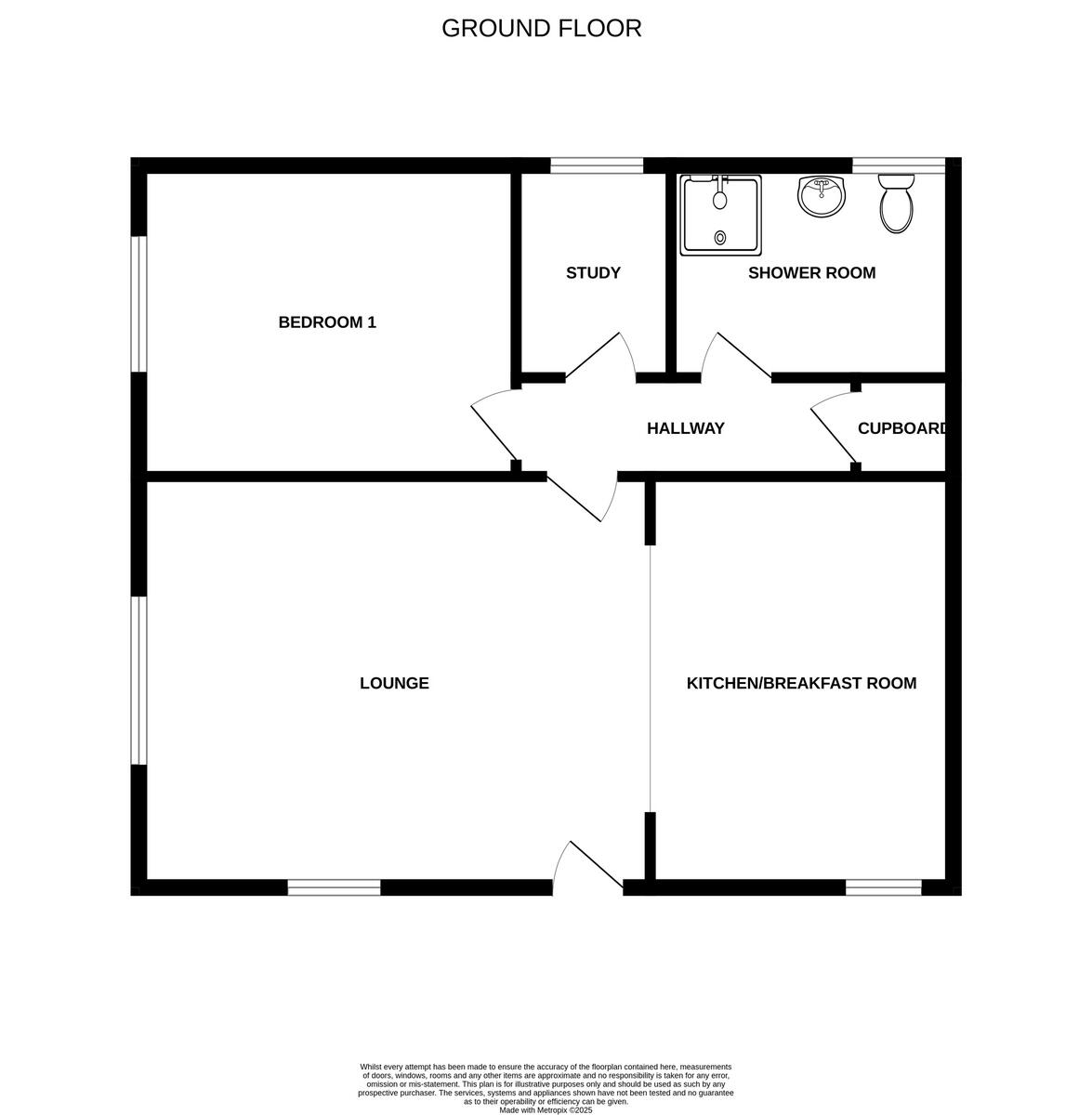
- Bedrooms
- 1
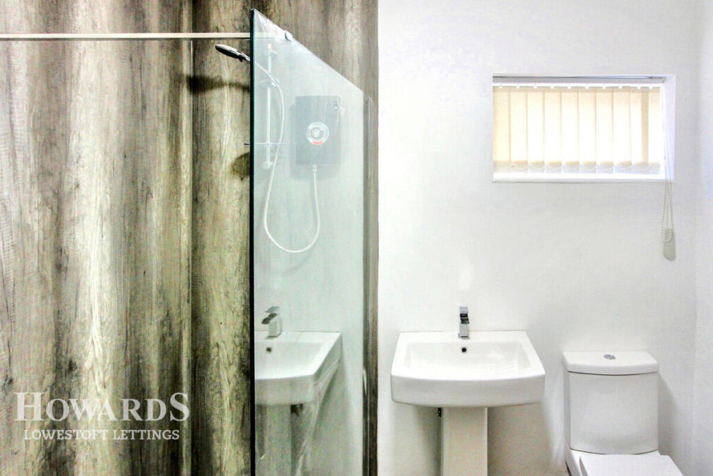
- Bathrooms
- 1
The heatmap indicates the level of crime in the area. The color of the heatmap indicates the crime severity and recency.
Metrics Year-on-Year
- Average area value
- 160,000.00 £Decreased by 7.61 %
- Average area rental value
- 777.00 £/moDecreased by 4.31 %
- Est rental Yield
- 5.83 %Increased by 3.55 %
- Crime Rate
- 29.00 %Unchanged by 0.00 %
from 173,185.00 £
from 812.00 £/mo
from 5.63 %
from 29.00 %
Agent Activity
Howards Lettings created the listing.
Nearby Schools
| Name | Type | Ofsted | Distance |
|---|---|---|---|
| Learning Support, Northern Area Education Office | Miscellaneous | 0.58 KM | |
| Ness Point School | Other Independent Special School | 0.94 KM | |
| St Margaret'S Primary Academy | Academy Sponsor Led | Requires improvement | 0.94 KM |
| Ormiston Denes Academy | Academy Sponsor Led | Serious Weaknesses | 1.03 KM |
| Ark Children'S Centre | Children's Centre | 1.13 KM |
Images

Nearby Streets
| Name | Average Price | Average Sqft | Distance |
|---|---|---|---|
| Albany Road | £ 93,333 | 0 | 0.00 KM |
| Godfrey's Court | £ 0 | 0 | 0.00 KM |
| Dawn Pointon Place | £ 475,000 | 0 | 0.00 KM |
| Swimming Pool Road | £ 0 | 0 | 0.00 KM |
| Herring Fishery Score | £ 0 | 0 | 0.00 KM |
Nearby Transport
| Name | NLC | TLC | Distance |
|---|---|---|---|
| Lowestoft | 7268 | LWT | 1.31 KM |
| Oulton Broad North | 7273 | OUN | 4.53 KM |
| Oulton Broad South | 7274 | OUS | 5.61 KM |
Nearby Listings
| Address | Price | Type | Score | Distance |
|---|---|---|---|---|
| Flat 2, 169 High Street, Lowestoft. | £ 525 | RENT | Unknown | 0.03 KM |
| High Street, LOWESTOFT | £ 575 | RENT | Unknown | 0.03 KM |
| High Street, Lowestoft | £ 1,200 | RENT | Unknown | 0.08 KM |
| High Street, Lowestoft, NR32 | £ 1,200 | RENT | Unknown | 0.08 KM |
| High Street, Arnold House, NR32 | £ 700 | RENT | Unknown | 0.12 KM |
Nearby Properties
| Address | Price | Distance |
|---|---|---|
| 38c D | £ 102,100 | 0.09 KM |
| 28 High Street | £ 338,346 | 0.09 KM |
| 32 High Street | £ 147,000 | 0.09 KM |
| 35 High Street | £ 289,000 | 0.09 KM |
| 36 High Street | £ 200,000 | 0.09 KM |