RO
High Street, Dorking, Surrey, RH4
By Robinsons
£ 900
Robinsons says ..
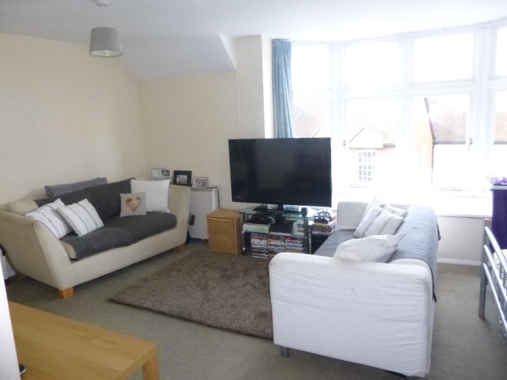
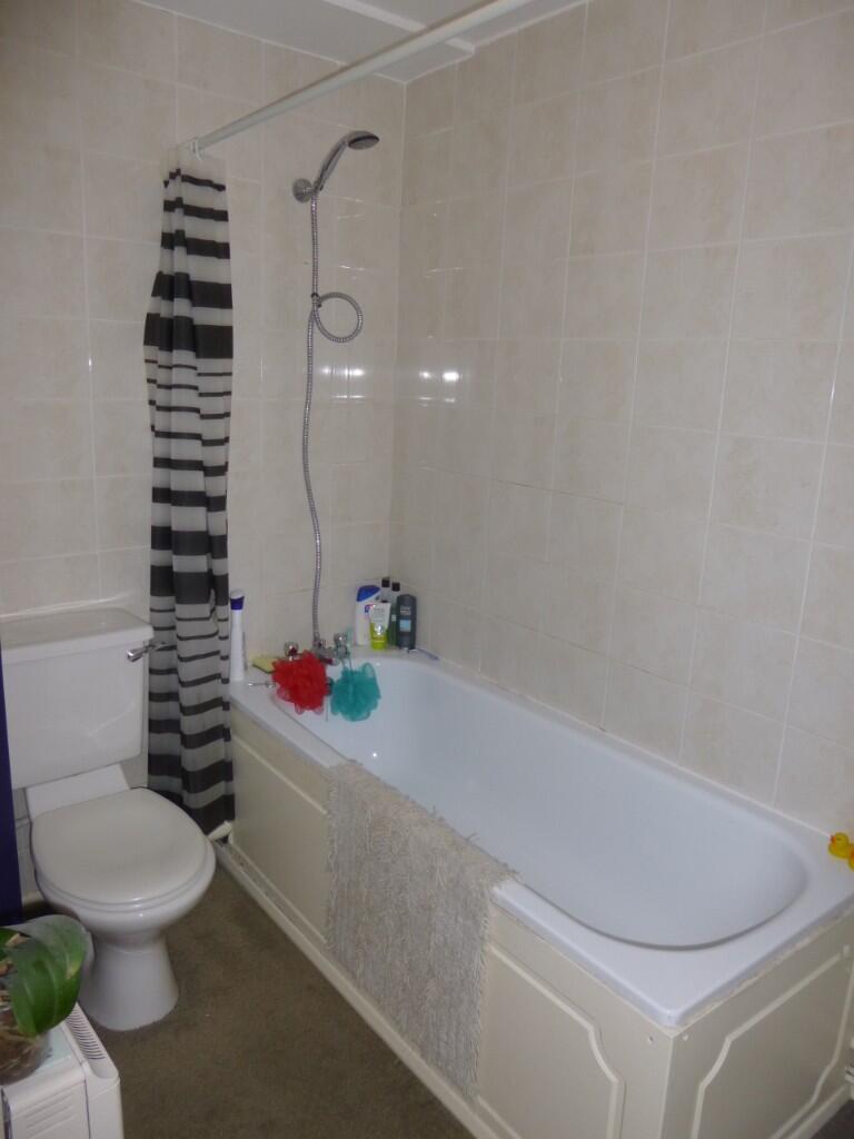
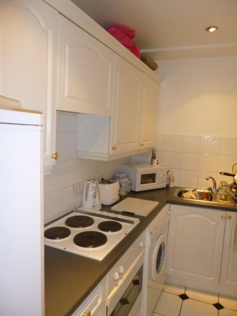
Light and bright second floor Studio Apartment in the heart of Dorking.
- Bedrooms
- 0
- Bathrooms
- 0
The heatmap indicates the level of crime in the area. The color of the heatmap indicates the crime severity and recency.
Metrics Year-on-Year
- Average area value
- 304,767.00 £Decreased by 41.06 %
- Average area rental value
- 1,483.00 £/moIncreased by 8.33 %
- Est rental Yield
- 5.84 %Increased by 83.65 %
- Crime Rate
- 26.00 %Unchanged by 0.00 %
from 517,113.00 £
from 1,369.00 £/mo
from 3.18 %
from 26.00 %
Agent Activity
Robinsons created the listing.
Nearby Schools
| Name | Type | Ofsted | Distance |
|---|---|---|---|
| St Paul'S Cofe (Aided) Primary School | Voluntary Aided School | Outstanding | 0.54 KM |
| The Ashcombe School | Academy Converter | Good | 0.64 KM |
| Dorking Nursery School | Local Authority Nursery School | Outstanding | 0.84 KM |
| Dorking Nursery School Sure Start Children'S Centre | Children's Centre | 0.85 KM | |
| St Joseph'S Catholic Primary School | Voluntary Aided School | Good | 0.96 KM |
Images


Nearby Streets
| Name | Average Price | Average Sqft | Distance |
|---|---|---|---|
| Stanleys Cottages | £ 0 | 0 | 0.00 KM |
| St Martin's Walk | £ 0 | 0 | 0.00 KM |
| Mill Lane | £ 260,363 | 0 | 0.00 KM |
| FP 75 | £ 0 | 0 | 0.00 KM |
| Cape Place | £ 0 | 0 | 0.00 KM |
Nearby Transport
| Name | NLC | TLC | Distance |
|---|---|---|---|
| Dorking (Deepdene) | 5412 | DPD | 0.81 KM |
| Dorking | 5357 | DKG | 1.03 KM |
| Dorking West | 5297 | DKT | 1.26 KM |
| Box Hill And Westhumble | 5403 | BXW | 2.34 KM |
| Holmwood | 5308 | HLM | 5.84 KM |
Nearby Listings
| Address | Price | Type | Score | Distance |
|---|---|---|---|---|
| High Street, Dorking, Surrey, RH4 | £ 900 | RENT | Unknown | 0.00 KM |
| High Street, Dorking, RH4 | £ 895 | RENT | Unknown | 0.01 KM |
| Cotmandene, Dorking, Surrey, RH4 | £ 1,950 | RENT | Unknown | 0.03 KM |
| Cotmandene, Dorking | £ 1,850 | RENT | Unknown | 0.04 KM |
| Dene Street, Dorking, RH4 | £ 1,425 | RENT | Unknown | 0.07 KM |
Nearby Properties
| Address | Price | Distance |
|---|---|---|
| 204 High Street | £ 96,000 | 0.01 KM |
| 44 Cotmandene | £ 485,000 | 0.04 KM |
| 40 Cotmandene | £ 265,000 | 0.04 KM |
| 43 Cotmandene | £ 350,000 | 0.04 KM |
| 215 High Street | £ 487,625 | 0.05 KM |