Harris Wickens Ltd says ..
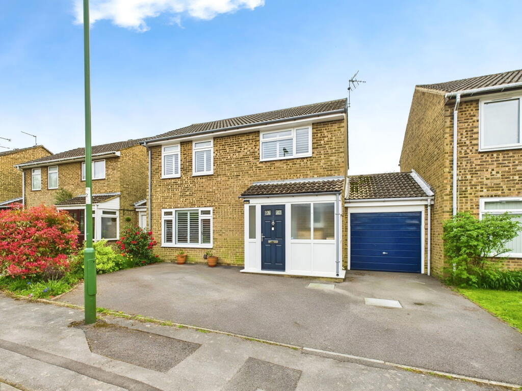
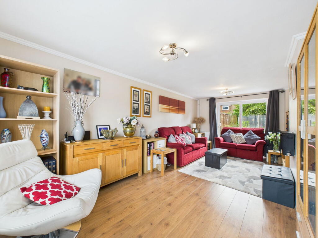
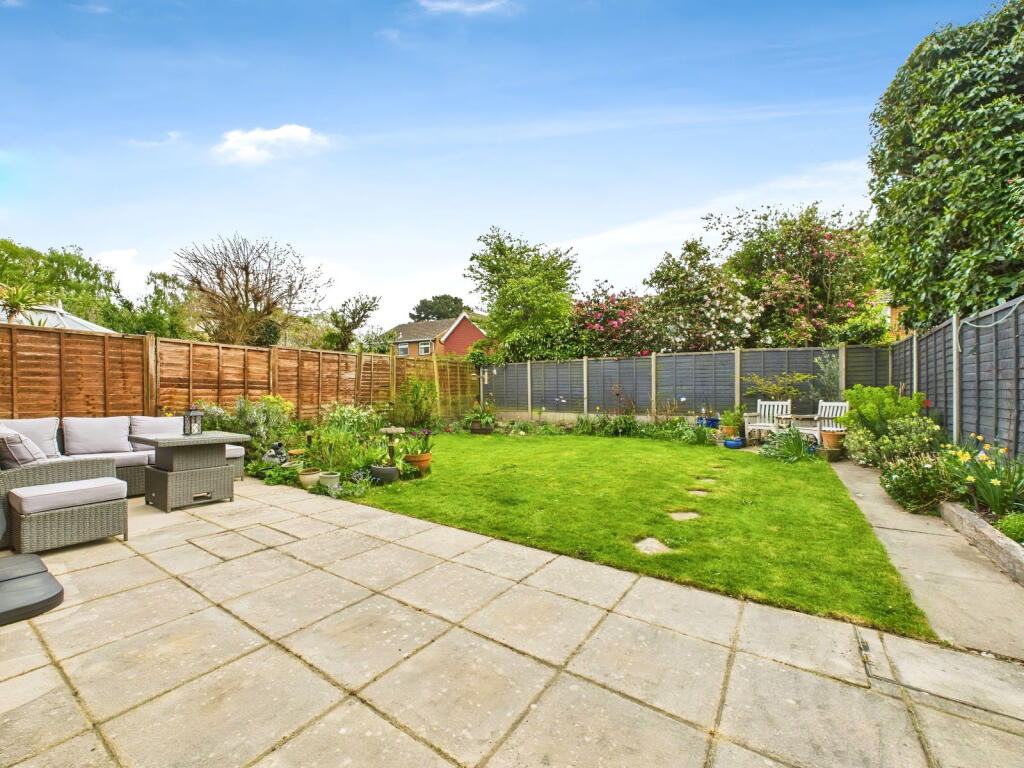
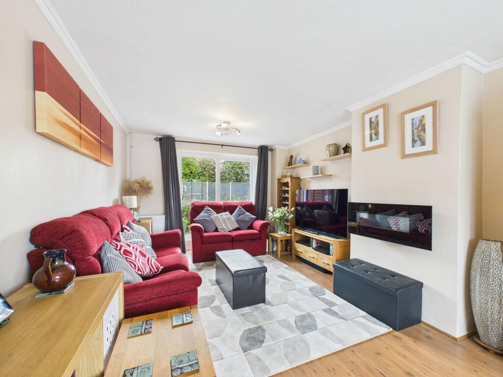
An attractive DETACHED FAMILY HOME located towards the end of a CUL DE SAC, boasting a 20ft DOUBLE ASPECT LIVING ROOM, driveway parking leading to an 18ft GARAGE and a lovely SOUTH FACING GARDEN.
Property Oracle says ..
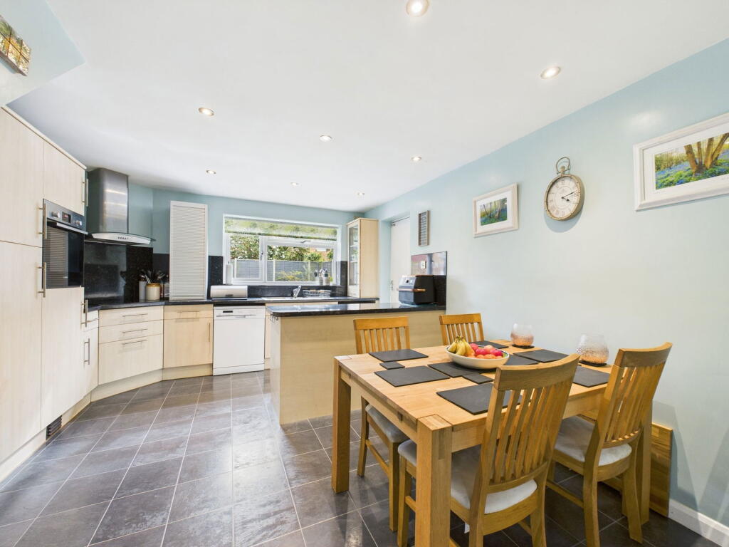
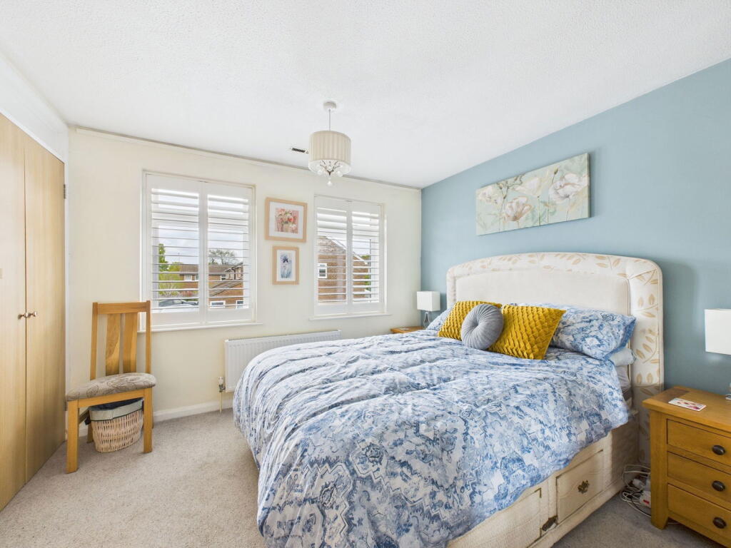
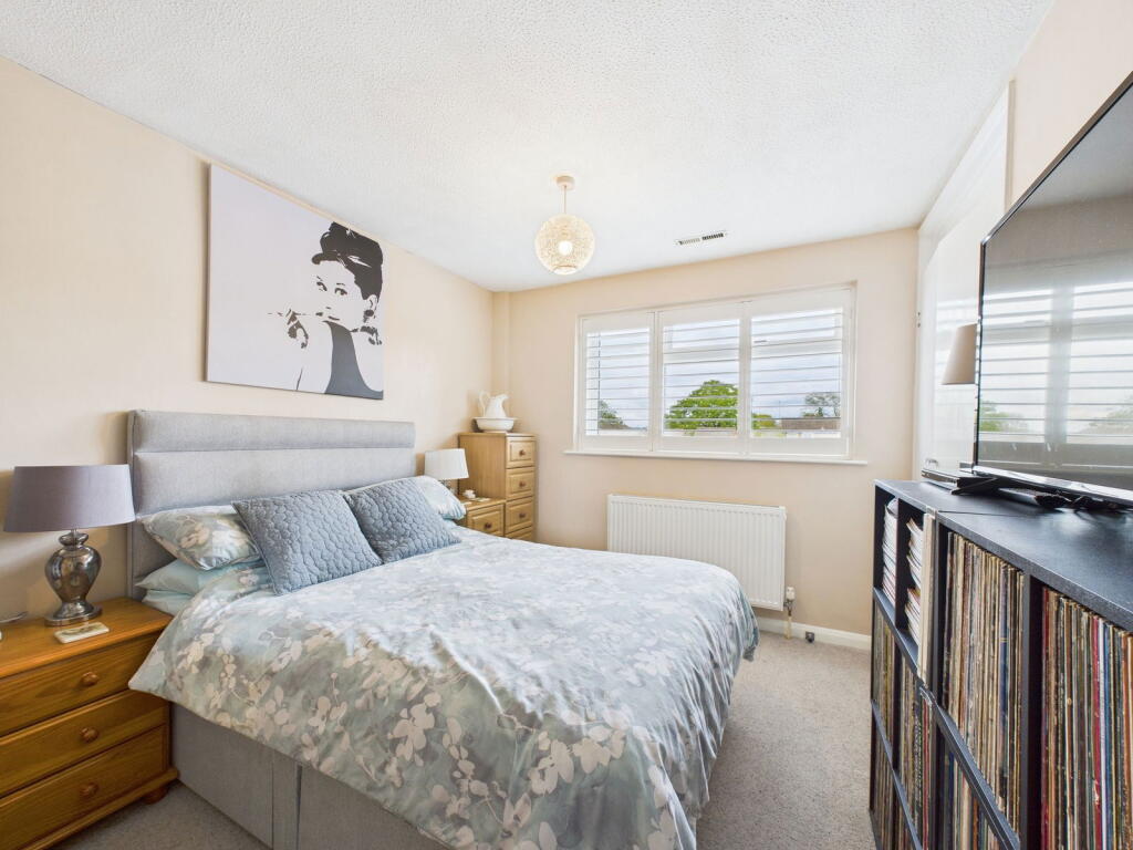
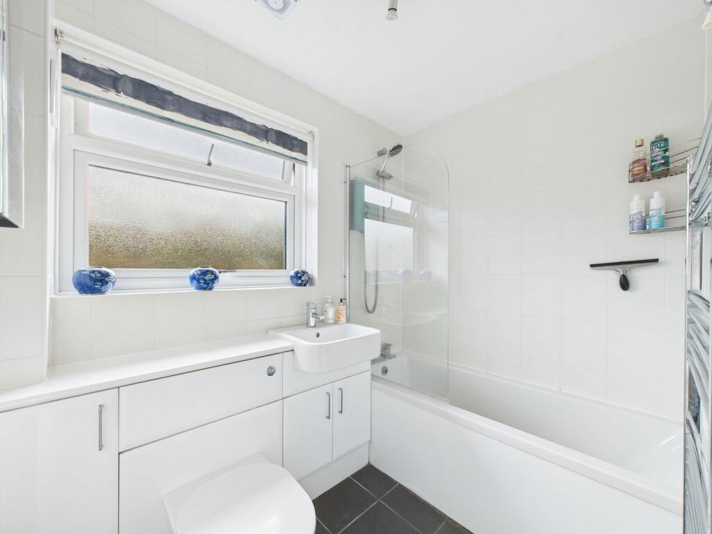
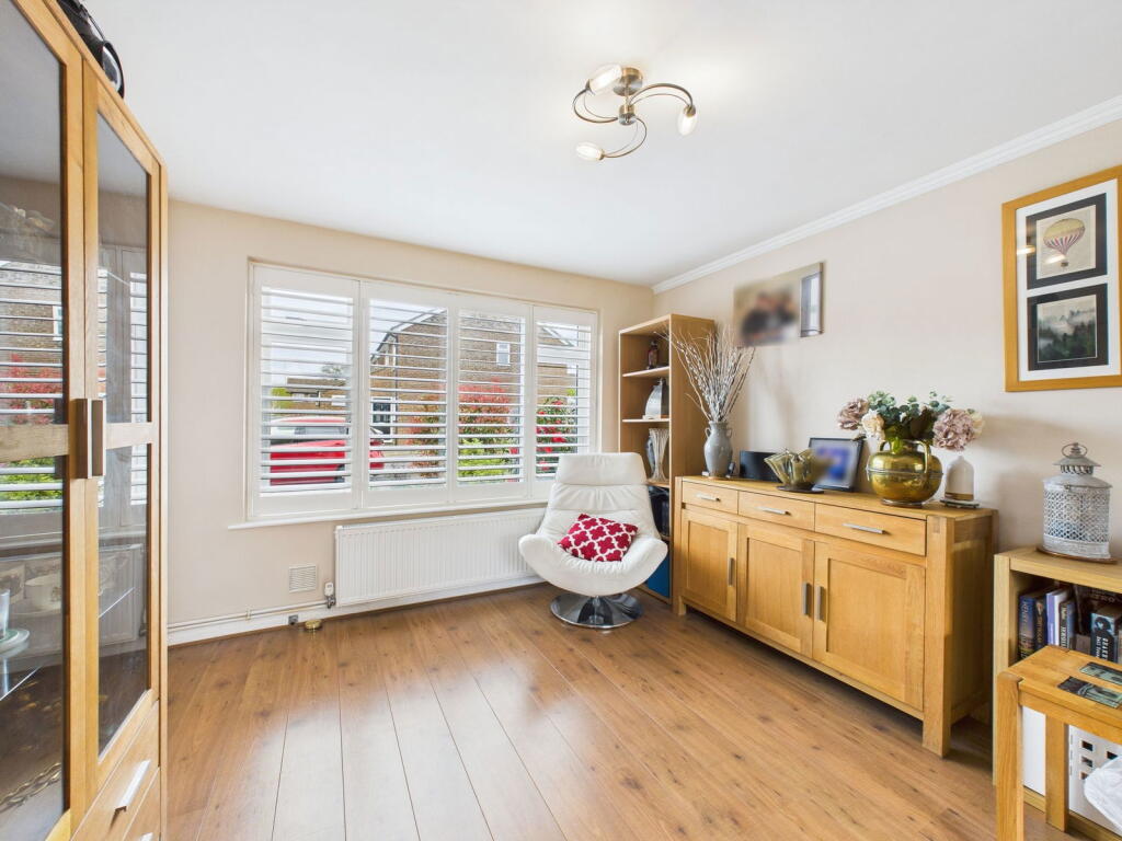
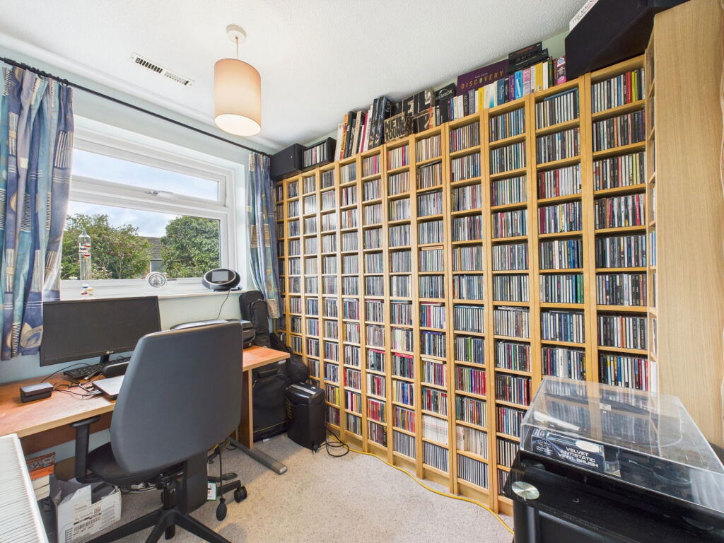
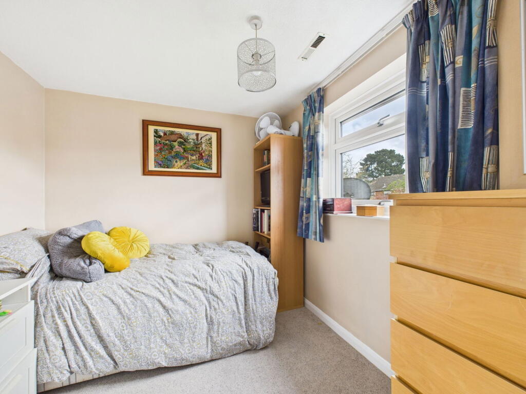
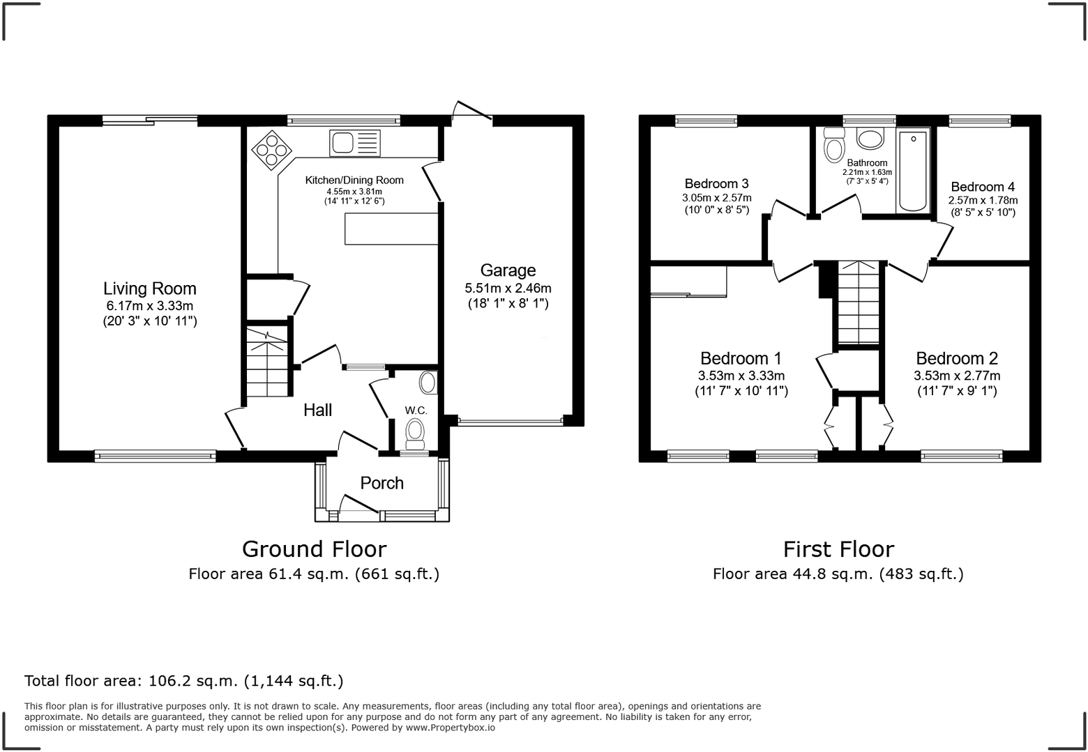
Plough Lane, Horsham is located in Holbrook East, a suburb of Horsham, West Sussex. The property is a link detached house with four bedrooms and one bathroom. It has a plot size of 1,143.13 sqft and is 956.91 sqft in size. The list price is £500,000. The average price for properties in the area is £479,894, with an average size of 1,075 sqft and an average price per sqft of £446. The property is slightly larger than average. Given its size and location, the list price of £500,000 appears reasonable, although slightly above the average price for the area. However, without more information on the specifics of comparable properties, a definitive conclusion on price value cannot be made. Based on the provided images, the property appears to be in good condition. The interior is well-maintained and modern, with updated kitchen and bathroom fixtures. The garden is also well-kept. There is no visible evidence of needing renovation. The property benefits from a good-sized garden, providing additional outdoor space. The location is convenient, with nearby schools and transportation links. North Heath Community Primary School and Kingslea Primary School are both within a kilometer of the property and have received “Good” Ofsted ratings. Littlehaven and Horsham train stations are also within a reasonable distance, providing easy access to other parts of the country.
Therefore, we give this property 8 / 10. *Disclaimer: This is our option and does constitute a recommendation or financial advice. Do your own research. *
- Price
- 7
- Condition
- 9
- Location
- 8
- Land
- 8
- Bedrooms
- 4
- Bathrooms
- 1
- Sqft (est)
- 956.91
- Lot (est)
- 1,143.13
The heatmap indicates the level of crime in the area. The color of the heatmap indicates the crime severity and recency.
Metrics Year-on-Year
- Average area value
- 475,000.00 £Decreased by 5.22 %
- Est sale value
- 686,104.47 £Increased by 29.66 %
- Average area rental value
- 1,525.00 £/moIncreased by 9.48 %
- Est letting value
- 1,913.82 £/moIncreased by 100.00 %
- Est rental Yield
- 3.85 %Increased by 15.27 %
- Crime Rate
- 8.00 %Unchanged by 0.00 %
Agent Activity
Harris Wickens Ltd created the listing.
Nearby Schools
| Name | Type | Ofsted | Distance |
|---|---|---|---|
| North Heath Community Primary School | Community School | Good | 0.53 KM |
| Kingslea Primary School | Community School | Good | 0.89 KM |
| Horsham Children And Family Centre | Children's Centre | 0.91 KM | |
| Horsham Nursery School | Local Authority Nursery School | Good | 0.91 KM |
| The College Of Richard Collyer In Horsham | Further Education | Outstanding | 1.07 KM |
Images


Nearby Streets
| Name | Average Price | Average Sqft | Distance |
|---|---|---|---|
| Sorrel Road | £ 0 | 0 | 0.00 KM |
| Mulbery Estate | £ 0 | 0 | 0.00 KM |
| Searle's View | £ 0 | 0 | 0.00 KM |
| Pixies' Hollow | £ 0 | 0 | 0.00 KM |
| Manston Court | £ 209,993 | 0 | 0.00 KM |
Nearby Transport
| Name | NLC | TLC | Distance |
|---|---|---|---|
| Littlehaven | 5498 | LVN | 0.97 KM |
| Horsham | 5309 | HRH | 1.11 KM |
| Warnham | 5316 | WNH | 2.49 KM |
| Christs Hospital | 5319 | CHH | 5.98 KM |
| Faygate | 5493 | FGT | 6.24 KM |
Nearby Listings
| Address | Price | Type | Score | Distance |
|---|---|---|---|---|
| Plough Lane, Horsham | £ 500,000 | BUY | 8 / 10 | 0.00 KM |
| Wheatsheaf Close, Horsham | £ 525,000 | BUY | 7 / 10 | 0.10 KM |
| Wheatsheaf Close, Horsham, RH12 | £ 400,000 | BUY | 7 / 10 | 0.11 KM |
| Braby Drive, Horsham, RH12 | £ 625,000 | BUY | 7 / 10 | 0.13 KM |
| Olive Close, Horsham | £ 180,000 | BUY | 7 / 10 | 0.14 KM |
Nearby Properties
| Address | Price | Distance |
|---|---|---|
| 9 Plough Lane | £ 226,000 | 0.05 KM |
| 12 Plough Lane | £ 535,000 | 0.05 KM |
| 31 Thatchers Close | £ 539,000 | 0.05 KM |
| 29 Thatchers Close | £ 249,950 | 0.05 KM |
| 27 Thatchers Close | £ 376,500 | 0.05 KM |