Extwistle Road, Burnley, BB10
By JonSimon Estate Agents
£ 60,000
Reviews
3 out of 5 stars
JonSimon Estate Agents says ..
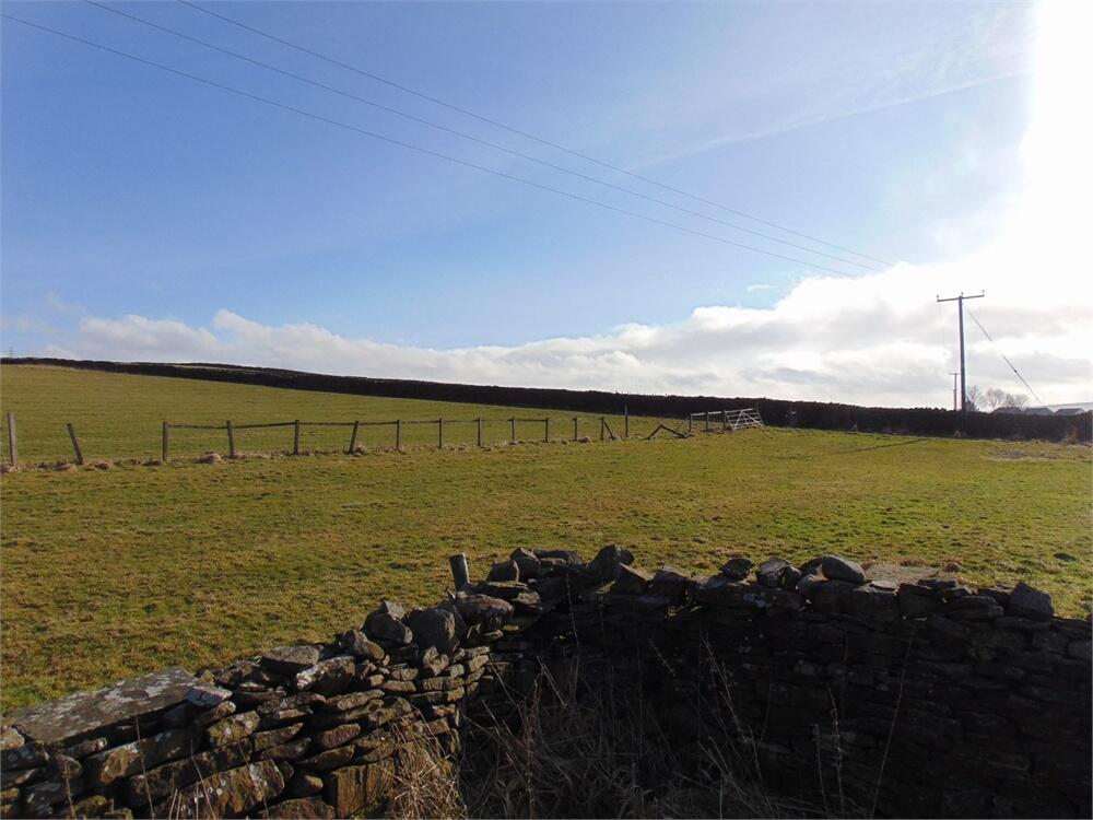
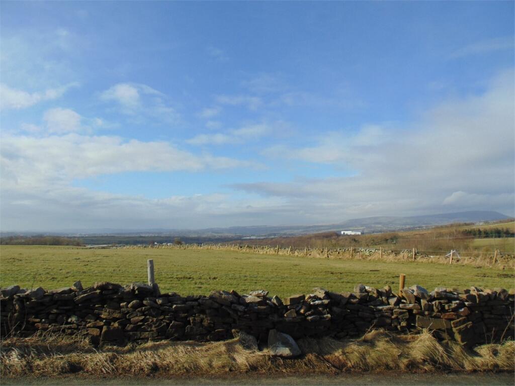
We are delighted to offer for sale a rare opportunity to purchase a desirable plot of land found just off the ever popular Extwistle Road on the outskirts of the village of Worsthorne. Labelled as 'Plot C' and highlighted on the plan with the pink cross markings the plot measures approximately...
Property Oracle says ..
This listing presents an opportunity to purchase a plot of land situated in Worsthorne, a village close to Burnley, Lancashire. The land appears relatively flat and of good quality, based on the provided photographs. The location is peaceful and offers proximity to Worsthorne Primary School, which is rated ‘Good’ by Ofsted, and it’s within reasonable travelling distance of Burnley and Nelson train stations. The absence of definitive square footage measurements for both the land and any potential building makes a complete assessment of price per square foot impossible. The lack of existing structures means there’s no bathroom or bedroom information. The listed price of £60,000 suggests that the value proposition lies primarily in the potential for development rather than the current state of the land. A buyer should conduct thorough due diligence, including obtaining detailed plot dimensions and conducting appropriate planning application checks before proceeding with a purchase. This could include obtaining surveys and considering the cost of development. The lack of information on existing services like water, electricity and gas connections makes a full evaluation difficult and potential buyer should factor these in to their estimations.
Therefore, we give this property 6 / 10. *Disclaimer: This is our option and does constitute a recommendation or financial advice. Do your own research. *
- Price
- 7
- Condition
- 5
- Location
- 7
- Land
- 6
- Bedrooms
- 0
- Bathrooms
- 0
The heatmap indicates the level of crime in the area. The color of the heatmap indicates the crime severity and recency.
Metrics Year-on-Year
- Average area value
- 537,450.00 £Increased by 70.34 %
- Average area rental value
- 988.00 £/moIncreased by 30.00 %
- Est rental Yield
- 2.21 %Decreased by 23.53 %
- Crime Rate
- 12.00 %Unchanged by 0.00 %
Agent Activity
JonSimon Estate Agents marked this listing as sold.
JonSimon Estate Agents created the listing.
Nearby Schools
| Name | Type | Ofsted | Distance |
|---|---|---|---|
| Worsthorne Primary School | Community School | Good | 0.97 KM |
| Compass Community School Lancashire | Other Independent Special School | 2.61 KM | |
| Briercliffe Primary School | Community School | Good | 2.96 KM |
| Sir John Thursby Community College | Foundation School | Good | 3.83 KM |
| St James' Lanehead Church Of England Primary School | Voluntary Aided School | Good | 4.03 KM |
Images


Nearby Streets
| Name | Average Price | Average Sqft | Distance |
|---|---|---|---|
| Halstead Street | £ 0 | 0 | 0.00 KM |
| Chapel Street | £ 159,950 | 0 | 0.00 KM |
| Extwistle Road | £ 0 | 0 | 0.00 KM |
| Hall Street | £ 0 | 0 | 0.00 KM |
Nearby Transport
| Name | NLC | TLC | Distance |
|---|---|---|---|
| Nelson | 2565 | NEL | 5.66 KM |
| Burnley Central | 2550 | BNC | 6.64 KM |
| Brierfield | 2554 | BRF | 6.66 KM |
| Colne | 2562 | CNE | 6.87 KM |
| Burnley Manchester Road | 2549 | BYM | 7.13 KM |
Nearby Listings
| Address | Price | Type | Score | Distance |
|---|---|---|---|---|
| Extwistle Road, Burnley, BB10 | £ 60,000 | BUY | 6 / 10 | 0.00 KM |
| Extwistle Road, Burnley, BB10 | £ 60,000 | BUY | 5 / 10 | 0.04 KM |
| Extwistle Road, Worsthorne, BB10 | £ 375,000 | BUY | 7 / 10 | 0.10 KM |
| Langfield, Worsthorne, Burnley | £ 390,000 | BUY | 7 / 10 | 0.36 KM |
| Langfield, Worsthorne, Burnley, Lancashire, BB10 | £ 390,000 | BUY | 7 / 10 | 0.38 KM |
Nearby Properties
| Address | Price | Distance |
|---|---|---|
| Lower Bottin House | £ 235,000 | 0.11 KM |
| Higher Bottin Barn | £ 332,000 | 0.11 KM |
| Lower Bottin Byre | £ 345,000 | 0.11 KM |
| Lower Bottin Cottage | £ 312,500 | 0.11 KM |
| Higher Bottin Stables | £ 290,000 | 0.14 KM |