
City Road - St Pauls
By Ocean
£ 1,200
Ocean says ..
A lovely one bedroom garden flat close to Gloucester Road!
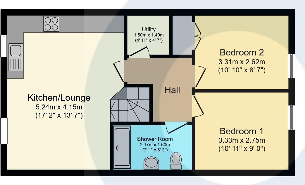
- Bedrooms
- 1
- Bathrooms
- 1
The heatmap indicates the level of crime in the area. The color of the heatmap indicates the crime severity and recency.
Metrics Year-on-Year
- Average area value
- 445,205.00 £Decreased by 3.69 %
- Average area rental value
- 1,836.00 £/moIncreased by 4.79 %
- Est rental Yield
- 4.95 %Increased by 8.79 %
- Crime Rate
- 7.00 %Unchanged by 0.00 %
from 462,259.00 £
from 1,752.00 £/mo
from 4.55 %
from 7.00 %
Agent Activity
Ocean created the listing.
Nearby Schools
| Name | Type | Ofsted | Distance |
|---|---|---|---|
| St Paul'S Nursery School & Children'S Centre | Children's Centre | 0.37 KM | |
| St Pauls Nursery School & Children'S Centre | Local Authority Nursery School | Outstanding | 0.38 KM |
| The Dolphin School | Academy Sponsor Led | Good | 0.45 KM |
| Montpelier High School | Academy Sponsor Led | Outstanding | 0.62 KM |
| Cabot Primary School | Community School | Good | 0.73 KM |
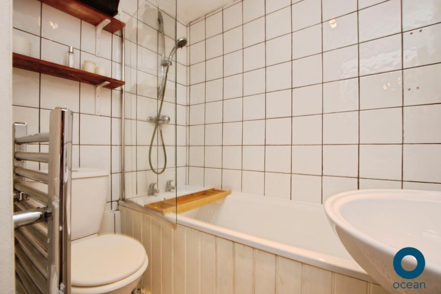
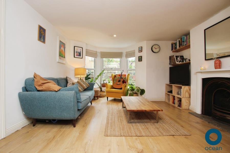
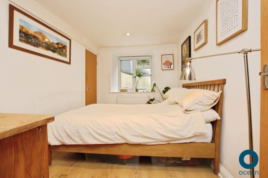
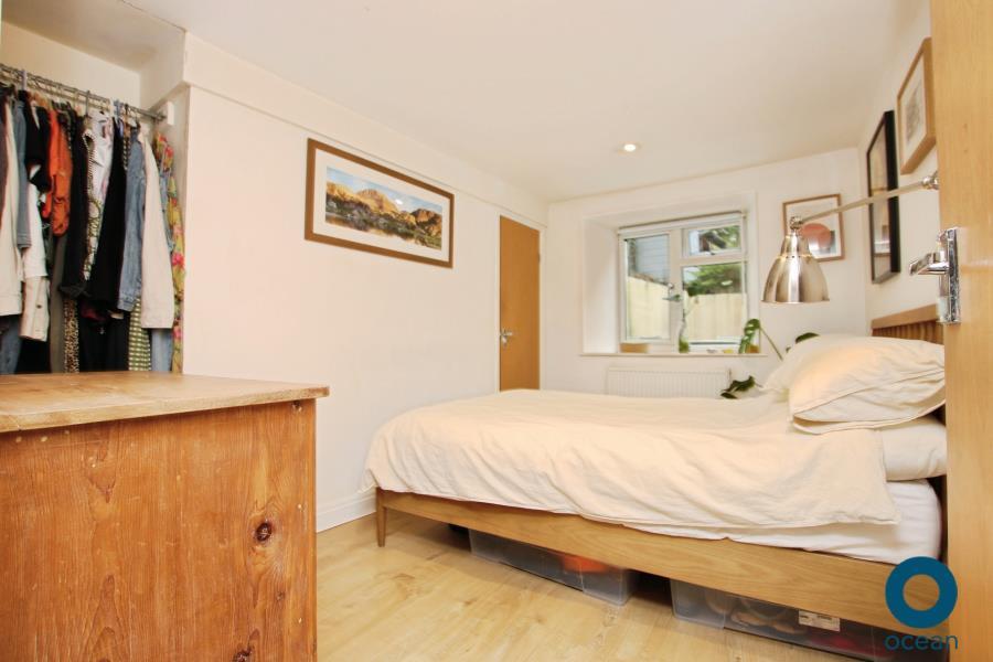
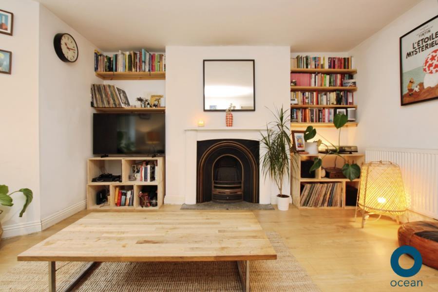
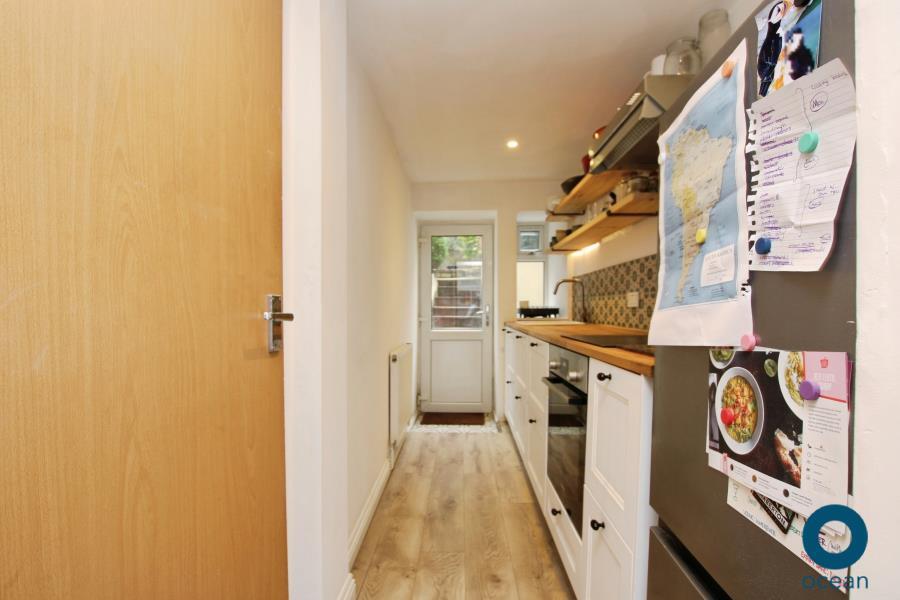
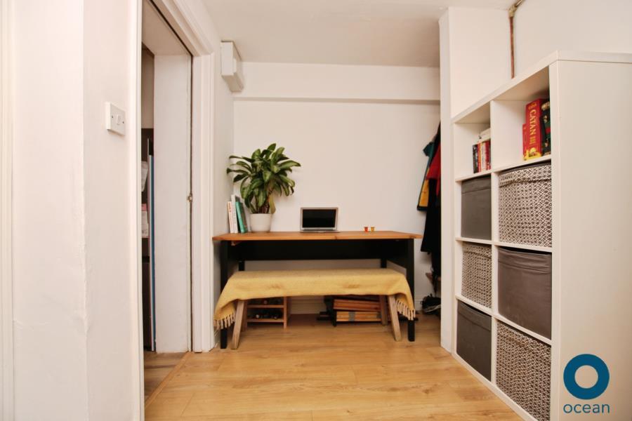
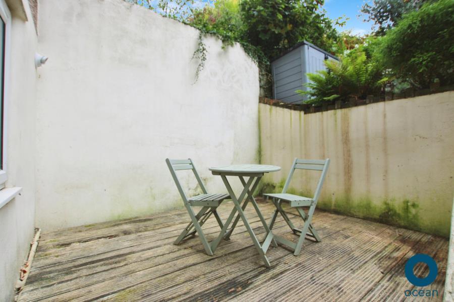
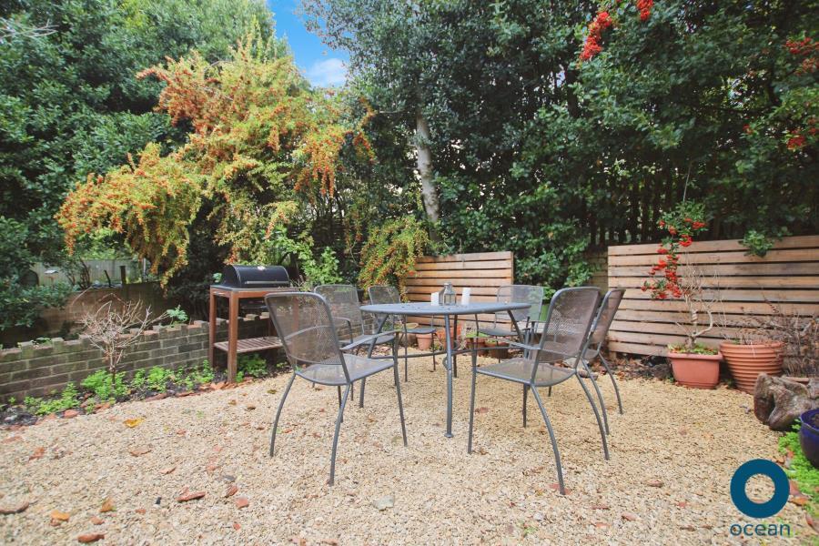
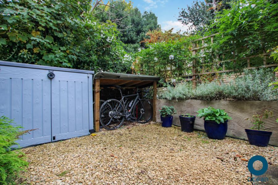
Images
Nearby Streets
| Name | Average Price | Average Sqft | Distance |
|---|---|---|---|
| Carmen Beckford Street | £ 0 | 0 | 0.00 KM |
| Stokes Croft | £ 245,000 | 0 | 0.00 KM |
| Dean Street | £ 184,875 | 0 | 0.00 KM |
| Armidale Avenue | £ 260,000 | 0 | 0.00 KM |
| North Street | £ 0 | 0 | 0.00 KM |
Nearby Transport
| Name | NLC | TLC | Distance |
|---|---|---|---|
| Montpelier | 3203 | MTP | 0.57 KM |
| Redland | 3247 | RDA | 1.37 KM |
| Bristol Temple Meads | 3231 | BRI | 1.73 KM |
| Stapleton Road | 3250 | SRD | 2.43 KM |
| Clifton Down | 3202 | CFN | 2.65 KM |
Nearby Listings
| Address | Price | Type | Score | Distance |
|---|---|---|---|---|
| City Road - St Pauls | £ 1,200 | RENT | Unknown | 0.00 KM |
| City Road, Bristol | £ 2,600 | RENT | Unknown | 0.00 KM |
| City Road, Saint Pauls, Bristol, BS2 | £ 1,600 | RENT | Unknown | 0.04 KM |
| Hepburn Court B, Hepburn Road, Stokes Croft, Bristol, BS2 | £ 1,650 | RENT | Unknown | 0.04 KM |
| Dairycroft, 39 City Road, St Pauls, Bristol, BS2 | £ 1,100 | RENT | Unknown | 0.09 KM |
Nearby Properties
| Address | Price | Distance |
|---|---|---|
| 51a City Road | £ 149,000 | 0.01 KM |
| 59 City Road | £ 73,500 | 0.01 KM |
| 55 City Road | £ 120,000 | 0.01 KM |
| 45a City Road | £ 76,000 | 0.01 KM |
| 41 City Road | £ 214,500 | 0.01 KM |