Dunston Lane, Chesterfield, Derbyshire, S41
By Reeds Rains
£ 850,000
Reviews
4 out of 5 stars
Reeds Rains says ..
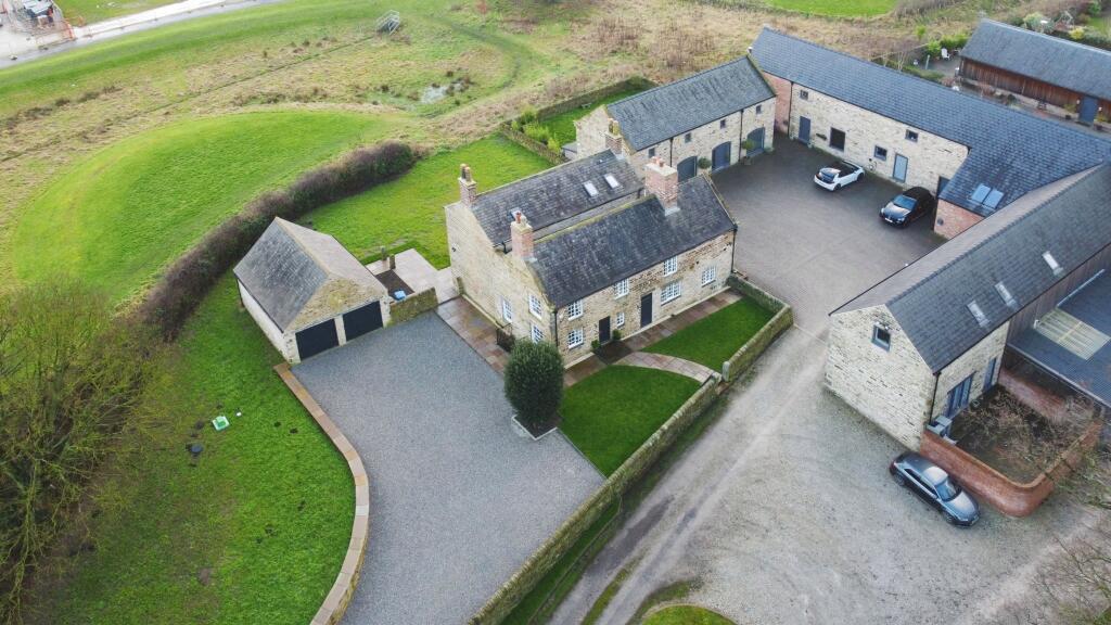
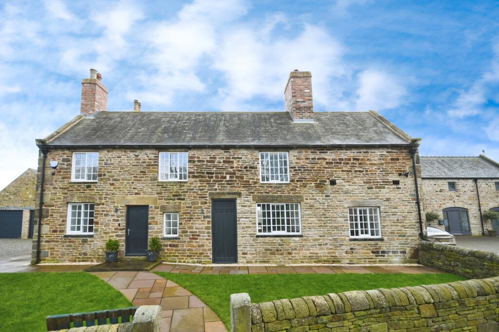
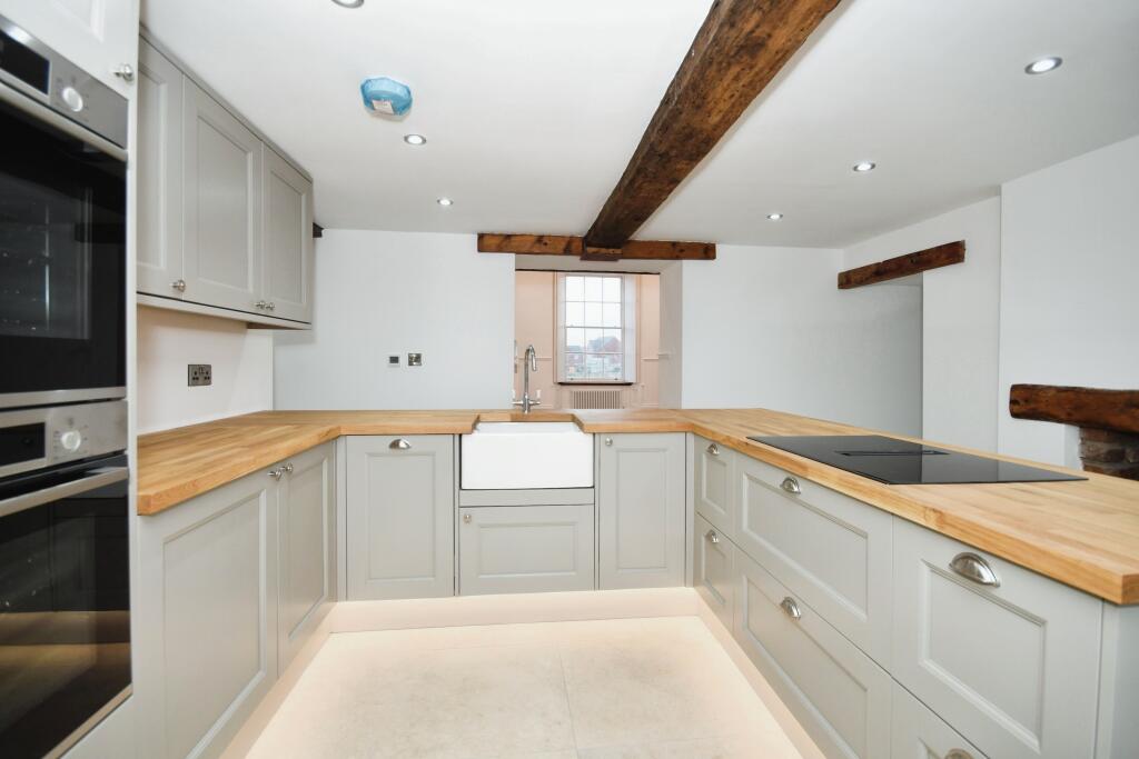
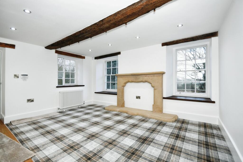
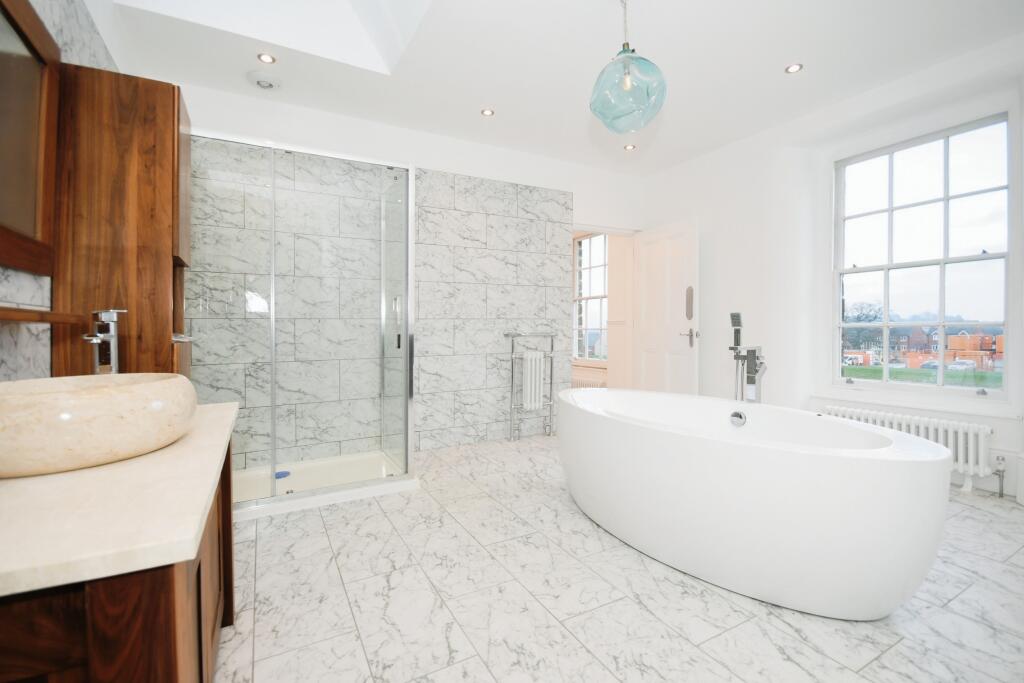
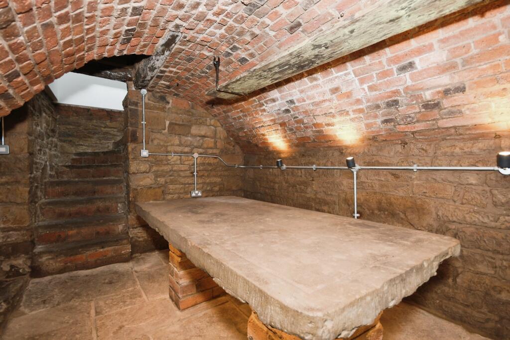
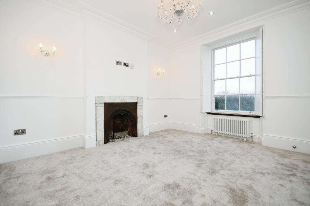
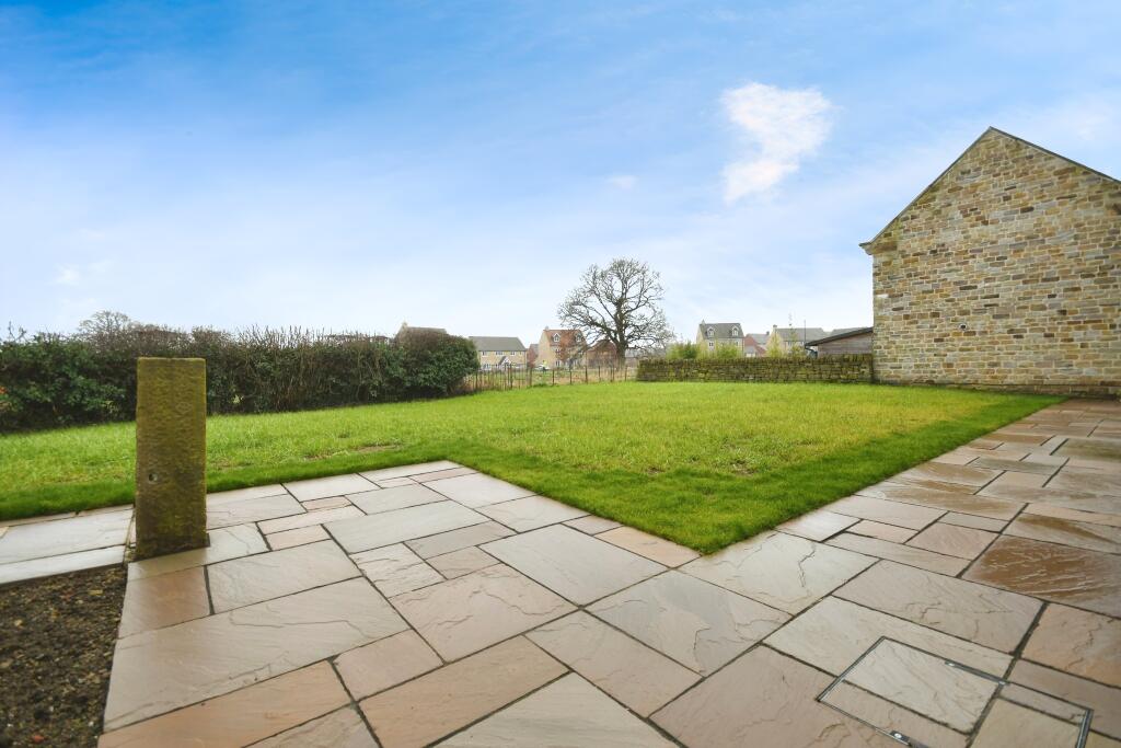
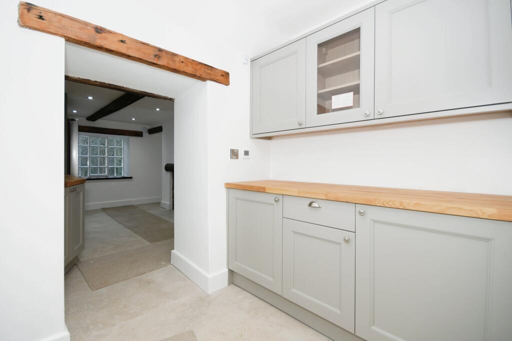
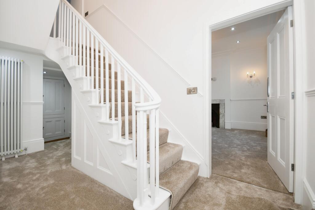
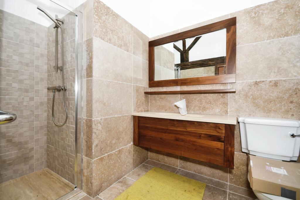
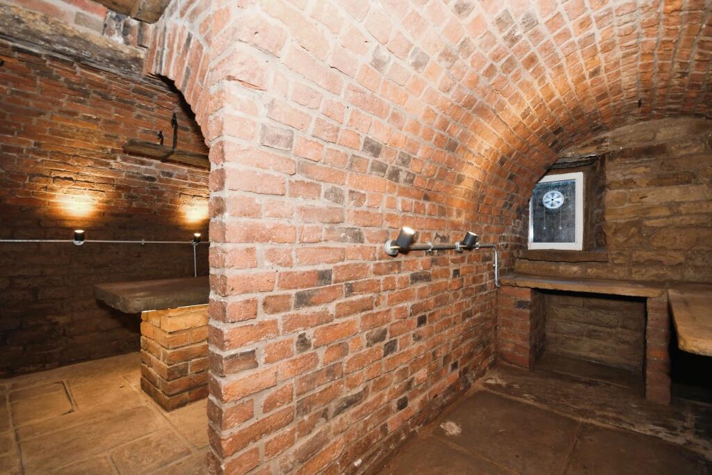
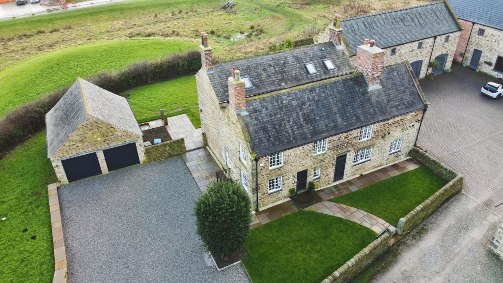
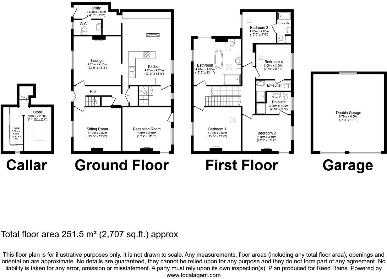
This is one on its own. Not only due to the grade II listing status but the quality workmanship, the high standard of fixtures and fittings and the charm on this extensive 2700 sqft, stone built home! Its nothing short of perfection. Having four bedrooms, four bathrooms, three reception rooms, be...
Property Oracle says ..
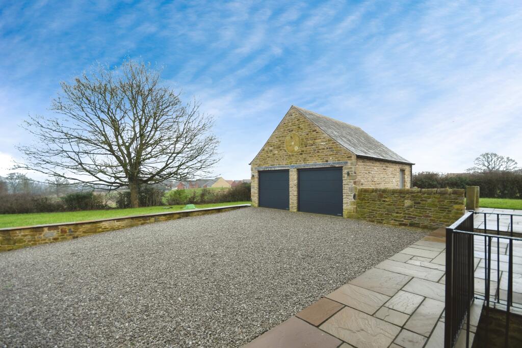
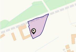
Dunston Lane is located in the desirable Dunston area of Chesterfield, Derbyshire. The property benefits from being within a short distance of Dunston Primary and Nursery Academy (0.77km), and St Mary’s Catholic High School (1.28km), both well-regarded schools. Chesterfield train station is also relatively close (4.33km), providing convenient access to other areas. The surrounding area appears peaceful and residential, based on the provided images and map. The property itself is a substantial stone building, which appears to be in excellent condition from the photos provided. It has been renovated to a high standard, with modern fixtures and fittings throughout, while retaining some original features. The extensive grounds include a sizeable garden and ample parking. The list price of £850,000 is significantly higher than the average house price in the area (£270,594), however, the size of the property (2,370.43 sqft), the high-quality renovation, and the substantial plot size (2,707.12 sqft) justify this to a degree. The price per sqft is also higher than the average for the area, reflecting the premium associated with the property’s size, condition, and location. Considering all factors, the property represents a significant investment in a desirable location.
Therefore, we give this property 8 / 10. *Disclaimer: This is our option and does constitute a recommendation or financial advice. Do your own research. *
- Price
- 7
- Condition
- 9
- Location
- 8
- Land
- 8
- Bedrooms
- 4
- Bathrooms
- 5
- Sqft (est)
- 2,370.43
- Lot (est)
- 2,707.12
The heatmap indicates the level of crime in the area. The color of the heatmap indicates the crime severity and recency.
Metrics Year-on-Year
- Average area value
- 296,000.00 £Increased by 16.27 %
- Est sale value
- 798,834.91 £Increased by 99.41 %
- Average area rental value
- 1,040.00 £/moIncreased by 8.67 %
- Est letting value
- 2,370.43 £/mo
- Est rental Yield
- 4.22 %Decreased by 6.43 %
- Crime Rate
- 0.00 %
Agent Activity
Reeds Rains created the listing.
Nearby Schools
| Name | Type | Ofsted | Distance |
|---|---|---|---|
| Dunston Primary And Nursery Academy | Academy Sponsor Led | 0.77 KM | |
| St Mary'S Catholic High School, A Catholic Voluntary Academy | Academy Converter | Outstanding | 1.28 KM |
| Newbold Cofe Primary School | Academy Sponsor Led | Good | 1.28 KM |
| Cavendish Junior School | Community School | Good | 1.62 KM |
| Outwood Academy Newbold | Academy Sponsor Led | Good | 1.97 KM |
Images


Nearby Streets
| Name | Average Price | Average Sqft | Distance |
|---|---|---|---|
| Scafell Avenue | £ 229,950 | 0 | 0.00 KM |
| Skelwith Close | £ 0 | 0 | 0.00 KM |
| Cumberland Drive | £ 395,000 | 0 | 0.00 KM |
| Hawkshead Way | £ 318,000 | 0 | 0.00 KM |
| Patterdale Road | £ 190,000 | 0 | 0.00 KM |
Nearby Transport
| Name | NLC | TLC | Distance |
|---|---|---|---|
| Chesterfield | 6615 | CHD | 4.33 KM |
| Dronfield | 6616 | DRO | 4.67 KM |
Nearby Listings
| Address | Price | Type | Score | Distance |
|---|---|---|---|---|
| Dunston Lane, Chesterfield, Derbyshire, S41 | £ 850,000 | BUY | 8 / 10 | 0.00 KM |
| The Hamble, Skylarks, Whinfell Road, Dunston, Chesterfield, Derbyshire S41 | £ 480,000 | BUY | 7 / 10 | 0.09 KM |
| Whinfell Road, Dunston, Chesterfield, Derbyshire S41 | £ 409,950 | BUY | 7 / 10 | 0.11 KM |
| Whinfell Road, Dunston, Chesterfield | £ 359,995 | BUY | 7 / 10 | 0.12 KM |
| Whinfell Road, Dunston, Chesterfield, Derbyshire S41 | £ 260,000 | BUY | 7 / 10 | 0.13 KM |
Nearby Properties
| Address | Price | Distance |
|---|---|---|
| 117 Dunston Lane | £ 44,500 | 0.23 KM |
| 121 Dunston Lane | £ 160,000 | 0.23 KM |
| 111 Dunston Lane | £ 115,000 | 0.23 KM |
| 108 Dunston Lane | £ 124,500 | 0.23 KM |
| 118 Dunston Lane | £ 130,000 | 0.23 KM |