HA
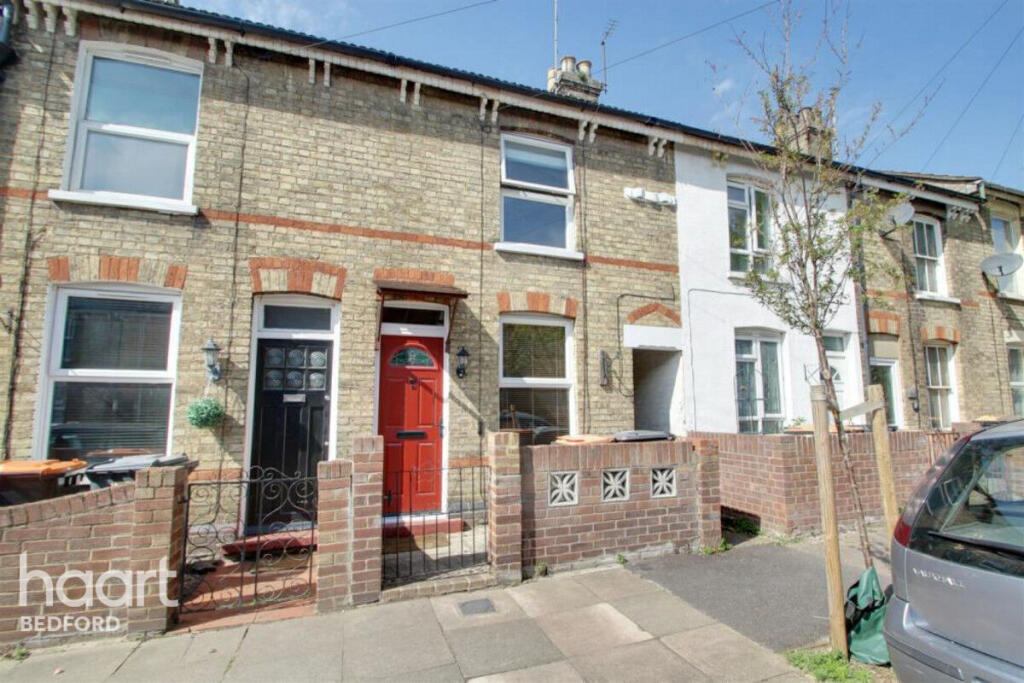
Garfield Street, Bedford
By haart
£ 1,200
haart says ..
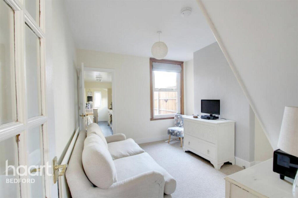
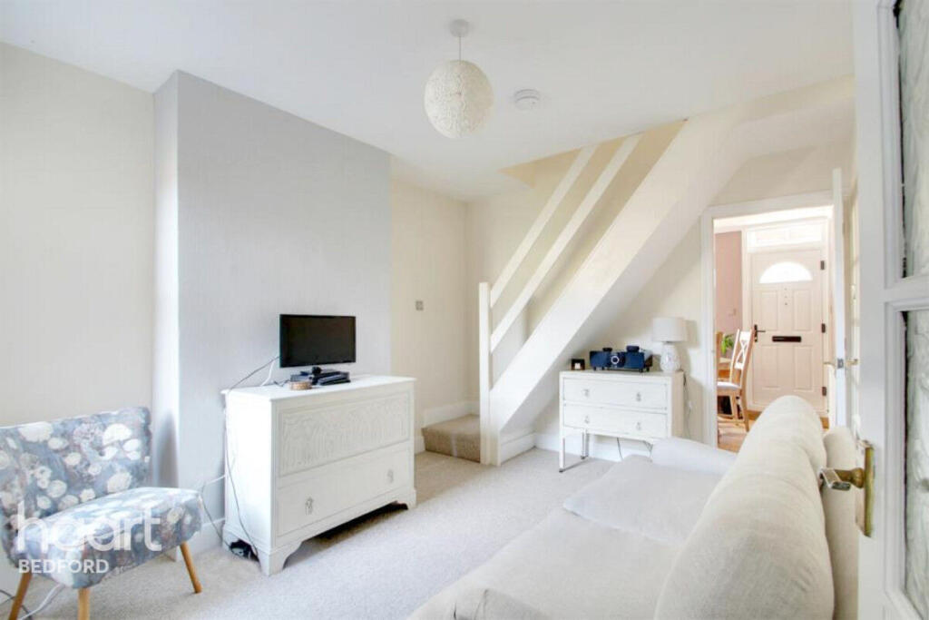
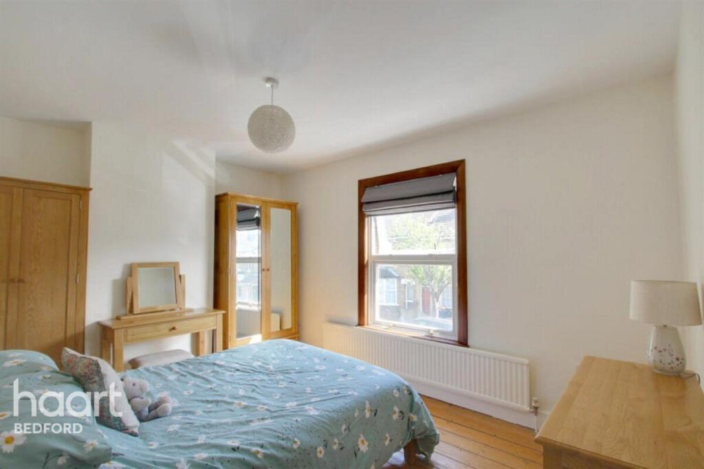
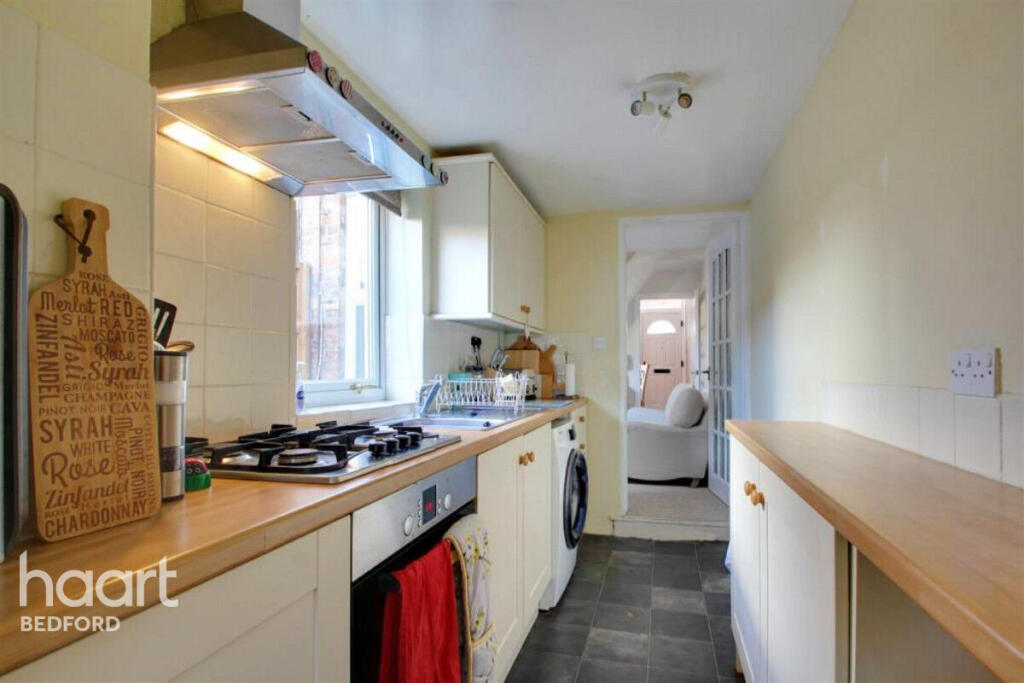
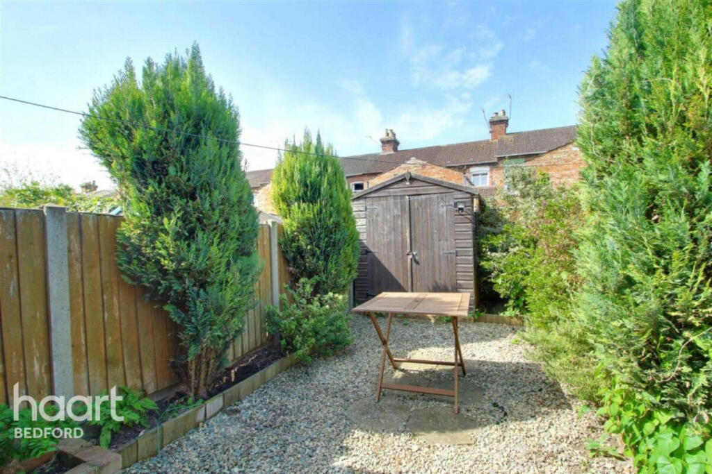
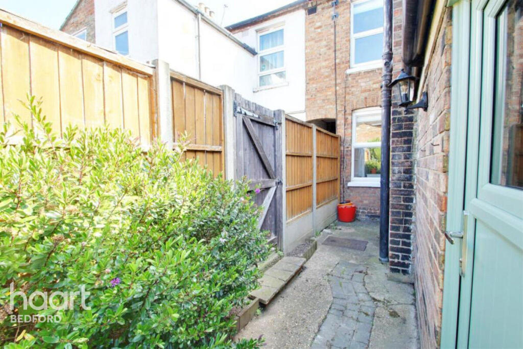
Approximately 0.9 miles from Bedford train station | Two double bedrooms | Two reception rooms |Shaker style kitchen | Low maintenance west facing rear garden with side access | Gas central heating | Sought after Prime Ministers area of Bedford
- Bedrooms
- 2
- Bathrooms
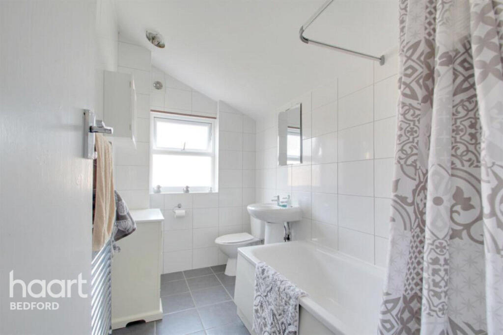
- 1
The heatmap indicates the level of crime in the area. The color of the heatmap indicates the crime severity and recency.
Metrics Year-on-Year
- Average area value
- 334,286.00 £Increased by 12.68 %
- Average area rental value
- 1,243.00 £/moIncreased by 20.21 %
- Est rental Yield
- 4.46 %Increased by 6.70 %
- Crime Rate
- 6.00 %Unchanged by 0.00 %
from 296,656.00 £
from 1,034.00 £/mo
from 4.18 %
from 6.00 %
Agent Activity
haart created the listing.
Nearby Schools
| Name | Type | Ofsted | Distance |
|---|---|---|---|
| Pine Cones Cc (Bedford Borough) | Children's Centre | 0.40 KM | |
| Livingstone Primary School | Foundation School | Good | 0.43 KM |
| Polam School | Other Independent School | 0.62 KM | |
| Edith Cavell Primary School | Foundation School | Good | 0.69 KM |
| Bedford Central Cc (Bedford Borough) | Children's Centre | 0.73 KM |
Images


Nearby Streets
| Name | Average Price | Average Sqft | Distance |
|---|---|---|---|
| Hogarth Close | £ 0 | 0 | 0.00 KM |
| Reynolds Close | £ 335,000 | 0 | 0.00 KM |
| Allhallows | £ 0 | 0 | 0.00 KM |
| Priory Street | £ 0 | 0 | 0.00 KM |
| Church Square | £ 0 | 0 | 0.00 KM |
Nearby Transport
| Name | NLC | TLC | Distance |
|---|---|---|---|
| Bedford | 1512 | BDM | 1.17 KM |
| Bedford St Johns | 1510 | BSJ | 1.72 KM |
| Kempston Hardwick | 1384 | KMH | 6.74 KM |
| Stewartby | 1386 | SWR | 9.91 KM |
Nearby Listings
| Address | Price | Type | Score | Distance |
|---|---|---|---|---|
| Garfield Street, Bedford | £ 1,200 | RENT | Unknown | 0.00 KM |
| , , | £ 1,275 | RENT | Unknown | 0.02 KM |
| Gladstone Street, Bedford, MK41 | £ 1,495 | RENT | Unknown | 0.08 KM |
| Gladstone Street, Bedford, MK41 | £ 1,295 | RENT | Unknown | 0.08 KM |
| Beaconsfield Street, MK41 | £ 1,300 | RENT | Unknown | 0.09 KM |
Nearby Properties
| Address | Price | Distance |
|---|---|---|
| 12 Garfield Street | £ 205,000 | 0.02 KM |
| 26 Garfield Street | £ 215,000 | 0.02 KM |
| 43 Garfield Street | £ 155,000 | 0.02 KM |
| 47 Garfield Street | £ 48,750 | 0.02 KM |
| 22 Garfield Street | £ 230,500 | 0.02 KM |