
BC
Long Lane, Newport
By BCM
£ 845,000
BCM says ..
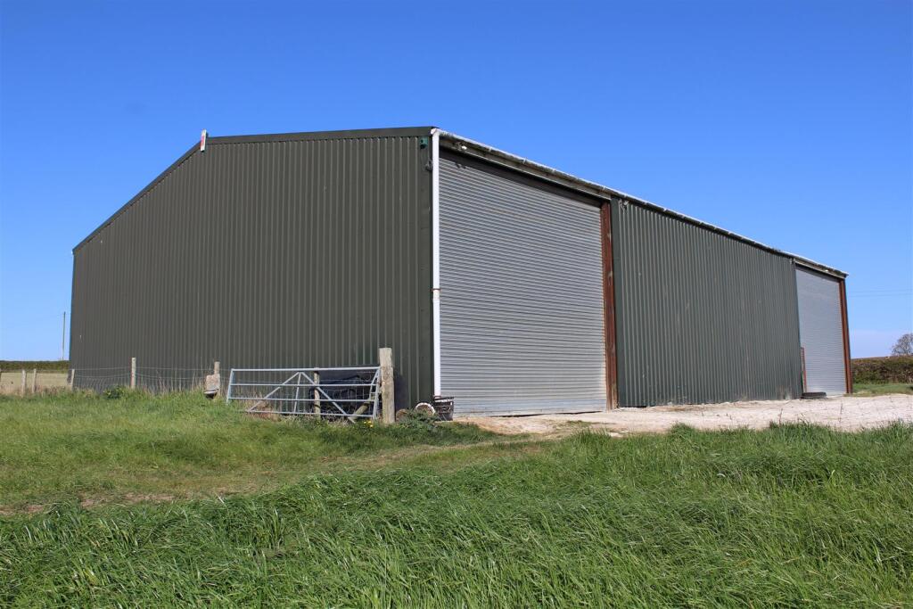
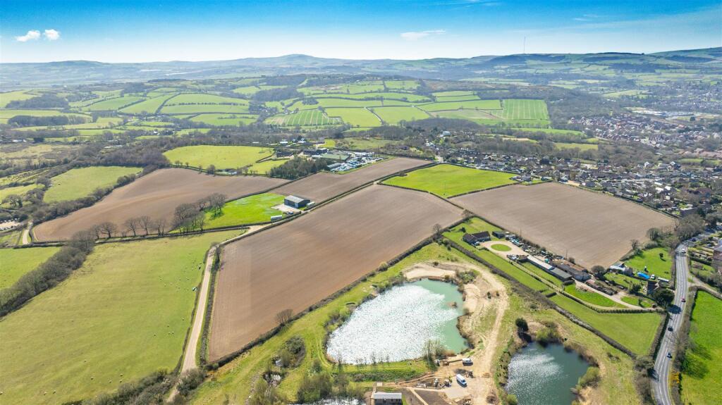
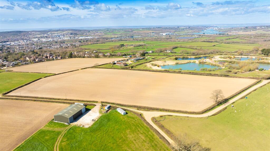
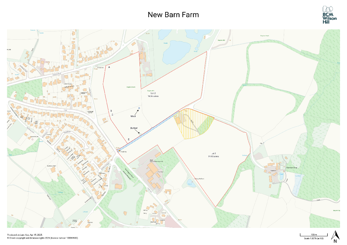
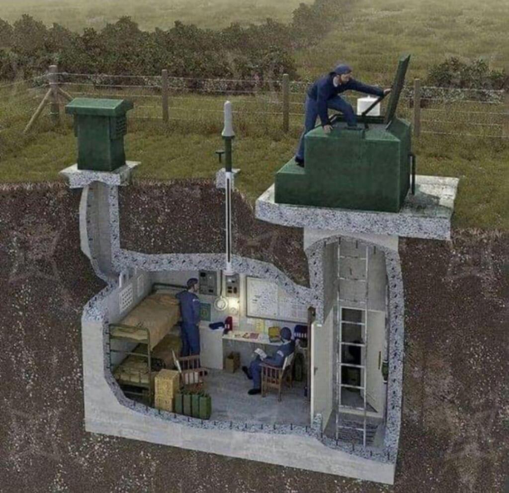
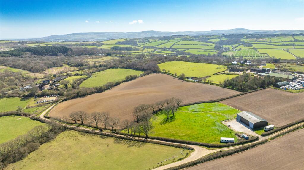
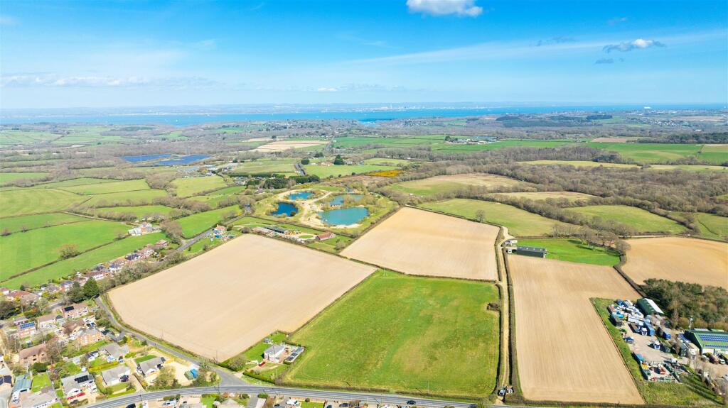
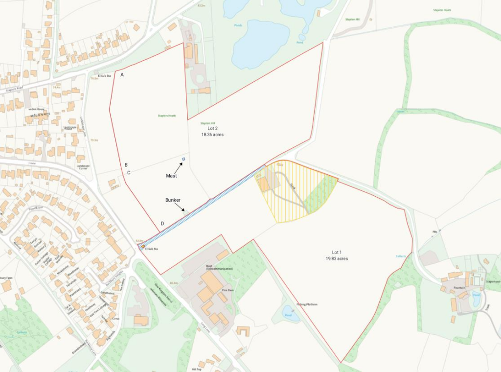
An easily accessible block of agricultural land with considerable potential complimented by a substantial farm building and derelict Cold War nuclear bunker. Available as a whole or in two lots.
- Bedrooms
- 0
- Bathrooms
- 0
The heatmap indicates the level of crime in the area. The color of the heatmap indicates the crime severity and recency.
Metrics Year-on-Year
- Average area value
- 431,250.00 £Increased by 5.19 %
- Average area rental value
- 1,300.00 £/moDecreased by 23.48 %
- Est rental Yield
- 3.62 %Decreased by 27.16 %
- Crime Rate
- 9.00 %Unchanged by 0.00 %
from 409,967.00 £
from 1,699.00 £/mo
from 4.97 %
from 9.00 %
Agent Activity
BCM created the listing.
Nearby Schools
| Name | Type | Ofsted | Distance |
|---|---|---|---|
| Summerfields Primary School | Community School | Good | 2.62 KM |
| Arreton St George'S Church Of England (Aided) Primary School | Voluntary Aided School | Requires improvement | 2.64 KM |
| Medina House School | Community Special School | Good | 2.91 KM |
| Barton Primary School | Community School | Good | 2.95 KM |
| East Newport Children'S Centre | Children's Centre Linked Site | 3.00 KM |
Images


Nearby Streets
| Name | Average Price | Average Sqft | Distance |
|---|---|---|---|
| Burnt House Lane | £ 285,000 | 0 | 0.00 KM |
Nearby Listings
| Address | Price | Type | Score | Distance |
|---|---|---|---|---|
| Long Lane, Newport | £ 845,000 | BUY | Unknown | 0.00 KM |
| Nr Newport, Isle of Wight | £ 1,925,000 | BUY | 6 / 10 | 0.91 KM |
| Buckbury Lane, Newport | £ 850,000 | BUY | 5 / 10 | 1.11 KM |
| Buckbury Lane, Newport | £ 1,000,000 | BUY | 6 / 10 | 1.11 KM |
| Burnt House Lane, Newport, Isle Of Wight, Hampshire, PO30 2PJ | £ 300,000 | BUY | 6 / 10 | 1.12 KM |
Nearby Properties
| Address | Price | Distance |
|---|---|---|
| 3 Buckbury Heights | £ 218,000 | 1.26 KM |
| 8 Buckbury Heights | £ 196,500 | 1.26 KM |
| 1 Buckbury Heights | £ 107,000 | 1.26 KM |
| Roslyn | £ 310,000 | 1.31 KM |
| 20 Powell Close | £ 221,000 | 1.44 KM |