SH
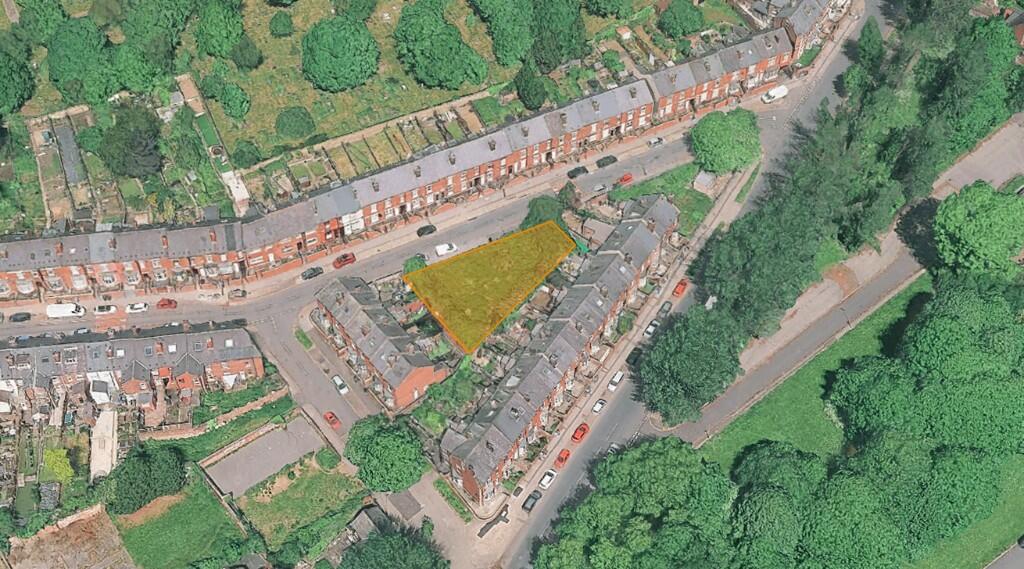
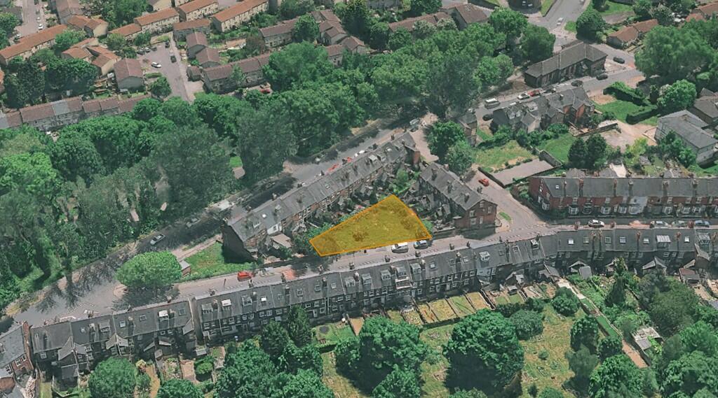
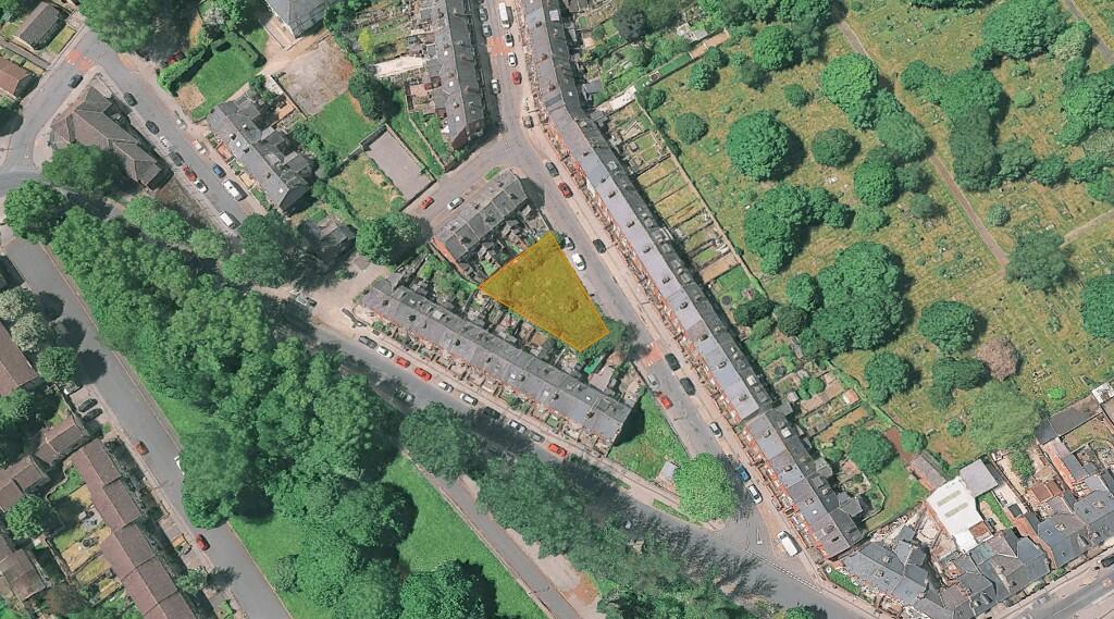
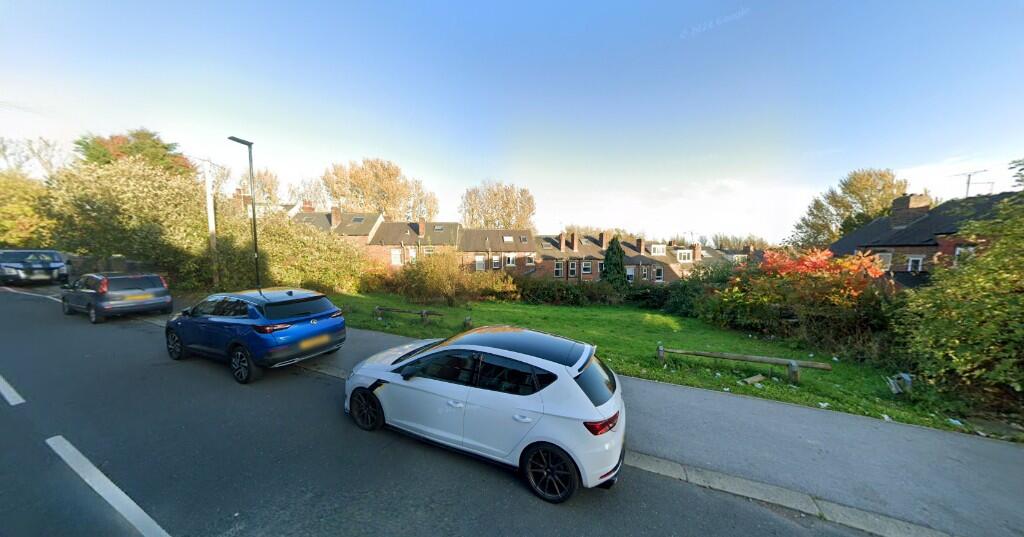
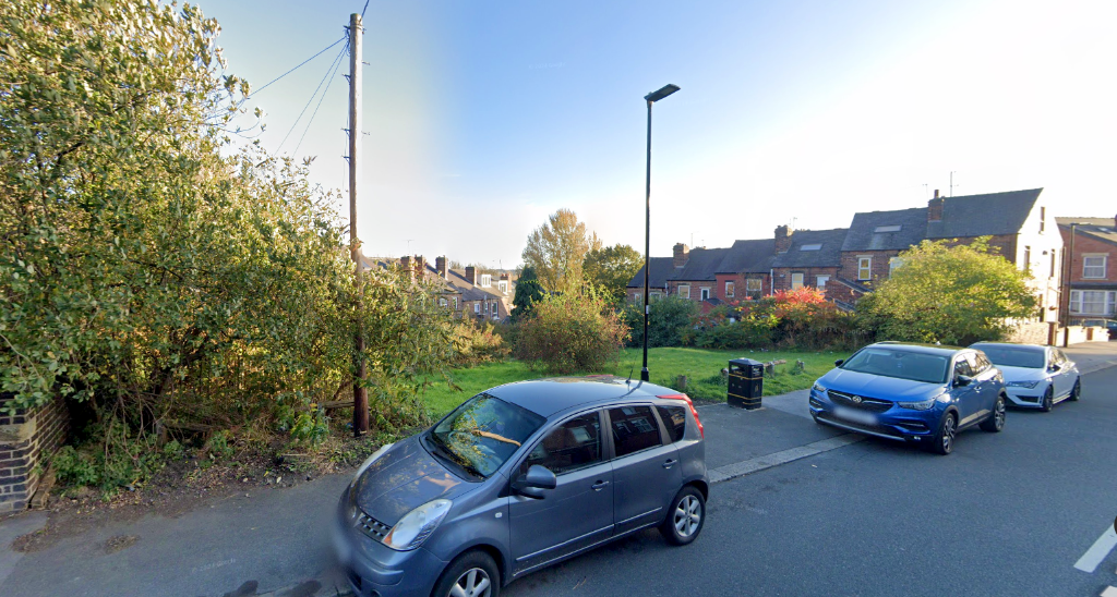
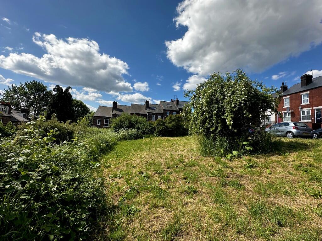
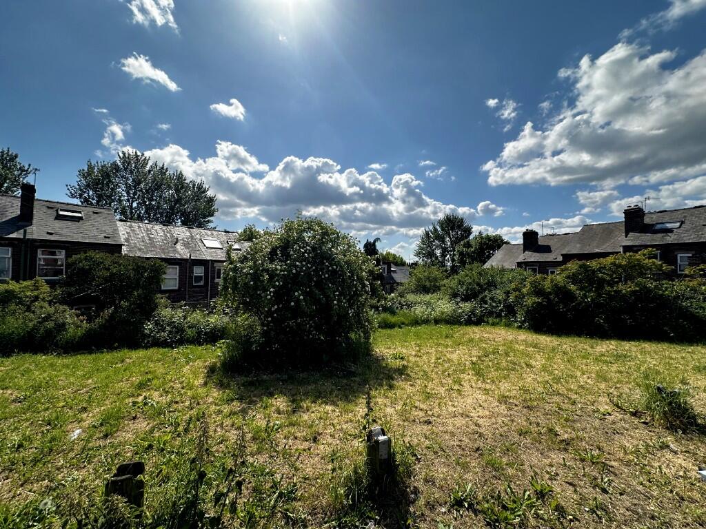
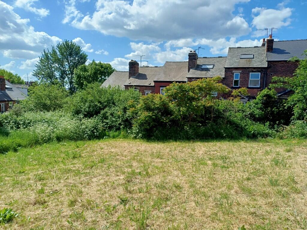
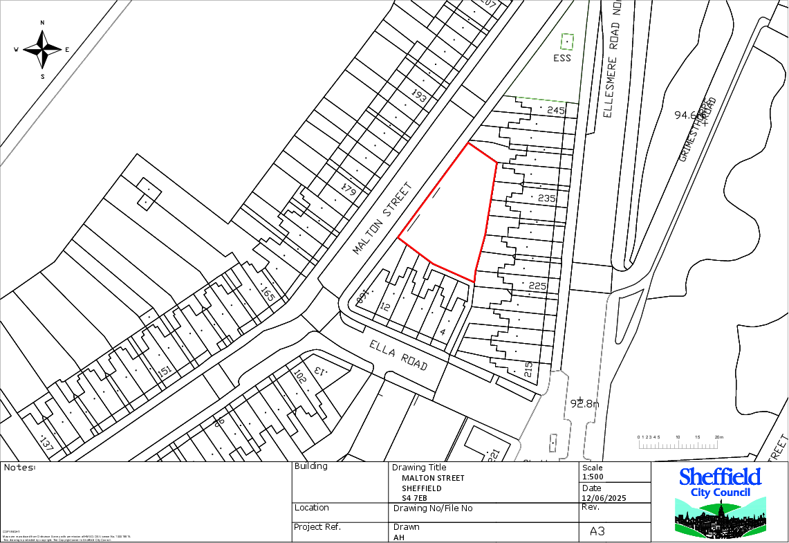
Land at Malton Street, S4 7EB
By Sheffield City Council
£ 1
Sheffield City Council says ..
Sheffield City Council are inviting offers for this development opportunity at Malton Street, S4 7EB.
- Bedrooms
- 0
- Bathrooms
- 0
The heatmap indicates the level of crime in the area. The color of the heatmap indicates the crime severity and recency.
Metrics Year-on-Year
- Average area value
- 155,000.00 £Increased by 18.10 %
- Average area rental value
- 772.00 £/moIncreased by 12.87 %
- Est rental Yield
- 5.98 %Decreased by 4.32 %
- Crime Rate
- 5.00 %Unchanged by 0.00 %
from 131,240.00 £
from 684.00 £/mo
from 6.25 %
from 5.00 %
Agent Activity
Sheffield City Council created the listing.
Nearby Schools
| Name | Type | Ofsted | Distance |
|---|---|---|---|
| Byron Wood Primary Academy | Academy Converter | Good | 0.55 KM |
| Whiteways Primary School | Academy Converter | 0.96 KM | |
| Oasis Academy Fir Vale | Academy Sponsor Led | Requires improvement | 1.10 KM |
| Burngreave Children'S Centre | Children's Centre Linked Site | 1.13 KM | |
| Abbeyfield Primary Academy | Academy Sponsor Led | Good | 1.13 KM |
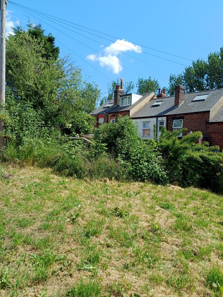
Images
Nearby Streets
| Name | Average Price | Average Sqft | Distance |
|---|---|---|---|
| Ellesmere Road | £ 0 | 0 | 0.00 KM |
| Skipton Road | £ 0 | 0 | 0.00 KM |
| Catherine Road | £ 0 | 0 | 0.00 KM |
| Hampton Road | £ 192,500 | 0 | 0.00 KM |
| Melrose Road | £ 0 | 0 | 0.00 KM |
Nearby Transport
| Name | NLC | TLC | Distance |
|---|---|---|---|
| Sheffield | 6691 | SHF | 2.47 KM |
| Darnall | 6729 | DAN | 4.90 KM |
| Meadowhall | 6663 | MHS | 5.04 KM |
| Chapeltown (South Yorkshire) | 6664 | CLN | 7.16 KM |
Nearby Listings
| Address | Price | Type | Score | Distance |
|---|---|---|---|---|
| Land at Malton Street, S4 7EB | £ 1 | BUY | Unknown | 0.00 KM |
| Malton Street, Sheffield, South Yorkshire, S4 | £ 110,000 | BUY | 5 / 10 | 0.16 KM |
| Blayton Road, Sheffield | £ 140,000 | BUY | 6 / 10 | 0.24 KM |
| Lyons Road, Sheffield, South Yorkshire, S4 | £ 140,000 | BUY | Unknown | 0.25 KM |
| Kirton Road, Sheffield | £ 80,000 | BUY | Unknown | 0.30 KM |
Nearby Properties
| Address | Price | Distance |
|---|---|---|
| 191 Malton Street | £ 85,500 | 0.04 KM |
| 160 Malton Street | £ 125,000 | 0.04 KM |
| 215 Malton Street | £ 105,000 | 0.04 KM |
| 167 Malton Street | £ 80,500 | 0.04 KM |
| 197 Malton Street | £ 75,000 | 0.04 KM |