
MA
High Street, IP31
By Map Letting & Property Management
£ 1,100
Map Letting & Property Management says ..
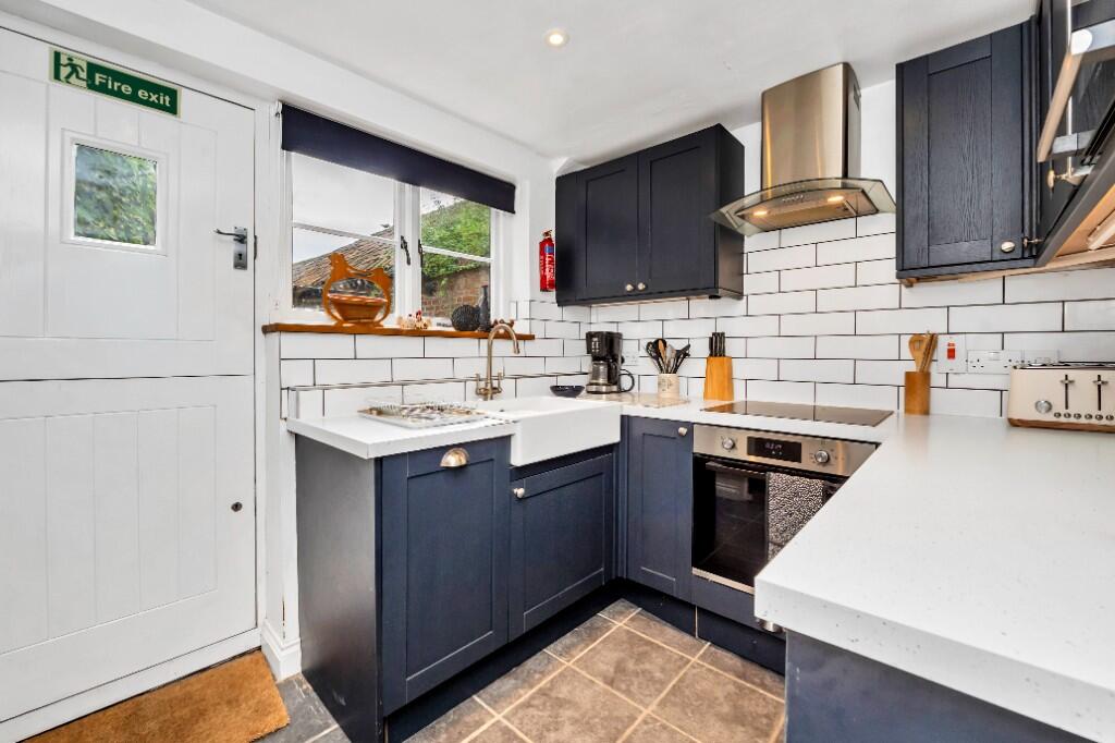
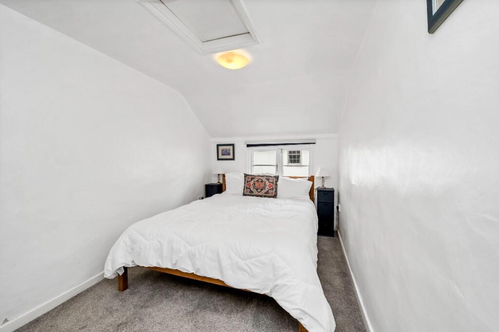
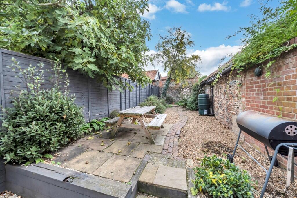
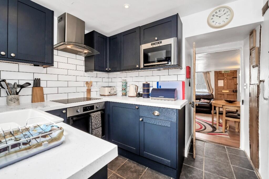
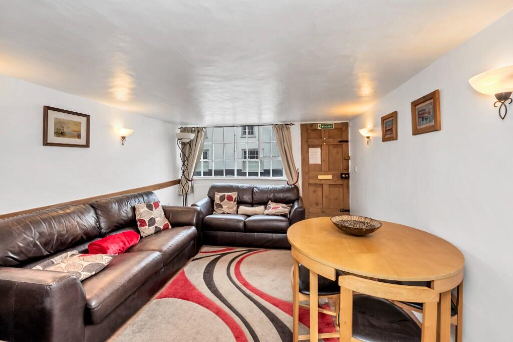
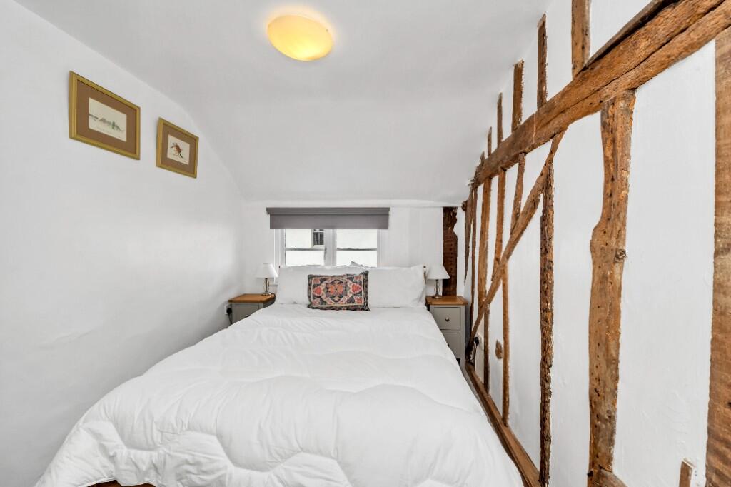
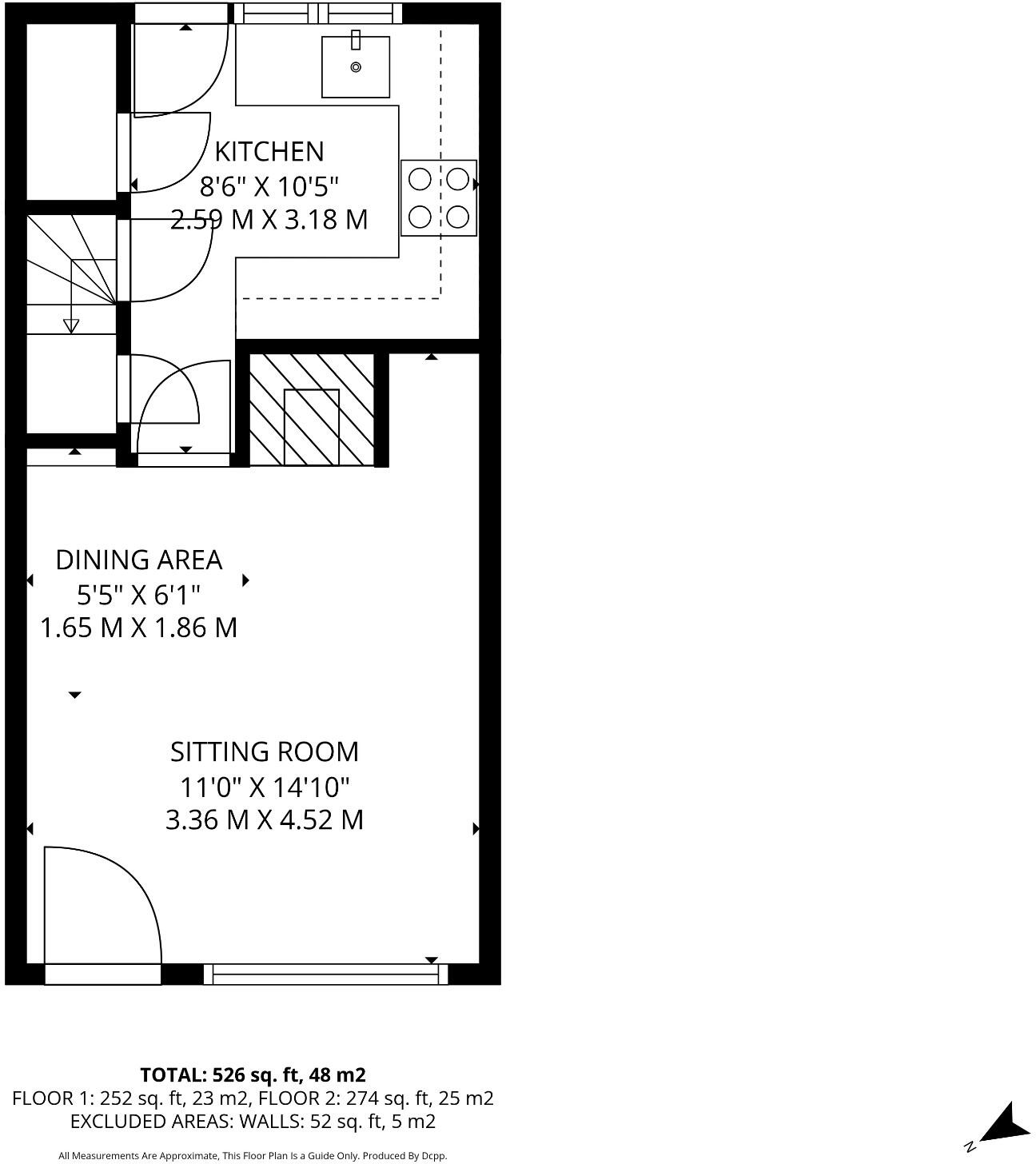
Charming two bedroom period cottage with courtyard garden in heart of village.
- Bedrooms
- 2
- Bathrooms
- 1
The heatmap indicates the level of crime in the area. The color of the heatmap indicates the crime severity and recency.
Metrics Year-on-Year
- Average area value
- 223,188.00 £Decreased by 13.36 %
- Average area rental value
- 1,283.00 £/moIncreased by 2.15 %
- Est rental Yield
- 6.90 %Increased by 17.95 %
- Crime Rate
- 86.00 %Unchanged by 0.00 %
from 257,594.00 £
from 1,256.00 £/mo
from 5.85 %
from 86.00 %
Agent Activity
Map Letting & Property Management created the listing.
Nearby Schools
| Name | Type | Ofsted | Distance |
|---|---|---|---|
| Ixworth Church Of England Primary School | Academy Sponsor Led | 0.47 KM | |
| Set Ixworth School | Free Schools | Good | 0.94 KM |
| Bardwell Church Of England Primary School | Academy Converter | Requires improvement | 3.71 KM |
| Honington Church Of England Voluntary Controlled Primary School | Voluntary Controlled School | Good | 5.06 KM |
| Thurston Community College | Community School | Good | 5.53 KM |
Images


Nearby Streets
| Name | Average Price | Average Sqft | Distance |
|---|---|---|---|
| The Paddock | £ 0 | 0 | 0.00 KM |
| Carpenter Close | £ 0 | 0 | 0.00 KM |
| Bury Road | £ 0 | 0 | 0.00 KM |
Nearby Transport
| Name | NLC | TLC | Distance |
|---|---|---|---|
| Thurston | 7356 | TRS | 6.04 KM |
Nearby Listings
| Address | Price | Type | Score | Distance |
|---|---|---|---|---|
| High Street, IP31 | £ 1,100 | RENT | Unknown | 0.00 KM |
| Ivy Dene, Bury St. Edmunds, IP31 | £ 1,000 | RENT | Unknown | 0.23 KM |
| Peasecroft Road, Ixworth, IP31 2EZ | £ 1,350 | RENT | Unknown | 0.38 KM |
| Chalk Lane, Bury St. Edmunds, IP31 | £ 1,650 | RENT | Unknown | 0.39 KM |
| 23 Thomas Close | £ 1,850 | RENT | Unknown | 0.58 KM |
Nearby Properties
| Address | Price | Distance |
|---|---|---|
| 52 High Street | £ 195,000 | 0.00 KM |
| Orchard House | £ 310,000 | 0.00 KM |
| 70 High Street | £ 315,000 | 0.00 KM |
| 29 High Street | £ 275,000 | 0.00 KM |
| 60 High Street | £ 58,000 | 0.00 KM |