FI
Todds Lane, Southport, Merseyside, PR9
By FIND
£ 125,000
FIND says ..
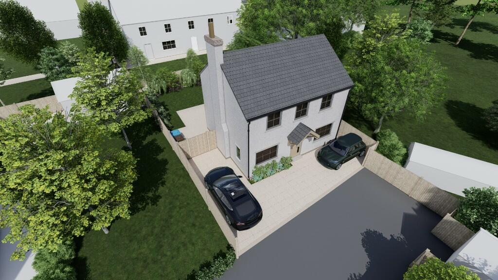
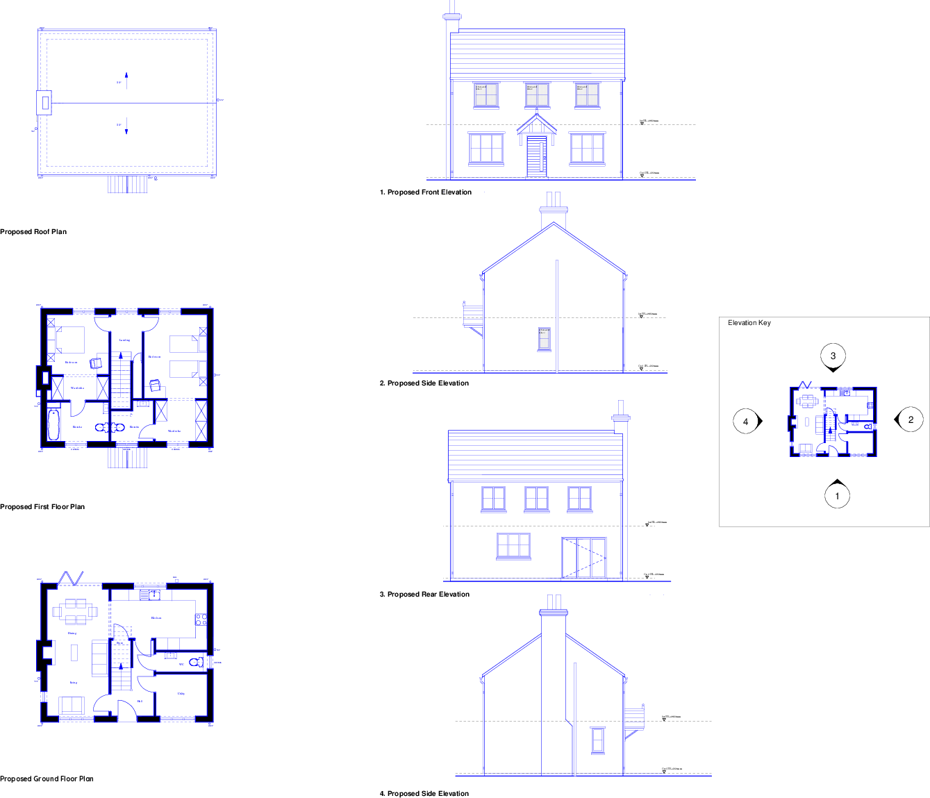
Full Planning Permission! Ready to go building plot for detached two story house.
- Bedrooms
- 2
- Bathrooms
- 3
The heatmap indicates the level of crime in the area. The color of the heatmap indicates the crime severity and recency.
Metrics Year-on-Year
- Average area value
- 382,533.00 £Increased by 3.77 %
- Average area rental value
- 1,090.00 £/moDecreased by 17.67 %
- Est rental Yield
- 3.42 %Decreased by 20.65 %
- Crime Rate
- 61.00 %Unchanged by 0.00 %
from 368,645.00 £
from 1,324.00 £/mo
from 4.31 %
from 61.00 %
Agent Activity
FIND created the listing.
Nearby Schools
| Name | Type | Ofsted | Distance |
|---|---|---|---|
| Banks St Stephen'S Cofe School | Voluntary Controlled School | Good | 0.79 KM |
| Banks Methodist School | Voluntary Controlled School | Good | 0.88 KM |
| St John'S Church Of England Primary School | Voluntary Controlled School | Good | 2.79 KM |
| Tarleton Mere Brow Church Of England Primary School | Voluntary Aided School | Good | 4.49 KM |
| Peterhouse School | Non-maintained Special School | Outstanding | 4.54 KM |
Images


Nearby Streets
| Name | Average Price | Average Sqft | Distance |
|---|---|---|---|
| Old School Close | £ 0 | 0 | 0.00 KM |
| Hesketh Avenue | £ 185,000 | 0 | 0.00 KM |
| Grange Close | £ 108,000 | 0 | 0.00 KM |
| Southport New Road | £ 248,120 | 0 | 0.00 KM |
Nearby Transport
| Name | NLC | TLC | Distance |
|---|---|---|---|
| Bescar Lane | 2351 | BES | 6.29 KM |
| Meols Cop | 2357 | MEC | 6.91 KM |
| Lytham | 2670 | LTM | 8.02 KM |
| Southport | 2262 | SOP | 9.51 KM |
| Moss Side | 2675 | MOS | 9.72 KM |
Nearby Listings
| Address | Price | Type | Score | Distance |
|---|---|---|---|---|
| Todds Lane, Southport, Merseyside, PR9 | £ 125,000 | BUY | 5 / 10 | 0.01 KM |
| Church Road, Banks, Southport, PR9 | £ 190,000 | BUY | 7 / 10 | 0.19 KM |
| Old School Close, Banks, Southport, Lancashire, PR9 | £ 50,000 | BUY | 7 / 10 | 0.21 KM |
| Station Road, Banks, Southport | £ 400,000 | BUY | Unknown | 0.25 KM |
| Fleetwood Drive, Banks, PR9 | £ 210,000 | BUY | 7 / 10 | 0.26 KM |
Nearby Properties
| Address | Price | Distance |
|---|---|---|
| 3 Todds Lane | £ 30,000 | 0.00 KM |
| 12 Todds Lane | £ 195,000 | 0.00 KM |
| 5 Todds Lane | £ 116,000 | 0.01 KM |
| 4 Todds Lane | £ 110,000 | 0.01 KM |
| 23 Hoole Lane | £ 184,000 | 0.12 KM |