W
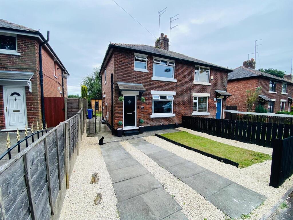
Miller Street, Ashton-Under-Lyne
By W C Dawson & Son Ltd
£ 1,150
W C Dawson & Son Ltd says ..
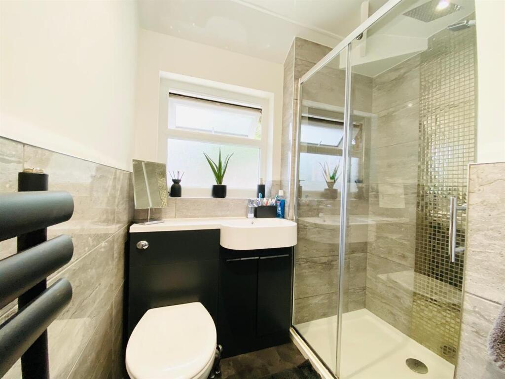
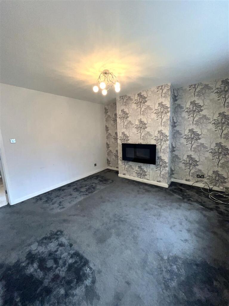
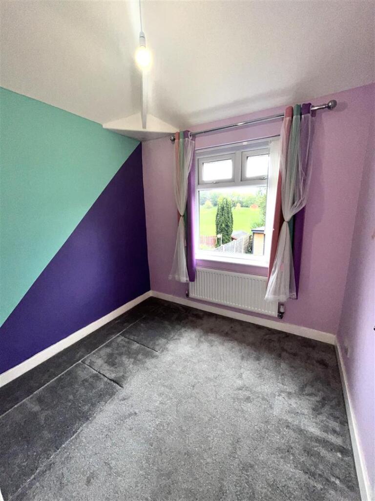
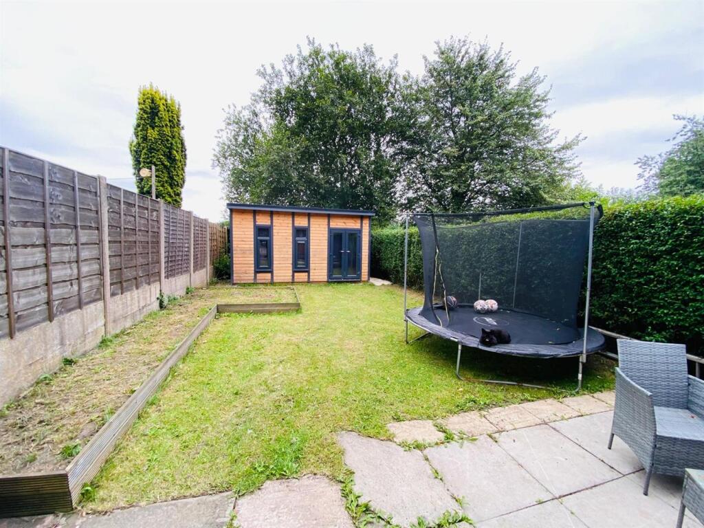
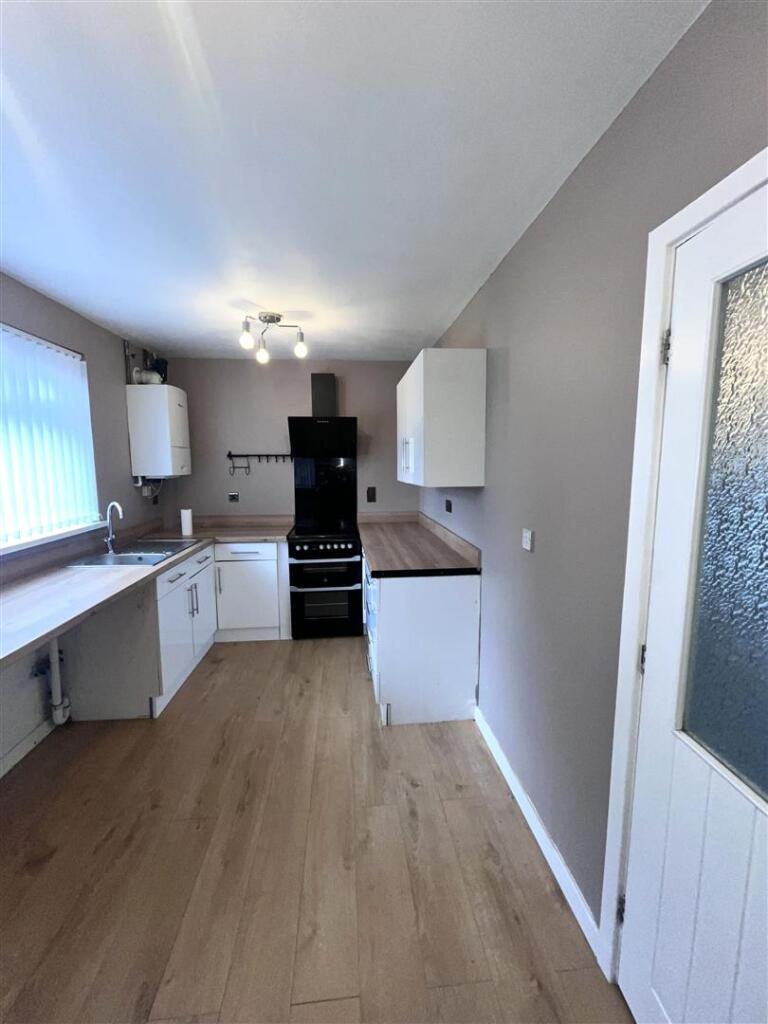
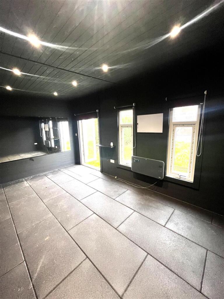
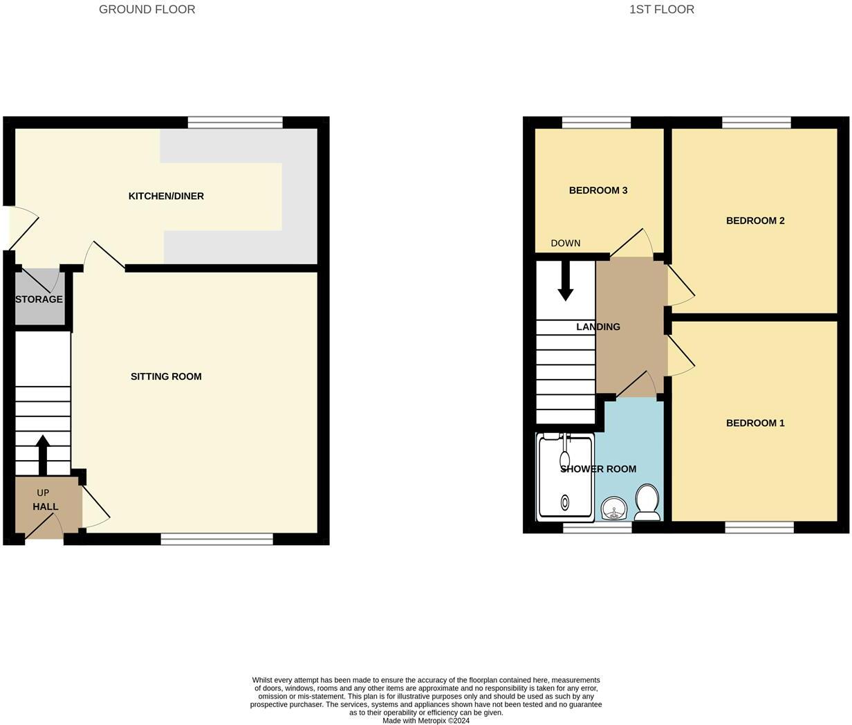
Traditionally built, semi detached property offering spacious living accommodation. Comprising Entrance Hall, Lounge with electric wall mounted fire, Kitchen/Diner with storage cupboard, Three Bedrooms, Modern Shower Room, off road vehicular parking to the frontage and a beautifully landscaped g...
- Bedrooms
- 3
- Bathrooms
- 1
The heatmap indicates the level of crime in the area. The color of the heatmap indicates the crime severity and recency.
Metrics Year-on-Year
- Average area value
- 489,766.00 £Increased by 6.36 %
- Average area rental value
- 2,264.00 £/moIncreased by 11.14 %
- Est rental Yield
- 5.55 %Increased by 4.52 %
- Crime Rate
- 0.00 %
from 460,462.00 £
from 2,037.00 £/mo
from 5.31 %
from 0.00 %
Agent Activity
W C Dawson & Son Ltd created the listing.
Nearby Schools
| Name | Type | Ofsted | Distance |
|---|---|---|---|
| St James' Church Of England Primary School | Academy Converter | 0.58 KM | |
| Hurst Knoll St James' Church Of England Primary School | Voluntary Controlled School | Good | 0.59 KM |
| Oasis Academy Broadoak | Academy Converter | Good | 0.69 KM |
| The Heys Primary School | Community School | Good | 0.84 KM |
| Our Lady Of Mount Carmel Rc Primary School, Ashton-Under-Lyne | Voluntary Aided School | Good | 0.87 KM |
Images


Nearby Streets
| Name | Average Price | Average Sqft | Distance |
|---|---|---|---|
| Elm Grove | £ 180,000 | 0 | 0.00 KM |
| Cranbourne Road | £ 0 | 0 | 0.00 KM |
| Cranbourne Terrace | £ 275,000 | 0 | 0.00 KM |
| Lord Street | £ 0 | 0 | 0.00 KM |
| Northumberland Avenue | £ 0 | 0 | 0.00 KM |
Nearby Transport
| Name | NLC | TLC | Distance |
|---|---|---|---|
| Ashton-Under-Lyne | 2790 | AHN | 0.59 KM |
| Stalybridge | 2983 | SYB | 3.40 KM |
| Guide Bridge | 2955 | GUI | 3.41 KM |
| Hyde North | 2959 | HYT | 3.50 KM |
| Flowery Field | 2786 | FLF | 3.94 KM |
Nearby Listings
| Address | Price | Type | Score | Distance |
|---|---|---|---|---|
| Miller Street, Ashton-Under-Lyne | £ 1,150 | RENT | Unknown | 0.00 KM |
| Miller Street, Ashton-under-Lyne, Greater Manchester, OL6 | £ 975 | RENT | Unknown | 0.06 KM |
| Wrigley Street, Ashton-under-Lyne, Greater Manchester, OL6 | £ 900 | RENT | Unknown | 0.26 KM |
| Beauchamp Street, Ashton-under-Lyne, Greater Manchester, OL6 | £ 995 | RENT | Unknown | 0.27 KM |
| Canterbury Street, Ashton-under-Lyne, Greater Manchester, OL6 | £ 1,100 | RENT | Unknown | 0.31 KM |
Nearby Properties
| Address | Price | Distance |
|---|---|---|
| 3 Sunderland Avenue | £ 77,000 | 0.03 KM |
| 12 Sunderland Avenue | £ 140,000 | 0.03 KM |
| 7 Sunderland Avenue | £ 149,000 | 0.03 KM |
| 14 Sunderland Avenue | £ 129,000 | 0.03 KM |
| 11 Sunderland Avenue | £ 158,000 | 0.03 KM |