Sherwood Street, Chesterfield, S40
By Purplebricks
£ 135,000
Reviews
3 out of 5 stars
Purplebricks says ..
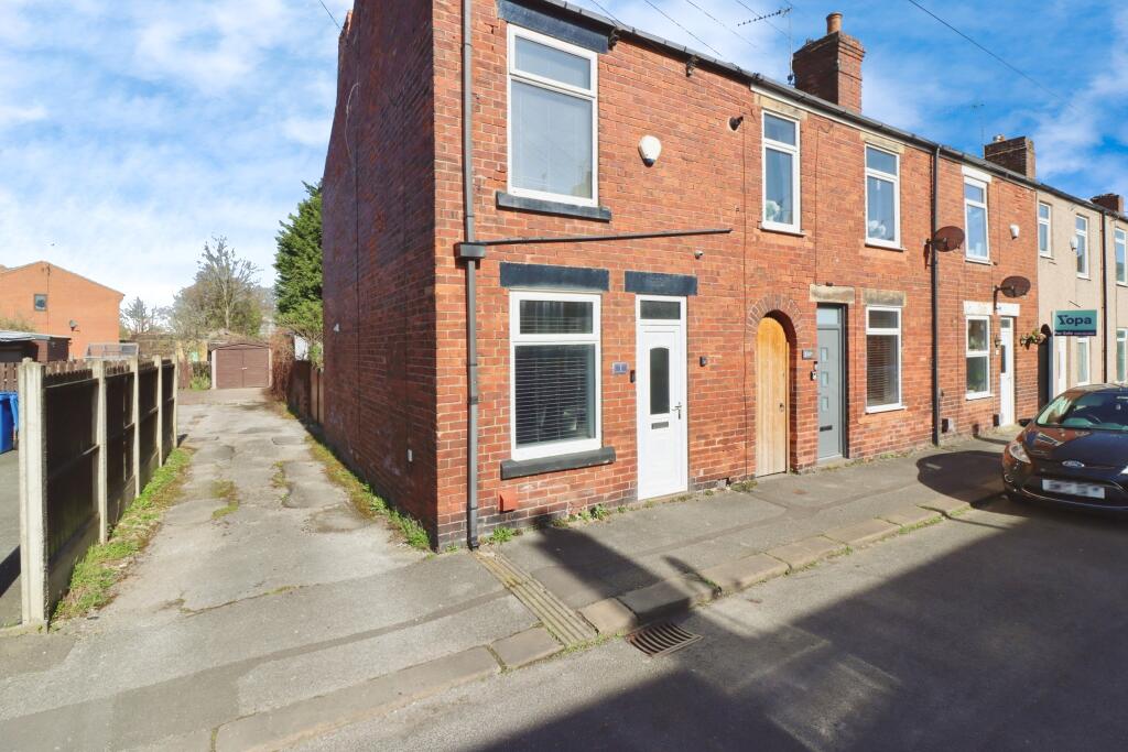
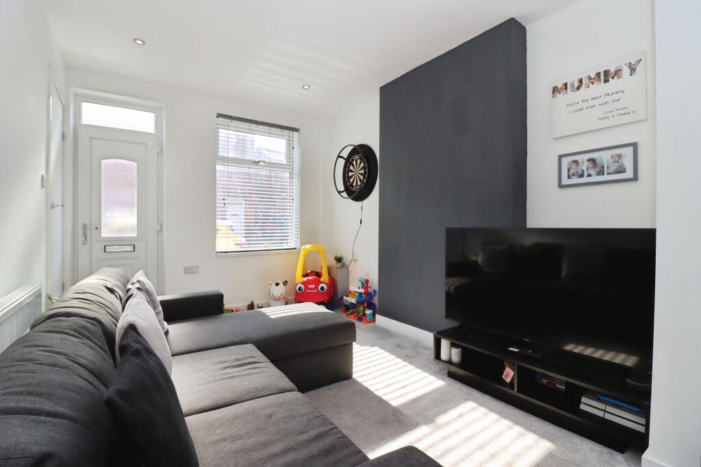
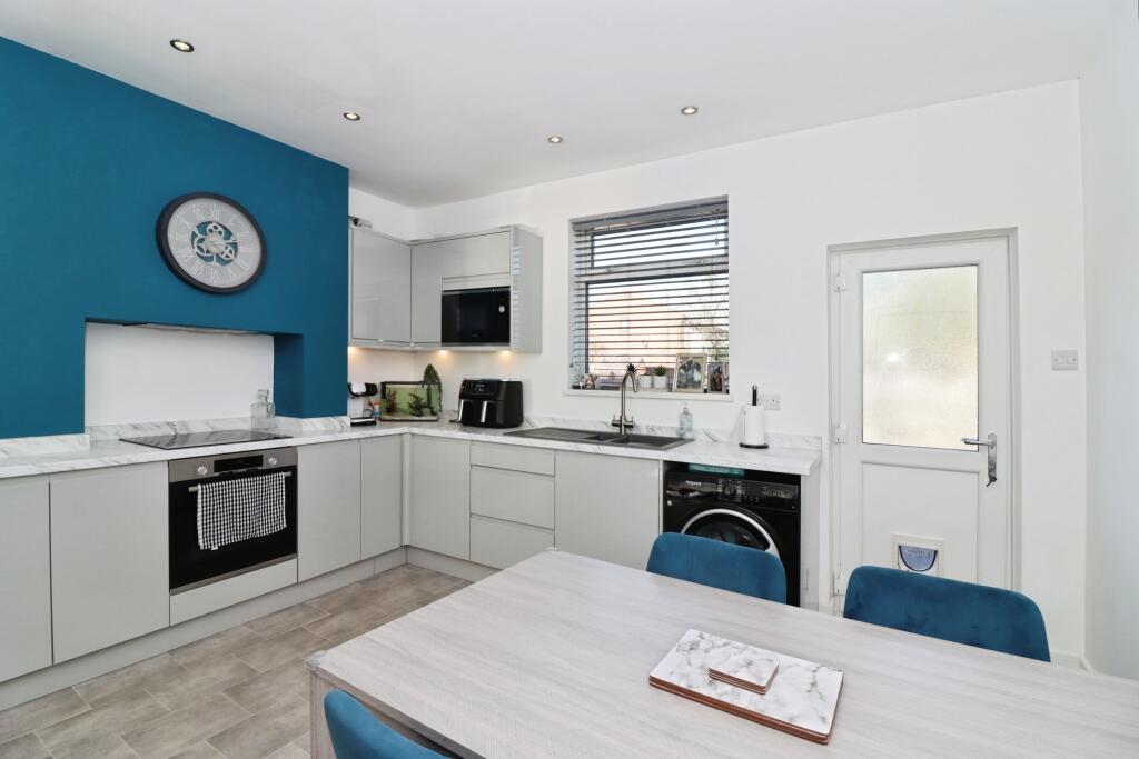
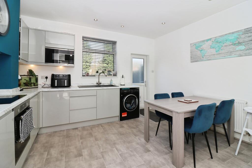
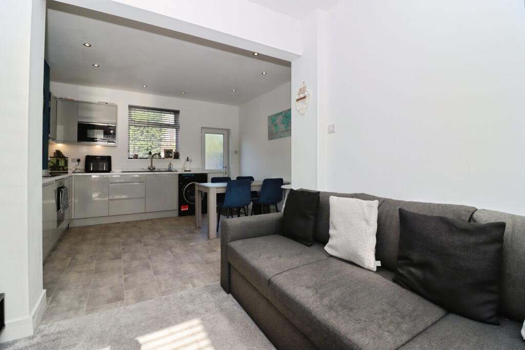
Offered for sale this extremely well presented two bedroom end terraced home, nestled in a sought-after location close to the town centre and popular retail parks. This delightful home is perfect for first-time buyers, landlords, or those looking to downsize. Enjoy a stylish and modern living sp...
Property Oracle says ..
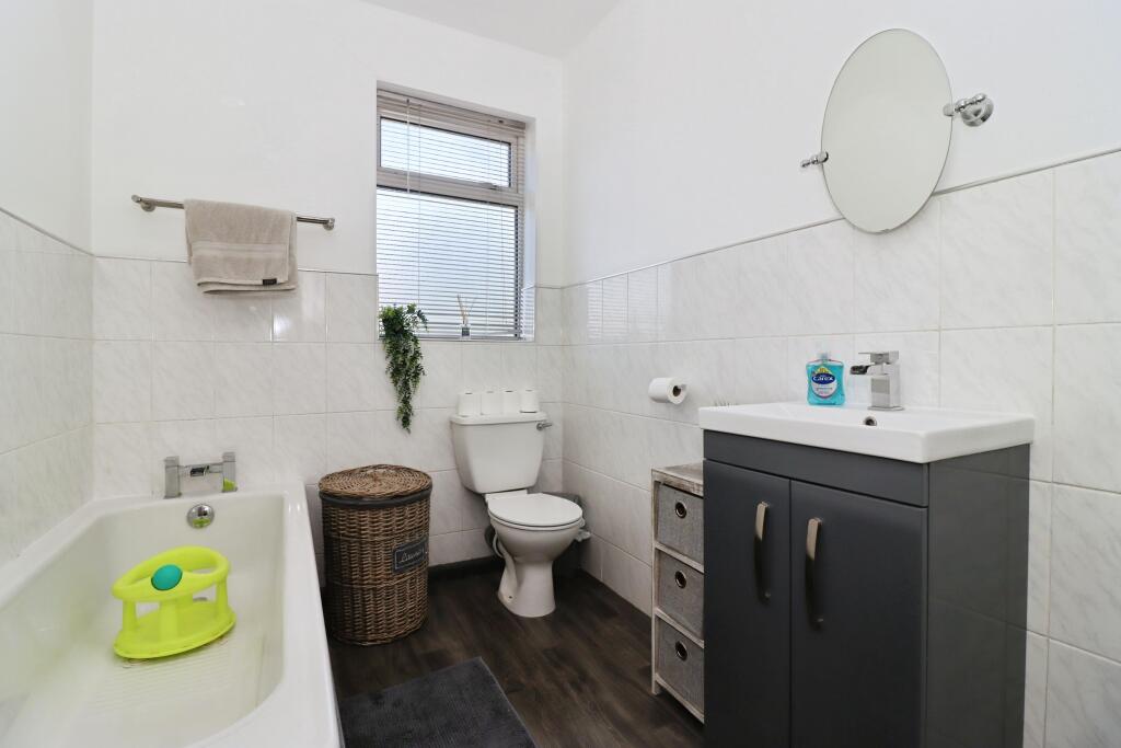
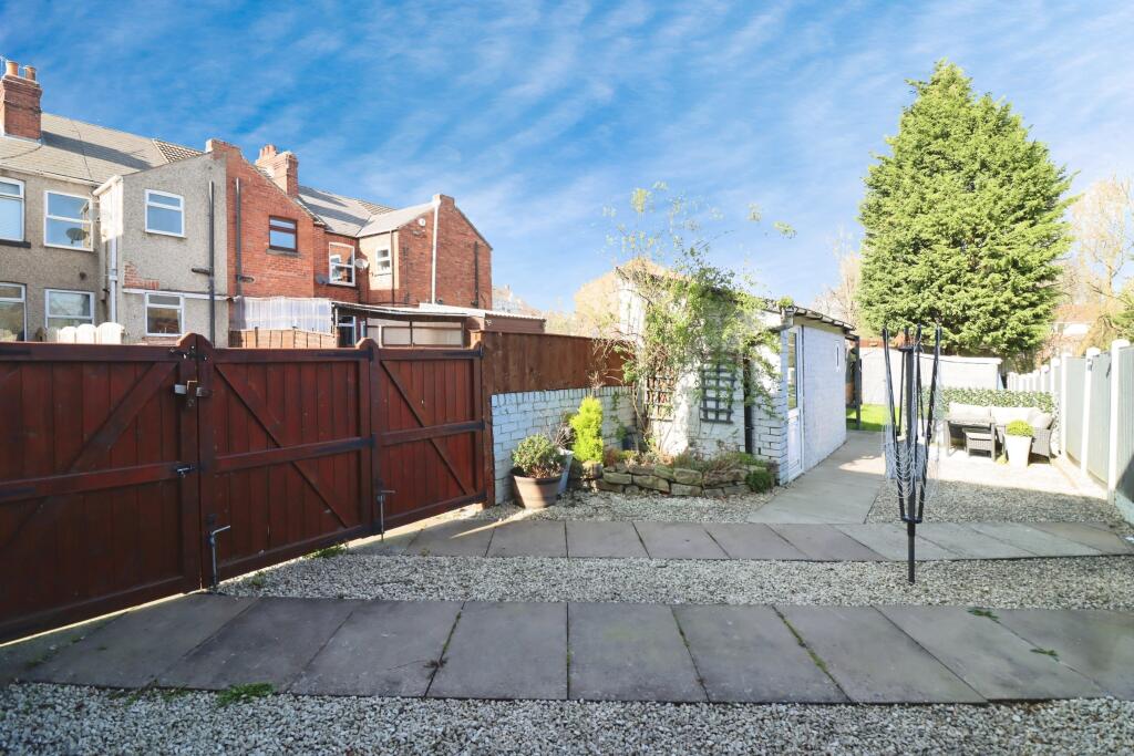
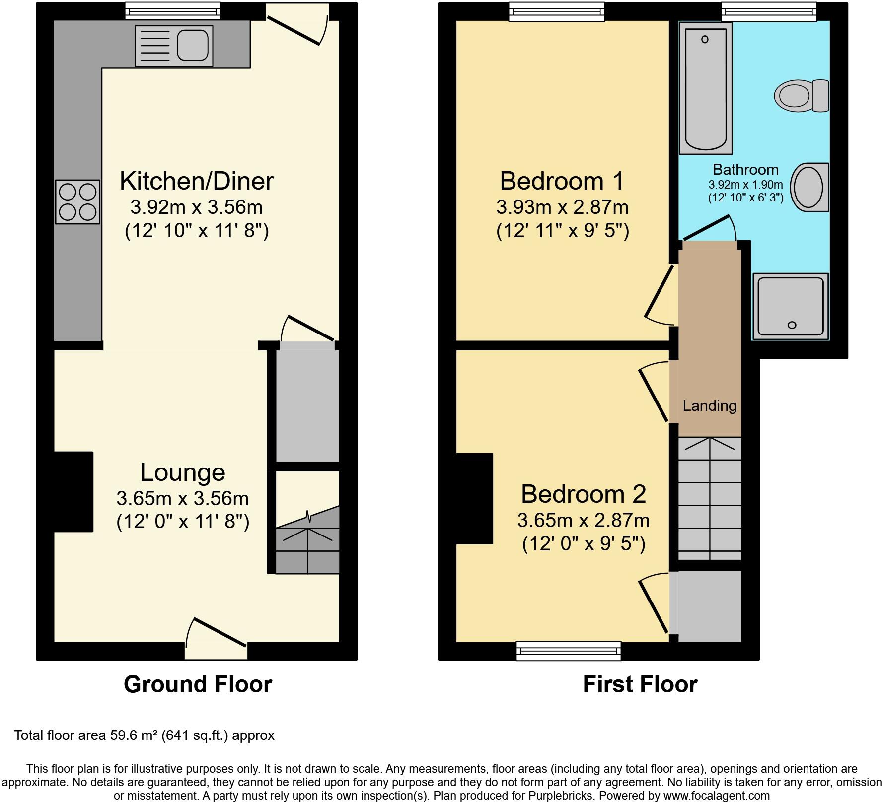
This property is a 2 bedroom end of terrace house located on Sherwood Street, Chesterfield, Derbyshire. The property benefits from a modern kitchen and bathroom and has a small garden with a shed. The location is close to local schools and Chesterfield train station providing good transport links.
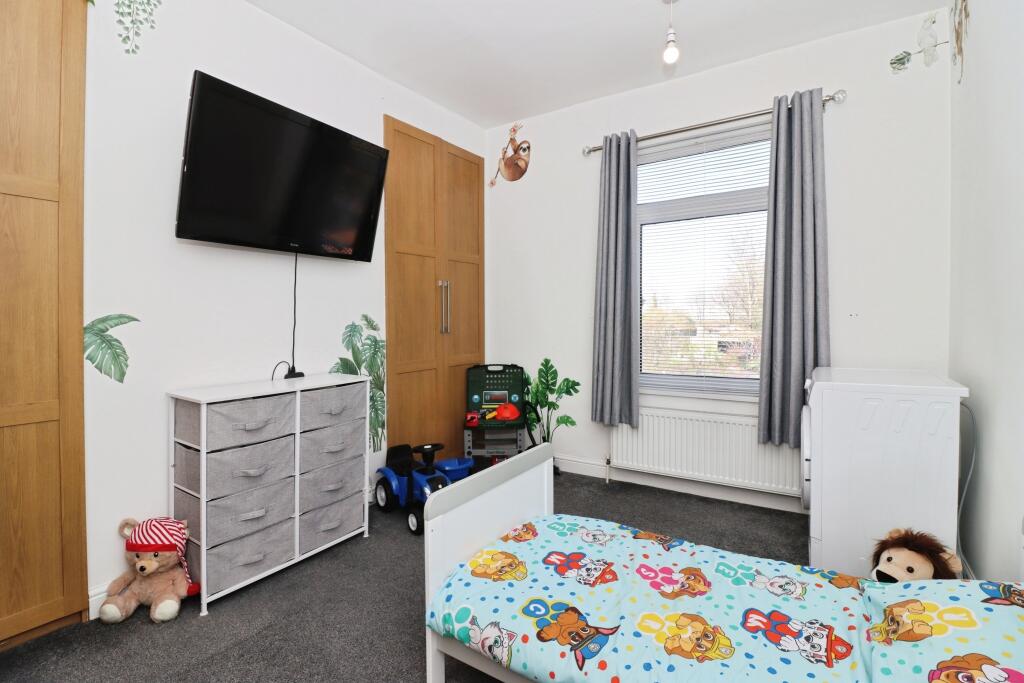
Given the images provided, the property appears to be in good condition and has recently undergone some modernisation. The kitchen and bathroom are modern and well-maintained. The décor throughout the property is contemporary.
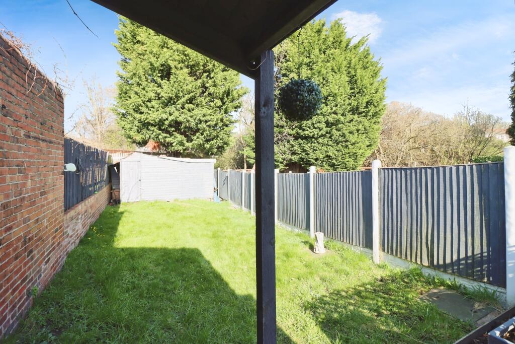
The plot size is 641 sqft which is relatively small for a property of this type. However, the property does benefit from a small garden and shed.
The list price of £135,000 is significantly lower than the average house price in the area (£470,843). However, this is likely due to the smaller size of the property and the fact that it is a terraced house rather than a detached or semi-detached property. Considering comparable properties on Sherwood Street, the price seems reasonable. The average price per sqft in the area is £561, however, this data is not useful given that the sqft for this property is not provided.
Based on the information provided, the property appears to be a good value for money, particularly for first-time buyers or those looking for a smaller property in a convenient location.
Therefore, we give this property 7 / 10. *Disclaimer: This is our option and does constitute a recommendation or financial advice. Do your own research. *
- Price
- 8
- Condition
- 8
- Location
- 7
- Land
- 6
- Bedrooms
- 2
- Bathrooms
- 1
- Lot (est)
- 641.00
The heatmap indicates the level of crime in the area. The color of the heatmap indicates the crime severity and recency.
Metrics Year-on-Year
- Average area value
- 487,285.00 £Decreased by 7.65 %
- Average area rental value
- 1,920.00 £/moIncreased by 13.27 %
- Est rental Yield
- 4.73 %Increased by 22.86 %
- Crime Rate
- 5.00 %Unchanged by 0.00 %
Agent Activity
Purplebricks created the listing.
Nearby Schools
| Name | Type | Ofsted | Distance |
|---|---|---|---|
| Spire Junior School | Community School | Good | 0.47 KM |
| Spire Nursery And Infant School | Community School | Good | 0.79 KM |
| Birdholme Children'S Centre | Children's Centre | 1.02 KM | |
| Hasland Infant School | Community School | Good | 1.38 KM |
| Walton Peak Flying High Academy | Academy Sponsor Led | 1.43 KM |
Images


Nearby Streets
| Name | Average Price | Average Sqft | Distance |
|---|---|---|---|
| Bridge Street | £ 0 | 0 | 0.00 KM |
| St. Giles Close | £ 350,000 | 0 | 0.00 KM |
| Lincoln Street | £ 0 | 0 | 0.00 KM |
| Park Drive | £ 0 | 0 | 0.00 KM |
| Dixon's Road | £ 0 | 0 | 0.00 KM |
Nearby Transport
| Name | NLC | TLC | Distance |
|---|---|---|---|
| Chesterfield | 6615 | CHD | 1.38 KM |
| Dronfield | 6616 | DRO | 9.68 KM |
Nearby Listings
| Address | Price | Type | Score | Distance |
|---|---|---|---|---|
| Sherwood Street, Chesterfield, S40 | £ 135,000 | BUY | 7 / 10 | 0.00 KM |
| Sherwood Street, Chesterfield, S40 | £ 129,950 | BUY | 7 / 10 | 0.00 KM |
| Sherwood Street, CHESTERFIELD, Derbyshire, S40 | £ 140,000 | BUY | 7 / 10 | 0.01 KM |
| Hawthorne Street, , S40 | £ 115,000 | BUY | 6 / 10 | 0.04 KM |
| Hawthorne Street, Chesterfield, S40 | £ 130,000 | BUY | Unknown | 0.04 KM |
Nearby Properties
| Address | Price | Distance |
|---|---|---|
| 5 Sherwood Street | £ 112,000 | 0.01 KM |
| 18 Sherwood Street | £ 131,500 | 0.01 KM |
| 12 Sherwood Street | £ 120,000 | 0.01 KM |
| 2 Sherwood Street | £ 82,000 | 0.01 KM |
| 13 Sherwood Street | £ 127,000 | 0.01 KM |